
Oatlands, Tasmania

Located on the shores of Lake Dulverton about half way between Hobart and Launceston on Tasmania's Midlands highway, Oatlands is a hauntingly beatiful, intact colonial era village with it architecture covering a broad range of styles. A designated historic town, Oatlands is said to have the largest collection of pre-1837 buildings in Australia. 87 such buildings are located in the main street while a total of 138 sandstone buildings are found within the town boundary.
Where is it?: South. 79km north of Hobart, 113km south of Launceston on the Midland Highway.
Oatlands Spring Festival (October long weekend); National Working Bullock Festival
Oatlands grew in the colonial days as a result of it being the ideal stopping place between Hobart and Launceston, a role it still plays for travellers between Tasmania's two largest urban centres. It is also a close enough destination to both Hobart or Launceston for a day's drive, and well worth the effort. There are plenty of cafes, museums and galleries to keep you occupied, not to mention a number of other interesting historic townships you drive through on your way to or from Hobart or Launceston. .
There are some amusing and amazing topiaries (trees and bushes clipped to particular shapes) at St Peter's Pass, and in Oatlands itself. The Oatlands topiaries continue an old tradition and are made by local residents to designs by Tasmanian sculptor Stephen Walker.
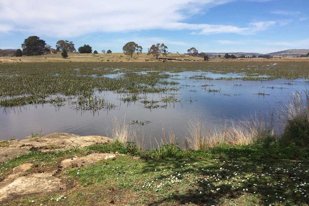
Lake Dulverton, behind the town, is a shallow lake maintained by a low dam wall which occurs on Triassic sandstone and Quaternary deposits and has a structural geomorphology. The Lake does not have permanent water, but reaches a maximum depth of 2-4 metres. The lake is an important bird habitat and has been an area of bird observation for many years. 78 bird species have been recorded on or around the lake. Of these, 45 species frequently or only use the lake. 11 of Australia's 19 species of duck, goose and swan have been recorded here, eight regularly. All three grebes, three cormorants and five heron-like species are also amongst the species present. The Lake is regularly restocked with fish from the Oatlands District High School Aquaculture Centre.
The Lake Dulverton area has a long history of occupation, with Aboriginal people living in the area before white settlement. The lake itself is currently a scenic attraction rather than a water resource, and has almost dried up completely in recent years. Development, particularly clearing in the catchment, may have led to reduced water inflow to the lake.
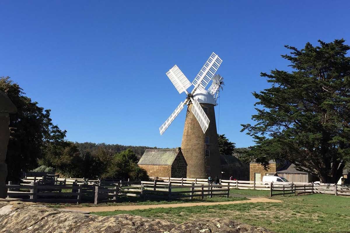
The mill complex, built by John Vincent in 1837, was the major flour mill for the region for many years. The complex of stone buildings includes a five-level windmill tower, a granary, steam mill, stable and miller's cottage. Callington Mill is a Lincolnshire tower mill built in 1837 by John Vincent. It has been restored so that it is now in full working order and is the only operating mill of its type in the Southern Hemisphere.
Thomas Jillett took over the ownership of the mill in 1853. Thomas and his, wife Elizabeth (nee Bradshaw), a free settler who arrived in Sydney in 1799, lived at York Plains near Oatlands after they married. Thomas was a successful sheep farmer before he purchased Callington Mill. In 1863 Thomas Jillett sold the mill to his nephew John Bradshaw and a few years later left Tasmania and bought a sheep property in the Wimmera in Victoria. The restoration of Callington Mill to its former glory was completed in 2010 and the first turning of its sails after being dormant for so many years was a magnificent sight. Location: Mill Lane, Oatlands.
A stone Victorian hall that is the work of local stonemasons, the Fish brothers. It was built in 1875. A former Rechabite's Hall, this Victorian sandstone hall of very simple design and relying on rusticated quoins, reveals and frieze for decoration. Location: 1 Gay Street, Oatlands.
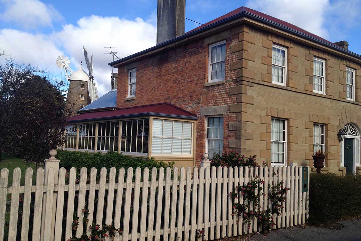
Constructed in 1834 by George Aitchison, this two-storey brick Georgian building features a stone facade, raised quoins and a four panel door with half-sidelights and fanlight. The licensee was John Jubilee Vincent, son of the builder of the Callington Mill. The building stands close to the street front and is an important townscape element. Location: 99 High Street, corner Old Mill Lane, Oatlands.
A two-storey Victorian building, erected in 1881 to a design by WH Lord. Its design, Georgian Revival, is sympathetic to other earlier buildings in the town. Location: 71 High Street, corner Stutzer Street, Oatlands.

Also known as the Doctor's House, this two-storey stucco Georgian house was built around 1840 for John Whiteford, the police magistrate. In 1852, Rev Trollope, a distant relative of novelist Anthony Trollope, conducted a school here. The building features three bay facade, a central entry of six panel door with transom light. Location: 40 High Street, Oatlands.
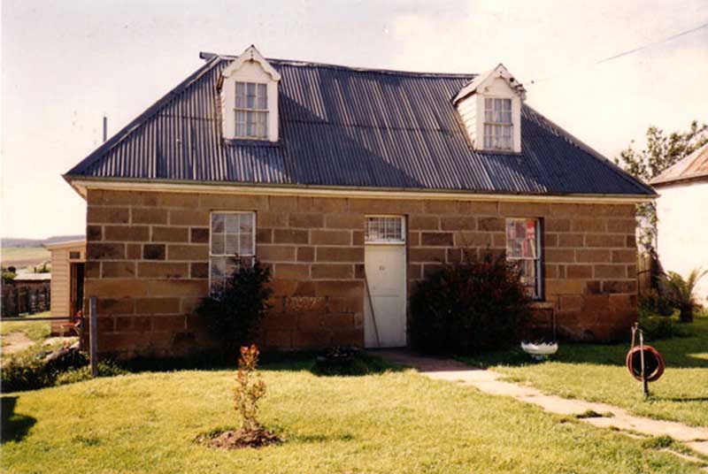
A simple Georgian stone cottage, built in 1844. It features a finely dressed facade and textured blocks at the rear, a central door with transom light, 12-pane windows and a stone wall.
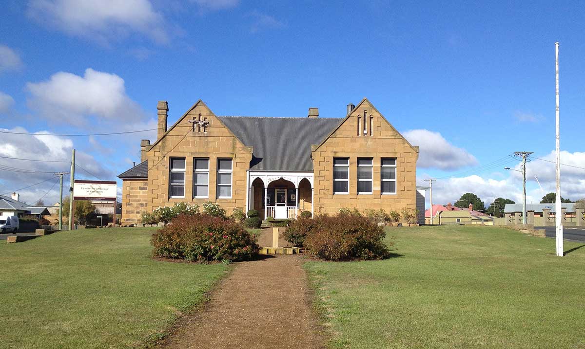
A single storey Victorian sandstone school building erected in 1886. The building is complemented by a fine entrance archway standing at the Midland Highway frontage. The vuilding features projecting gables with groupings of three windows, and three narrow ventilators above. Gables have parapet and quoins and reveals expressed. The school is well sited atop a low rise. Location: 73 High Street, between Campbell and Stutzer Streets, Oatlands.
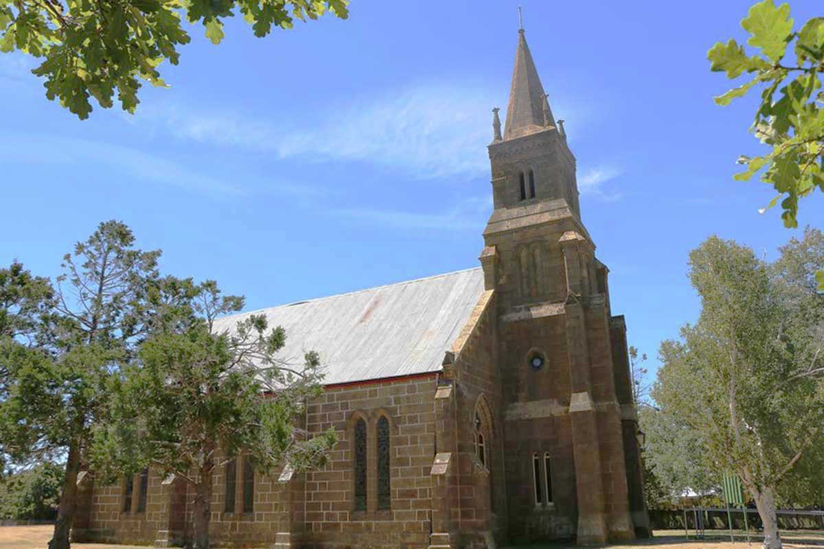
St Luke's Presbyterian Church
The first Presbyterian minister to serve Oatlands was Thomas Dove who was appointed by the Hobart presbytery in 1837. However it was not until the 1850’s that progress was made towards building a ‘Scotch’ church. The foundation stone was laid on 16 October 1854. The first Presbyterian minister to serve Oatlands was Thomas Dove who was appointed by the Hobart presbytery in 1837. However it was not until the 1850’s that progress was made towards building a ‘Scotch’ church. The foundation stone of the first Presbyterian church was laid on 16 October 1854.
Rebuilding began in mid 1859 and the church was completed and reopened on 6 May 1860. A Gothic Revival church, its four level square tower has a stone spire surrounded by four corner spirelets. The heavily buttressed tower of the new church has stood the test of time and has endured over 150 years of Midland storms. It is now part of the Uniting Church and remains a landmark feature of Oatlands. The adjacent Manse (12 High Street) was built in 1860 by George Wilson for his daughter and her husband, the Reverend Lachlan Mackinnon Campbell, first Presbyterian Minister of the Campbell Free Church. The manse is a symmetrical stone two-storey house.
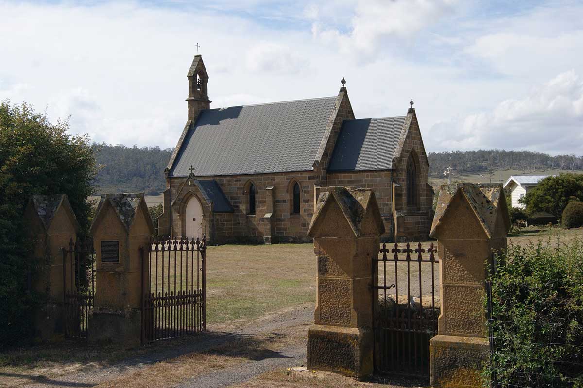
St Paul's Catholic Church
The church reflects the lives of two remarkable men; Bishop Robert William Willson, the first Catholic Bishop of Hobart and English architect and designer, Augustus Welby Northmore Pugin. When Bishop Willson arrived in Van Dieman’s Land in 1884 he brought with him Pugin designed and inspired regalia needed to establish the new diocese. He also brought with him texts, drawings and models that were to be used to guide the building of Gothic Revival churches in the colony. Willson was a close friend of Pugin and shared the notion that the building style of the High Middle Ages could serve to revive and deepen the Catholic faith.
The model used for St Paul's was that of a small English medieval church. The design was drawn from one of three detailed models built by George Myers. The models had been created because it was thought that the skills necessary for builders to interpret and use conventional architectural plans were not available in Van Dieman’s Land. On 9 April 1850 Bishop Willson laid the foundation stone for St Paul's Church. The church was completed within 6 months although progress was delayed after a tragic accident that killed one workman and several injured others. St Paul's is still a beautiful country church and is a fitting symbol for the vision of Tasmania’s first Catholic Bishop and the dedication of the pioneering priests.
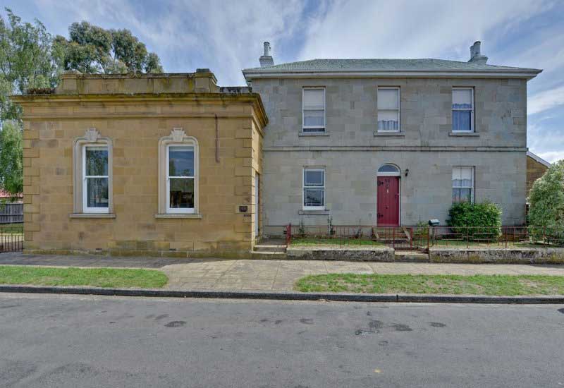
ANZ Bank, Residence and Stables
Originally built as a home for Dr Frederick John Park, the district surgeon in the late 1840s. The two storey sandstone late Georgian residence has a single storey parapetted late Victorian bank chamber attached and sandstone stables detached at the rear rear. From 1873 to 1886 the sandstone building housed the Oatlands Grammar School. As can be seen from the varying styles of stonework, the banking chamber was a later addition. Location: 50 High St, cnr Wellington St, Oatlands.
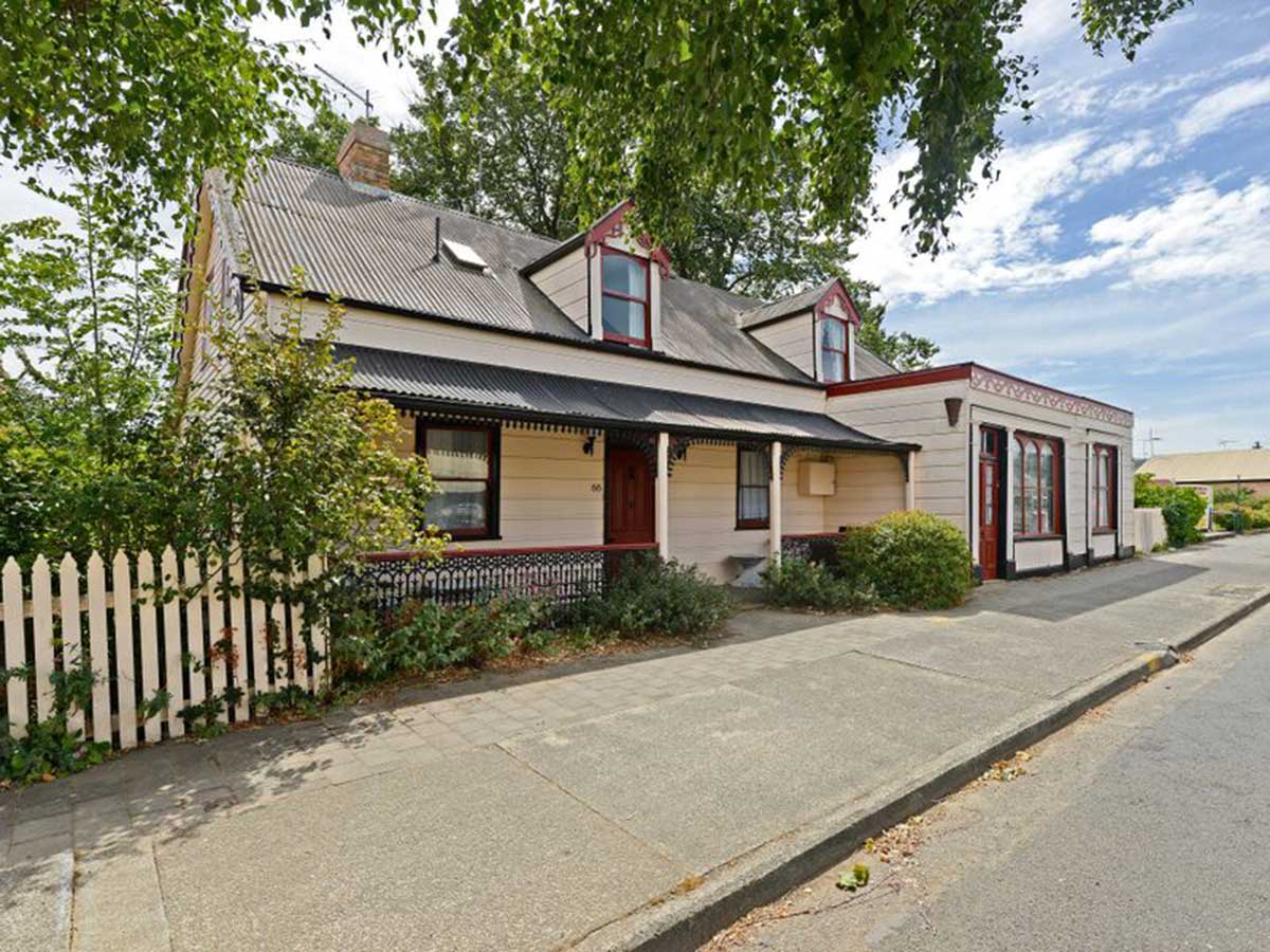
66 High Street
Built as a residence around 1881, additions were made in the early 1900s to accommodate Dando’s Pharmacy. The pharmacy was also home to Mr Heane, Dentist.
Elm Cottage
A single storey Georgian stone cottage featuring an ron hip roof with twelve pane dormers, a central entry with six panel door and transom light, twelve pane windows. A one storey stone and brick addition at rear could incorporate the original stone outbuilding. In the 1850's Kevin Izod O'Doherty (1823-1905), an Irish exile, lived in this cottage. After being convicted of sedition in the Irish Rebellion of 1848, O'Doherty and his colleagues were "exiled" for life to Van Diemen's Land (now Tasmania). O'Doherty arrived in November 1849, accepted a "ticket-of-leave" upon giving his word not to attempt to escape without first notifying the authorities, and was at once released on parole to reside at Oatlands.
His professional services were utilised at St. Mary's Hospital, Hobart. In 1862 he went to Brisbane, and became well known as one of its leading physicians. O'Doherty was elected a member of the Queensland Legislative Assembly in 1867, in 1872 was responsible for a health act being passed, and was also one of the early opponents of the traffic in kanakas. In 1877 he transferred to the Queensland Legislative Council, and in 1885 resigned as he intended to settle in Europe. Location: 82 High St, Oatlands.
A heritage listed group of three stone buildings including what is reputed to be the finest sheep dip in Tasmania which was built in the 1830's. It has a 750 gallon, 5 foot deep well, carved out of a solid sandstone shelf. It features a sloping solid sandstone floor, incised with drainage channels. The other buildings are a stone cottage, c1860, and a stone barn, 1863. The stone cottage has a very small with attic, an iron gable roof and a timber verandah. It was extended in 1860 and 1863. The barn, of Ashlar stone, has a loft and iron gable roof. Location: RA 180 Inglewood Rd, Parattah.
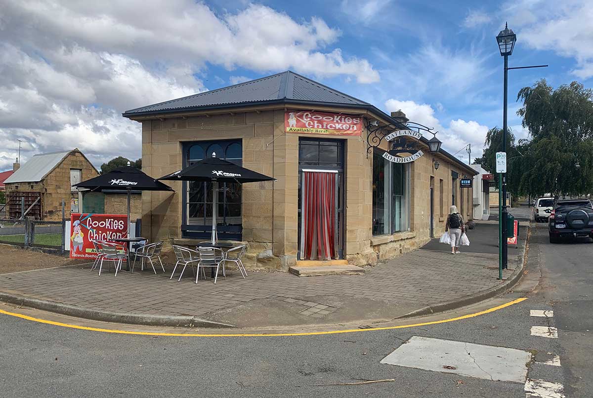
Oatlands Roadhouse
This sandstone shop and residence was known until 1890 as Wright’s Butchery. In 1896, William Fisher acquired the building and added the extension which now houses the dining room and shop. The building later became a general store, an antiquarian bookshop, and for a time housed the Department of Agriculture. Calder’s map of 1846 shows a small stone building on this site which appears to be part of the present-day outbuildings at the rear of the shop. The quaint stables at the rear are of typical nineteenth century design, and would have been absolutely essential for any retail business in the age before motor vehicles. The most recent addition dates to 1897 and adjoins the shop expanding the High Street frontage. It is currently the Oatlands Roadhouse. At the rear of the property is the original two story sandstone barn. Location: 47 High Street, Oatlands.
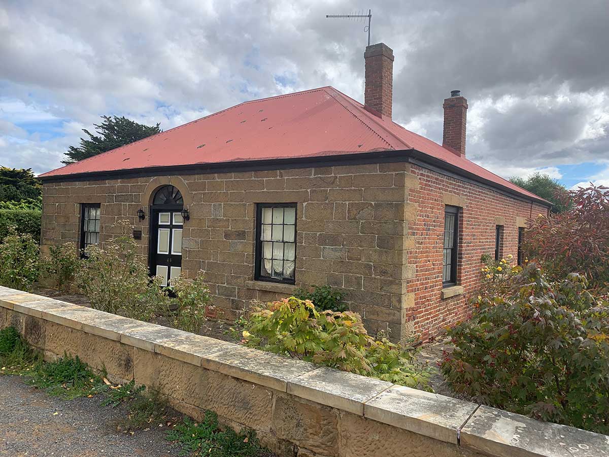
Built by John Baker, this stone-fronted cottage is shown on Surveyor Sharland’s 1832 map, making it one of the oldest buildings in Oatlands. In 1837 it was purchased by Chief District Constable Thomas Salmon, who had emigrated from England in 1816. In 1829, Salmon married Mary Bailey from New Norfolk, and the couple went on to have ten children. Thomas passed away in 1868. This single storey Georgian cottage is one of the earliest cottages remaining in Oatlands. It is basically intact. The main facade features a central four panel door with radial fanlight. The cottage has stone lintels throughout, an iron hip roof, a verandah at the rear and an old picket fence. Location: 48 High St, Oatlands
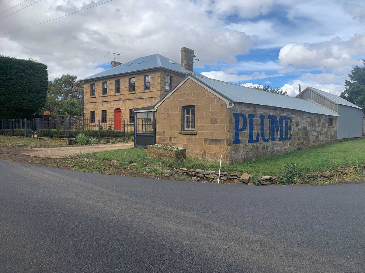
Wardour Castle Inn (Former)
The former Wardour Castle Inn is today a two storey stone residence. The building is complemented by stone outbuildings and its location at the southern end of town gives it townscape significance. It features an iron hip roof, smoothly carved stones to quoins, a five bay facade and two pane windows. The stone outbuildings at rear and on side contain a courtyard. The Innkeeper, Edmund White, provided his inn as a meeting space for the Oatlands Races committee as well as numerous public balls. White was also known for stretching the licensing rules, with one customer in 1854 resisting arrest for after-hours drinking with the words, “Surely you won’t stop me now, I’ve come seven miles for this!”
In more recent years, the coach house on the property operated as a service station, hence the ‘Plume’ sign still visible on the side of the building. Mobil Oil's predecessor company, Vacuum Oil, introduced its popular "Plume" (petrol) and "Laurel" (kerosene) brands to the Australian market in 1916. The Flying Red Horse (Pegasus) logo was introduced in 1939, and in 1954, the Plume brand was replaced by Mobilgas. Location: 1 High St, corner Dudley St, Oatlands.
Waverley House
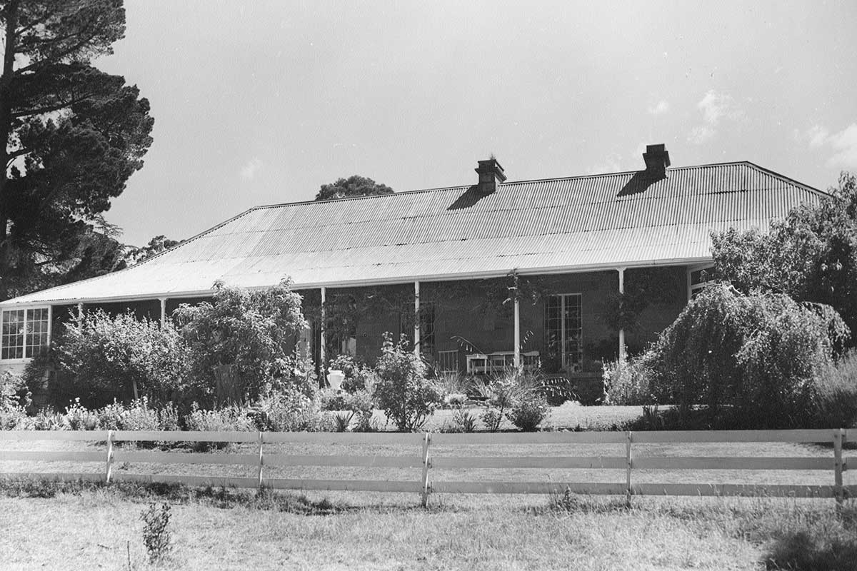
A fine single storey stone Georgian house in the Tasmanian idiom built about 1853 by Henry Frampton Anstey for his bride Adelaide, second daughter of Assistant Commissary-General Peter Roberts. The house is intact, in near-original condition and is complemented by a fine old garden. Waverley is a long low single storey Georgian-vernacular house, constructed of timber verandah on three sides. Two by eighteen pane French doors open to stone paved verandah - there is one other on the south side. The house features a conservatory, a six panel front door with half sidelights and a fanlight, all in an old-style grden setting. Location: RA 654 Bowhill Rd, Oatlands.
 Oatlands Commissariat
Oatlands Military Precinct
The area known as the Oatlands Military Precinct is the area bounded by High, Barrack, Church Streets and the Esplanade, Oatlands – which is the centre of the town and is still the administrative centre of the Southern Midlands. It is in this area where the township was established in the early 1820s, and by the 1840s it was the centre for what was to intended to become the interior capital of Van Diemens Land. The precinct comprised of buildings associated with the civil, government and convict establishments, and was the longest operating military-lead administrative precinct outside the major cities and secondary punishment stations in Van Diemens Land - being disbanded in the late 1850s. Of the 30 buildings originally built within the civil and military precinct, seven remain.
The Oatlands Military Precinct is unique, as it was established as the centre of what was to become a large city – which didn’t eventuate. The remnants of the precinct therefore have not been subject to as thorough destruction as the early remnants of those places which were to become cities. Seven buildings remain of this precinct, and the entire area has been demonstrated to be an area of extremely high archaeological potential which may offer vast knowledge about the formative processes of colonial military and civil establishments. The Oatlands Gaol and Court House are included within this precinct, but are also detailed below.

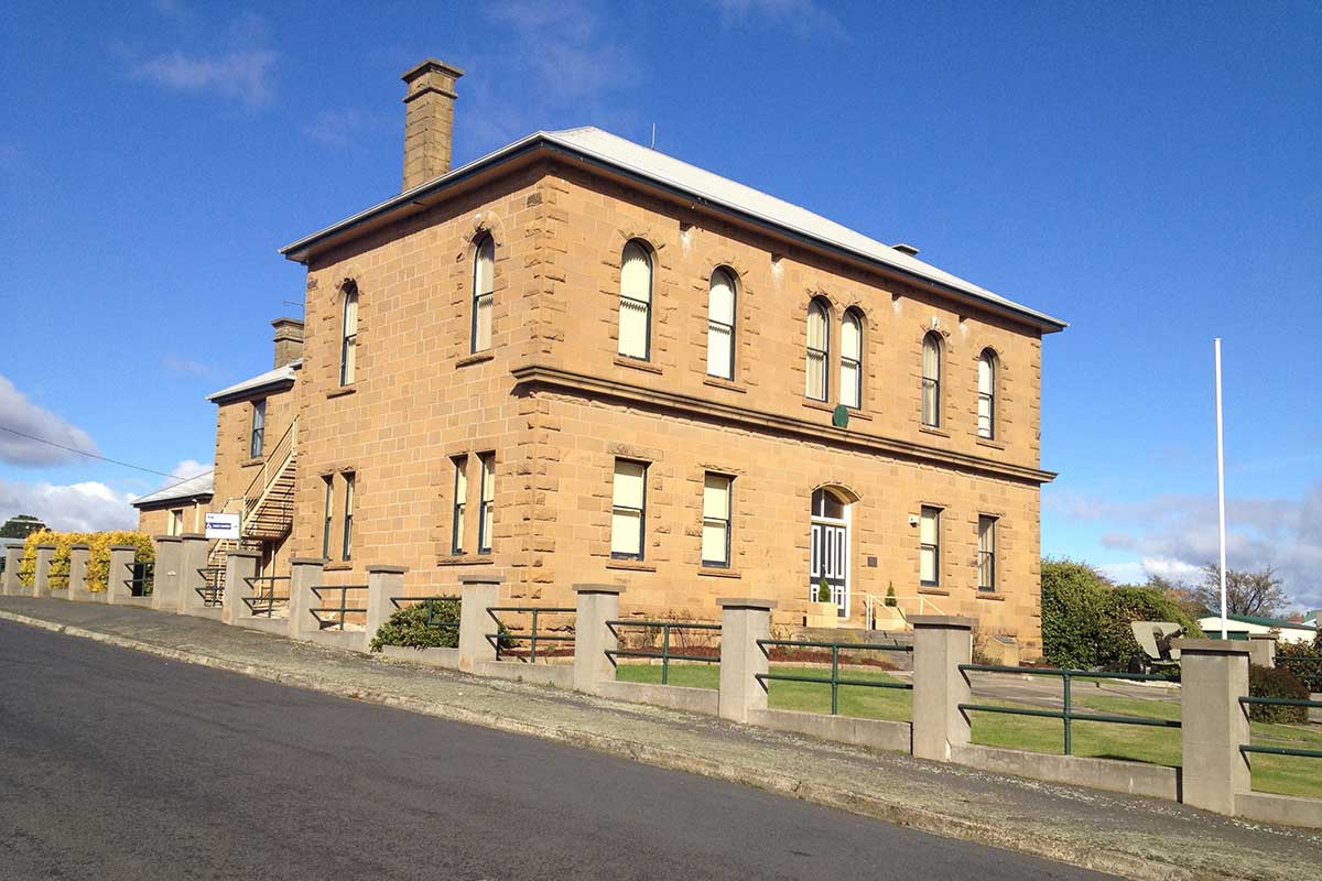
Built in 1827, this Georgian-styled sandstone building is the oldest in Oatlands. It is also the most significant building relating to the Oatlands Military Precinct. It is in remarkably original condition and is arguably the most significant heritage building in Oatlands, being also one of the oldest Supreme Court Houses in Australia. It features a central entry which includes timber casing with pilasters and simple cornice. The building was acquired from the National Trust in 2007. Location: Campbell Street, between Albert Street and Esplanade, Oatlands.
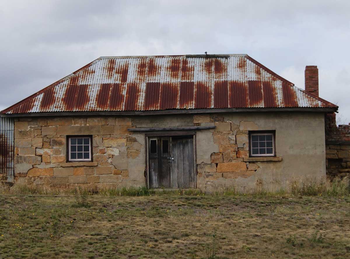 Oatlands Commissariat prior to restoration
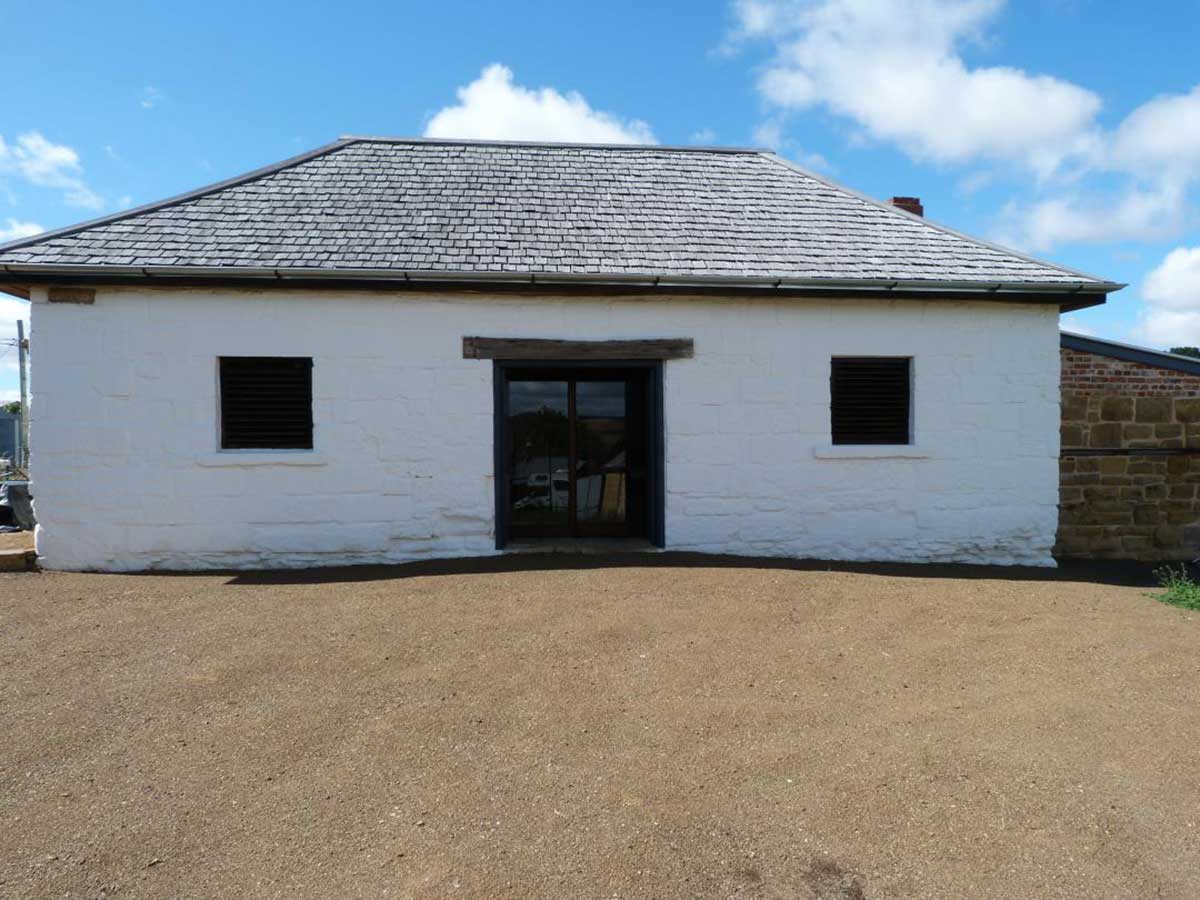
the former commissariat store is a small classically Georgian building, originally symmetrical in form and has one main room plus two skillion additions (one dating from pre-1845, the other post-1859). Most of the early military buildings were roughly built from logs, but the commissariat was carefully built in stone to protect the precious stores from theft. Built late in 1827, the commissariat is the oldest remaining building of the Military Precinct. The guard house that was nearby housed the corporal and three privates who guarded the chain gang, the labour force engaged in building the Military Precinct. The building was constructed to securely house the provisions for the military and convict establishment at Oatlands. It was later (c1880s) converted to a bakery. A massive baker’s oven is partially intact on the southern end of the building. Location: 79 High Street, Oatlands.
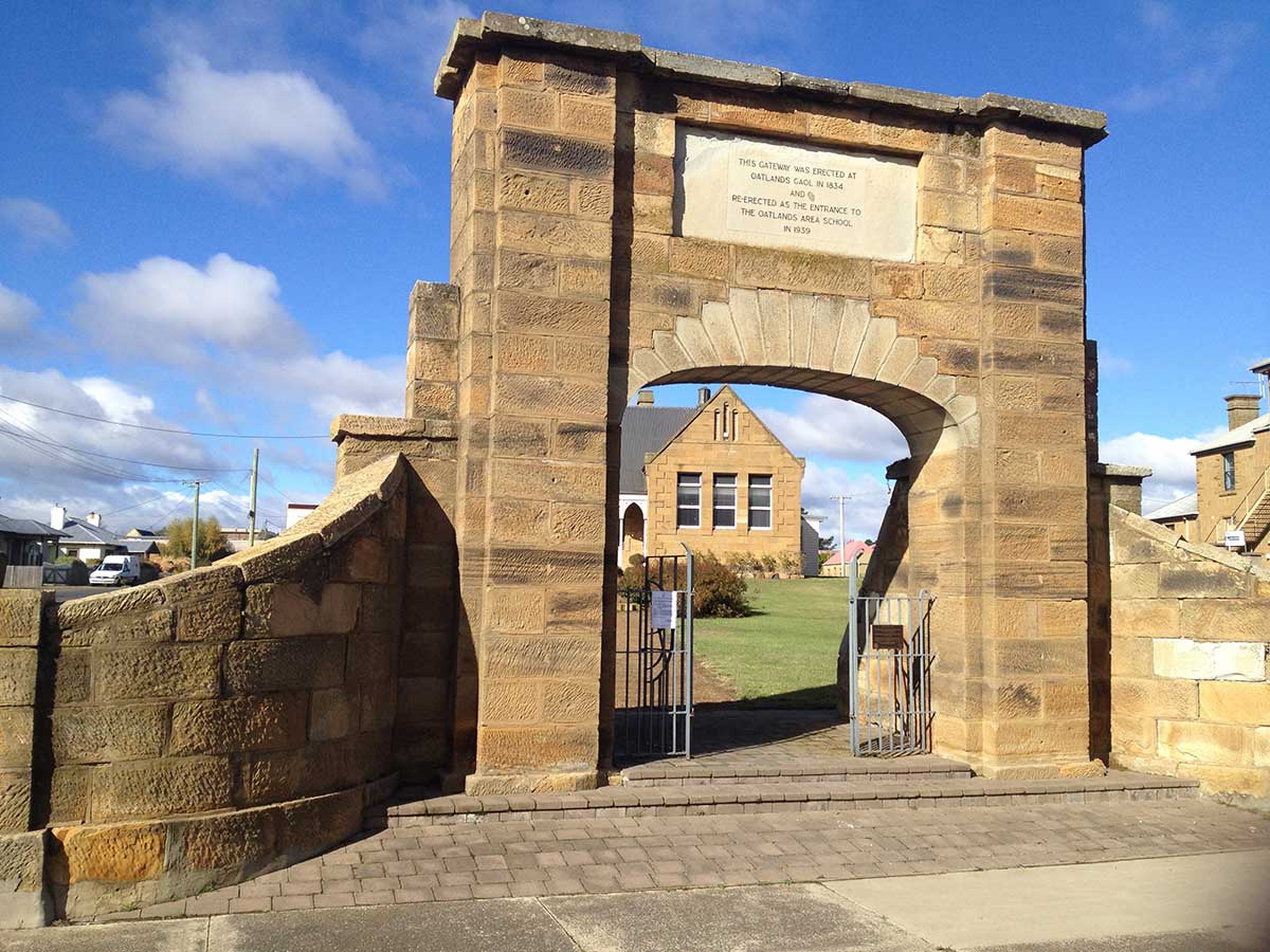
The largest remaining section of the Oatlands Military Precinct is the 1837 Oatlands Gaol complex. Comprising of the two-storey Georgian Gaoler’s Residence, as well as a c2000 square metre former gaol yard and the lower portion of the formerly 6-metre high sandstone perimeter wall, these are the remains of the largest regional colonial gaol in Tasmania. Most of the gaol buildings were demolished in 1937, and in 1954 the yard was filled to accommodate the municipal in-ground swimming pool.
A symmetrical two-storey sandstone Georgian building, built around 1836. A high stone wall surrounds the former exercise yard. The Oatlands Gaol was the largest regional gaol in colonial Tasmania being built to hold up to 200 prisoners. By 1849 Oatlands was the only remaining fully functional rural gaol in the colony. Despite public opposition, most of the gaol was demolished in 1937. The most significant remnant of the gaol complex is the arched entranceway, which was removed before being returned to its original position in 2015.
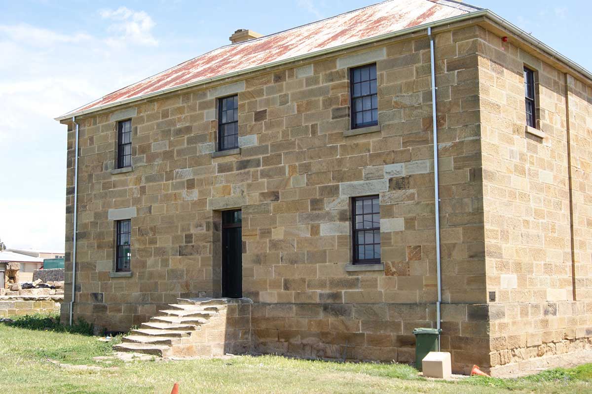
The large building which survives today was the gaolers residence (above) which serviced both the gaol and the gaoler's family who lived on the 2nd floor. The main walls of the gaol were originally 20ft (6 metres high) and surrounded the entire block on which the gaol was constructed. Construction took over two years with up to 68 convict tradesmen working at one time. The foundations alone required some 2000+ cart loads of stone.

The brutality of the convict system in colonial Tasmania is rightly a central theme in popular history. However, a critical point is that for all of the system’s notorious cruelty, it was in fact (at least in theory) a revolutionary system designed to reform the criminal class. As such, religion was an integral part of the penal system in Tasmania and played a critical role in the reform of the convict population. The Oatlands Gaol chapel was located on the second floor in a wooden structure built above 6 cells. Like most prison chapels, very little information is available about its appearance or contents as this was an aspect of prison life of little interest.
More
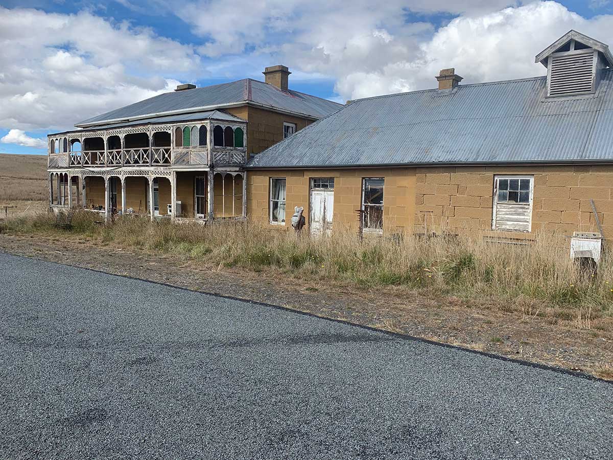
An intact example of 1860's coaching inn architecture, with Edwardian additions important in their own right. Historically associated with Oatlands former role as a staging point on the Hobart - Launceston Road. It is a two storey stone building with attached two storey timber verandah added in 1890-1900 to the original building. It has a single storey stone stables and storeroom and 'dairy' attached. The former hotel was once one of the horse changing stops for the stage coach from Hobart to Launceston. Location: 229 Birmingham Arms Road (closed Section of Midland Highway), 3kms south-west of Oatlands.
Oatlands Self Guided Street Map Tour
History of Oatlands
The earliest known history of the Oatlands area is that of Richard Lemon, one of the first of the notorious bushrangers of Van Diemen’s Land, who roamed the area between 1806 and 1808. Governor Macquarie is said to have been the ‘real founder’ of Oatlands, travelling between Hobart and the north of the colony on horseback with his wife in 1811. At this time, he saw the need for a road linking the southern and northern regions of Van Diemen’s Land. Macquarie recorded the area as being a ‘jungle with fine springs of fresh water’. Following this journey, Surveyor James Meehan was sent back to survey a road between Hobart and Port Dalrymple in the north.
It was during Macquarie’s second visit to the area, in 1821, that Oatlands was named. It is said that the land reminded Macquarie of his native Scotland, where good crops of Oats were grown. Another theory offered by Weeding (1975: 1) for the naming of the town is that it is named after the township of that name in the County of Surrey, England.
Even before the township of Oatlands was laid out, several settlers occupied land grants in the district, including Thomas Salmon, James Weeding, Joseph Mackersey and Thomas Anstey. Oatlands was initially established as a convict station. However, the settlement did not remain an exclusively military one, as settlers were already established in the area\. The two aspects, of free and convicted, developed simultaneously in the progress of Oatlands, making it a unique feature of the township.
In 1825 the first detachment of troops was sent to Oatlands, though this was a mere handful of men from H.M 3rd Regiment Foot (Buffs) under the control of Ensign Thomas Everden. Sharland (1983: 4) states that ‘the military and central colonial administration played an extremely significant role in the early years of settlement. The military were responsible not only for the administration of the developing town, but also for the protection and discipline of the early settlers, both free men and convicts’. The primary purpose of the military was to supervise and discipline the convicts, including those who were labouring on buildings and roads, and those in chain gangs working on the main line of road between Hobart and Launceston.
The development of the military precinct at Oatlands demonstrates its perceived importance as a central capital of Van Dieman’s Land. In 1826 Gov. Arthur initiated the Police District Act, dividing up the colony into police districts. In addition to the military detachment at Oatlands, the Governor appointed a district field police force there. These men were located in the township, and were mostly emancipated or ticket of leave convicts.
At this time, Arthur ‘resolved on the founding of Oatlands that Thomas Anstey should be appointed the first Police Magistrate’, one of nine Police Magistrates in the district. Anstey had been in the district since 1823. Anstey was a man of common sense with a kindly nature, which never allowed him to become cruel. Anstey even succeeded in winning the trust and affection of the convicts who were assigned to him. Anstey remained in this position until 1833, when he retired due to ill health. The presence of the two forces of military and police force was an incentive for free settlers and their families to settle in the town and district.
The most important feature in the initial years of the township was the role that the engineer department and convicts played in its development. Through a convict workforce, the colonial administration provided an infrastructure for the island and the interior stations like Oatlands benefited considerably from the extensive programme of public works undertaken during the first decades of settlement’.
It was not until 1827 that the township of Oatlands began to develop. In this year, 35 skilled tradesmen were sent to the area to lay the foundations of the new village. During the first years of the township, Government buildings and public works were the main focus of construction. Following Macquarie’s suggestion, nearly all the buildings were constructed of local stone, or brick.
A gaol was established, and buildings constructed for the gaoler and the overseer of the chain gang, which was working on the roads (Von Stieglitz, 1960: 42). Very soon, the initial barracks established were too small and a new building was built to accommodate them in 1829. By 1859 the former Barracks had been converted to a school. With the exception of the Gaol, School and Police Reserves, the precinct was sold to individuals.
An early pioneer of the Oatlands district included Dr. Thomas Gorringe, who held church services in the district for many years, both at the old Gaol for convicts and at the first church when it was built. Oatlands was the home of the colony’s most unpopular public servant, Solomon Blay, the hang-man. It is said that if Blay was required for an execution in either Hobart, 50 miles to the south, or Launceston, 70 miles to the north, he would walk, as no coachman would take him.
The 1830s and ‘40s saw the main phase of development in the town, with an increase in the free population, attributed to the economic success of pastoralism (Sharland, 1983: 25). By the mid 1840s the town was well established and had made substantial progress from its beginnings in 1827.
By 1833 Oatlands, as a Government outpost, consisted of 20 dwellings, the majority of which housed officials, including the Police Magistrate, catechist, doctor, surveyor and the school teacher. By 1835, due to the fact that many tradesmen were attracted to the town, Oatlands had grown to almost 200 dwellings, including seven hotels, stores, breweries, wind and steam driven flour mills, all of which were thriving off the rural economy.
In the middle of the nineteenth century, Oatlands became one of the primary wool-growing regions in Tasmania. Oatlands developed into a flourishing town in the 1870s after the Imperial Regiments had been withdrawn. By the late nineteenth century, with the development of advanced transport systems, the need for Oatlands to become a major centre had passed, and the rapid rise of the settlement began to decline.
With the advent of the railway in the 1870s came the end of prosperity of the towns along the Midlands, with trade then diverting to the cities. The Oatlands population anticipated that the railway would run through the main town centre of Oatlands and thus provide an efficient rail service between Hobart and Oatlands. However, ‘the terrain around Oatlands was such that the (Main Line) Company found it would be very uneconomical to build the line through the town’ (Weeding, 1988: 43). The Oatlands Railway Station was over four miles from the centre of town. Eventually, in 1884 a tramway was sanctioned to connect the town of Oatlands with the Hobart-Launceston Railway. This was in the form of a branch line to Parattah.
Today, Oatlands has the largest number of sandstone buildings within a township setting in Australia, comprising 138 buildings. It is also said to have the largest collection of pre-1837 buildings in Australia.
![]()