Number of offshore islands: 334 (16 are privately owned)
Length of Tasmanian islands' coastline:
2,049 km
Flinders Island (Bass Strait): 134,000 Ha
King Island (Bass Strait): 109,400 Ha
Cape Barren (Bass Strait): 46,500 Ha
Bruny Island (Tasman Sea): 35,300 Ha
Macquarie Island (SW Pacific Ocean): 12,400 Ha
Maria Island (Tasman Sea): 10,100 Ha
Clarke Island (Tasman Sea): 8,200 Ha
Robbins Island (Bass Strait): 9,900 Ha
Hunter Island (Bass Sea): 7,100 Ha
Three Hummock Island (Bass Strait): 7,000 Ha
Schouten Island (Tasman Sea): 7,000 Ha
Length of Tasmanian mainland coastline:
2,833 km
Marine area: 22,357 sq km
Marine area (percentage of Australia): 5.5%
There are some 8,222 islands dotted around Australia's shores, of 334 are off the coast of Tasmania. Those featured below are the most well known of the state's islands, having significance for a variety of reasons, some because of their size or position, others because of their mineral wealth or their natural beauty.

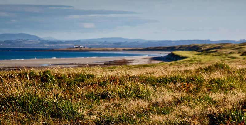
Across the D'Entrecasteaux Channel to the south of Hobart, Tasmania, is Bruny Island with its wild seascapes and sweeping surf beaches, rich maritime history, abundant birdlife and wildlife, tall forests and historic lighthouse. Effectively two quite different islands connected by a narrow neck of sand, Bruny was once home to a large group of Aborginal Tasmanians, (members of the proud Nuenonne tribe, who were decimated by violence and disease following European settlement) the island still carries the evidence of their pre-European existence in shell middens on its beaches. Many of Bruny's landmarks are named after these original inhabitants.

Tasmania's largest and Australia's 6th largest island, Flinders Island is located in Bass Strait, some 20 km from the north-eastern tip of Tasmania, Australia. It is the largest island of the Furneaux Group. Flinders is a long, narrow island, 75km long and 40km wide, with the Darling Ranges running along the middle of the island. With a height of 756m Mt. Strzelecki is the island's highest peak. The total land area of the island is 1.333 sq km. Its population is just over 1000 people. The major population centres are Whitemark (which has the island's main airstrip) and Lady Barron (the port).

The Furneaux Group is a group of 52 islands, at the eastern end of Bass Strait, between Victoria and Tasmania. The islands were named after British navigator Tobias Furneaux who sighted the eastern side of these Island after leaving Adventure Bay in 1773 on his way to New Zealand to rejoin Captain James Cook. The largest islands in the group are Flinders Island, Cape Barren Island and Clarke Island. The islands are the remnant of a land bridge which joined Tasmania to the Australian mainland through this group of islands.

Governor Island is a well known landmark of Bicheno, a fishing resort village on Tasmania's East Coast. The coarse-grained granite bedrock of Tasmania's north-east outcrops throughout the Bicheno region, and nowhere is it more spectacular than Governor Island. Underwater, the granite fractures into large blocks which often overlie each other creating spectacular underwater scenery.
The rocky reef drops steeply into deep water; its sheer vertical walls and overhanging rock faces are home to an unusually diverse range of colourful and captivating marine communities. Deep fissures and caves are brim full of fish both large and small. At depths below 30m, the granite reef slopes into sandy-bottomed trenches scattered with boulders. The Castle, Hairy Wall and Mr Whippy are some of the names given by divers to underwater features.
The Hunter Group of Islands lie in Bass Strait off the north-west tip of Tasmania due south of Geelong, Victoria. The island and the island group were named by British navigator Matthew Flinders after John Hunter, Governor, of the Colony of New South Wales, in December 1798 during the first recorded circumnavigation of Tasmania. Hunter, Three Hummock and the not so well known Robbins and Walker Islands and the numerous lesser islands of the group have a charm of their own. The currents here are swift and the tides repeatedly empty much of the area to an expansive desert wasteland. Adding to the beauty of the islands are the mutton birds, the pelicans and albatross along with the myriad of other wild life. The islands are small, but crammed with individual characteristics identifying each in its own very special way.
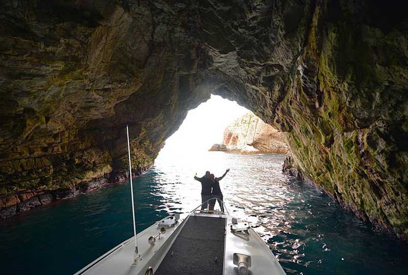
Isle des Phoques is a tiny rock in the middle of Great Oyster Bay around 10km south of Schouten Island and 18km north of Darlington on Maria Island. It has several spectacular caves which provide some of the Tasmania's best diving. A two-hour cruise from Coles Bay via Schouten Island is one of the best ways to see the island. Ile des Phoques was named by French explorer Nicolas Baudin whose expedition spent considerable time charting the coastline and documenting the wildlife in 1802. The small granite island's name means Island of Seals; it is home to a significant colony of Australian Fur Seals - mammals once on the brink of extinction. From May to August, humpback and southern right whales can be sighted. Dolphins are a common sight.
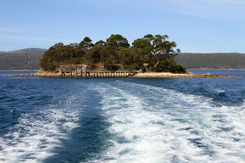
A small island located in the harbour off Point Puer adjacent to the Port Arthur Historic Site, Tasmania. It is a small, picturesque island roughly the size of Sydney's Fort Denison, and lies in the bay between the prison and the open ocean. Originally called Opossum Island, it was selected as a burial place by the Rev. John Manton in 1833. Between 1833 and 1877, about 1,000 burials took place on the island. The majority were convicts and ex-convict paupers who were buried mostly in unmarked graves on the lower part of the island. The graves of free people - 180 officials, soldiers, women and children - were located in the higher side of the island and sometimes marked by elaborate headstones cut by the convict stonemasons.

King Island is located in the Roaring Forties of Bass Strait, off the north-western tip of the main island of Tasmania, approximately 80 km northwest of Tasmania in Australia and about 90 km southeast of Cape Otway on the Victorian coast of Australia. King Island, with a population between 1500 and 2000. Wildly rugged and windswept, it boasts over 145 km of untouched coastline, an estimated 57 offshore wrecks and a wide and unusual variety of seabirds and wildlife. It is not a tiny island, being some 64 km long and 26 km wide.
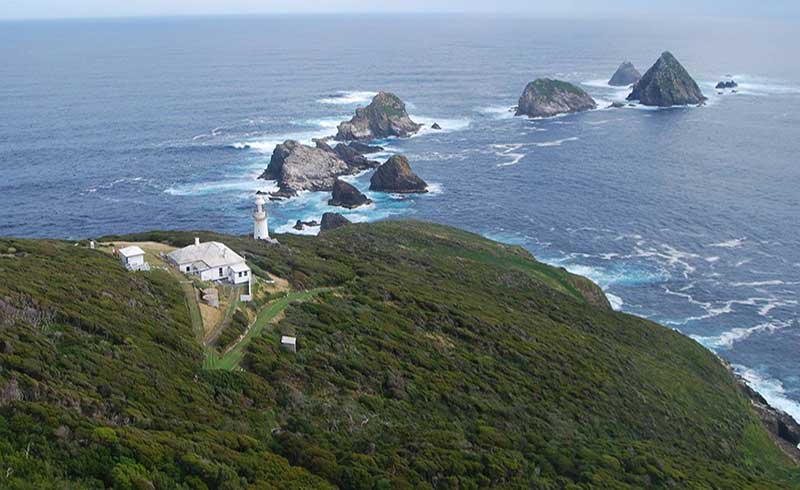
Located approximately 10 km off the south coast of Tasmania, Maatsuyker is the second largest island in the Maatsuyker Group. It is 3 km long and 1.5 km wide at its widest point and covers 180 hectares. Maatsuyker Island is lashed by the unobstructed force of the Roaring Forties coming across the Southern Ocean from as far away as Africa. The island has an average of 250 rain days each year, with an annual average rainfall of 1.2 metres. The lighthouse's keepers log book from 1907 has this interesting entry: "Five days continuously without rain this month". There is a constant gale blowing across the island with winds averaging 50-60 knots. The highest recorded speed is 112 knots though it believed it get much higher in a storm. This cannot be proved, however, as every time attempts have been made to record it, the equipment has failed to survive the storm.
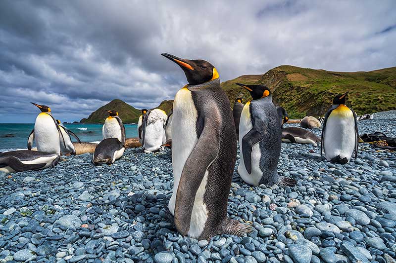
A tiny fragment of land half-way between New Zealand and Antarctica in the Southern Ocean. Each Spring, thousands of sea birds and mammals converge on the island in order to leave the water and breed. This seasonal influx of life also makes Macquarie an oasis for biologists. With the creative application of technology, those scientists are gaining fascinating insight into the mysterious ocean-going lives of the island's seasonal visitors.
The island's natural history has been a magnet for scientists and for over 50 years Australia has operated a research station at the northern end of the island. The station is home to over 40 people over the summer and around 20 through winter. A wide variety of research is carried out on the island including biology, botany, auroral physics, meteorology and medical research.

Maria is a mountainous island off the east coast of Tasmania, from Orford and Triabunna. The entire island is a National Park. It is about 20 km in length from north to south and, at its widest, is about 13 km west to east, and comprising two halves that are linked by a sandy isthmus. For two periods during the first half of the 1800s, the island hosted convict settlements, established in the mid-1820s and mid-1840s around Darlington. Among those held during the later convict period was the Irish nationalist leader William Smith O'Brien, exiled for his part in the Young Irelander Rebellion of 1848. His cottage still exists in the former penal colony.
Maria Island has sparkling white sandy beaches and a coastal mountain range with lush gullies, but it is most known for its spectacular limestone and sandstone cliffs. The Painted Cliffs are one of nature's masterpieces. Beautifully coloured and patterned sandstone, carved and moulded by the sea, and bordered by rock pools teeming with marine life. Although this sort of rock formation is not uncommon, it is rare in a natural situation for it to be so extensively and beautifully exposed. The wonderful patterns are caused by ground water percolating down through the already formed sandstone and leaving traces of iron oxides, which have stained the rock formation.

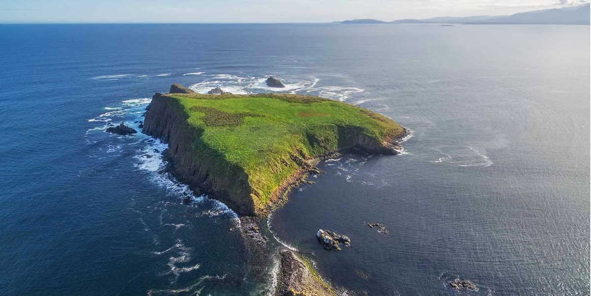
Pedra Branca is a 2.5 ha rock or small island about 26 km south-south-east of South East Cape, Tasmania. It is known for its inaccessibility, rich marine wildlife, wet and windy weather, interesting geology and large waves. It is part of the Southwest National Park, and thus in the Tasmanian Wilderness World Heritage Site. An erosional remnant of the Tasmanian mainland, Pedra Branca is approximately 270 metres long, 100 metres wide, and 60 metres high. This is small enough to provide an example of an outcrop that lies on the border between being a rock or islet and an island.

Situated in the remote southerly reaches of Macquarie Harbour in Tasmania's wilderness south-west, Sarah Island was the site of the first convict settlement in Tasmania. Established in 1822 it has remained unoccupied and relatively undisturbed since it was finally abandoned as a penal settlement in 1847. Its convicts laboured under the harshest conditions in nearby rainforest felling Huon pines for boat building. Of all the sites that might have been chosen, this six-hectare (15-acre) island would have been the most windswept and barren, but it was also the most secure.

On navigating the east coast of Tasmania in 1642, Dutchman Abel Tasman named Schouten Island, at the southern tip of the Freycinet Peninsula on the state's east coast, after Willem Schouten (1567?-1625), a Dutch explorer and a member of the Council of the Dutch East India Company in Tasman's time. Freycinet National Park was declared in August 1916. Schouten Island, which had been administered as a scenic reserve from 1916-1941, and then again from 1967, was added to the park in 1977.

Tasman Island stands defiantly beyond the tip of Cape Pillar, a rugged, desolate and windswept rock; it was named after Dutch seaman Abel Tasman who cautiously skirted its thunderous shores in 1642. Like a fortress, its grey basalt columns rise 240 metres straight out of the sea. Above is a plateau of only 50 hectares, pock-marked with sink holes, caves and small clumps of windswept vegetation.
Located off the south eastern tip of the Tasman Peninsula, the island stands off-shore from a rugged, awe inspiring corner of Tasmania known as Tasman Peninsula, that features magnificent cliffs and coastal formations such as the Devil's Kitchen, Tasman's Arch, Waterfall Bay, Pirates Bay Lookout, Fortescue Bay, Remarkable Cave and Cape Pillar. The cliffs of Tasman Island and nearby Cape Pillar are in fact the highest sea-cliffs in the southern hemisphere.
© All rights reserved | Design by W3Layouts