
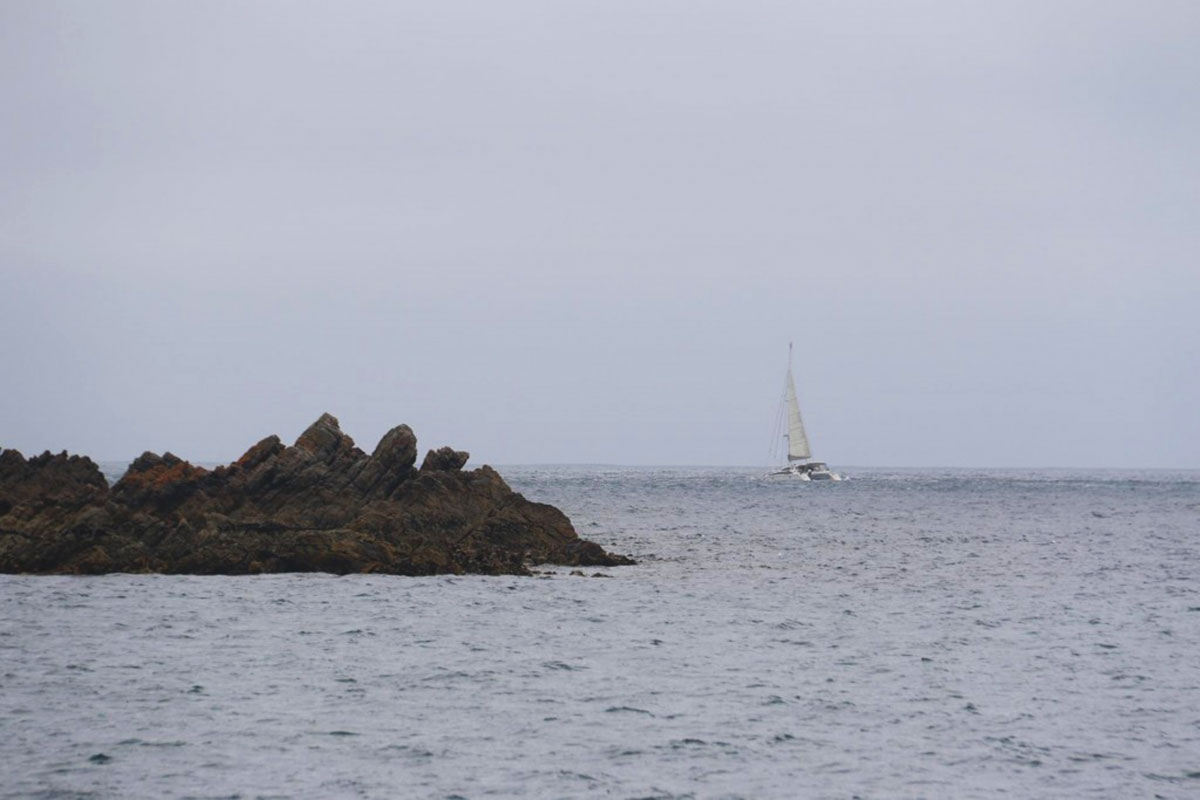
Hunter Island Group, Tasmania
The Hunter Group of Islands lie in Bass Strait off the north-west tip of Tasmania due south of Geelong, Victoria. The currents here are swift and the tides repeatedly empty much of the area to an expansive desert wasteland. Adding to the beauty of the islands are the muttonbirds, the pelicans and albatross along with the myriad of other wild life.

The islands are small, but crammed with individual characteristics identifying each in its own very special way. Hunter Island (Muttonbird Reserve), Three Hummock Island, Robbins Island, Albatross Island (Wildlife Sanctuary) and Walker Island are the most visited of the Hunter Island Group, which is offshore from Smithton. Hunter Island shows evidence of 23 000 years of continuous occupation by Aboriginal people and has been inhabited by non-Aboriginal people for approximately 170 years.
You may notice, by looking at the Google map of the islands, that they have two names - the Fleurieu Group and the Hunter Group. Matthew Flinders named them the Hunter Island Group on 10th December 1798 during his circumnavigation of Tasmania with George Bass. The name honours John Hunter, the Governor of New South Wales at the time, who instigated the Bass and Flinders expedition. Nicolas Baudin named them the Fleurieu Island Group on 25th February 1802, after Compte Alphonse de Fleurieu, who had organised Baudin's 2-ship expedition to survey the coasts of New Holland (Australia) and Van Diemen's Land (Tasmania) at the request of the Emperor Napoleon.
At the time, the French were seriously considering colonising that part of the Australian continent not yet settled by the British. During 1801-02, Flinders and Baudin conducted exploratory journeys around the Australian coast simultaneously, but in opposite directions, naming coastal features as they went. This resulted in many localities being given two names - and at times, three, as Baudin's 2nd in command, Louis de Freycinet, took it upon himself to bestow names also.
In the main, those given by Flinders were adopted, with French names being retained where Flinders had not recorded a name. In the case of the Hunter/Fleurieu Group itself, the French name was officially adopted later, but by then the Flinders' name was already in common use and remains so to this day.
Hunter Island is the main island of the Hunter Island Group, is a 7,330-hectare island that lies between King Island and the north-west coast of Tasmania. The island is run as a cattle property and there is a homestead on the island. A privately owned barge is used for transport to Smithton on the north coast of Tasmania. The island is approximately 25 kilometres long, and 6.5 kilometres wide at its widest point. The East India Ship Phatisalam was wrecked on the island in 1821.
The highest point of the island lies at 90 m above sea level, from where low undulating hills roll away to the coast. The native vegetation is largely intact with only 860 ha cleared for grazing and residential use. Heathlands and coastal scrub make up nearly 80 per cent of the native vegetation, with swamp forests, buttongrass moorlands, native grasslands, woodlands, muttonbird colonies, saltmarshes and lichen fields providing a wide range of habitats. As can often be the case, despite its history of occupation, clearing and grazing, Hunter Island still retains its significance for conservation. The island is important for six threatened bird species, including the orange-bellied parrot, swift parrot, white-bellied sea eagle, shy albatross, Tasmanian wedge-tailed eagle and fairy prion.
Hunter Island shows evidence of 23 000 years of continuous occupation by Aboriginal people (more information) and has been inhabited by non-Aboriginal people for approximately 170 years. The island and the island group were named in December 1798 by British navigator Matthew Flinders after John Hunter, Governor, of the Colony of New South Wales, during the first recorded circumnavigation of Tasmania. Many different owners have grazed cattle on the island lease since 1853. As can often be the case, despite its history of occupation, clearing and grazing, Hunter Island still retains its significance for conservation. The island is important for six threatened bird species, including the orange-bellied parrot, swift parrot, white-bellied sea eagle, shy albatross, Tasmanian wedge-tailed eagle and fairy prion.
The orange-bellied parrot is nationally endangered with only 200 mature individuals remaining. The birds use Hunter Island as a resting and feeding place each year on passage to King Island and the Victorian and South Australian coasts. However, in recent years there has been significant damage to the island's saltmarsh and coastal dune communities on which the parrots depend. White-bellied sea eagles, recently listed as vulnerable in Tasmania, nest on Hunter Island in numbers greater than anywhere else in the state.
Hunter Island supports six ecological communities that are of priority for conservation at state level: Eucalyptus viminalis coastal forest, muttonbird colony, Leptospermum/Melaleuca swamp forest, Melaleuca ericifolia forest, dune vegetation and shrubby coastal heath. There are eight plant species of conservation significance, including one of the most spectacular of the greenhood orchids, the endangered leafy greenhood Pterostylis cucullata. This amazing, ancient plant was thought to be lost to science until rediscovered on Hunter Island in about 1970. The leafy greenhood grows only along the very old (Holocene) sand dunes that transverse certain sections of the island, unfortunately the same areas where cattle grazing has been concentrated.
For many centuries the island was a summer hunting ground for aborigines of the North West tribe who reached the island by swimming across five kilometres of open water from nearby Hunter Island. Its European discoverers were Bass and Flinders who named the island in 1798. More explorers, shipwrecked mariners and sailors followed. Many paths on the island lead to locations of exceeding beauty. The 237 metre high South Hummock of the island offers views of the island, nearby Hunter Island and Tasmania.
Birdlife abounds on the island, with over 90 species recorded. Wild ducks, black swans and eagles frequent the small lakes behind the sand dunes lining the beaches. A wide variety of sea birds are seen around the coast, including international visitors that come to the Island to breed. Shearwaters (Moonbirds) are a spectacular sight as they return in thousands to their rookeries at dusk during summer. Penguins can be observed making their nightly trip up the beach to their nests.
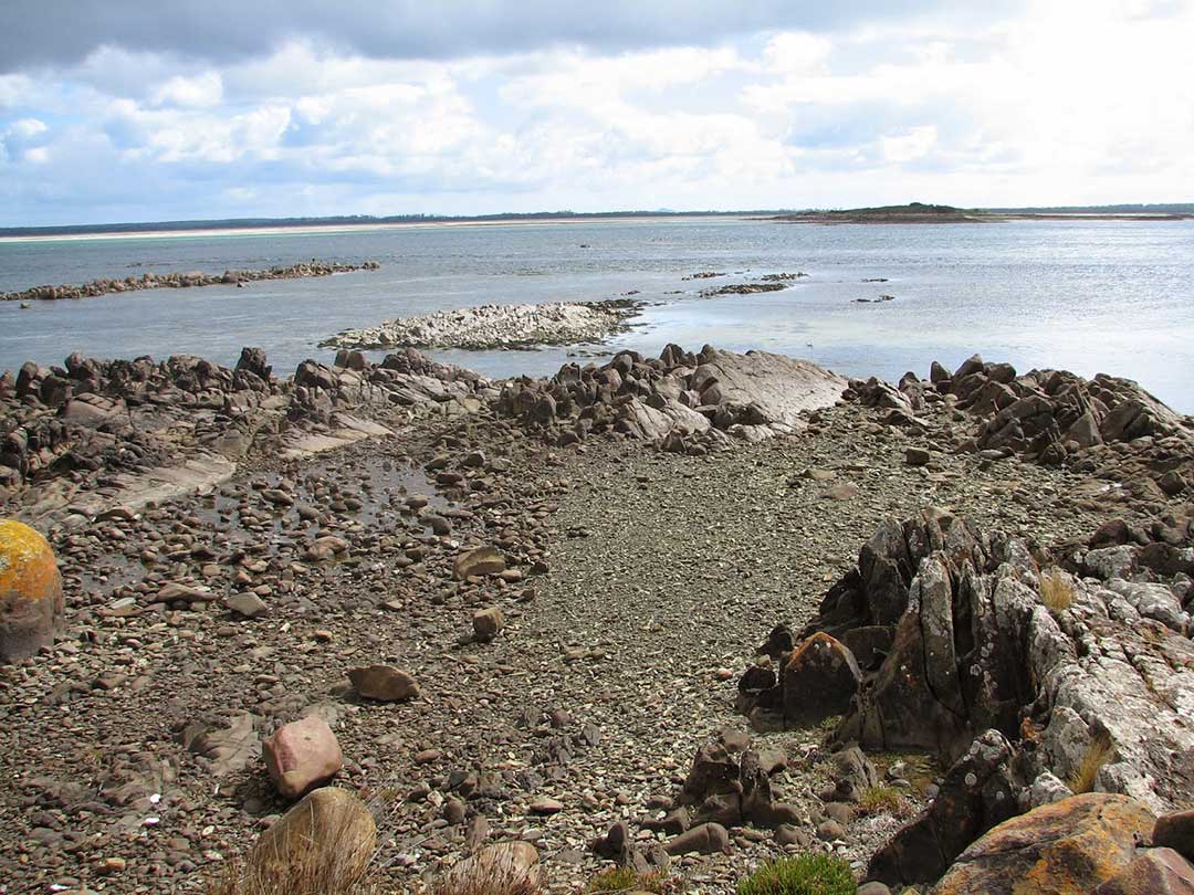
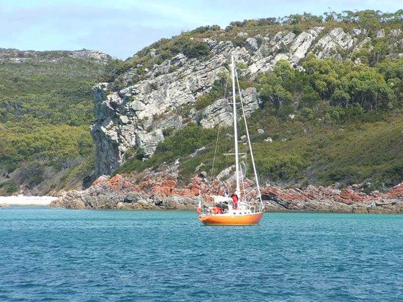
Robbins Island and Robbins Passage from Stony Point
Robbins made a shambles of it; after hoisting it in a large gum tree and firing three volleys in salute low over the nearby French tents (Robbins had to borrow the gunpowder for the salute from the French as he had not brought any with him), he made a garbled proclamation of possession, and then realised that in his haste he had raised the flag upside down. Luckily, the French, who numbered nearly one hundred, compared to the 17 of Robbins and his crew from the Cumberland, treated the incident with ridicule and not with force. Baudin tartly remarked to Robbins that he had 'no intention of annexing a country already inhabited by savages'. Upon his return to England, age 24, as master of the Integrity, Robbins set out on an assignment to South America. Neither he nor his ship was heard of again.
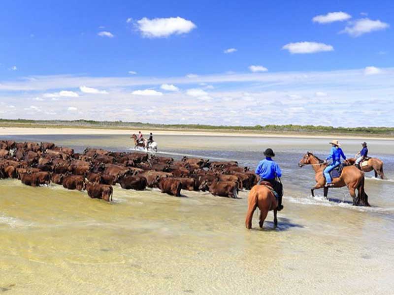
The island was used for livestock to graze on, primarily for wool production before the 1850s. William B. Reid leased the island for 43 years commencing in 1873, when native animals on the land were used as wild game, farming and dairy products were made. Bill and Norah Holyman then bought the island in 1916 using it for sheep husbandry, selling off the island in 1958. In 1961, H. E. Hammond was the owner of the island, and it remains in family ownership today. His descendants, Keith and John Hammond currently produce on Robbins Island wagyu beef, which is exported to Japan and mainland Australia.
Commercial aquaculture industry from Circular Head (Stanley) presently harvest rock lobster and abalone in waters around the island.
The centre of the island is cut lengthways by a deep gulch which runs through the short axis; one of the caves runs through the long axis. The cave is usually occupied by a few Albatross that have become trapped. It was in this cave that early sealers slaughtered thousands of Albatross in the 1870's. The island has steep cliffs on all sides, and these have afforded the Albatross some protection. They nest on the top of the highest cliffs. The island once boasted over 12,000 seals but these were less fortunate.
The islands are small, but crammed with individual characteristics identifying each in its own very special way. Hunter Island (Muttonbird Reserve), Three Hummock Island, Robbins Island, Albatross Island (Wildlife Sanctuary) and Walker Island are the most visited of the Hunter Island Group, which is offshore from Smithton. Hunter Island shows evidence of 23 000 years of continuous occupation by Aboriginal people and has been inhabited by non-Aboriginal people for approximately 170 years.
You may notice, by looking at the Google map of the islands, that they have two names - the Fleurieu Group and the Hunter Group. Matthew Flinders named them the Hunter Island Group on 10th December 1798 during his circumnavigation of Tasmania with George Bass. The name honours John Hunter, the Governor of New South Wales at the time, who instigated the Bass and Flinders expedition. Nicolas Baudin named them the Fleurieu Island Group on 25th February 1802, after Compte Alphonse de Fleurieu, who had organised Baudin's 2-ship expedition to survey the coasts of New Holland (Australia) and Van Diemen's Land (Tasmania) at the request of the Emperor Napoleon.
At the time, the French were seriously considering colonising that part of the Australian continent not yet settled by the British. During 1801-02, Flinders and Baudin conducted exploratory journeys around the Australian coast simultaneously, but in opposite directions, naming coastal features as they went. This resulted in many localities being given two names - and at times, three, as Baudin's 2nd in command, Louis de Freycinet, took it upon himself to bestow names also.
In the main, those given by Flinders were adopted, with French names being retained where Flinders had not recorded a name. In the case of the Hunter/Fleurieu Group itself, the French name was officially adopted later, but by then the Flinders' name was already in common use and remains so to this day.
Hunter Island
The largest island in the Hunter Group, Hunter Island lies six kilometres off the north-west tip of Tasmania. The island is 7330 ha in size, approximately 25 km long, and 6.5 km wide at its widest point. Three Hummock Island, another island in the group, is managed for conservation. The highest point of the island lies at 90 m above sea level, from where low undulating hills roll away to the coast. The native vegetation is largely intact with only 860 ha cleared for grazing and residential use. Heathlands and coastal scrub make up nearly 80 per cent of the native vegetation, with swamp forests, buttongrass moorlands, native grasslands, woodlands, muttonbird colonies, saltmarshes and lichenfields providing a wide range of habitats.Hunter Island is the main island of the Hunter Island Group, is a 7,330-hectare island that lies between King Island and the north-west coast of Tasmania. The island is run as a cattle property and there is a homestead on the island. A privately owned barge is used for transport to Smithton on the north coast of Tasmania. The island is approximately 25 kilometres long, and 6.5 kilometres wide at its widest point. The East India Ship Phatisalam was wrecked on the island in 1821.
The highest point of the island lies at 90 m above sea level, from where low undulating hills roll away to the coast. The native vegetation is largely intact with only 860 ha cleared for grazing and residential use. Heathlands and coastal scrub make up nearly 80 per cent of the native vegetation, with swamp forests, buttongrass moorlands, native grasslands, woodlands, muttonbird colonies, saltmarshes and lichen fields providing a wide range of habitats. As can often be the case, despite its history of occupation, clearing and grazing, Hunter Island still retains its significance for conservation. The island is important for six threatened bird species, including the orange-bellied parrot, swift parrot, white-bellied sea eagle, shy albatross, Tasmanian wedge-tailed eagle and fairy prion.
Hunter Island shows evidence of 23 000 years of continuous occupation by Aboriginal people (more information) and has been inhabited by non-Aboriginal people for approximately 170 years. The island and the island group were named in December 1798 by British navigator Matthew Flinders after John Hunter, Governor, of the Colony of New South Wales, during the first recorded circumnavigation of Tasmania. Many different owners have grazed cattle on the island lease since 1853. As can often be the case, despite its history of occupation, clearing and grazing, Hunter Island still retains its significance for conservation. The island is important for six threatened bird species, including the orange-bellied parrot, swift parrot, white-bellied sea eagle, shy albatross, Tasmanian wedge-tailed eagle and fairy prion.
The orange-bellied parrot is nationally endangered with only 200 mature individuals remaining. The birds use Hunter Island as a resting and feeding place each year on passage to King Island and the Victorian and South Australian coasts. However, in recent years there has been significant damage to the island's saltmarsh and coastal dune communities on which the parrots depend. White-bellied sea eagles, recently listed as vulnerable in Tasmania, nest on Hunter Island in numbers greater than anywhere else in the state.
Hunter Island supports six ecological communities that are of priority for conservation at state level: Eucalyptus viminalis coastal forest, muttonbird colony, Leptospermum/Melaleuca swamp forest, Melaleuca ericifolia forest, dune vegetation and shrubby coastal heath. There are eight plant species of conservation significance, including one of the most spectacular of the greenhood orchids, the endangered leafy greenhood Pterostylis cucullata. This amazing, ancient plant was thought to be lost to science until rediscovered on Hunter Island in about 1970. The leafy greenhood grows only along the very old (Holocene) sand dunes that transverse certain sections of the island, unfortunately the same areas where cattle grazing has been concentrated.
Three Hummock Island
This island has been described as a coastal wonderland. It has dozens of beaches, some magnificent with breakers and sand dunes, others as small as 20 metres, protected by jutting granite boulders and seething in life. Its vegetation is rapidly returning to natural heaths under the new management program of the National Parks and Wildlife Service.For many centuries the island was a summer hunting ground for aborigines of the North West tribe who reached the island by swimming across five kilometres of open water from nearby Hunter Island. Its European discoverers were Bass and Flinders who named the island in 1798. More explorers, shipwrecked mariners and sailors followed. Many paths on the island lead to locations of exceeding beauty. The 237 metre high South Hummock of the island offers views of the island, nearby Hunter Island and Tasmania.
Birdlife abounds on the island, with over 90 species recorded. Wild ducks, black swans and eagles frequent the small lakes behind the sand dunes lining the beaches. A wide variety of sea birds are seen around the coast, including international visitors that come to the Island to breed. Shearwaters (Moonbirds) are a spectacular sight as they return in thousands to their rookeries at dusk during summer. Penguins can be observed making their nightly trip up the beach to their nests.
Robbins Island and Robbins Passage from Stony Point
Robbins Island
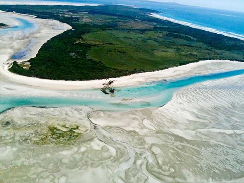
The eastern and northern coasts of Robbins offer a variety of sights and wildlife. There are hills, cliffs, rolling paddocks, a lagoon, sand dunes, and surf beaches and a six square km inlet that dries entirely twice a day with every low tide. The other islands are quite small. Robbins Island is named after Charles Robbins, whose main claim to fame was to lead a small party of men to thwart any attempts by the French to colonise Van Diemens Land (Tasmania). On 13th December 1802, while mapping Bass Strait, Robbins entered Sea Elephant Bay, King Island to find French explorer Nicolas Baudin's ships at anchor off shore near the present site of Naracoopa. Panic struck, Robbins launched a long boat with a party of men and made a dash for the shore, Union Jack in hand so as to beat the Frenchman in claming the island.
Robbins made a shambles of it; after hoisting it in a large gum tree and firing three volleys in salute low over the nearby French tents (Robbins had to borrow the gunpowder for the salute from the French as he had not brought any with him), he made a garbled proclamation of possession, and then realised that in his haste he had raised the flag upside down. Luckily, the French, who numbered nearly one hundred, compared to the 17 of Robbins and his crew from the Cumberland, treated the incident with ridicule and not with force. Baudin tartly remarked to Robbins that he had 'no intention of annexing a country already inhabited by savages'. Upon his return to England, age 24, as master of the Integrity, Robbins set out on an assignment to South America. Neither he nor his ship was heard of again.
The island was used for livestock to graze on, primarily for wool production before the 1850s. William B. Reid leased the island for 43 years commencing in 1873, when native animals on the land were used as wild game, farming and dairy products were made. Bill and Norah Holyman then bought the island in 1916 using it for sheep husbandry, selling off the island in 1958. In 1961, H. E. Hammond was the owner of the island, and it remains in family ownership today. His descendants, Keith and John Hammond currently produce on Robbins Island wagyu beef, which is exported to Japan and mainland Australia.
Commercial aquaculture industry from Circular Head (Stanley) presently harvest rock lobster and abalone in waters around the island.
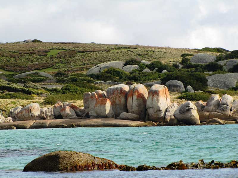
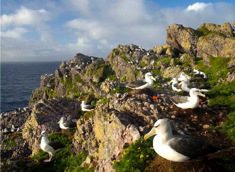
Albatross Island
Albatross Island has many delights but none come near the feeling of awe and inspiration of walking amongst the thousands of nesting birds. The Albatross is strong, confident and totally in control of its environment. The island has four caves, two are concealed by tunnels and easily missed. These caves extend up to 60 metres with ceilings of 15 metres, large enough to accommodate the hundreds of penguins that come ashore to rest there each night.The centre of the island is cut lengthways by a deep gulch which runs through the short axis; one of the caves runs through the long axis. The cave is usually occupied by a few Albatross that have become trapped. It was in this cave that early sealers slaughtered thousands of Albatross in the 1870's. The island has steep cliffs on all sides, and these have afforded the Albatross some protection. They nest on the top of the highest cliffs. The island once boasted over 12,000 seals but these were less fortunate.
Walker Island
Walker Island, sometimes also Walker's Island, is separated from the Tasmanian mainland by a highly tidal area known as Robbins Passage,[3] lies north of the adjacent Robbins Island. Access to Walker Island is available via the Walker Island Airport. The island, together with the adjacent Robbins Island, has been privately owned by the Hammond family since 1961. In 2016 it was reported that the family graze approximately 7,000 head of Wagyu cattle on both islands, and mainland Tasmania.
A PocketOz Travel and Information Guide
Design and concept © Stephen Yarrow | Email | W3Layouts | Test