
Dover, Tasmania

A small fishing port with quaint cottages and English trees, Dover was once a convict station. Today it is an important centre for both apple orchards and the salmon, abalone and cray fishing industries.
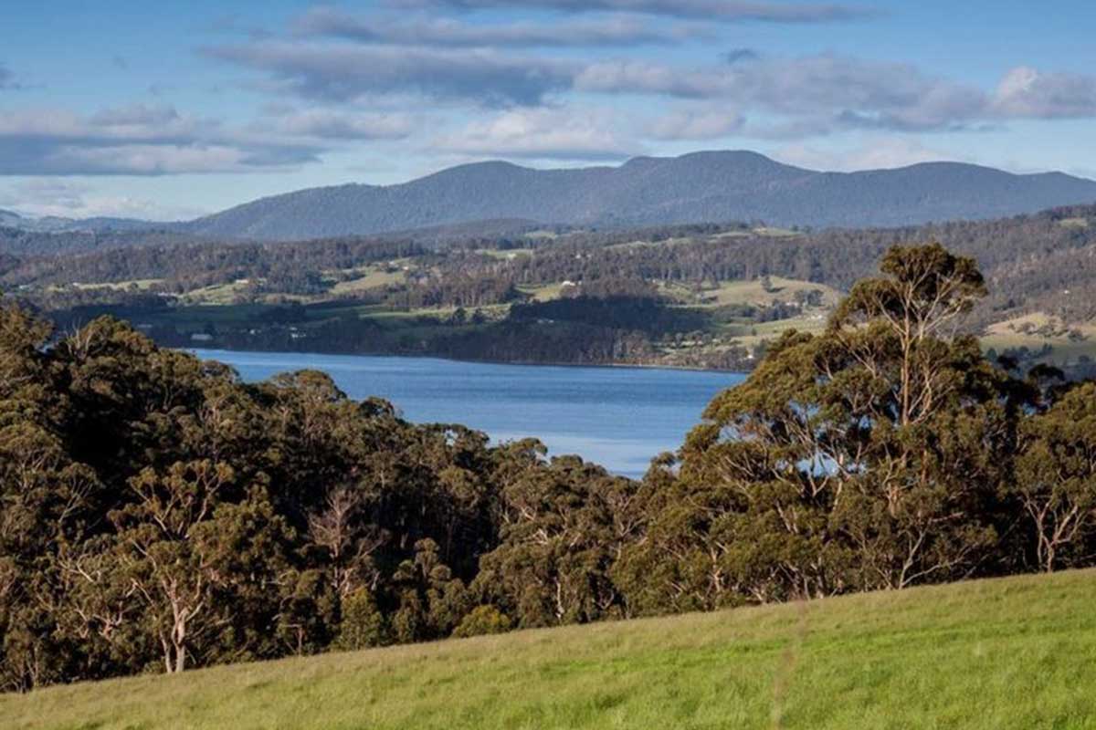
Where is it?: 83 km south west of Hobart, in the Huon Valley. Dover lies beside the waters of Esperance Bay and the D'Entrecasteaux Channel, with the imposing figure of Adamson's Peak in the background.
Dover enjoys a moderate climate, sheltered from the prevailing cold winds by Bruny Island, and is frequented by tourists keen to experience the idyllic coastal scenery or those eager to explore the deep wilderness further south.
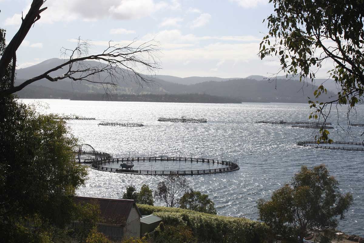
Salmon Farms
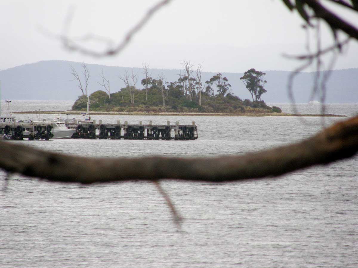
Charity Island
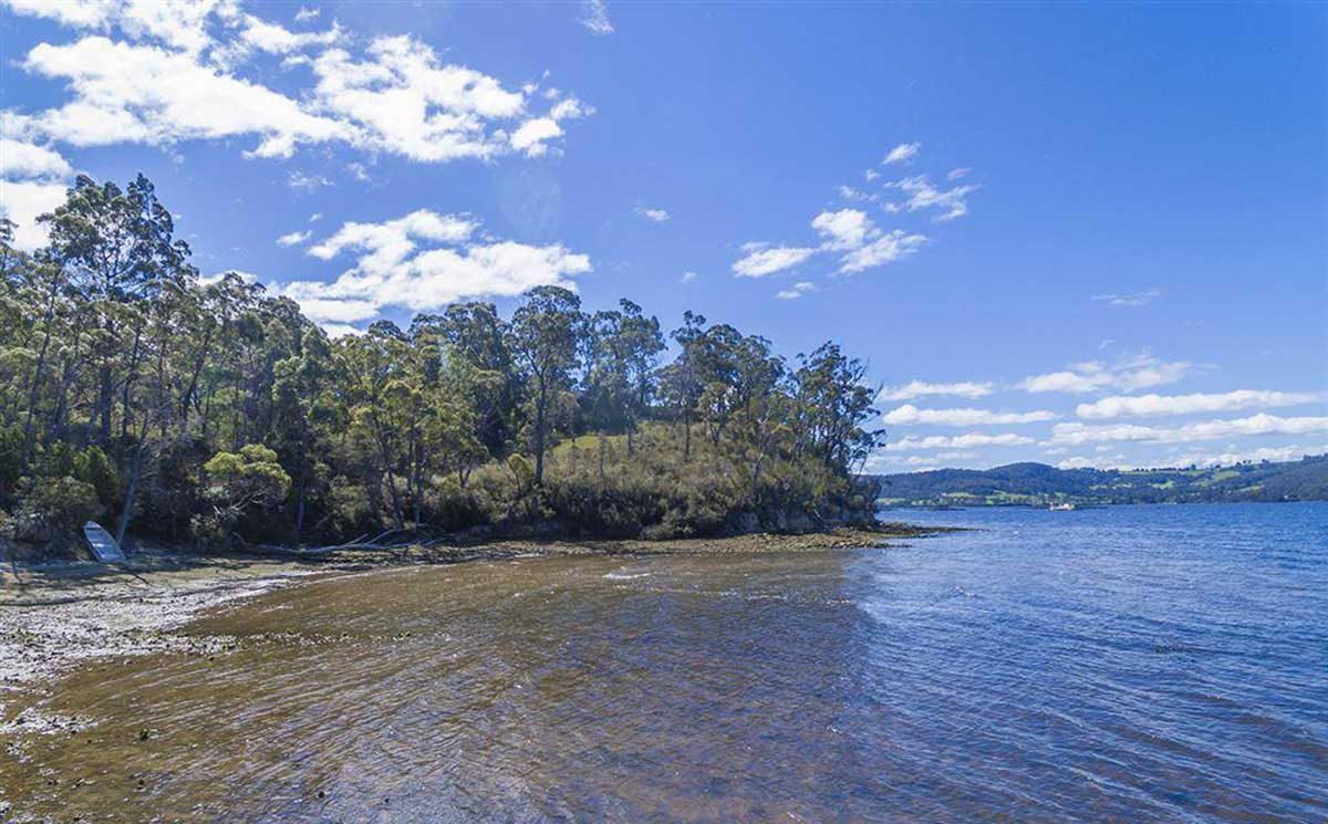
A trip out to three islands in the bay - named Faith, Hope and Charity - is recommended. The nsmes of the three islands are a Biblical reference, perhaps selected to inspire the convicts held at the original probation station. The smallest of the three islands in Esperance Bay, Faith Island, was known in earlier times as Dead Island. When the Dover Convict Probation Station was in use between late 1844 and 1848, numerous convicts were buried here, hence its early name.
Charity was first named Snatchel Island by Lady Jane Franklin when she visited in the 1830s. She named it after her maid who was ill at the time. Charity Island is closest to the shore. Faith Island is between Charity and Hope Islands. The first public cemetery was on Faith Island, and also was probably the place of some convict burials, but they would not have been numerous.
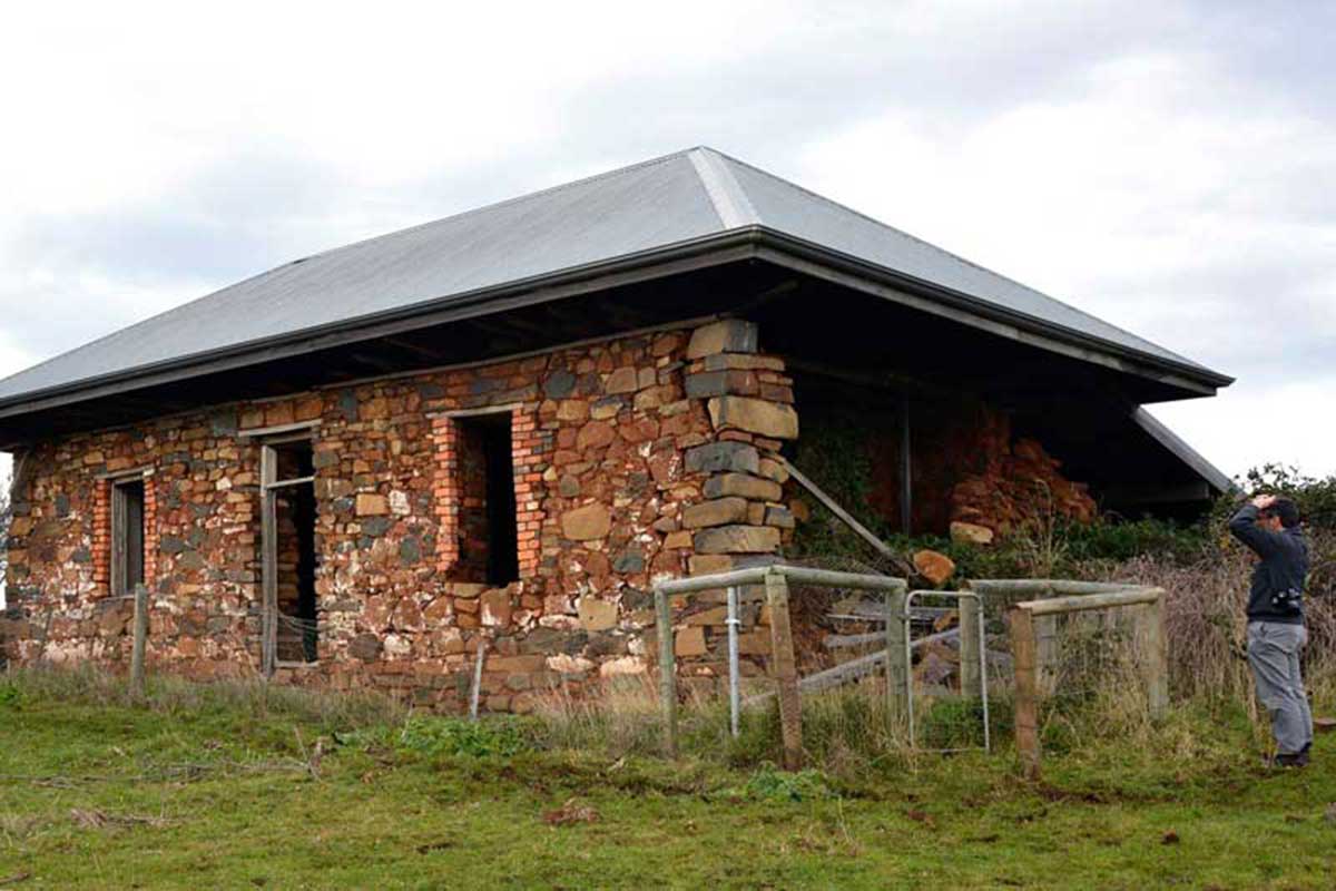
Assistant Superintendent's Quarters, Hope Island Probation Station
The Hope Island Probation Station was a colonial convict outstation of the Dover Probation Station. In 1847 there were 18 convicts on the island under an assistant superintendent; the men being primarily engaged in growing vegetables. Around 1848, shortly after abandonment of the probation station, the island was leased for private farming. By 1851 some of the buildings were already reported as falling in ruins. The Assistant Superintendent's Quarters is the most prominent of the ruins on the island. It was a basic Georgian style cottage built from local field stone bonded with the rich red clay of the island. It was originally whitewashed and had a timber shingled roof. In 2015, Tasmanian Parks and Wildlife Service rangers, field officers and heritage staff worked with a local stonemason to stabilise the building by rebuilding the collapsed western wall.
The mud brick kiln was built in the late 1860s for David Chapman who built the first Hopetoun sawmill adjacent to it. The bricks for the mill chimney were probably made there, however Mr Chapman started a business firing clay drainage pipes. The business did not last long, possibly because of the illness and death of the owner in the early 1870s. It is quite probable that the actual labourers were emancipated ex-convicts. Location: Brick Kiln beach, Esplanade, Dover.
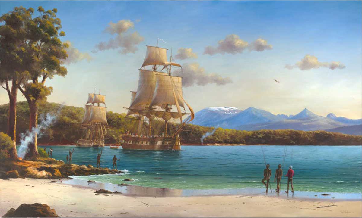
The town's locality was named Port Esperance by the French explorer, Admiral Bruni D'Entrecasteaux, who charted the area in 1792. It was named after one of his ships, which is also remembered in the name of the town of Esperance in Western Australia. Bruni D'Entrecasteaux and his expedition had visited the Western Australian coast and the locality where the town of Esperance now stands a short while before visiting the Huon region of Tasmania.
Dover was originally established as a convict probation station. Here, inmates transitioned to the status of a pass-holder, eligible to be assigned to employers and earn wages while still serving their time in the penal system. There is now little evidence of the town's penal past. All that remains is the well preserved (and privately owned) Commandant's Office which is located next to the Caravan Park on Beach Road.
There are villages further south but Dover can legitimately claim to be the southern most town of significance in Australia. Some of the villages on Bruny Island are further south and, inevitably, there was a long standing argument between the hotel in Alonnah on Bruny Island and the Dover Hotel (destroyed by fire in 2013) as to which is the most southern hotel in Australia.
Surrounding Area
The road south from Geeveston to Dover is the Huon Highway. It travels mainly inland until it reaches Surges Bay where it touches the coast and then turns inland again. To travel closer to the river, take Scotts Road from Geevston; it passes through the settlement of Cairns Bay before joining Huon Highway. To continue following the river, at Surges Bay you can take Esperance Coast Road which becomes Kent Beach Road before meeting up with Huon Highway at Dover.
Cairns Bay, Waterloo, Surges Bay, Brooks Bay, Police Point, Surveyors Point, Roaring Bay and Kent Beach are all small communities you will pass through when following the coastal road. The early name for Waterloo was Flights Bay.
Cairns Bay
Cairns Bay is a small bay and settlement 4 km south of Geeveston on Scotts Road. The southern end of the settlement is close to the Huon Highway. Cairns Bay is in an orchard-growing district, but the settlement was once used as a timber port. Ferries were the means of getting timber and produce out of the area.
Waterloo is a small community on the Huon Highway 4 km south of Cairns Bay and 8 km south of Geeveston. It is an orchard growing area and has good access to the popular Waterloo Bay.
Surges Bay
Surges Bay is a small township on the Huon Highway 10 km south of Geeveston. It is situated in a small bay on the Huon River of the same name. Once an important port for the ferries it was still being used well into the 1930's. Small boats and barges also took the apples to Cygnet for processing. It is at Surges Bay that you can take Esperance Coast Road which becomes Kent Beach Road before meeting up with Huon Highway at Dover. Surges Bay was originally known as Adelaide but was changed to the same name as the bay.
The settlement of Brooks Bay is 5 km south of Surges Bay on the Esperance Coast Road on a pleasant small bay. It is a quite place with a good frontage onto the Huon River and overlooks the mouth of Port Cygnet.
Desolation Bay (foreground) and Granny Gibbons Bay near Police Point
Police Point is 6 km east of the Huon Highway at Glendevie on the shores of the Huon River. It is situated at the junction of the Esperance Coast and Police Point Roads. The point from which the name is taken is about 1.5 Km. further south on the Huon River. The small farming and orchard growing district community of Glendevie is on the Huon Road, 12 km south of Geeveston. It started as a wood-milling district; the mill was situated close to the township. It was formerly known as Snake Plains - the name was changed in 1923. The first mill was at Flights Bay, then at Surges Bay. A tramline carried timber from valley of Glendevie (before there were any homes there) back to the Surges bay mill.
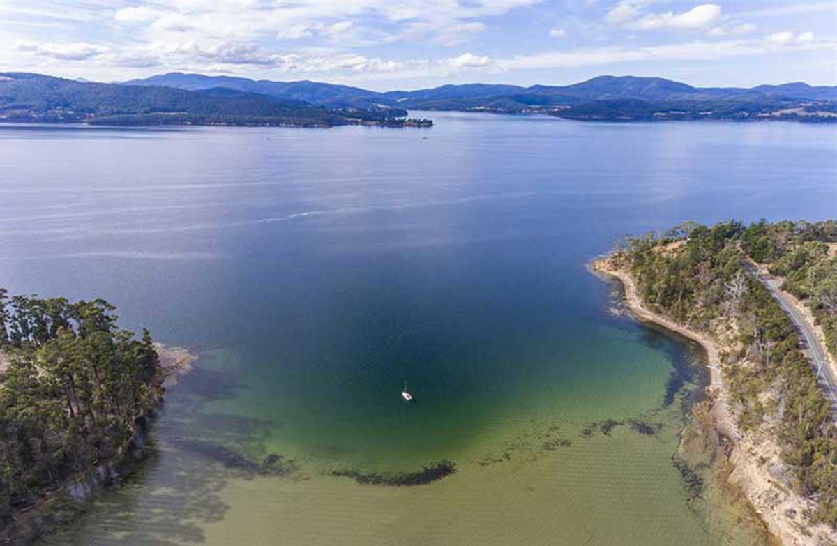
Barretts and Surveyors Bays are two small east-facing embayments located on the southern side of the entrance to the Huon River estuary. Barretts Bay has a 200 metre long narrow beach, which faces east out of the estuary. The Esperance Coast Road clips the southern end of the beach, with a small car park and reserve behind the beach.
Holiday settlement at Roaring Beach
Surveyors Bay is 10 km east of Dover on the Esperance Coast Road. It was once a busy port for the timber trade that once thrived in the area. Surveyors Bay is situated at the mouth of the Huon River and this made it easy to access. The bay lies 3 km to the southeast and 1.5 km north of Huon Point, the entrance to the Huon estuary, with Surveyors Point forming the northern boundary. The curving 600 metre wide bay has a 350 metre long beach which receives waves averaging up to 0.5 metres. The beach is backed by a row of holiday cottages. Adjoining Surveyors Bay is Hideaway Bay, the home of HUON Aquaculture.

Roaring Beach Lagoon
The forty metre high Huon Point borders the eastern end of Roaring Bay, which has a 1.4 km long south-facing beach, which receives south swell averaging about 1 metre. The bay has a row of beachfront houses, with a small creek crossing towards the western end and another 200 metres of the more sheltered beach extending west of the creek. Little Roaring Bay lies 500 metres to the south and is a more sheltered east-facing beach located at the mouth of a valley. Kubes Creek drains the valley and crosses the centre of the beach.
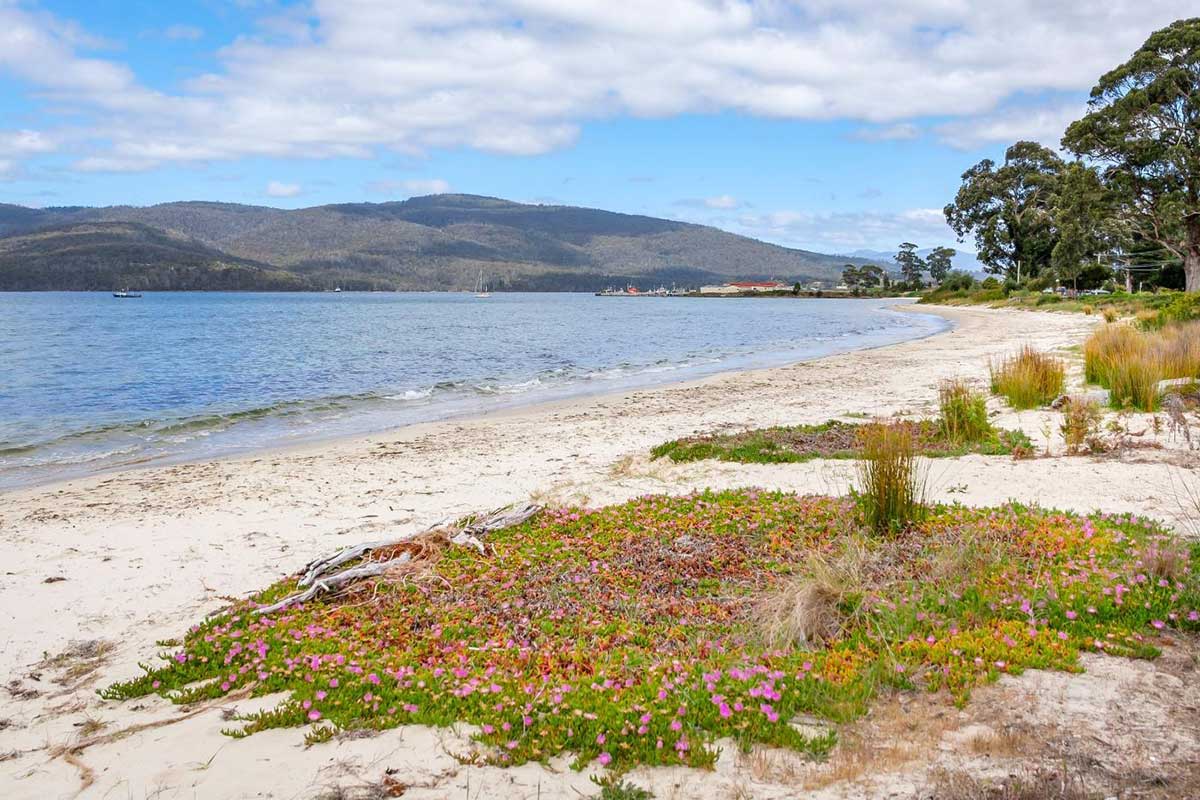
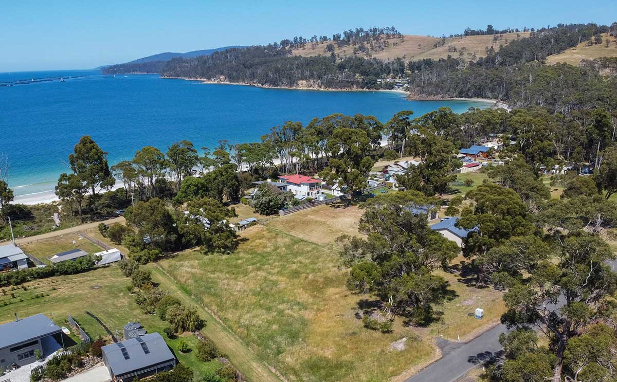
Kent Beach
Closer to Dover, Kent Beach Road runs behind the 800 metre long Kents Beach on Port Esperance, which is good for swimming, having a low swell, as well as some wind waves. The small Glenbervie Rivulet and wetland are located at its eastern end, with Bells Lagoon at its western end.