
Hobart's Rivulets

If you take even a brief look at the maps of Australia's state capital cities, you see that the smaller waterways around most cities and their suburban areas are named rivers or creeks - except for Hobart. Here they are called rivulets, a word meaning 'small stream', from Latin 'rīvulus', meaning stream, and the sufix 'let', meaning small. In Britain, from where the use of the word was imported to describe and name Hobart's small watercourses, a rivulet is a stream, small in length, that feeds directly into a large river, rather than join a tributary first. Therein lies the possible reason for Hobart - and Hobart alone, among the capital cities - having rivulets. Hobart sits snugly in the shadow of Mt Wellington and Mt Nelson from where fresh water run-off travels only a short distance along the numerous rivulets that criss-cross the hillsides behind the city, before emptying into the Derwent River.
For the Mouheneener and Nuenonne Aboriginal peoples who populated the Hobart area prior to European settlement, the rivulets were an important source of fresh water. Early colonial records indicate that indigenous Tasmanians frequently camped along the shores of the River Derwent where these rivulets entered the river, having hunted and gathered in the rivulets and foreshores of the Derwent Estuary for thousands of years. The coastal zone of the river provided these people with fresh fish and shellfish where they gathered mussels, limpets, oysters and crayfish. The lightly wooded foothills of this region consisted of dry schlerophyll forests with an abundance of native fauna for food. The aboriginal bands of this area fed on speared kangaroo, wallaby, emu and possum. The rivulets that carved their way down the mountain side were places where aboriginal women and children searched for thick white grubs in the banksias and rotting logs that lay beside the streams
The arrival of the European’s in February 1804 forced the aboriginal families to retreat into the sanctity of neighbouring woodlands. In the months and years that followed the landscape was transformed from one of traditional hunting grounds to widespread European settlement. The Mouheneenner and Nuenonne bands were driven from their homes by encroaching settlementand had little choice but to disappear from the area, never to return.
The white settlers also established their camps and settlements alongside the rivulets, the land around the Hobart Rivulet being the site of the first and main settlement, which grew into the City of Hobart. Sadly, the value of the rivulets as an integral part of the natural landscape was not recognised as the city developed, and most ended up flowing into stormwater drains that piped their waters undergound, out of sight below the urban development that displaced them.

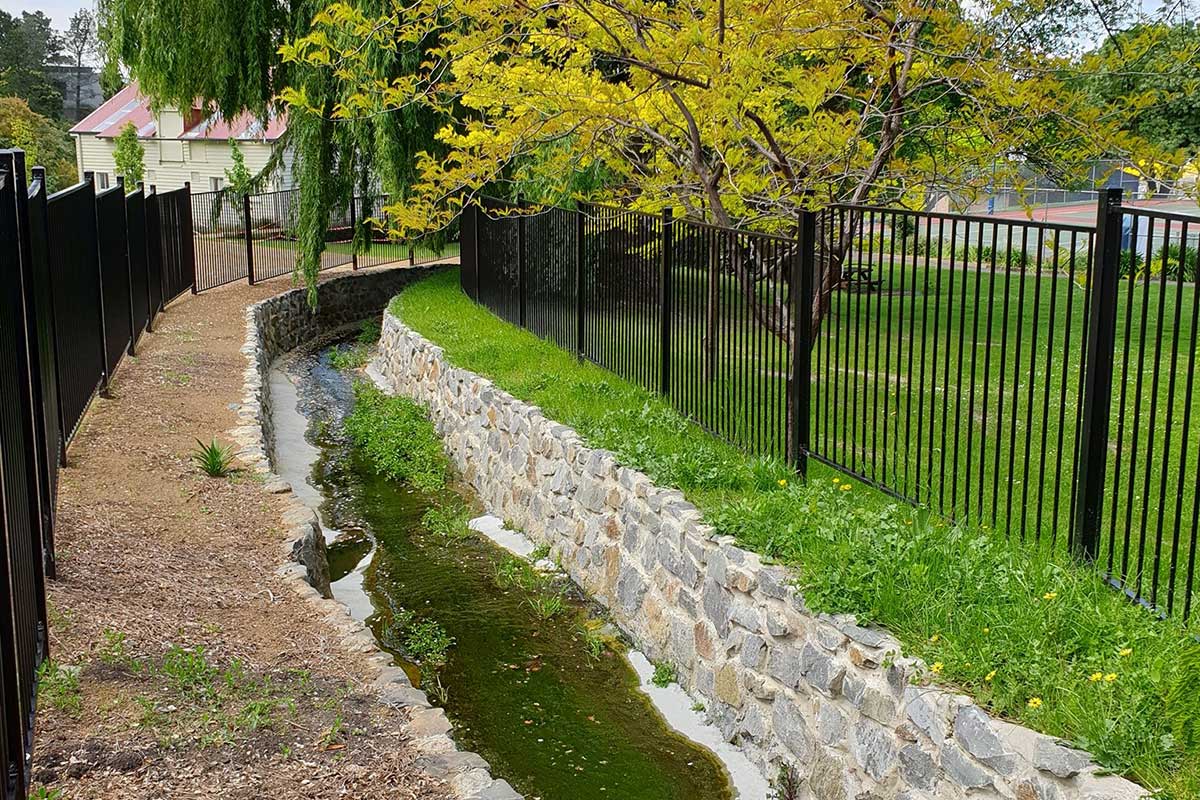
Hobart Rivulet
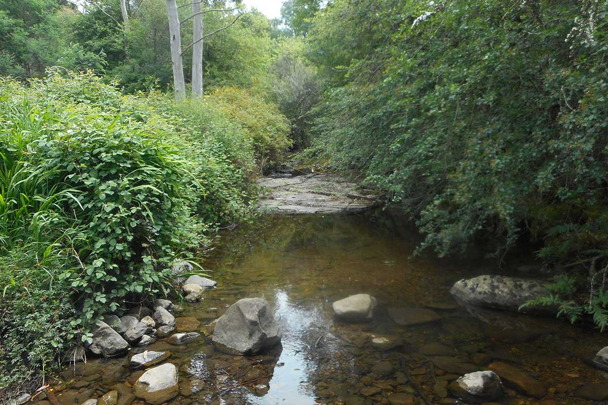
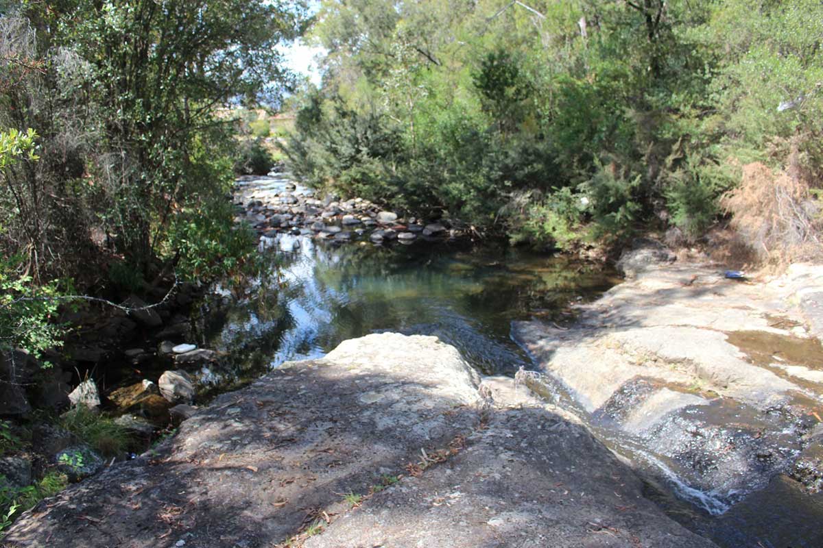
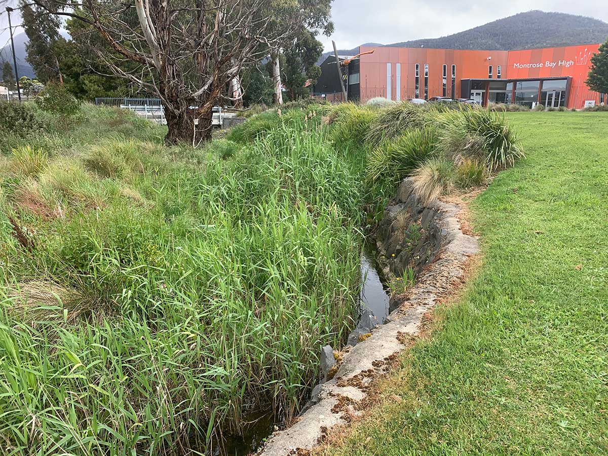
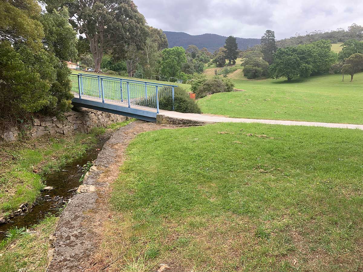
The Hobart Rivulet is one of the few rivulets to have been the given care and attention it deserves, no doubt because of its significat role in the establishment and development of Hobart. The rivulet was an important source of drinking water for the Mouheneener Aborigines, and later for the first European settlers. The site for Hobart was originally chosen in part due to the availability of fresh water from the rivulet - unlike the rancid creek at Risdon Cove on the eastern shore, where they had originally tried to settle. Hobart Rivulet rises on the slopes of Mount Wellington and flows generally northeast over O'Grady's Falls, Strickland Falls, through South Hobart and past what was known as the World Heritage-listed Cascades Female Factory towards the Hobart central business district.
More
An illustration from one of James Ross' almanacs, 1830 (Tasmaniana Library, SLT)
Ross Rivulet
McRobies Rivulet and Ross Rivulet are both small tributaries of Hobart Rivulet. The name Ross Rivulet appeared on Lands Department charts in 1868, and was derived from a grant in the name of Susan Ross. Dr James Ross and wife Susannah lived on their property - Paraclete - through which it flows. The name Tara Street Rivulet had been officially adopted by the Hobart City Council on 9th July, 1952 but has reverted back to being Ross Rivulet.
Dr James Ross, a Scot who had conducted schools, emigrated to Van Diemen's Land in 1822. He received a land grant soon after his arrival and was the tutor to Governor Arthur’s children in 1825. He became a prominent and influential publisher, editor of The Hobart Town Gazette (1825-1827) and took charge of the government printing office. He went on to publish the weekly Hobart Town Courier (1827), the annual Hobart Town Almanack (1829-1836), the Hobart Town Chronicle (1833), and the Van Diemen’s Land Monthly Magazine (1835). Some of his articles in the Hobart Town Almanack were used by Marcus Clarke in For the Term of His Natural Life.
In 1832, he was granted 312 acres (126 ha), Paraclete, on Knocklofty, making him one of the earliest settlers in the Mount Stuart area. He built a homestead in the vicinity of Summerhill Road (now West Hobart) and a substantial stone pigeon house on Knocklofty. It is believed he had ambitions to lay out botanical gardens but it never came to fruition. Parclete is thought to have covered 430 acres comprising Knocklofty and the top of today’s Mount Stuart, extending from the Female prison to Kangaroo Bottom (now Lenah Valley).
Dr Ross retired in 1836, and died of apoplexy 2 years later and was buried in St Luke’s cemetery, Richmond, leaving his widow with thirteen children. Susannah moved her boarding school from Carrington to Paraclete in 1842, subsequently married Hobart solicitor Robert Stewart, and died at Battery Point on 12 May 1871, aged 75
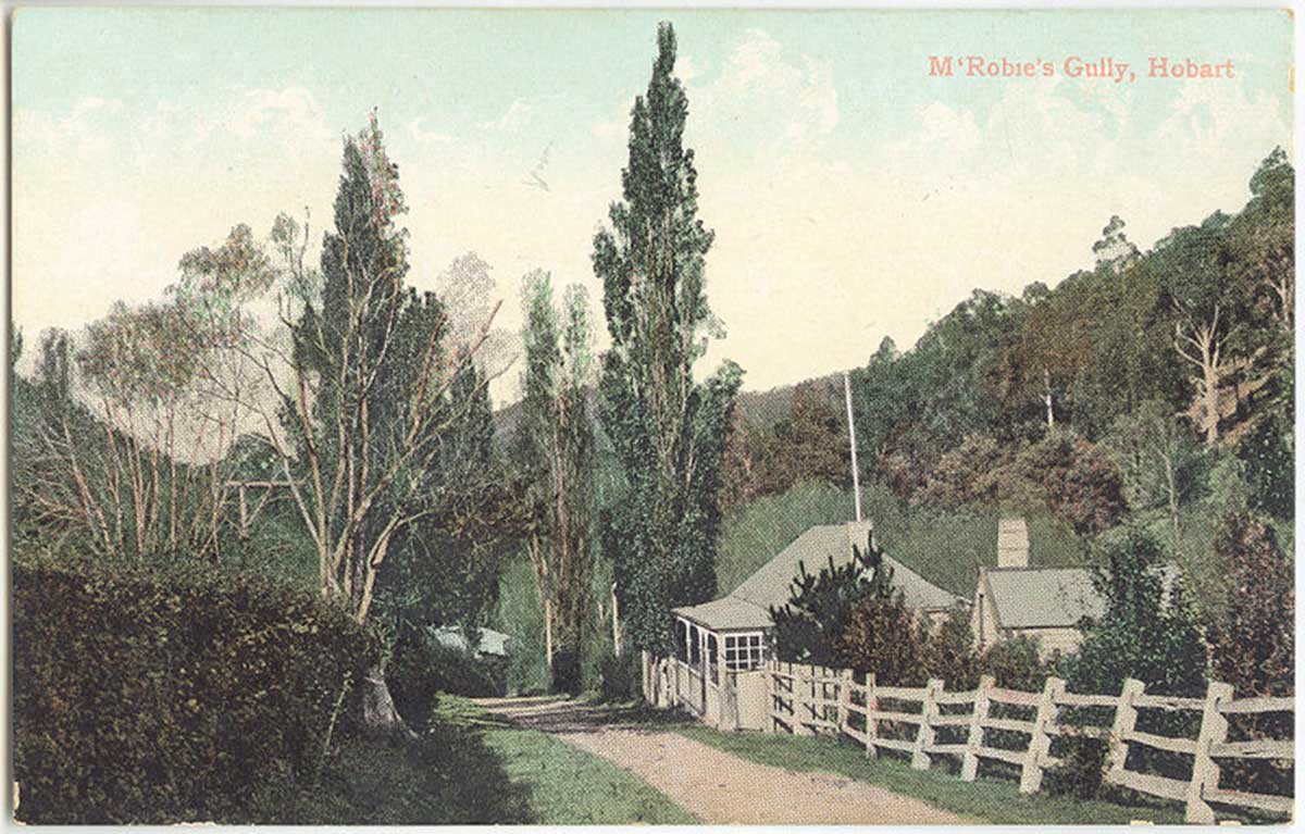
Postcard of McRobies Gully, c.1900s
McRobies Rivulet
McRobies Rivulet, also recorded as McRobies Gully Creek, is named after William McRobie (1801-1877), a Hobart flour miller who migrated from Falkirk, Stirlingshire, Scotland. William McRobie owned over 2,600 acres near the Hobart Rivulet, giving it the name McRobie’s Gully and McRobie's Rivulet. William McRobie and his wife, Jane (nee Hall), were the great great great grandparents of media publisher, Rupert Murdoch.
It was under McRobie's ownership that the mill on the Hobart Town Rivulet started to be called Dynnyrne, no doubt to differentiate it from Degraves' Cascade Mill. (The Cascade was a general name given to quite a long section ofthe rivulet.) Even having the first of the water did not guarantee that the mill could always grind: in 1874 there was said to be enough water to power the water wheel for only nine months each year. By April 1845 McRobie had added a steam engine, and it was shortly afterwards that he put his Campbell Street windmill up for sale, obviously no longer requiring this insurance against dry seasons. In 1854 he was also leasing the Sorell Mill.
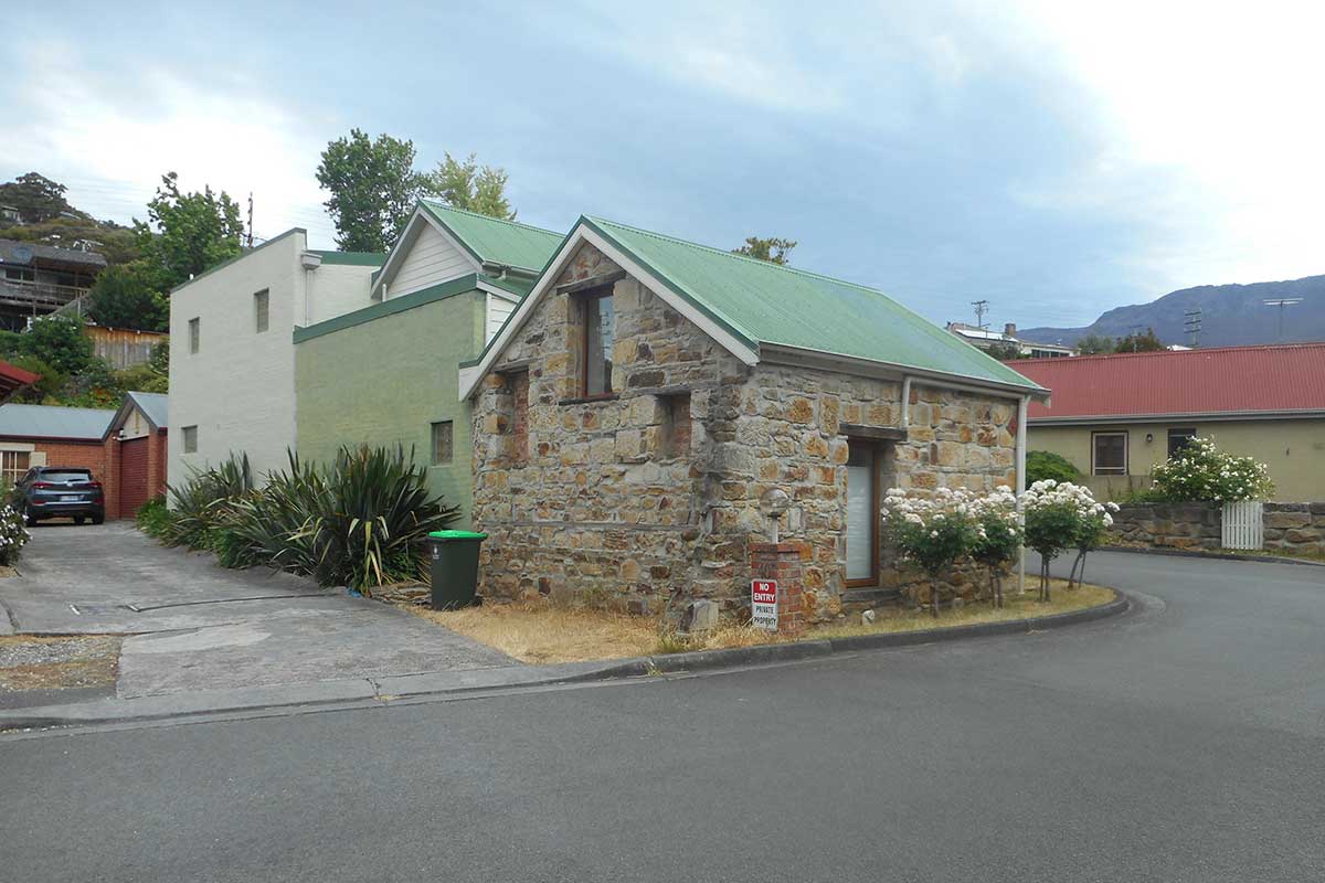
A small stone cottage still exists on McRobie's mill site at 40 Macfarlane Street (above) but it would be very difficult to say whether it belonged to the original mill or was a later addition in the site's history. Several large sandstone blocks and the remains of a steam engine lie nearby.
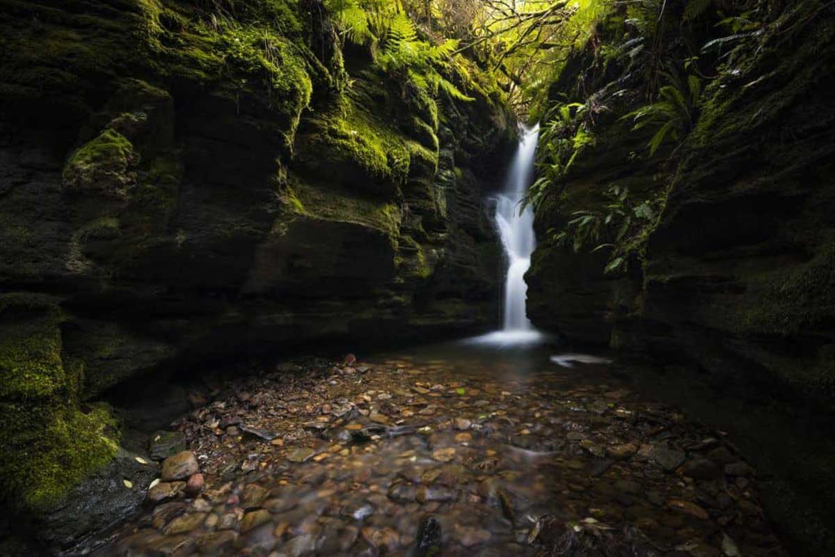
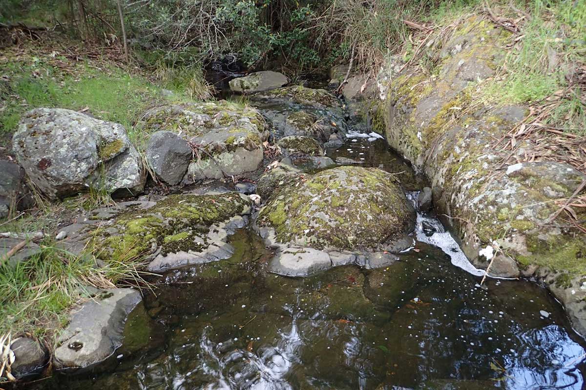
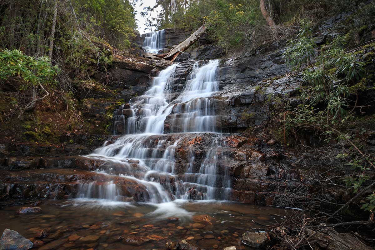
Secret Falls
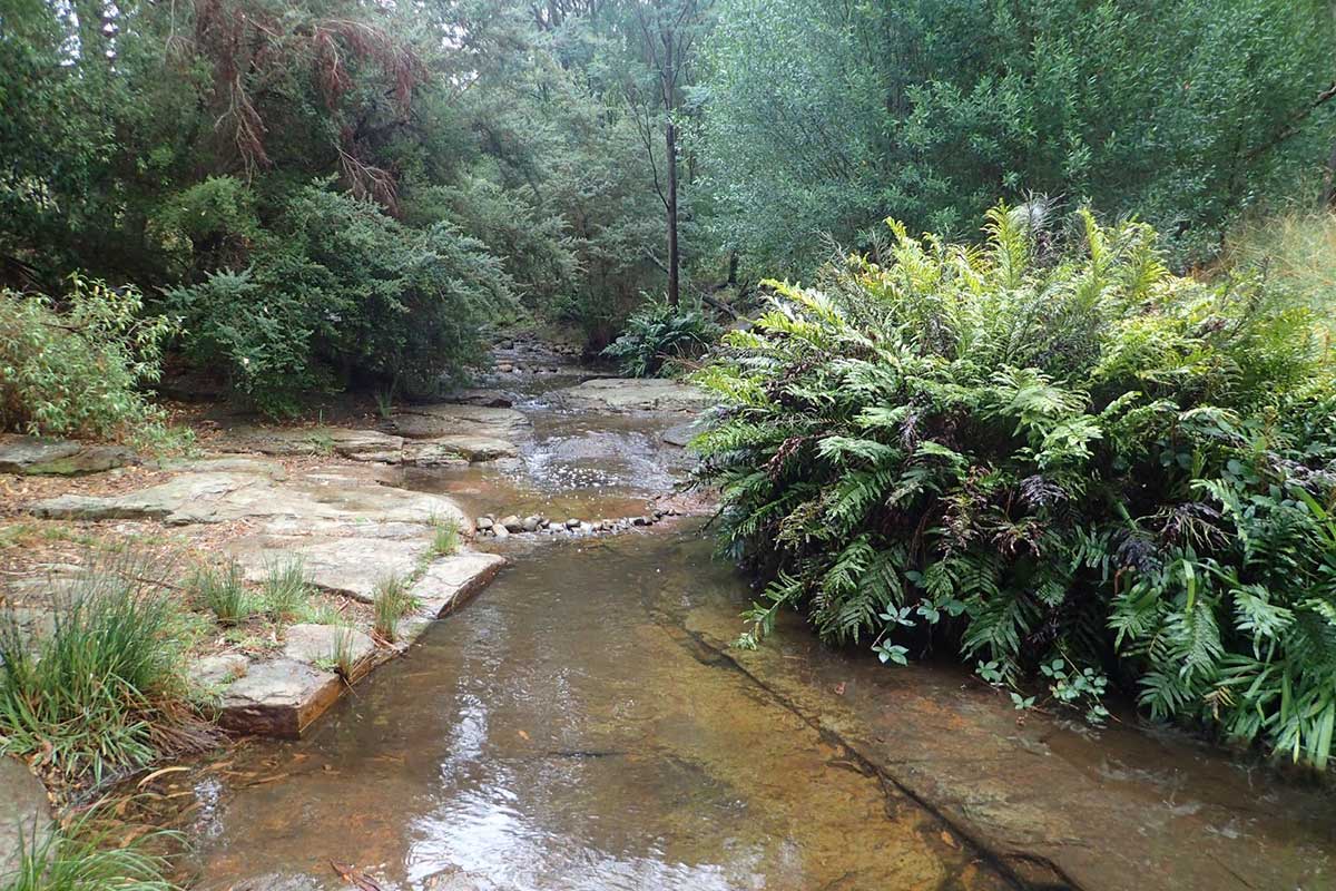
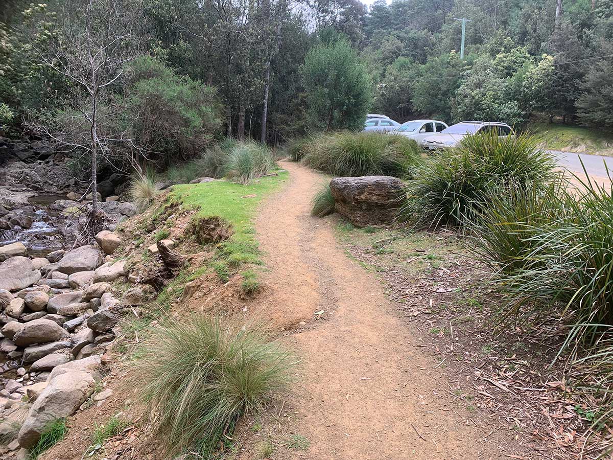
Guy Fawkes Rivulet
Guy Fawkes Rivulet is one of the major tributaries of the Hobart Rivulet, which it joins at the rear of Cascade Brewery on Cascade Road, South Hobart. When travelling west, Old Farm Road follows the Rivulet to the road's end at the Old Fire Trail and its junction with the Old Farm, Cascades, and Myrtle Gully Tracks. There is a car park nearby when walkers can leave their cars and follow whichever tracxk they choose on foot.
To continue to follow Guy Fawkes Rivulet, take the Myrtle Gully Track which runs alongside it. Not too far from the carpark, the Rivulet tumbles over the very pretty Secret Falls. Guy Fawkes Rivulet rises near Lone Cabin on the Leana Valley Track on Mt Wellington.
Guy Fawkes Rivulet flows alongside Old Farm Road, meeting and joining Hobart Rivulet at the back of Cascade Brwery.
The rivulet is named after a notorious member of a group of provincial English Catholics involved in the failed Gunpowder Plot of 1605, while fighting for the Spanish. Guy Fawkes, also known as Guido Fawkes, converted to Catholicism and left England for mainland Europe, where he fought for Catholic Spain in the Eighty Years' War against Protestant Dutch reformers in the Low Countries. He travelled to Spain to seek support for a Catholic rebellion in England without success.
In 1604 Fawkes became involved with a small group of English Catholics, led by Robert Catesby, who planned to assassinate the Protestant King James and replace him with his daughter, third in the line of succession, Princess Elizabeth. The plotters leased an undercroft beneath the House of Lords, London; Fawkes was placed in charge of the gunpowder that they stockpiled there. The authorities were prompted by an anonymous letter to search Westminster Palace during the early hours of 5 November, and they found Fawkes guarding the explosives. He was questioned and tortured over the next few days and confessed to wanting to blow up the House of Lords. Immediately before his execution on 31 January, Fawkes fell from the scaffold where he was to be hanged and broke his neck, thus avoiding the agony of being hanged, drawn and quartered.

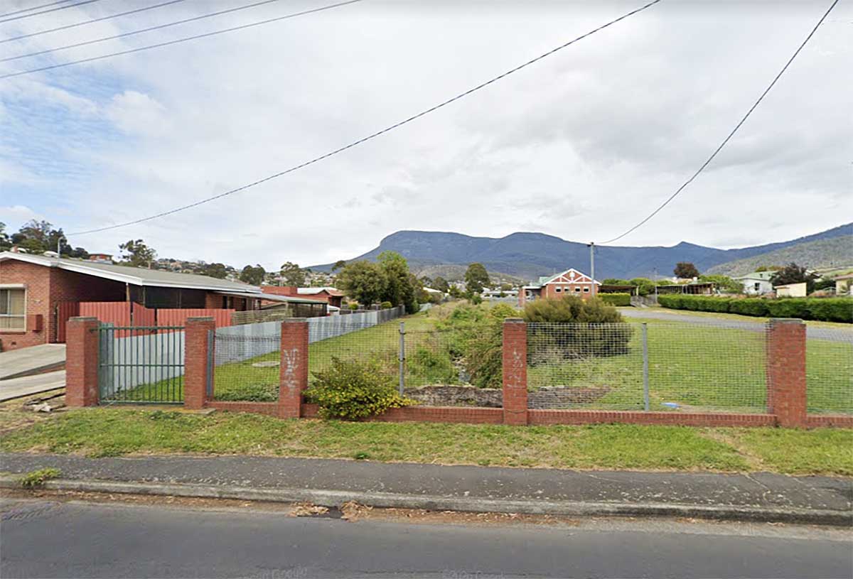
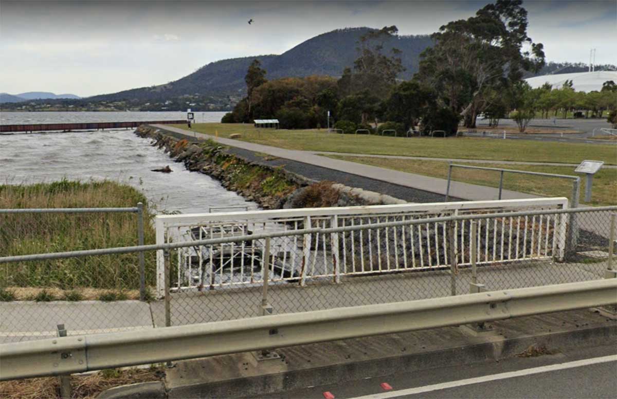
Sandy Bay Rivulet
The Sandy Bay Rivulet formed Hobart Town’s southern most boundary, with all outlying areas primarily used for farming. The development of the Sandy Bay area began as early as 1805 when 100 acres of land behind the beach and beside the Sandy Bay Rivulet was granted to Captain William Sladden. The natural values associated with Sandy Bay Rivulet are centred on the ecological integrity of the rivulet itself. It is often rare to see a stream still existing in an urban environment, and not being replaced with pipes and culverts to hide it from view. Like many of the smaller rivulets around Hobart, Sandy Bay Rivulet has been modified over time and has been perceived as a creek, a drain and a natural waterway by the people who have resided in the area.
More
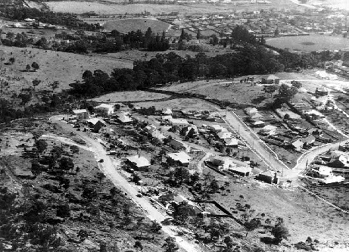
Aerial view of Sandy Bay showing Beddome Street, Waimea Avenue, Queenborough Oval & Rifle Range, 1952. Rifle Range Creek follows the line of trees through the centre of the photograph
Rifle Range Creek
This is a relatively short watercourse which rises around Tolmans Hill near the end of Brinsmead Road, Mount Nelson. It flows through the bushland to the south of the University of Tasmania, before following College Road on its eastern side. At French Street it is channeled below ground beside the University Ovel and Rugby Ground to an outlet on the river near the Derwent Sailing Squadron.
Maning Rivulet
Maning Rivulet
Maning Rivulet enters the Derwent through an underground channel at today's Red Chapel Beach. Its name recalls the Maning family, through whose property the Rivulet flowed. Frederick Maning (1788-1864) migrated from Dublin, Ireland, mo Tasmania with his family in the "Ardent" in 1824. He worked at the customs office at Hobart. Maning bought the lower half of Edward Garth's first Land Grant in 1850. Maning's son, Frederick Edward Maning (1812-1883), likely participated in the infamous Black Line and at least witnessed aspects of the Black War. He reportedly did not speak of this period much in his later life. It is possible that these incidents may have contributed to his decision to leave Hobart and pursue his fortune in New Zealand. In 1840, Maning Jnr acted as a translator at meetings about the Treaty of Waitangi.
Lambert Rivulet
Lambert Rivulet rises near the summit of Mt Nelson. It enjoys a lot of daylight and makes its way through a densely foliaged linear reserve on its way to the Derwent, flowing into river at the Derwent Sailing Squadron yacht club at Sandy Bay. Along the banks of Lambert Rivulet, Lambert Park protects remnant wet forest vegetation that is home to a range of birds, plants and animals. Higher up, the tracks run into the dry, open woodland of Bicentennial Park on the skyline ridge of Mt Nelson. Lambert Rivulet is named after Sir Lambert Dobson, Chief Justice and Administrator, 1884-1897, whose land it passed through.
Lambert Rivulet flows through Lambert Park, a rare example of private benevolence in Hobart, when land was bequeathed to the community as open space. The Park’s uneasy history is an indicator of its unusual status. Its status and management was compounded by the premature death of Lambert Dobson, its original owner, in 1898
Fisher Rivulet
Refered to simply as 'the creek' by those who know of its existence, Fisher Rivulet (also known as Wayne Rivulet) flows into the Derwent at Long Beach, Sandy Bay, via a concrete stormwater drain. According to colonial records, there was a late Aboriginal village around the mouth of the Rivulet. The rivulet enters a concrete pipe alongside the playground of Fahan Presbyterian Girls College on Fisher Lane from where it flows to the Derwent. The exposed section in the school grounds extends for 86 metres and comprises the middle section of the rivulet. The section of the rivulet above the School is predomimently piped underground.
Fisher Rivulet originates from rising springs at the top of Mt Nelson and through its 90.8 hectare catchment area is joined by underground urban reticulation from private dwellings. The natural vegetation of the Rivulet is largely restricted to the upper reaches of the catchment where remnant dry sclerophyll forest remains. The riveulet is named after Edward and Elizabeth Fisher, who were trnsported to New South Wales (he as a convict on the Matilda, 3rd Fleet, she as a child, Elizabeth Gregory, accompanying her convict mother on the Lady Juliana, 2nd fleet). They met, married and had five children before moving to Van Diemen's Land, establishing a 85-acre farm at Sandy Bay, where today Fisher Avenue is named after the family.
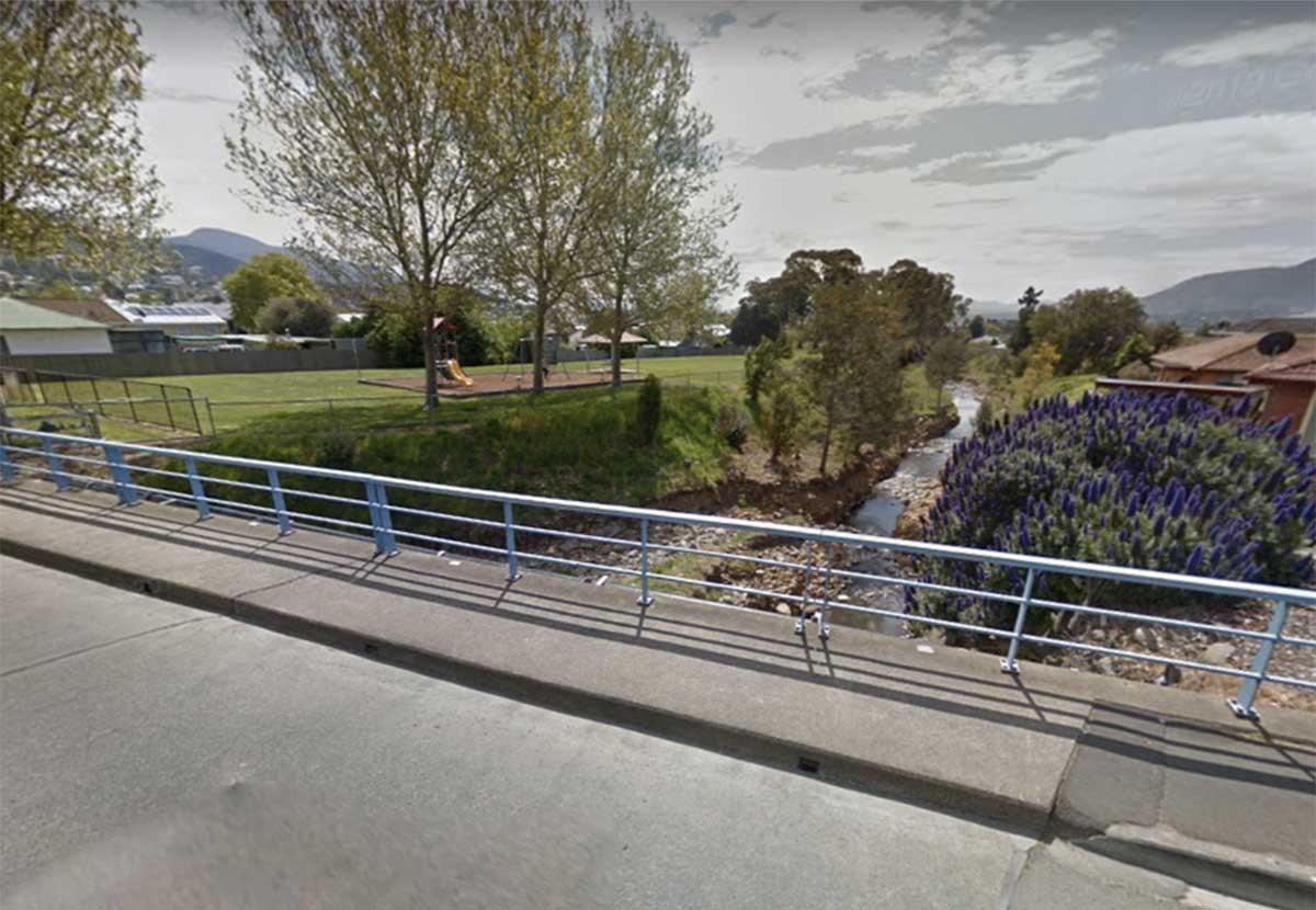
New Town Rivulet
The New Town Rivulet (also known as Newtown Creek) is a permanently flowing creek that has as its headwaters the springs and snow water run-offs of Mount Wellington. The New Town Rivulet flows from its headwaters though the Hobart suburbs of Lenah Valley and New Town to New Town Bay in the River Derwent. The rivulet is fed by a number of underground springs in the Wellington Range. New Town Rivulet starts around Big Bend Carpark at an elevation of 982m and ends flowing into the River Derwent. The Rivulet drops around 982m over its 10.9km length.
The upper reaches of New Town Rivulet are easy to access via walking and cycling tracks alongside the Rivulet and Lenah Valley Road. The Rivulet can also be accessed via the Intercity Cycleway at Creek Road and then up it to Lenah Valley Road, following the New Town Rivulet. The track paralells the road for most of the way beside the Rivulet.
The two and a half hour return trip from the start of the Lenah Valley Track to New Town Falls takes you from sea level to 430m in elevation to meet this lovely waterfall. It is highly recommended to be prepared for this walk by taking plenty of water and some food with you. Once you do arrive you will be greeted by multiple tiers of cascades and a beautiful view out across Lenah Valley towards the Derwent River. There are multiple sections to New Town Falls with the main path leading to the middle tier. You can ascend higher to see the top or descend to the very lower-tier via a track approximately 5 minutes back from the main section of the fall. It flows best after heavy rain and is part of the New Town Rivulet.
The New Town Rivulet Track is a very rewarding walking trail. Following New Town Rivulet upstream from its junction with the Derwent River is a wonderful journey of discovery. The landscape changes steadily from urban to suburban to bushland. There is history too, with glimpses of colonial houses with their rambling gardens, a convict-built bridge beneath New Town Road plus the unexpected Greek-style temple of Lady Franklin Museum. The sound of running water is ever present and in the higher reaches there are lovely pools and cascades. Small trout and native fish are often seen darting past and if you are very lucky you may even spot a platypus.
Track notes and map
Barossa Creek at Bowden Street, Glenorchy, from where it is channelled below ground.
Barossa Creek
Like the famous Barossa Valley in South Australia, Barossa Creek is thought to be named after the Battle of Barossa (1811), part of an unsuccessful manoeuvre by an Anglo-Iberian force to break the French siege of Cádiz during the Peninsular War. During the battle, a single British division defeated two French divisions and captured a regimental eagle.
Barossa Creek enters the Derwent at the south-east cormer of Elwick Bay beside the Glenorchy Art and Sculpture Park.
In November 1811, the British Prince Regent commanded that a medal be struck to commemorate the "brilliant Victory obtained over the Enemy"; this was awarded to the senior British officers present at the battle. Four Royal Navy ships have taken their names from the battle including HMS Barrosa (1812) launched the year after the battle. There is also a Barossa Road in Lenah Valley.
Humphreys Rivulet
In 1804, soon after Sullivans Cove was occupied, the first land grants were made south of Humphreys Rivulet. Former Norfolk Island convicts were relocated there in 1807; by 1821, 71 percent of the population were convicts or former convicts and their families, and a convict road gang was active by 1828. Farms grew up along rivulets and the Derwent with a few rural-based industries and several small villages supported by local amenities, including churches, inns and schools. Initial water transport was supplemented gradually with roads.
Humphreys Rivulet passing under Brent Street, Glenorchy
Humphreys Rivulet was previously charted and named by explorer Hayes as Duke's Rivulet, after his servey ship, the Duke of Clarence. The Rivulet rises between Mt Bull and Mt Wellington, close to the Big Bend Trail, passing through the suburb of Glenorchy between Chapel Street and Tolosa Street on its way to the Derwent at Elwick Bay and Montrose Boardwalk.
The Rivulet passes over a small waterfall ay the top end of Chapel Street past Werner's Garden Service. Overgrown stone steps lead to crumbling wooden picnic tables at what was once a well-used recreation reserve. Platypus have been seen swimming in the pools around the waterfall. A pathway for a shared walking and cycling track has been identified between the Intercity Cycleway and Murrayfield Close which will provide a traffic-free connection to bypass the busiest section of Tolosa Street. Upstrem from the suburban streets the Rivulet flows over Cherry Falls, Bear Falls and a number of cascades in natural bushland.
More (Nature Lover's Walks blog)>
The rivulet is presumed to be named after Adolarius William Henry Humphrey. He sailed as mineralogist with David Collins from England in 1803 to found a colony on Port Phillip, Victoria. Collins, dissatisfied with Port Phillip, sent William Collins and Humphrey to Port Dalrymple at the mouth of the Tamar River, with a view to settling there. They searched especially for fresh water, so much lacking at Port Phillip, but apart from the South Esk, found only a little stream which they named the Supply River. Here Humphrey carved with his hammer and chisel the legend, 'A.H.1804', deep into the dolerite rock, where it is still legible.
He made several journeys of exploration with the botanist, Robert Brown, and Jorgen Jorgenson. They ascended the Derwent at least as far as the River Clyde and made two excursions over Mount Wellington to reach the Huon River. In 1805 Humphrey moved to New South Wales where he worked for two years on both Norfolk Island and the mainland, chiefly engaged in examining iron deposits, samples of which were sent to Sir Joseph Banks. He resigned in 1812 as mineralogist, pleading that he was worn out by the privations endured in his explorations in both colonies, but it seems that he was no longer interested in his profession. When Van Diemen's Land was made a separate colony Humphrey was appointed a member of the newly-established Legislative Council and in 1825 of the Executive Council.
Islet Rivulet
A comparatively short rivulet which has its source near the Zig Zag Trail near Dooleys Hill. It follows Montrose Trail then Montrose Road. The rivulet enters the Derwent at Montrose Bay, Rosetta, through an underground stormwater drain. The line of Islet Rivulet is marked by a row of trees and bushes on Foreshore Road, Rosetta (photo above). An 1832 list of names of early settlers and their land grants from New Town to Bridgewater (on the western side of the River Derwent) lists Edward Barnes (80 acres), James Barnes, and Thomas and Charles Beechy as early settlers who established farms around the rivulet.
Littlejohn Creek where it passes under the road between numbers 26 and 28 O'Brien Street, Glenorchy.
Littlejohn Creek
Littlejohn Creek recalls an early Montrose white settler, Robert Littlejohn (1756–1818), who was born in Scotland and had received a very liberal education there. Littlejohn was given a grant of 120 acre which he named Montrose Estate, and built the original section of Montrose House in 1813. The Georgian extension was added in 1836 by colonial Politian and lawyer Thomas Horne. Littlejohn Creek runs through the property. No more than a forgotten stormwater drain as it passes through Glenorchy these days, Littlejohn Creek enters the Derwent at Elwick Bay.
Littlejohn had arrived in Van Diemens Land in 1803 and soon built a reputation as a renowned botanist and collector of rare indigenous plants. A bay tree planted by Littlejohn survives. He was also a painter and teacher who taught children from the Glenorchy area in the dining room of his Georgian residence. A man of some wealth, he is remembered for his water-colour drawings.
Montrose House is the state's third oldest house. Convict brick walls, a Blackwood staircase and Huon pine floors, and a hand-made shingled ceiling in the dining room are just some of the original features to remain intact. Littlejohn named the home after his ‘back home’ property on Scotland’s east coast, and records from first fleet wills note that it was referred to as ‘Montrose Estate’. The property has another well-known colonial connection but of the infamous kind, in regards to the original six-horse stable block. It is rumoured that the notorious colonial bushranger Martin Cash would stable his horse here to allow for a quick getaway.
Faulkners Rivulet where it enters Windermere Bay, Claremont
Faulkners Rivulet
Named after John Faulkner, one of Tasmania's first white settlers who was granted land around the watercourse. Faulkner, his wife Elizabeth and their two children, arrived at the River Derwent on the Lady Nelson in February 1804 among the first shipload of settlers. One of the children was John Pascoe Faulkner, who would later play a leading role in the founding of Melbourne. There were no white people living in Hobart when the ships arrived and the Faulkner family had to live in tents along the Rivulet, until they were given land along the River Derwent. John Snr. built their hut, it was made of straw at Faulkner’s Creek (later called Faulkner’s Rivulet). The hut burnt down shortly after it was built and was replaced with a wooden one with a shingle roof.
After he moved up the river to Faulkner’s Rivulet, John Snr. brought more animals for his farm. There was only a track from Hobart and they often had to go by boat. Young John had to look after the sheep. He had no shoes so he cut pieces of kangaroo skins and made them into moccasins to keep his feet warm. By 1807 the farm at Faulkner’s Rivulet had 22 sheep and 18 goats. They also had a garden where they grew vegetables.
Abbotsfield Rivulet at Rosbar Street, Claremont
Abbotsfield Rivulet
The suburb of Abbotsfield takes its name from the Abbotsfield Rivulet, which in turn is named after Edward Abbott, who owned much of the land in the vicinity of the rivulet. Now part of the northern Hobart suburb of Claremont, Abbotsfield is centred on Abbotsfield Road, which is an older part of Claremont. A relatively short watercourse, Abbotsfield Rivulet rises in the vicinity of Russell Road, passes through the bushland to the south of Ebden Street, through Carnegie reserve and alongside Abbotsfield Park on its southern side. On the eastern side of Berooker Highway, it flows between Westfield and Belgrave Streets, Abbotsfield Road and Delange Place, entering the Derwent at Beedhams Reserve.
Roseneath Rivulet, Claremont
Roseneath Rivulet
In 1815 James Austin and James Earle built their first ferryboat and cattle punt but it is 1816 that is recognized as the year this, the first trans Derwent ferry service, began. By 1818, an inn had now been built to accommodate travelers overnight, not far from Austin's Cottage. The ferry and Austin’s inn and farm were renamed “Roseneath” by Governor Macquarie on his tour of Van Diemen’s Land in 1821 who visited Austin’s three times, staying at the inn overnight.
It was in June 1821 that he recorded the following in his journal: ”Previous to leaving Austin’s Mrs. Macquarie and myself (after obtaining the sanction of Austin and his partner Earl) named their place Roseneath on account of the great beauty and very picturesque scenery of this place and its similarity to the place of the same name in Scotland.” The names of the locality was then given to the Rivulet that entered the river nearby. Roseneath Rivulet enters the River Derwent at Shoobridge Park, Austins Ferry.
Black Snake Rivulet
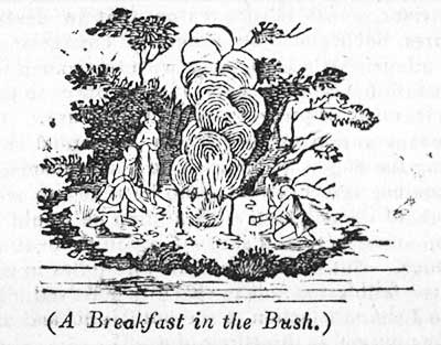
Black Snake Rivulet rises in the upper slopes of Snake Mount and enters the River Derwent near the corner of Main Road and George Street, Granton. By 1813, a parcel of land west of the Black Snake Rivulet was reserved for the town of Bridgewater, but this site was abandoned and the Bridgewater settlement laterdeveloped on the northern shore of the Derwent. The reserve at Black Snake (now Granton) was later used for the Bridgewater Road Probation Station. In 1811 Governor Macquarie, in his diary, makes mention of a trip to the New Norfolk area, where he and his party breakfasted en-route at a farm at Black Snake Point.
Black Snake Inn
By 1816, Black Snake was a substantial settlement. At this time there were two main crossing points on the Derwent River, from Roseneath (Austin's Ferry) to Herdsman's Cove and Old Beach, and from Black Snake to Herdsman's Cove and Green Point. Travel by ferry was sometimes dangerous and often inconvenient, being dependent on the river current and prevailing wind. The Black Snake ferry was operated by Richard Burroughs (or Burrows) from his public house and his service complemented James Austin's more frequently used punt at Roseneath, while also plying a river trade to Hobart and possibly New Norfolk.