
Lime Bay, Tasmania
The Lime Bay Nature Reserve is seldom visited, but contains a surprisingly large network of trails linking together some beautiful beaches and lagoons with some great convict history thrown in. The reserve is a popular spot for camping, boating and walking. Facilities include toilets, picnic tables and fire places. It is advisable to bring your own water and firewood.
Where Is it?: 54 km by road from Dunalley, on the Tasman Peninsula. To get there, take the C341 from Premaydena, through Saltwater River. The reserve is at the end of Coal Mines Road, on the north-west tip of the Tasman Peninsula.
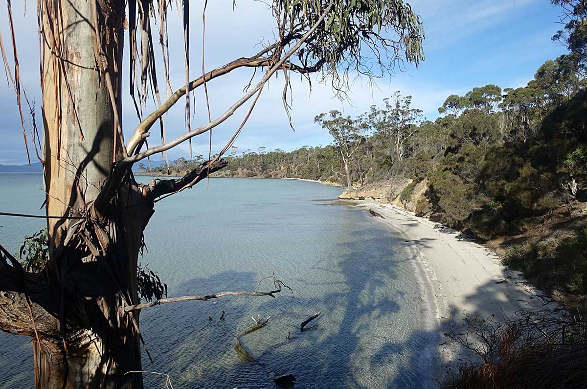
Lime Bay State Reserve is a beautiful 1300 ha secluded reserve of sheltered beaches and pretty eucalypt woodlands. There are two tranquil beaches: Lime Bay is next to the camping area, while the picturesque Lagoon Beach lies in the lee of Sloping Island, an easy 40 min walk. The southern boundary of the 1.6 km long Lagoon Beach is the densely vegetated headland, Lobster Point. Lagoon Beach receives waves averaging about 0.5 m, which pick up a little towards the northern end. A small lagoon backs the northern end of the beach and a vehicle track accesses the southern and central section between the lagoons.

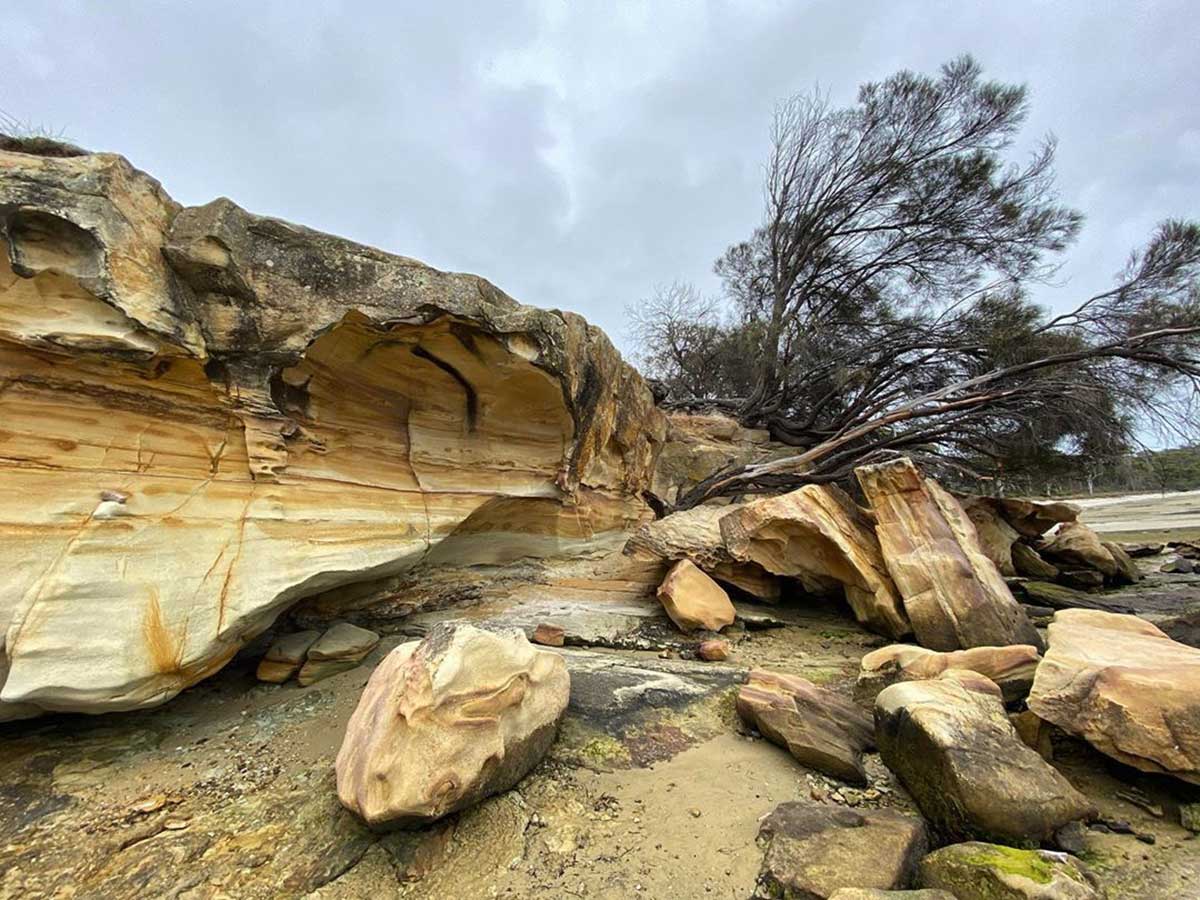
Saltwater River coal mines ruins
Nearby are remnants of the 1833 Saltwater River coal mines, where Port Arthur's most hardened convicts were sent for punishment. Underground cells and mine entrances are still visible. A picturesque, grassed camping area is 4 km beyond the historic mining site and is the starting point for an easy, scenic walk to Greens Point Cliffs and Lagoon Beach. Gas/fuel stoves are recommended, and you need to bring firewood and drinking water.
Lime Bay itself is a north-facing 1 km wide bay located at the northern end of the Tasman Peninsula to the west of Whitehouse Point. Only low wind waves usually enter the bay. A gravel road reaches the centre of the beaches, with an extensive camping area under the trees behind the western end of beach. Small boats can be launched across the beach.

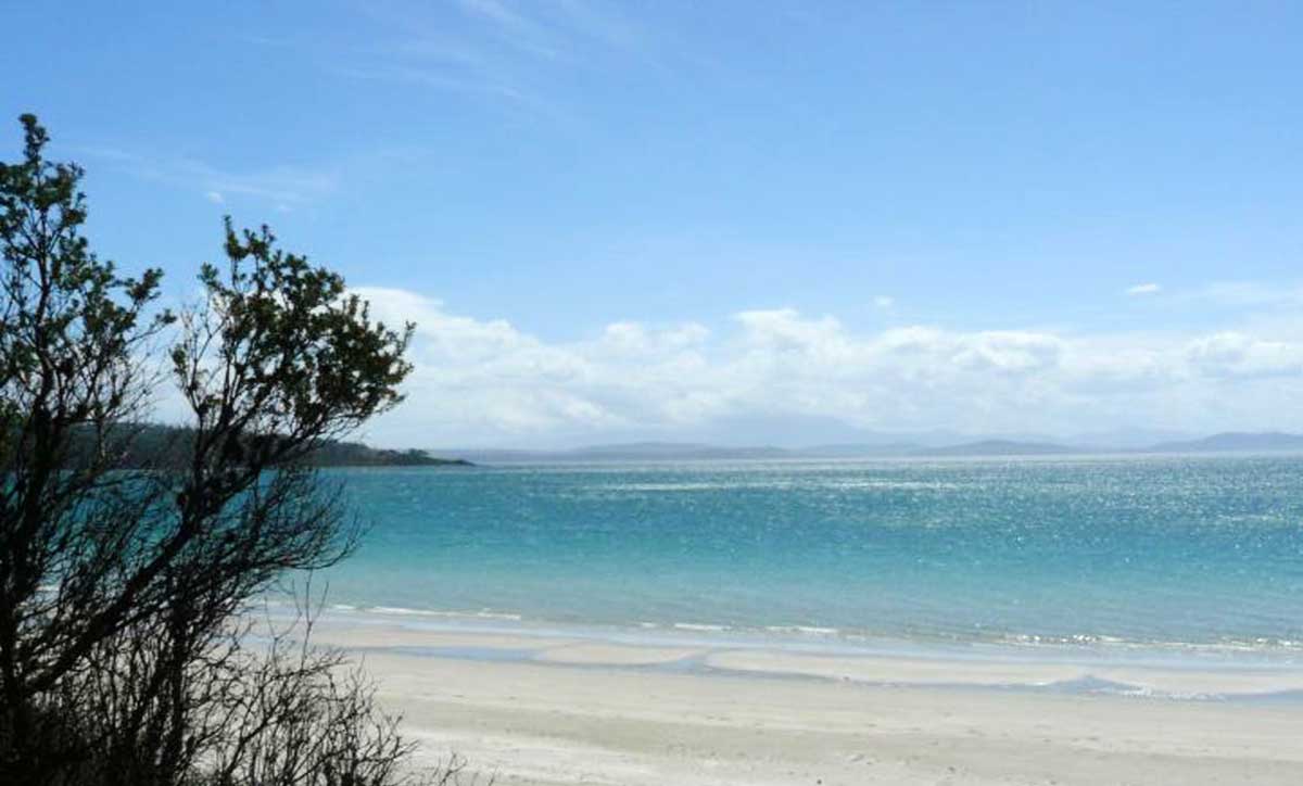
Lagoon Beach
Green Head is at the tip of the peninsula. Its 20 metre high bluffs restrict land access to two small protected beaches on the headland. Both beaches open onto the sand seafloor, which surrounds the tip of the headland. They are only accessible by boat. Lagoon Beach is a similar 100 m long strip of high tide sand, fronted by continuous 50 metre wide intertidal rock flats, with only a small sandy opening at the southern end. There is no formal access through the dense vegetation.
Slopen (aka Sloping) Island
This island, in Frederick Henry Bay on the western side of the Lime Bay State Reserve headland, has particularly significant Aboriginal values and is one of the few islands in the region to have played a significant role in Tasmania’s whaling, convict and agricultural history. It has ten known Aboriginal sites comprising shell middens and artefact scatters.
In 1824 the first whaling station in the water approaches to Hobart were established at Slopen Island by Walter Angus Bethune and John Grant. In 1832, George Meredith applied to rent the island from the government for grazing livestock. Meredith was also a well-known whaling personality and he may have also carried on whaling from Sloping Island, although his application does not mention it. The island was established in 1841 as a Probation Station to house convicts arriving in Van Diemens Land. The convicts were involved in timber getting and land clearing. The station was forced to close only three years later, due to the lack of availability of fresh water. The convicts were assigned to Port Arthur. In the 1850s the island was leased again for grazing purposes to James Smith (Evans 1993). The lease continued until 1973, when renewal was refused on the grounds that the island was infected with the noxious weed, serrated tussock (Nassella trichotoma).
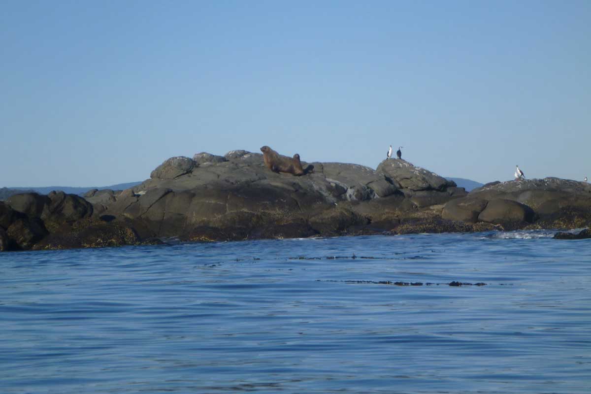
The island supports breeding populations of little penguins, short-tailed shearwaters, Pacific gulls, sooty oystercatchers and pied oystercatchers. There are also kelp gulls and swamp harriers. Ringtail possums and rabbits also inhabit the island. The vegetation of the island consists of eucalyptus woodland, sheoak open forest, open and closed heaths dominated by Banksia marginata, sagg-dominated herblands, Poa poiformis tussock grasslands, disturbance-induced bracken fields and succulent herbfields dominated by Tetragonia implexicoma and Carpobrotus rossii.
The island has been modified during many years of agricultural use and has not yet recovered. Rabbits have caused severe denudation of the vegetation, which has led to erosion and burrow collapse in shearwater colonies. Some control was attempted in the early 1980s but was unsuccessful. The nationally significant noxious weed, serrated tussock (N. trichotoma), occurs on the island, having been transported with infected pea crops in the 1950s and 1960s when the island was actively farmed. Concerted attempts over many years have been made to control it.
In 1911, readers made submissions to the local newspaper The Mercury regarding the naming of the island. Their conclusion was: "It is called Sloping Island on the Admiralty maps, and was called St. Aignon, after one of his officers by D'Entrecasteaux, on his map. Since then it has been variously called Sloping, Slopen, Sterring, and St. Aignon."
Although the island is regularly visited by sea kayakers, overnight camping is rare. Recreational diving and fishing occur around the island. Recreational gill netting is common in the area. Visits from the yachting and motor boat communities are frequent during the summer. There is a protected cove with good all-weather access, which provides a safe anchorage for boats.