
Pontville, Tasmania
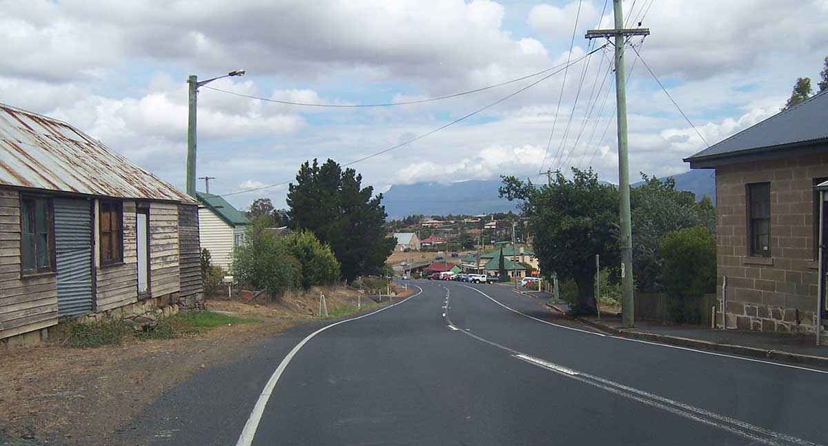
The settlement of Pontville is contiguous with the town of Brighton, established in 1821 by Governor Macquarie as a location for military barracks, and named by him in 1821 after "our present gracious Sovereign's favourite place of residence". Pontville became an important stopping point on the road from Hobart to Launceston in the 1830s and effectively replaced Brighton which, at one time, had been promoted as a possible future capital of the island. From this time on it became one of the major suppliers of stone for the whole southern region of Tasmania.
Where is it?: 35 km north of Hobart off the Midlands Highway.
The area around Pontville was first explored by Europeans in early 1804 and by 1806, with serious food shortages in Hobart Town, expeditions of soldiers were being sent into this area to kill kangaroos and emus. It is claimed that Private Hugh Germain, a well educated member of the Royal Marines, and a convict named Jorge Jorgensen, went out together on one of these expeditions to shoot kangaroos for food for the townsfolk. According to the story, the only books carried by them were the Bible and The Arabian Nights and they amused themselves by naming geographical features from each book in turn. As they travelled they gave place names like Jerusalem (now Colebrook), Bagdad, Jericho, the Jordan River, and Lake Tiberius. Thus, only a few kilometres north of Pontville, lies the incongruously named village of Bagdad and Pontville is actually situated on the banks of the equally incongruously named, Jordan River. In fact the headwaters of the Jordan River rise in Lake Tiberius before flowing through Jericho. Other less romantic sources say the names were given by the surveyors who pegged out the route for the highway. The origin of the name Pontville is unclear but it literally translates from the French as 'bridge town’, which relates to the bridge over the Jordan River.
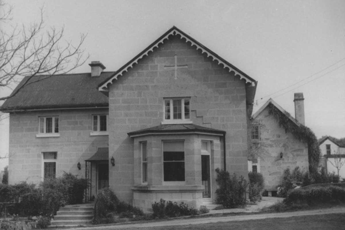
Epson House
By the 1820s there was a small settlement at Pontville but the real development of the village occurred in the 1830s and 1840s when it took over from Brighton and became a major centre for the district and an important traveller's stopping point on the road between Port Dalrymple (Launceston) and Hobart. Pontville was developed on land which was originally owned by William Kimberley. In 1838 this land was sold and a number of important buildings - the Police Station (1839), the Courthouse (1842) - were constructed.
By the mid 1840s the town was thriving with a population of over 2000 people. By the 1860s there were six flour mills operating in the area. Although the town's growth occurred in the 1840s many of the old buildings predate this period of development.
The Sheiling
located behind St Marks Church of England, The Sheiling dates from about 1819 and was originally constructed as two separate cottages. The strange name is nothing more complex than the Gaelic for 'cottage'. The land was sold to William Kimberley in 1818 and he built the cottages on what was the main road through the village. It is likely that the house was used by the local police at one stage. It was converted into a single private residence in the early 1950s.
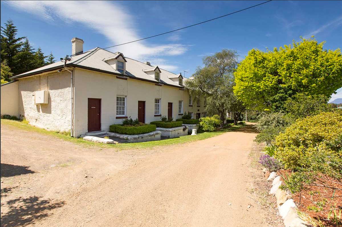
Lythgo's Row
This charming and neat row of sandstone houses, located near the bridge over the Jordan River, was built between 1845 and 1855, by William Lythgo, a convict who arrived in 1836. He had been transported for fourteen years for stealing. In 1845 he purchased land from Gamaliel Butler which had been used as a sandstone quarry. He built a house there and used part of it as a store. In 1852 he purchased additional land and extended his building erecting 3 cottages at the northern end and then filling in the middle part to create a new store section. Location: 253 Brighton Road, Pontville, Tas.
on Brighton Road, near St Mark's Church, is the Old Post Office which was built sometime before 1830 to house the Officer's Mess. It is a typical Georgian era stone building and stands right at street frontage. There is some evidence that in the 1850s, when a timber verandah was added, it was a coaching inn. In 1861 it became the Pontville Post Office. It is currently an antique and gift shop. Location: 268 Brighton Road, Pontville, Tas.
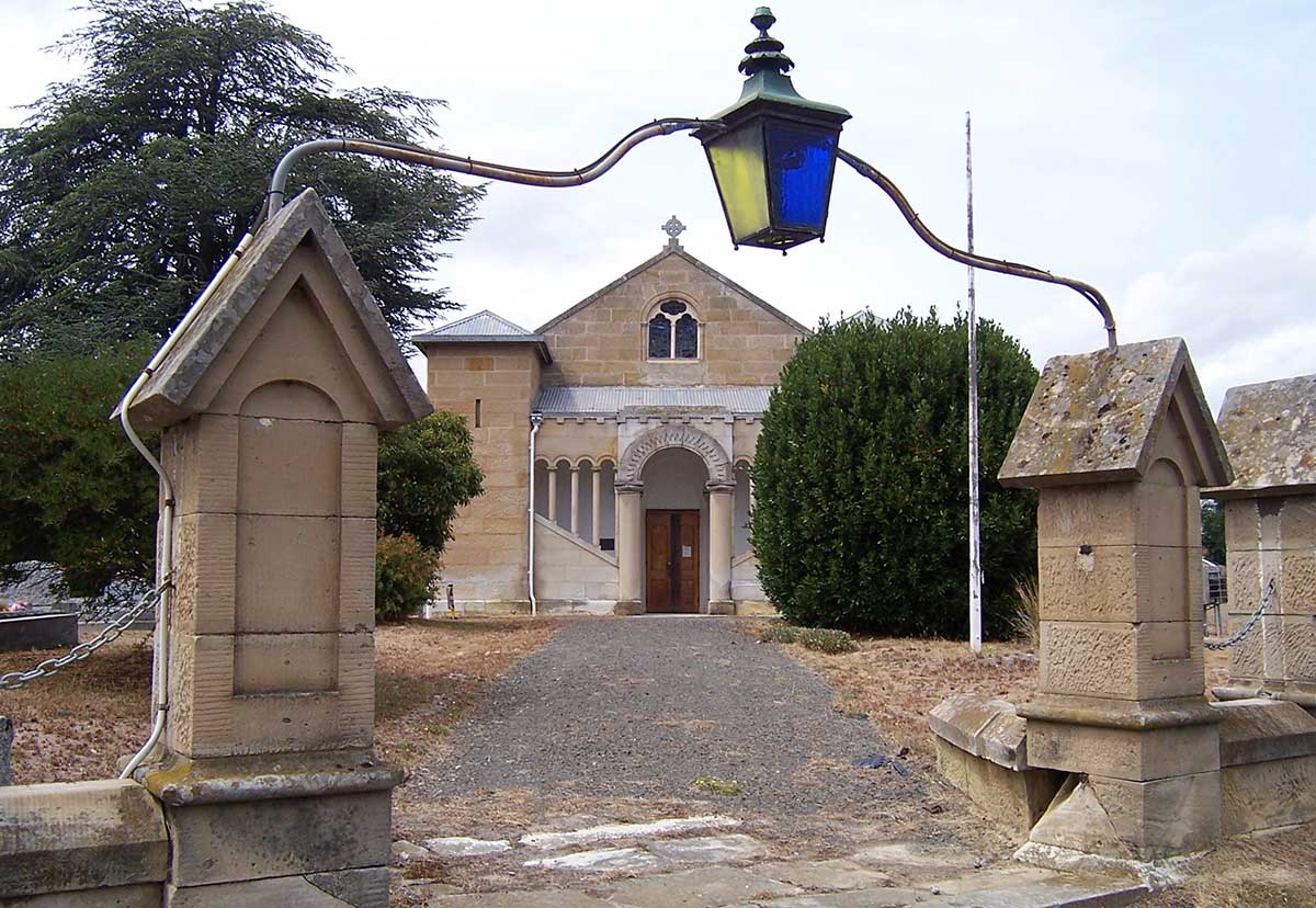
The first Congregational services at Pontville were led by Reverend Joseph Beazley and held in the local courthouse. In 1854 a small stone church was built which stood on the riverbank opposite the present church and near to the remnants of the original Congregational cemetery. In early 1874 the foundations of this church collapsed and the church’s trustees decided to build a new church on a site on the opposite bank of the Jordan River. Construction of the new church began in early 1875. While construction was underway, religious services were temporarily held in the district police office. The church was built on land donated by Mr. H. Finlay and was designed by Mr. John Paul. Soon after the new church was opened the old building was demolished and most of the stone was used to construct a minister's residence. The building is now the Brighton District Uniting Church. Location: Cnr Brighton and Ford Roads, Pontville, Tas.
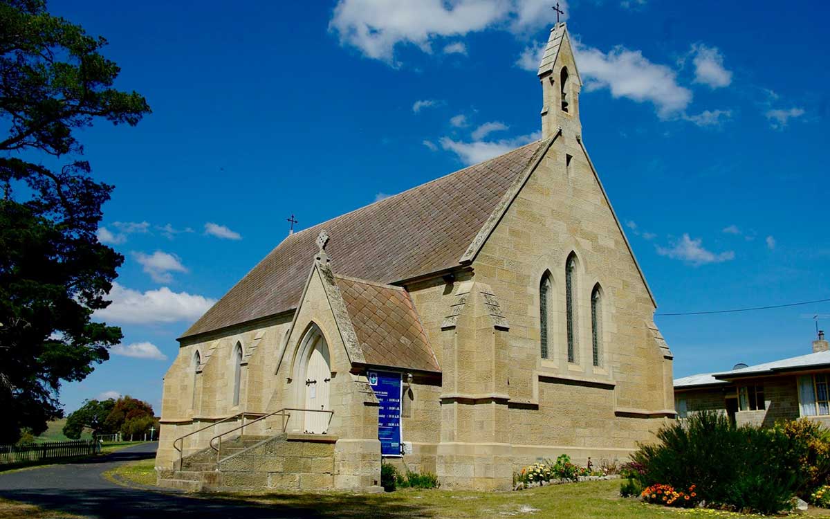
Designed by renowned Tasmanian architect Henry Hunter, and built using surplus stone left over from the construction of the Brighton gaol, the church’s foundation stone was laid in 1866. In 1927, the church was completely gutted by fire, burning down in suspicious circumstances on the evening of its 60th jubilee. Two days before the fire, the Prime Minister, Joseph Lyons, opened the parish fair held to raise funds for memorials placed in the church. About a decade earlier an adjoining Catholic school had similarly been destroyed in a fire. St Matthew’s was reopened in 1930 after being beautifully restored. Today it shows not hint of its age or the tragic fire that consumed it. Location: 314 Brighton Road, Pontville, Tas.
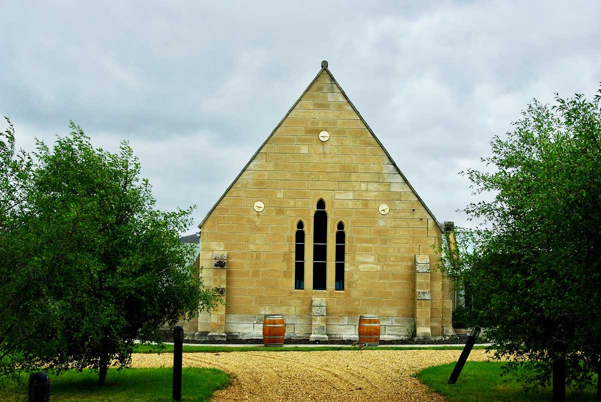
situated on the old Midland Highway, St Marks Church of England Pontville was built between 1839-41. The National Estate register records the importance of the building in great detail: 'A very unusual Romanesque-style church designed by noted architect James Blackburn and built of finely tooled local white ashlar stone'. It is not a large structure, comprising only four bays, and is symmetrical in composition, featuring a simple pitch-roofed nave with Celtic crosses at each gable end and square towers at each corner. The latter are pyramid-roofed in iron and their smooth walls are interrupted only by fortress-like slits.
The foundation stone was laid by the Governor Sir John Franklin and the building was constructed by Joseph Moir, probably better known for his construction of the landmark Taroona Shot Tower. The church was dedicated in February 1841 by Archdeacon William Hutchins. However, owing to trouble with the Crown Solicitor over the title deeds, it was not consecrated until 12 March 1884.
Over the road from St Mark's is the historic home 'Brooksby' (c. 1840), a two storey stone Georgian house originally built for Lieutenant George Brooks Foster, the Assistant Police Magistrate in the district. Early church services were held in the stone stables. In 1874, after it had been used as a boarding school, it was sold to the Butler family. Location: 284 Brighton Road, Pontville, Tas.
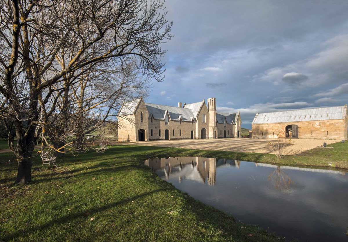
An outstanding and unique stone stables contrived by Francis Butler and his father Gamaliel Butler as a romantic, picturesque composition. It is a notable example of a Victorian Gothic building influenced by pattern books. Two-storey building has a romantic picturesque composition iron roof with three transecting gables; narrow two pane windows; arched openings to ground floor, lancet openings to upper floor. The octagonal tower of three levels contains a stone circular staircase. There are grouped chimneys on the east side and many small gables over each opening to the upper floor. There is an adjoining two-storey rectangular stone barn. The building is now home to Shene Distillery. Location: RA 76 Shane Road, Pontville, Tas. 2.5kms north of Pontville.
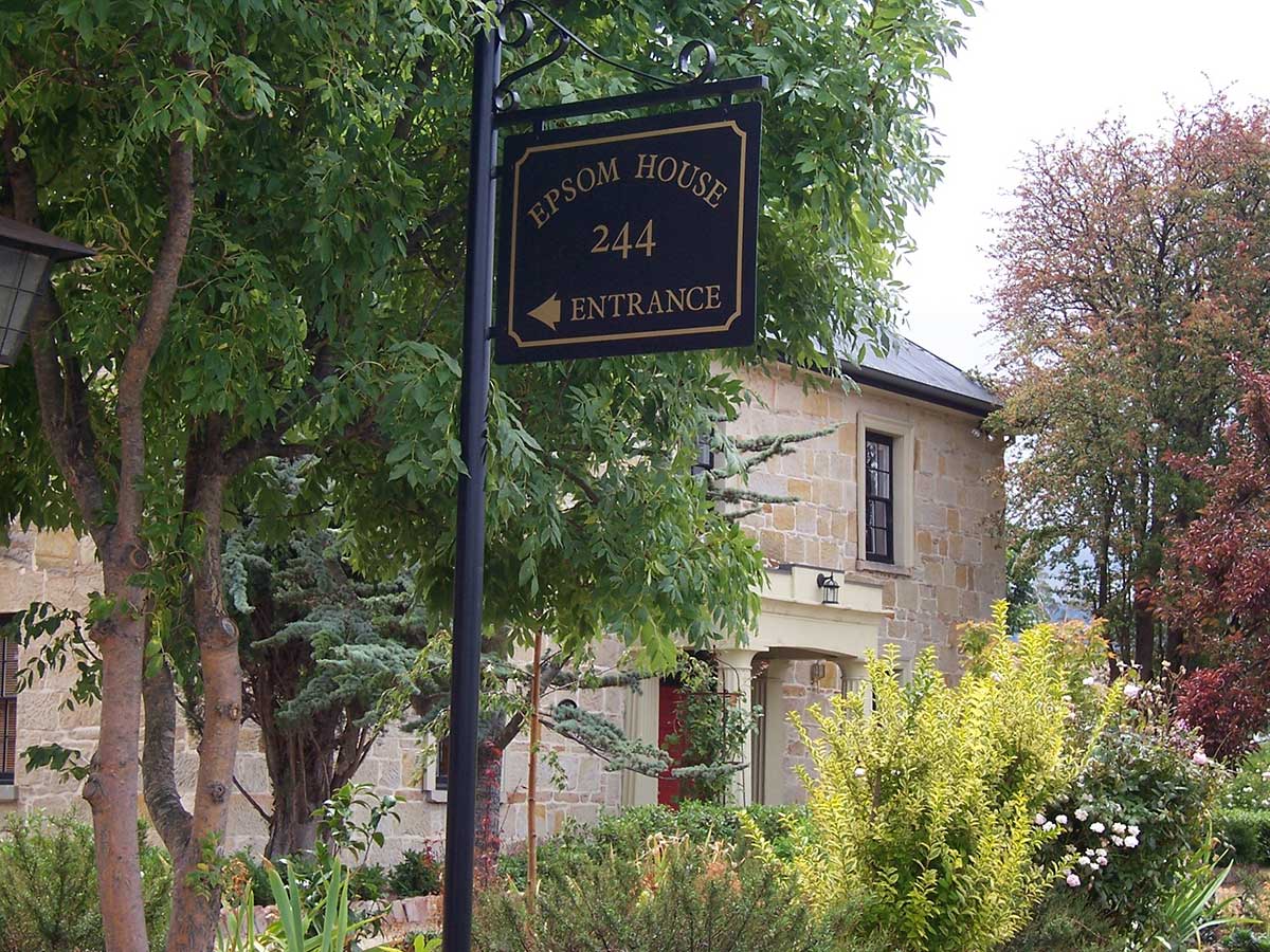
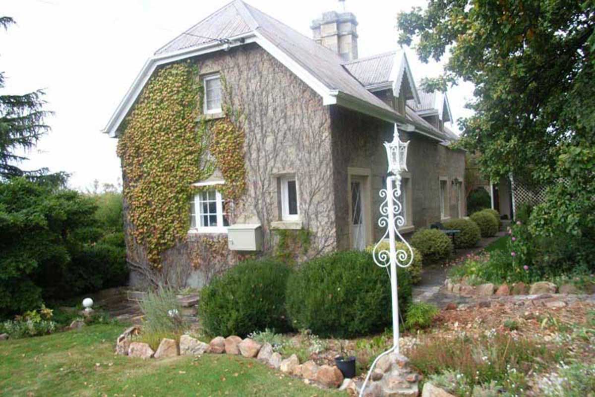
Other buildings of interest in Pontville include 'Landsdowne' at 4 Glebe Street which was built around 1840 with a wide verandah and interesting diagonal balustrading; the Pontville Bridge (1847) which has been considerably modified over the years; 'Epsom' (c. 1835) which has been variously known as 'The Castle Inn and Brighton Hotel', 'Tasmanian Hotel', 'The Crown Inn' and 'Epsom Hotel'.
![]()
Broadmarsh
Broadmarsh is a rural locality and town, located about 14 kilometres west of Pontville on Elderslie Road. The Jordan River flows through from north to south-east. A prominent surveyor of the colony, Peter Murdock, named the area after the marshlands in the vicinity. Like Pontville and Brighton, Broadmarsh has numerous heritage buildings dating from early colonial days. Two churches were established at Broadmarsh, an Anglican church, St Augustine’s (1847) and a Congregational church (1861). Both churches have closed in recent years but the buildings still exist as residences.
‘Stonefield‘ (1824), formerly ‘Braeside’, is a good example of a two storey Georgian stone home with a separate kitchen wing (now incorporated into house).. Location: 266 Elderslie Rd, Lower Broadmarsh. (private residence, no public access)
The Broadmarsh post office (1832) is a picturesque example of a Gothic Revival house built about 1845. The two and three storey stone house has a separate kitchen wing and a detached stable-coach house. The building is the focal element of the small hamlet of Broadmarsh. It was built by Pr. John Pearson Rowe and named Stonyhurst estate. Location: 1175 Eldersie Road, Broadmarsh. (private residence, no public access)
Jordan House is an impressive late Georgian house of near square plan and built of mellow convict bricks with sandstone trimmings. The heritage-listed house and its adjacent stone stable are intact and in good condition, standing close to the road and providing a good contribution to the landscape. Location: RA 622 Elderslie Road, 4 km west of Brighton (private residence, no public access).
Strathelie is a very impressive Victorian Regency house built in 1851 of silver grey sandstone, featuring a parapeted facade, enclosed rear courtyard, fine front door and front verandah with slender iron columns. Also heritage-listed, the house is complemented by particularly fine outbuildings comprising stone barn with arched openings and brick stable forming a u-shape about a central yard. Location: RA 974 Elderslie Road, 4 km west of Brighton (private residence, no public access).
Stonyhurst was built by Dr John Rowe in 1840. It has recently been tastefully renovated and stands beside Elderslie Road, a gracious Georgian gothic revival building, which adds a certain English ambience to the area.
In 1835, an extensive land grant at Brighton, which became the properties Invercarron and Arndell at Broadmarsh, and Glen Quoin at Tea Tree was granted to Police Lieutenant William Gunn, who at the age of 15 had attended the Battle of Waterloo, and became known as Wingy in consequence of having an arm shot off in a battle with notorious bushranger, Matthew Brady and his gang in Sorell. Wingy’s wife was the daughter of First Fleeters Dr. Thomas Arndell, and Elizabeth Dalton who arrived in Terra Australis as a convict. In 1842 Invercarron became the site of the Broadmarsh Convict Probation Station, which was deemed to be such a disaster that it was closed in 1847, and the Probation Station system began to wind down from that time.
From the late 1850s Invercarron was inhabited for over 60 years by William Gunn Jnr (Wingy’s son), who died on the property in 1920, 19 years after the death of Queen Victoria. It was later purchased by Henry Jones, the famous jam entrepreneur, but the unoccupied homestead subsequently became derelict over the next 20 years or so until new ownership in the 1970s heralded the second and continuing period of occupation. It is today a young Tasmanian vineyard producing premium wines. On the Invercarron property is The Picker's Hut, now a luxury vineyard escape, originally built to house and train soldiers before World War Two. This historic hut is on the property of the working vineyard, Invercarron.
In November 1836 local landowners again petitioned the Governor to either have the old line improved or a new line surveyed. As a result, s convict probation station housing about 300 men was established at Broadmarsh (1842-47) to build the road, which in large part follows the present road from Brighton to Broadmarsh. There are now few remains of the station’s buildings.
More
Black Brush/Brighton
Black Brush is a small small township between Mangalore and the Elderslie Road, 7 kilometres off the main highway from Hobart to Launceston. It is approximately 25 kilometres north of Hobart and 8 kilometres east of Broadmarsh. Black Brush derived its name from John Blacklow, an early land grantee.
The property known as Blendon was originally part of the grant of land at Black Brush to John Blacklow 1st, when the Royal Marines in Tasmania were disbanded and returned to England. However, John Blacklow died before he was able to formerly take up his grant. On the 20th of September 1812, Governor Lachlan Macquarie signed the land grants to John Staples, 80 acres, and separately to his wife Rebecca Staples, 60 acres, and another grant of 60 acres to a Mr Pryce Pritchard and all this land was in the future to become part of the Blacklow property Blendon.
Blendon is now a 353 acre property that lies on the right hand side of the road, tucked under a hill, across the fields. The Jordan River flows lengthwise from west to east through the property and 5 km east of Blendon the river passes through the township of Pontville. The house, located 2 km from Elderslie Road on Fergusson Road, comprised originally of a 2 storey, 4 room cottage, with a very steep roof and two attic rooms and a full cellar beneath the house and is constructed of thick hand cut sandstone blocks. At the rear of the stable is what appears to be an old coach house, also built by convicts from hand cut sandstone blocks and the roof is also of a pitched gable finished with weatherboard below the front and rear eaves. Next to the house is a large ‘drinking trough carved from solid stone for cattle and horses, which was made by convict labour.
The Brighton Racecourse is now approximately 1.5 kilometres from the remaining part of Blendon, but was closed down in 1973, as were many of Tasmania’s country race courses. This was believed at the time to be a mistake as the Brighton Races were a very popular track which was used for both mixed trotting and galloping.
Black Brush became the town of Brighton and was named by Governor Macquarie to honour the Sovereign, Queen Victoria, in 1821 as Brighton, England was her favourite residence in England. Brighton is also called Brighton Junction. From 1826 onwards, the Brighton township was the site of the Brighton Barracks, a military accommodation facility until sold off for subdivision in the early 2000s. A Brighton Post Office opened on 1 June 1832. This was renamed Pontville in 1895 and closed in 1973. The current Brighton office opened on 22 May 1964.