Richmond Bridge, Tasmania

Richmond in southern Tasmania is home to many buildings and structures built by convicts under the most appalling conditions. One such structure, the bridge over the Coal River at Richmond was completed in 1825, making it the oldest surviving freestone bridge in Australia. Its original name recalls
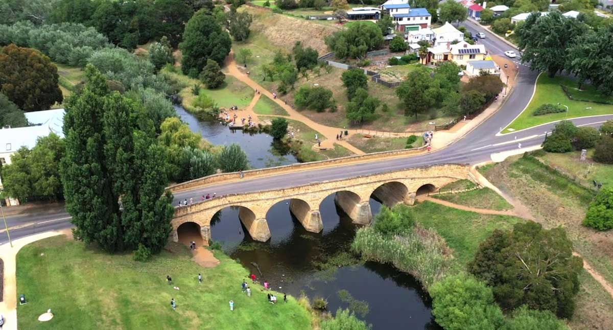
For some years Richmond had been used as a crossing point for people travelling by land to the Tasman and Forestier Peninsulas. The bridge was built by convict labour between 1823 and 1825 for movement of military, police and convicts between Hobart and Port Arthur. It was originally named Bigge's Bridge after John Thomas Bigge (1780-1843), an English judge and royal commissioner, who visited Australia in order to report on the state of the colonies. During his visit to Van Diemen's Land in 1820 he recognised the need for a bridge across the Coal River and authorised its construction.
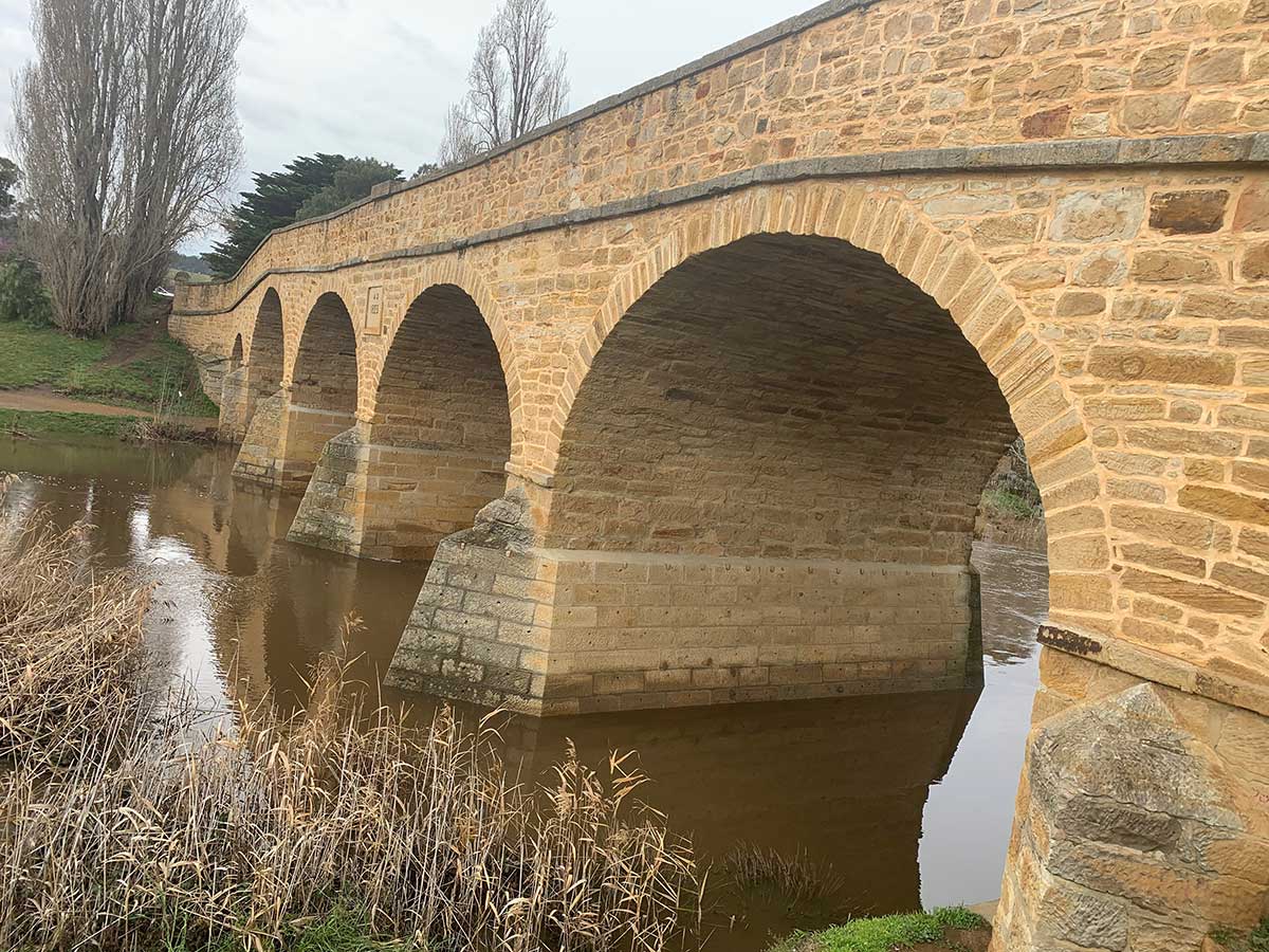
Under the supervision of Major Thomas Bell, Acting Engineer and Inspector of Public Works, and William Wilson, Superintendent of stonemasons, construction of the bridge proceeded. The first stone was laid 11 December 1823, at a narrow point on the river having a relatively low escarpment. It was constructed of sandstone quarried from Butchers Hill, hauled to the construction site by convicts using hand carts.
David Lambe, Colonial Architect, visited the site before it was completed. The attribution of the designer is not certain – both Thomas Bell and David Lambe have been attributed with the design but it seems more likely that it was Bell, who had six years experience as Acting Colonial Engineer and overseer of several building constructions, rather than Lambe who would have had to design the bridge as a twenty year old just arrived from England, site unseen, and at least eight months before his own appointment as Colonial Architect by the Lieutenant-Governor, and indeed the latter’s own appointment.
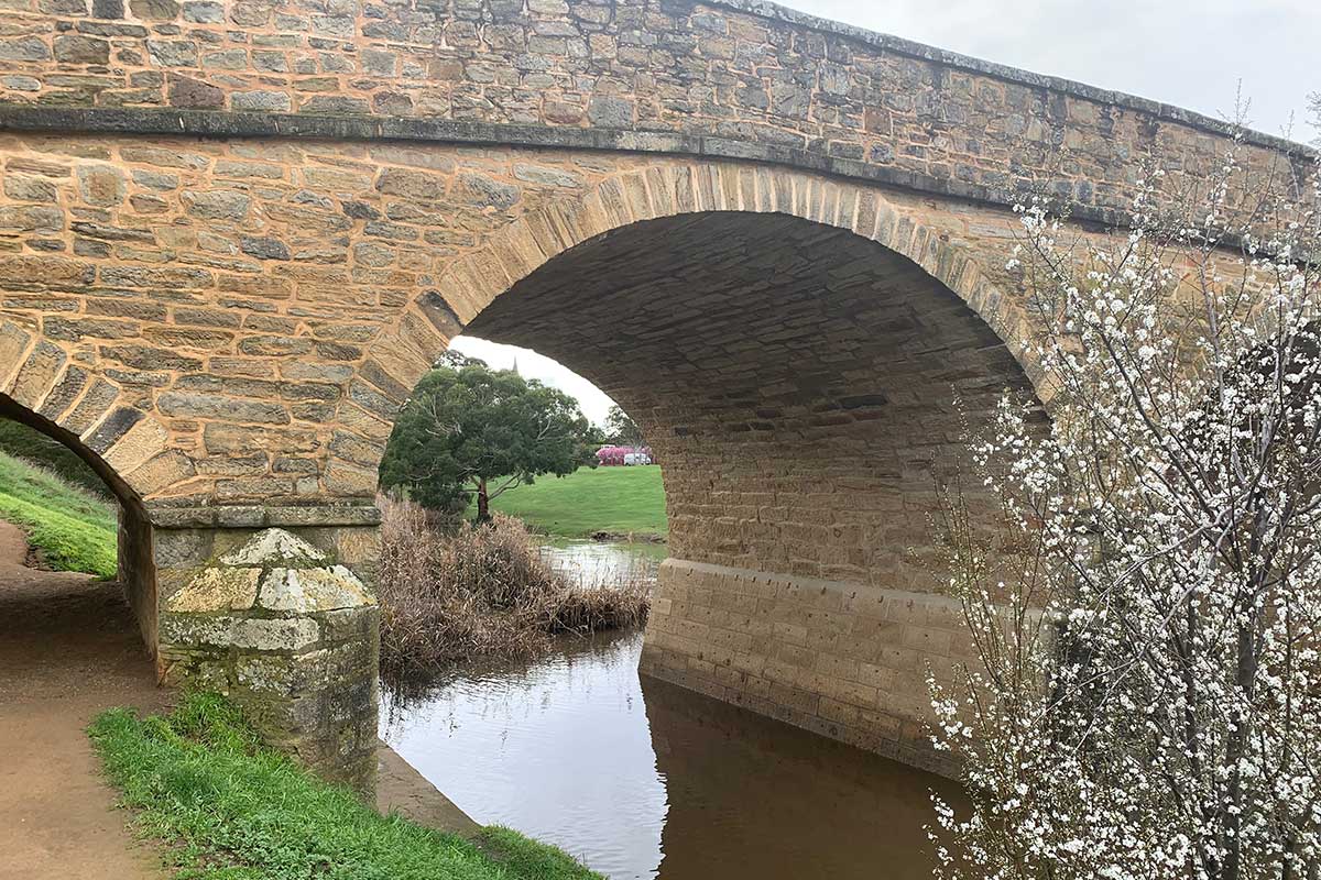
The stone structure comprises of four main arches with a smaller arch to each side, the arches springing from sloping buttresses, with angular leading edges aligned with the flow of the river. The solid stone ballustrade terminates in a round bollard. It consists of four main arches, of span 4.3, 8.1, 8.3, 8.5, 8.3 and 4.1 metres respectively, which spring from sloping fins with angular leading edges aligned with the flow of to the river.
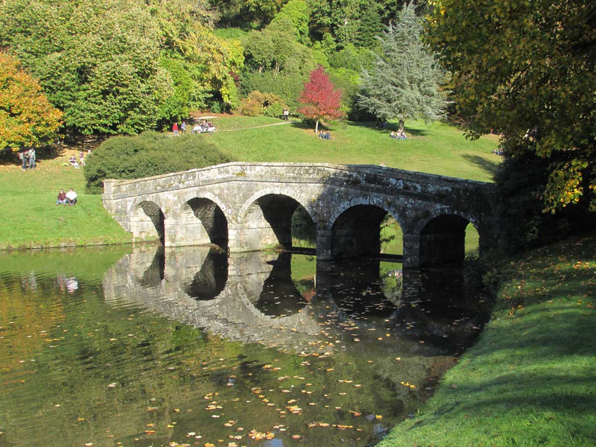
Stourhead Bridge at the Stourhead Gardens in Wiltshire, England
Initially Richmond Bridge, although larger, was identical in line and design to Stourhead Bridge at the Stourhead Gardens in Wiltshire, England, which Thomas Bell, William Wilson or David Lambe copied. David Lambe seems the most likely, as he had family in Wiltshire, whereas the other two hailed from English-Scottish border country. Subsequent modifications were made to its pier foundations due to settlement within a few years of construction. Later again, around 1835, changes were made to the town-side upper walls, raising the inclined wall to become horizontal in order to take the degree of slope out of the roadway, and to improve safety at the bridge entry point. The eastern end remains as it was.
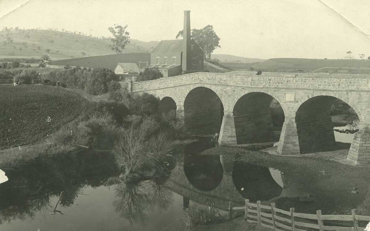
In 1885, as a result of flood damage, other changes in the form of bulky (and less attractive) buttresses were attached to the three mid stream piers. These were required to further protect the piers and foundations against water damage during times of heavy rainfall and flooding.
Another change to the bridge and its setting occurred with the construction, in c1939-40, of a downstream weir, originally called Gatty Weir, raising the water level. This was motivated by both town water and recreation needs. Weir construction raised the water level so that the access road under the main west arch and spillways under the main arches were permanently inundated. Erosion of the river bank has also meant that the classic views of St John’s framed by the bridge arch is no longer possible from the bank. The weir also provided access across the river but was not used for irrigation.

The bridge served to consolidate Richmond as a focus for commercial and institutional development. The township developed to the south-west of the new works, being along the road to Kangaroo Point where a ferry/punt connected with Hobart. The early town layout is shown on two undated plans from the mid-1820’s. The first buildings constructed in the new town were part of the police and penal systems – a court house, gaol, gaoler’s quarters and residence for the Police Magistrate. Several private houses soon appeared and within ten years two inns were catering for local trade.
The bridge has more than its fair share of mythology. It is suggested that one convict, tired of his lot, committed suicide by hurling himself from the bridge. Another story tells of the murder of a particularly cruel overseer named George Grover. Grover was transported to Van Diemens Land in 1825 for stealing. He died early March, 1832 a number of years after the bridge was built. By then he was an ex-convict employed at Richmond Gaol as a flagellator at Richmond. He seemed particularly good at 'aiding' other people to get into trouble, particularly for fighting and sexual assault. His record indicates that the convicts working on the bridge, tired of his maltreatment, turned on their tormentor, beat him, and threw him from the parapet of Richmond Bridge to his death after drunkenly falling asleep. No one was convicted of his murder.
Grover's ghost is said to appear around the bridge at certain times. The ghost of a large black and white dog, sometimes called "Grover's Dog," is also seen on the bridge. One woman states that it appeared at her side on a few separate occasions when she walked the bridge at night. The animal would would walk alongside her, from on end to the other, and then disappear.