Mount Ossa: 1,614 m
Legges Tor, Ben Lomond: 1,572 m
Giblins Peak, Ben Lomond: 1,569 m
Mt Pelion West: 1,560 m
Barn Bluff: 1,559 m
Cradle Mountain: 1,545 m
Markham Heights, Ben Lomond: 1,569 m
Hmilton Crags, Ben Lomond: 1,538 m
Stacks Bluff: 1,527 m
Smithies Peak, Bluff Cirque: 1,527 m
Mt Geryon: 1,520 m
Du Cane Range: 1,520 m
Mt Massif: 1,514 m
Frenchmans Cap: 1,446 m
Mt Field West: 1,436 m
Dry's Bluff: 1,340 m
Mount Murchison: 1,275 m
Hartz Mountains: 1,254 m
Mount Roland: 1,234 m
Adamsons Peak: 1,225 m
Federation Peak: 1,224 m
Tasmania has a diverse range of geography but a prominent feature is the mountains of the island. Overall Tasmania is comparatively low-lying with the highest point at 1,617 metres. With ten peaks over the height of 1,500 metres and thirty peaks higher than 1,200 metres, Tasmania is one of the most mountainous islands in the world, and is Australia's most mountainous state.
The majority of the mountain peaks of Tasmania are located in the Western half of the state, starting at the coast in the South West and extending inland to the north, or in the Central Highlands.
Tasmania's mountains were part of an ancient range of volcanic peaks from the period of Gondwana, and are the source of a large portion of Tasmania's wealth in the form of mining. Although the eastern half of the state is generally lower and flatter, there are still sizeable peaks located there. As late as the mid-1950s adequate surveying of the mountains had not been completed - with the height of 19 peaks described as "about" in the list in Walch's Tasmanian Almanac of the over 115 peaks mentioned.
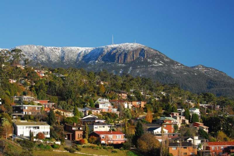
Rising 1270 metres above Hobart's harbour and the wide Derwent River, Mount Wellington provides a wilderness experience within 20 minutes' drive of the city and is much loved by locals. The short 21 km drive to the summit takes you from temperate rainforest to sub-alpine flora and glacial rock formations, ending in panoramic views of Hobart, Bruny Island, South Arm and the Tasman Peninsula from the sheltered lookout.
More >>
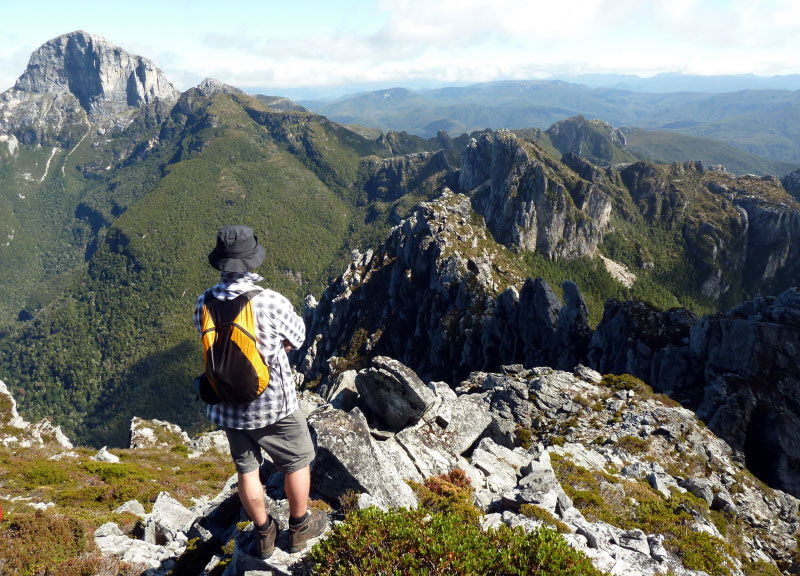
The magnificent white quartzite dome of Frenchmans Cap (1446 metres) is the most prominent mountain peak in the Franklin-Gordon Wild Rivers National Park. It is visible from as far away as the coast. There is a track to the summit, so a trek to the top is not limited to diehard mountain climbers, but it is considerably more arduous than many other Tasmanian walks, including the Overland Track. Most walkers spend between 3 and 5 days completing the return trip, a distance of about 23 km each way. There are two lakes on the way to the summit - Lake Vera, and Lake Tahune - there are huts at both of these locations. The track starts at the signpost beside the Lyell Highway about 55 km from Queenstown.

At 1,234 metres, Mt Roland is only Tasmania's 44th highest mountain, yet it provides a dramatic backdrop to the town of Sheffield and the surrounding Kentish municipality of north west Tasmania. For those more interested in climbing to the top, there are two tracks to the summit which take in the plains and plateau leading to the peak. The trig point at the top of the summit, which is an hour's walk, provides spectacular 360 degree views to Bass Strait, Cradle Mountain and Barn Bluff.
Deep in the heart of Tasmania's World Heritage Wilderness Area, Mount Ossa (1,617 metres) is the highest of the state's 1,144 mountains. Unlike many of Tasmania's highest peaks, Mount Ossa is quite literally not far off the beaten track, that beaten track being the Overland Track from Cradle Mountain to Lake St Clair. Accessed via a side track, the climb to the top is rated as 4 out of 10 by experienced mountain climbers.

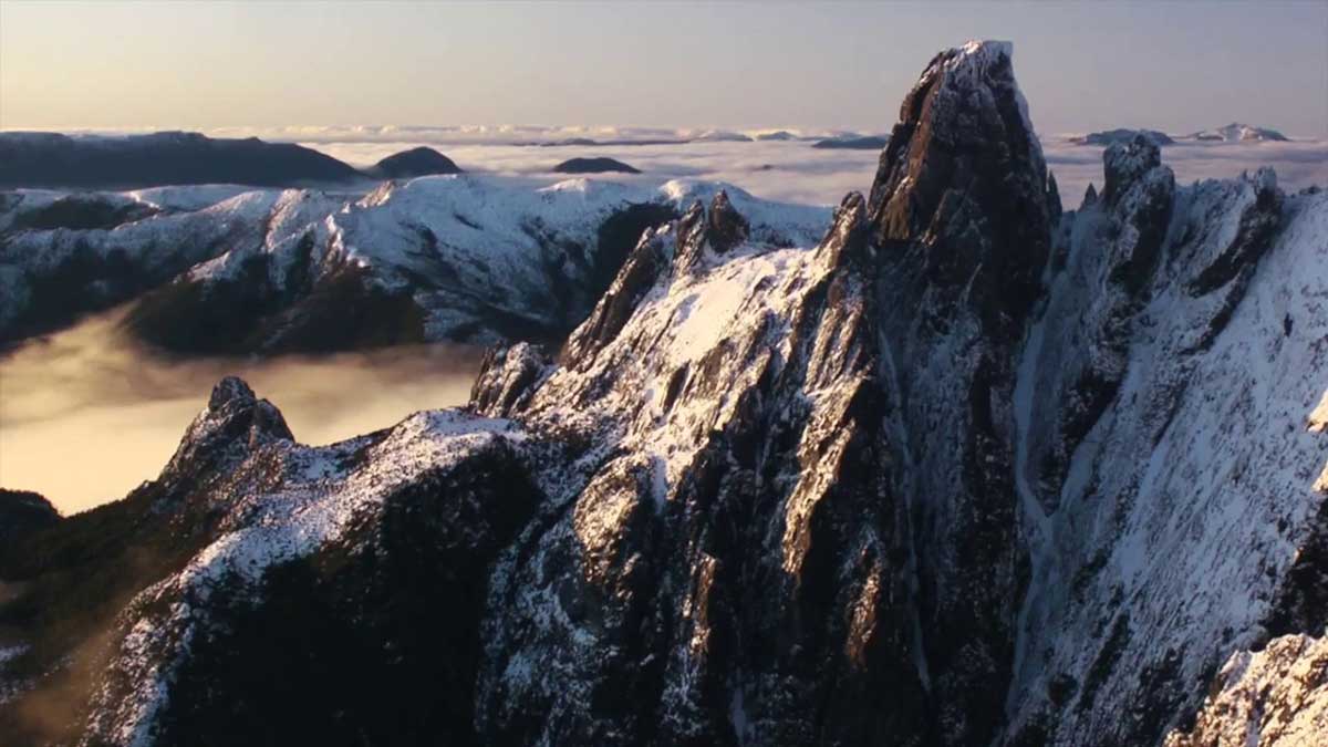
If mountain climbing is your thing, then Federation Peak (1,224 metres) should be at the top of your list of "must-do" climbs in Tasmania. With its sharp spire and 600 metre cliffs, this majestic peak in the state's remote south-west, is rated as Australia's most challenging mountain to climb. For decades, Federation Peak remained unclimbed; a party from Victoria finally conquered it in 1949, just four years before the pinnacle of Mount Everest was first reached. The tracks to the peak, such as they are, are very rough climbing, and many cliffs are without any ladders or other aids. The weather and the steep terrain deter and often stop many would-be ascent parties.
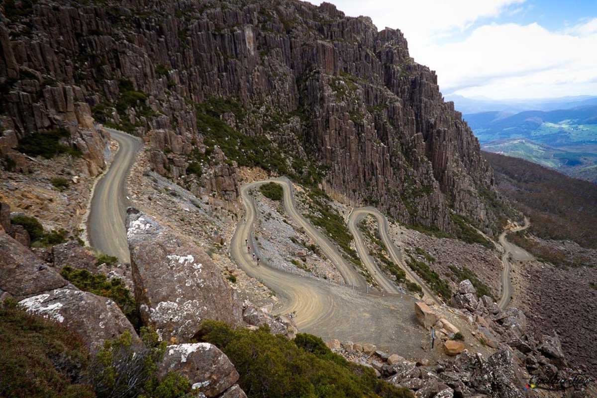
This imposing mountain with its precipitous cliffs is visible over much of the northern midlands of Tasmania. The mountain's alpine plateau is roughly 14 kilometres in length, 6 kilometres wide and is in excess of 1300 metres in height. A summit on the plateau - Legges Tor - is the second highest point in Tasmania (1572 metres). Ben Lomond is the main focus of downhill skiing in Tasmania. The skifield on Ben Lomond is Tasmania's only downhill skiing area which offers some of the facilities expected of a contemporary skifield.

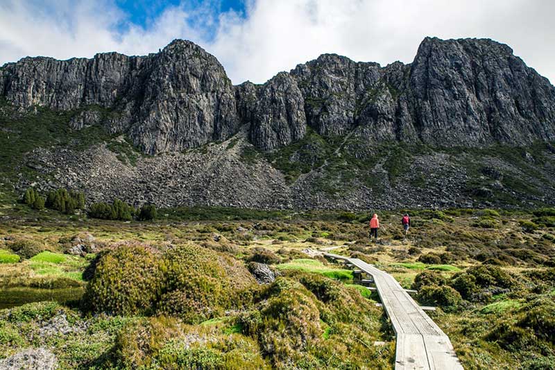
Australia's most recognisable mountain, Cradle Mountain forms the northern end of the wild Cradle Mt. - Lake St Clair National Park, itself a part of the Tasmanian Wilderness World Heritage Area. The familiar jagged contours of Cradle Mountain epitomise the feel of a wild landscape, while abundant wildlife, icy streams, alpine heathlands, colourful deciduous beech and ancient pines reflected in still glacial lakes entice many visitors to stay and explore.
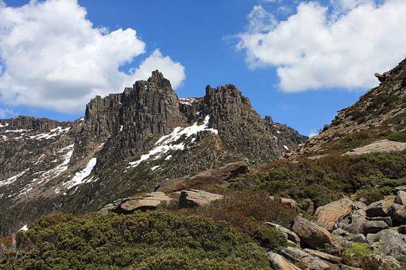
The Walls of Jerusalem is situated on the western side of the extensive central plateau of Tasmania, in approximately the centre of the island. Thousands of lakes formed by an ice cap during relatively recent glaciation cover the plateau and the features known as the Walls of Jerusalem are a series of higher, craggy hills. From a distance, these peaks seem to be the dominent feature but once within the Walls, in fact, the major features are the typically U-shaped glacial valleys and pretty lakes.
This relatively small but stunningly beautiful park is located on a high plateau of dolerite peaks, and features alpine vegetation and endemic conifer forests. The name Walls of Jerusalem appears on plans by surveyor James Scott dating back to 1849 and the biblical theme was taken up from the early days for park features, including Ephraims Gate, Zions Gate, Herods Gate, Pool of Bethesda, Pool of Siloam, Wailing Wall and The Temple. There are a range of walks of varying lengths that lead to its natural features.

Hartz Mountains National Park is a window into the south-west wilderness, offering views of remote mountain ranges as far as the southern coast. As well as spectacular views of a landscape which has been shaped by glaciers during past ice ages, the park offers a variety of unique features. Waterfalls tumble off the dolerite range that runs through the centre of the park and small glacial lakes dot the plateau. The park contains a wide variety of vegetation from wet eucalypt forest and rainforest through to alpine heath on the exposed mountain tops. The park was included in Tasmania’s Wilderness World Heritage Area in 1989, in recognition of its spectacular natural and cultural values.
Take your time and enjoy short strolls out to the glacial lakes in the area, or try the more challenging walks up to the range top. Its highest point, Hartz Peak (1255 m), provides panoramic views into the heart of the southwest.
© All rights reserved | Design by W3Layouts