
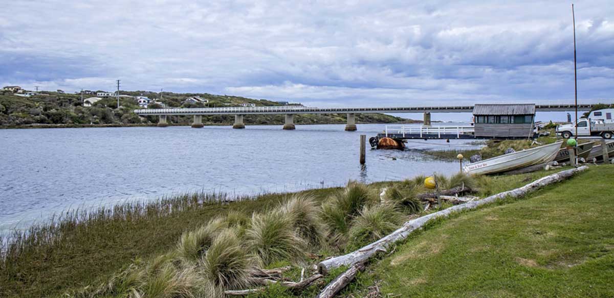
Arthur River, Tasmania
Situated at the mouth of the Arthur River, the tiny settlement of Arthur River is an ideal base for walking (both in the bush and along the coastline), horse riding, fishing, off-road driving, cruising the river and picnics in this remote, beautiful area. Tasmania’s wild western river, the Arthur, brews a tempest in the Southern Ocean as they meet. Wind and waves enliven the spirit. Let nature sweep you away.

Location: 16 km south of Marrawah, 308 km west of Launceston, 85 km south west of Smithton.

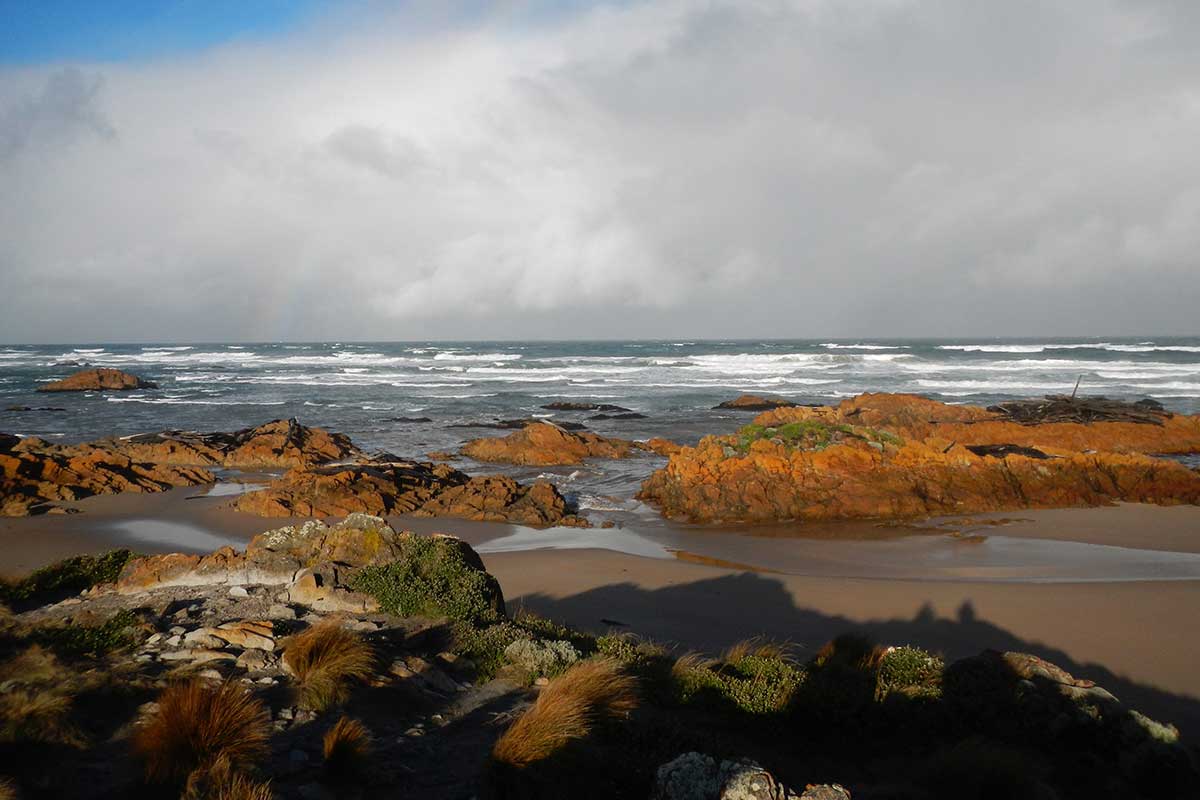
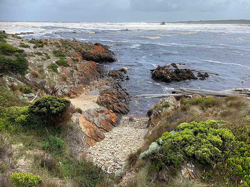
These ocean currents mix with the river flow, creating a washing machine effect. Foaming waves push ancient logs up onto lonely beaches, having been carried by floodwaters up to 100km away down the river from the heart of the Tarkine Wilderness. As a result, five hundred-year-old forest giants of Tasmanian oak, Blackwood, myrtle, or sassafras, became the foundation of coastal dunes, having laid buried in the sand for perhaps a 1,000 years. Those near the waterline are revealed by scouring tides from time to time. Some of the timbers scattered across the rocks appear to have been carried across the world from South America with the currents, as they are from trees not found on Tasmania's shores but are native to South America.
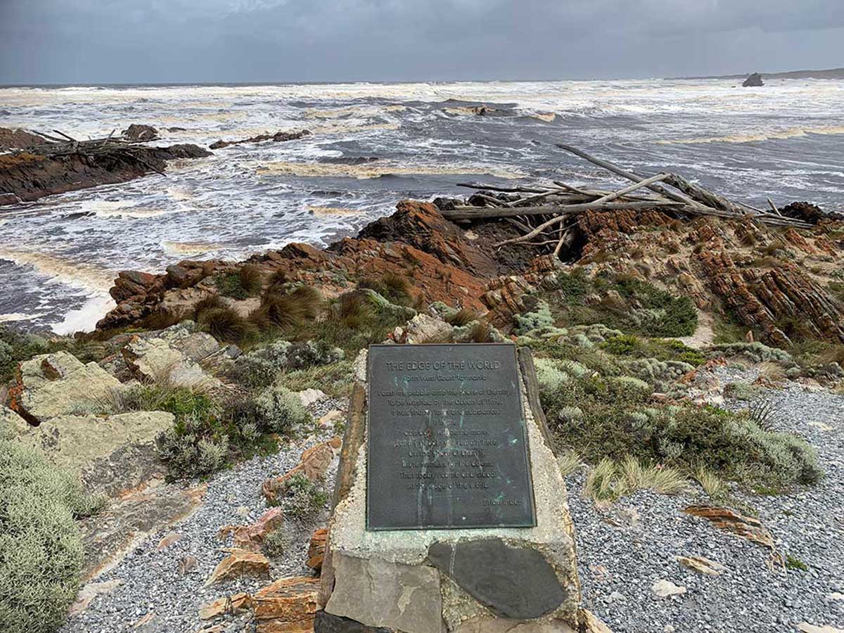
The Edge of the World is an incredible spot, well worth visiting; the beachfront at sunset is an unforgettable sight. To get there from Arthur River township, cross the bridge, and take the second street past it and make your way to the car park at Gardiner Point. A cairn explains the significance of the locality.

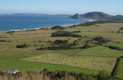
Tasmania's westernmost community and the furthest settlement from Hobart, Marrawah is the most popular surfing spot in Tasmania's north. The small town services the surrounding rich dairy farming area.
More
Location: 16 km south of Marrawah, 308 km west of Launceston, 85 km south west of Smithton.
Arthur River Cruises
The Arthur River is one of the State's seven major rivers, but it is the only one which is completely wild, having never been logged, dammed or had a hot fire through the rainforest for almost 650 years. One of the best and most convenient ways to experience the river is on a cruise from the settlement of Arthur River. The MV George Robinson leaves Arthur River daily at 10.00 am and travels upstream for 70 minutes. The cruise includes lunch and a walk in the riverside rainforest, before returning to Arthur River by 3.00 pm.
Gardiner Point - 'The Edge of The World'
Just to the south of Arthur River, Gardiner Point has been dubbed The Edge of The World as the sea here stretches uninterrupted all the way to Argentina, 15,000 km away. The sea west of Tasmania is, in fact, the longest uninterrupted expanse of ocean on the globe. From Argentina the currents known as the roaring 40's sweep unimpeded more than halfway around the planet until they hit this point.
These ocean currents mix with the river flow, creating a washing machine effect. Foaming waves push ancient logs up onto lonely beaches, having been carried by floodwaters up to 100km away down the river from the heart of the Tarkine Wilderness. As a result, five hundred-year-old forest giants of Tasmanian oak, Blackwood, myrtle, or sassafras, became the foundation of coastal dunes, having laid buried in the sand for perhaps a 1,000 years. Those near the waterline are revealed by scouring tides from time to time. Some of the timbers scattered across the rocks appear to have been carried across the world from South America with the currents, as they are from trees not found on Tasmania's shores but are native to South America.
The Edge of the World is an incredible spot, well worth visiting; the beachfront at sunset is an unforgettable sight. To get there from Arthur River township, cross the bridge, and take the second street past it and make your way to the car park at Gardiner Point. A cairn explains the significance of the locality.
Marrawah
16.4 km north via Arthur River RoadTasmania's westernmost community and the furthest settlement from Hobart, Marrawah is the most popular surfing spot in Tasmania's north. The small town services the surrounding rich dairy farming area.
More
Beyond Arthur River
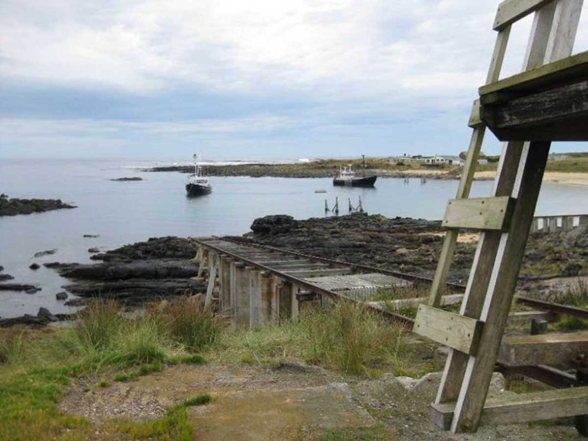
Temma
Little more than a collection of fishermen's shacks, Temma is one of the most isolated localities in Australia. For around 20 years it was the sea port for the 700 residents of the copper and tin mining town of Balfour, after tin was first found in the area in the 1870s. A horse-drawn wooden tramway connected the town and port. Balfour is one of the most mineralized copper districts in Tasmania; copper workings occur intermittently along a 35km track between the two localities.The origin of the name 'Temma' is not known. Mary Hopkin's 1969 hit song of the same name is not about this locality. Its name did inspire the song 'Temma Harbour', however, but the songwriter, Philamore Lincoln, states the name was selected randomly from a map while looking for a place name that sounded romantic. "catch a fish and light a fire, drink some wine with me" - it sounds like Temma to me.
More

South Arthur Forest Drive
East of Arthur River via Temma RoadThe South Arthur Forest Drive is a safe and easy way to have a taste of the Tarkine region of Tasmania's north west, with a minimum of fuss and without having to do the whole 4-wheel drive thing. The drive begins at Smithton and is an easy 130 km round trip. A mix of sealed and gravel roads give access to a number forest reserves on the way. To begin, take the turnoff which indicates South Arthur Forest Drive from the road between Stanley to Smithton. The following features are visited on the South Arthur Forest Drive.

Lake Chisholm
63.7 km east via Temma, Rebecca and Sumac RoadsA hidden gem, Lake Chisholm is a flooded limestone sinkhole, one of the many sinkholes in the area, but one of only two filled with water. A gentle, half-hour return walk meanders through a majestic old myrtle forest to the tranquil waters of the lake. This can be a fantastic photo opportunity, especially in the early morning, so remember to bring your camera.

Julius River Forest Reserve
56.1 km east via Temma, Rebecca and Sumac RoadsThis site has recently been upgraded and has excellent picnic facilities. A half-hour return walk winds through the cool, temperate rainforest. Interpretive signs provide an insight into the nature of this forest.
Julius River Rainforest Walk: From Milkshakes Hills, continue on to the 30-minute Julius River Rainforest Walk, situated in a beautiful reserve, set in sinkhole country. There are two easy walks into the mossy, myrtle forests, found throughout the Tarkine. BBQ facilities, picnic shelter and a toilet are provided.


A PocketOz Travel and Information Guide
Design and concept © Stephen Yarrow | Email | W3Layouts | Test