Detention River
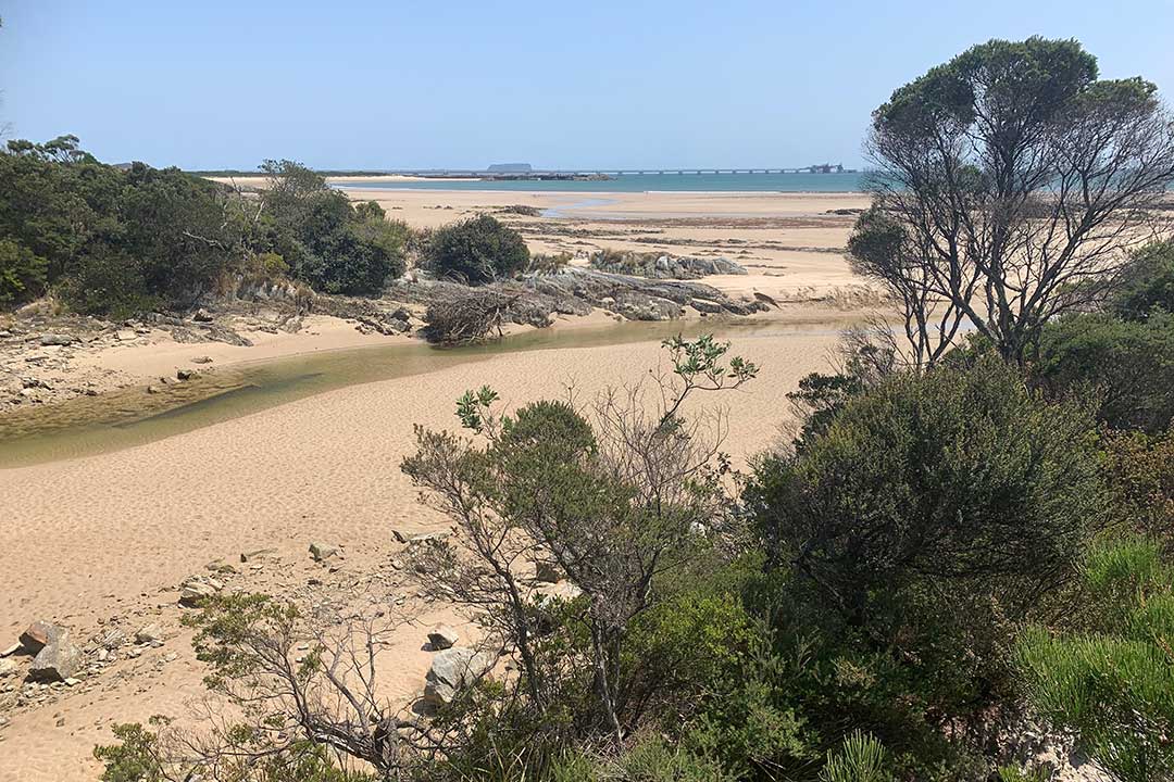
Detention River lies about a five minutes drive west from the Rocky Cape turn off. It is a picturesque spot where erosion continues to threaten homes, and is now threatening the foreshore as well. It's popular for beach fishing, the with a few species of fish that can be targeted by the shore angler. They include sea-run trout, Australian salmon and flathead. Spinning for sea-run trout and salmon towards the mouth is the most common form of fishing. These fish can be caught further up the estuary when the tide is full.
Detention River Store serves hot food, groceries, fishing gear and giftwear. Ddtention River was first named the Tret River by the Van Diemen's Land Co.'s survey staff, but afterwards was changed to Detention River because of the uncomfortable forced detention of Alexander Goldie and his party at the river by a heavy flood in 1826. Known as Mayntranga to the local Tasmanian Aboriginal peoples, it was given its present name by Joseph Fossey of the survey vessel, Caroline, April and May 1827.

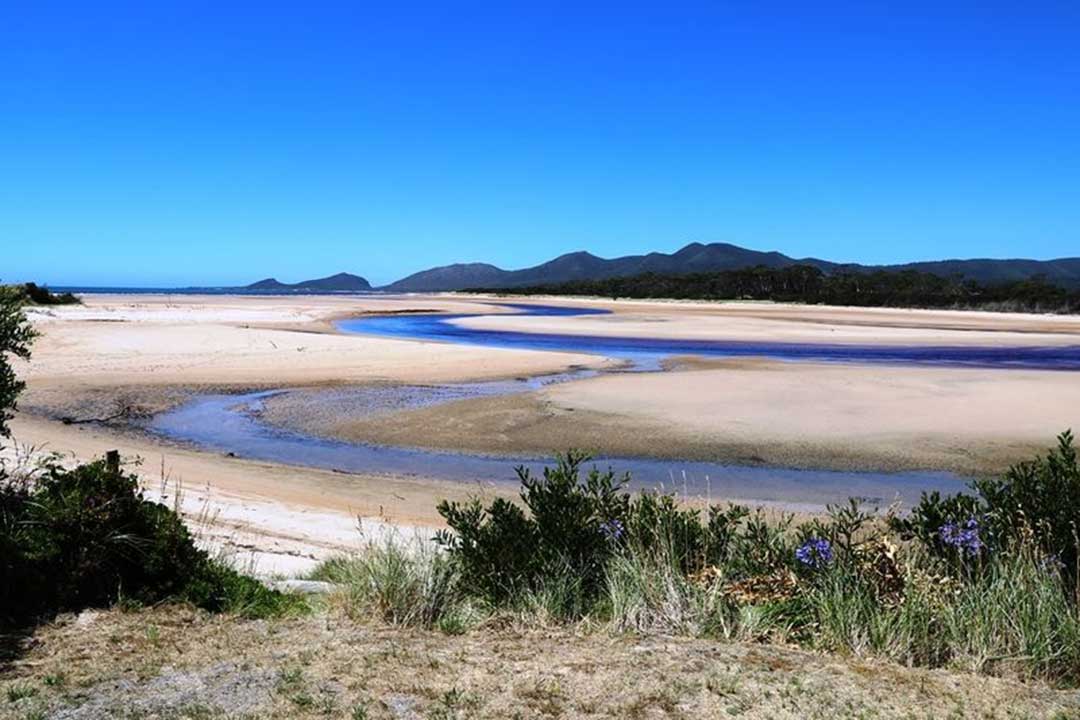
A 2.5 km long slightly curving north-northeast-facing sandy beach, bordered by low rocky points and platforms in the west and the shallow mouth of Pebbly Bay and the Detention River in the east. Most of the area between the highway and beach is a coastal reserve. The small settlement of Hellyer is located at the eastern end of the beach between the highway, beach and bay. The highway crosses Detention River 800 metres in from the mouth and then trends southeast, not nearing the coast again until Boat Harbour 18 km to the east.
The name recalls Henry Hellyer, Architect and Surveyor of the Van Diemen's Land Co Company. Hellyer led an expedition along the Bass Strait coast during a voyage of the Caroline in 1827. Born at Portchester in Hampshire circa 1790, Hellyer arrived in Tasmania in 1826 as an employee of the company. He commited suicide in 1832.
Home to a beachside holiday community, at the extremities of the beach are some interesting volcanic rock formations. Interbedded siltstone and mudstone was deposited between 750 and 1000 million years ago and folded around 510 million years ago. In places these have been intruded by dolerite dykes that might be about 700 million years old. It has a good shore platform exposure of rocks that underlie much of northwest Tasmania.
The name Edgcumbe Beach comes from a land grant in the vicinity in the name of Mary Edgcumbe. Sand dunes nearby had been once known as Edgcumbe Bank. The strip of beach between Black River and Brickmakers Bay had originally been known as Peggs Beach, after a family in the vicinity. Mary (Martha) Edgecumbe was born in London in 1817. She was married John Warburton and they had 5 children. She died 18 February 1874 in Hobart, Tasmania.
The name conjures up images of the Giant Tasmanian crayfish which inhabit the inland waterways of the North West and gave the creek its name. The settlement, set around the beach where Crayfish Creek enters Bass Strait, consists of an older-style resort and a collection of holiday shacks. From the beach there are view towards the Port Latta iron ore facility and Circular Head beyond.
The creek was named by Henry Hellyer, Architect and Surveyor of the Van Diemen's Land Company, when he caught crayfish there during an exploratory expedition, whwn he followed the coast on board the Caroline in 1827.

Originally known as Cowrie Point. Latta is the native name for iron ore. It was changed in 1965 when Port Latta was established as the location for an iron ore pelletising plant and port from which iron ore mined at Savage River is exported.
Other names considered were Tayatea and Port Hardwicke, after Charles Browne Hardwicke (1788-1880), naval lieutenant and racing enthusiast and settler in Launceston. In 1823, with his brother Frederick and a crew of six men he examined the north coast from Port Dalrymple to West Point and the west coast for forty miles (64 km). The name Lattawinne was also considered for the site of the Davage River mine.
The Post Master General's Dept. had originally requested approval of the name "Brickmakers Bay" for a telephone office to be built at the site of the proposed port and pelletising plant on the North West Coast. The Nomenclature Office were told that the site was not at Brickmakers Bay, but was a mile to the East and nearer to a shack area, and officially inmed it Cowrie Point.
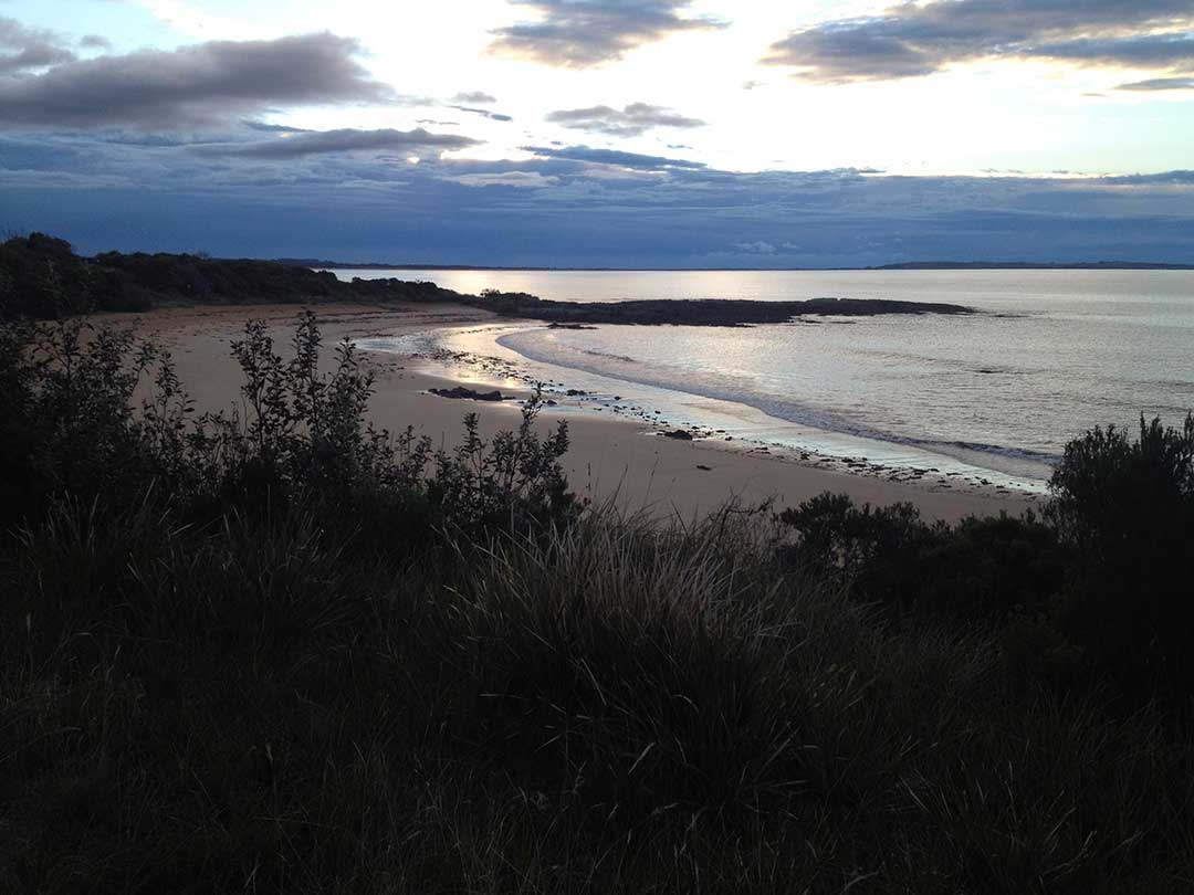
A pretty spot, and a great place to view the sunset over Bass Strait. It has a curving 250 m long north-facing beach bordered by low rocky points. It is backed by a narrow band of scrub, with a car park and small picnic and camping reserve at the western end of the beach and the highway immediately behind the eastern end.
Brickmakers Bay Loop is a walking track around the bay to Cowrie Point.
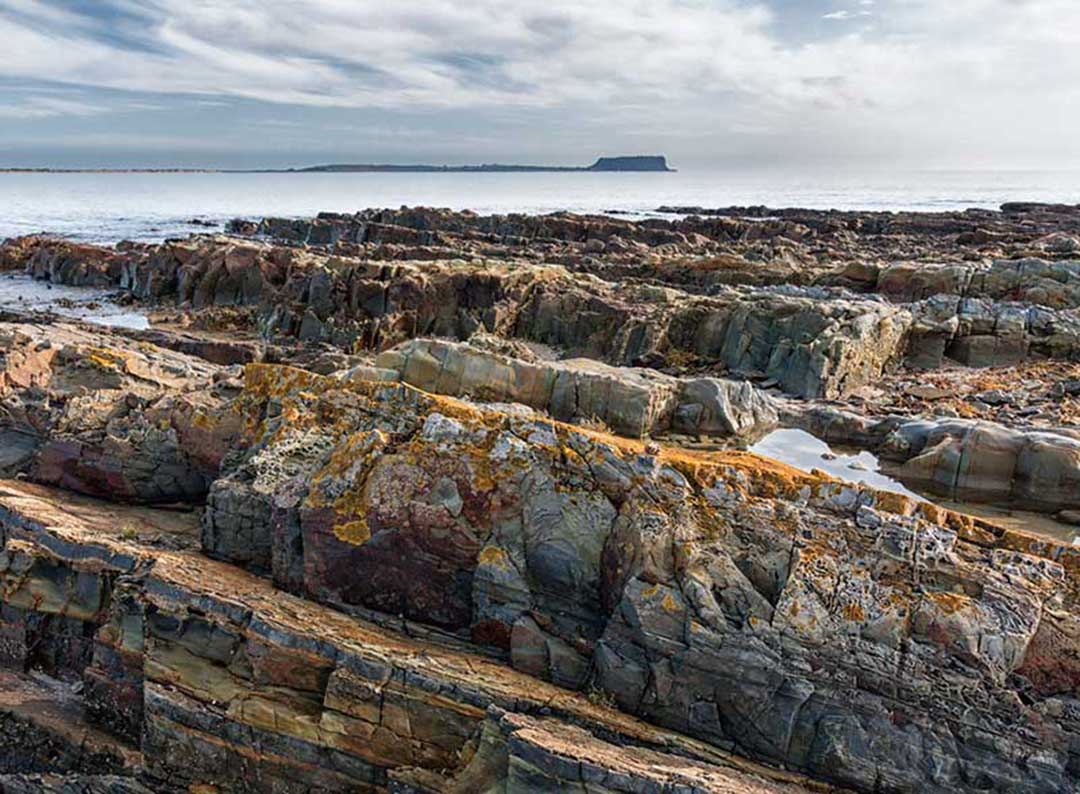
Geologically, you'll see fretwork and honey comb weathering of the rocks; hyllite and slate sequences in tilted rocks, highly sculptured with evidence of iron and minerals. The interbedded siltstone and mudstone were deposited between 750 and 1000 million years ago and folded around 510 million years ago. In places these have been intruded by dolerite dykes that might be about 700 million years old. Good shore platform exposure of rocks that underlie much of northwest Tasmania.
The locality is about 26 kilometres east of the town of Smithton. The 2016 census recorded a population of 14 for the state suburb of Cowrie Point at Brickmakers Bay. It was proposed in 1965 that the settlement be renamed Brickmakers Bay but this was not accepted.
Little Peggs Beach
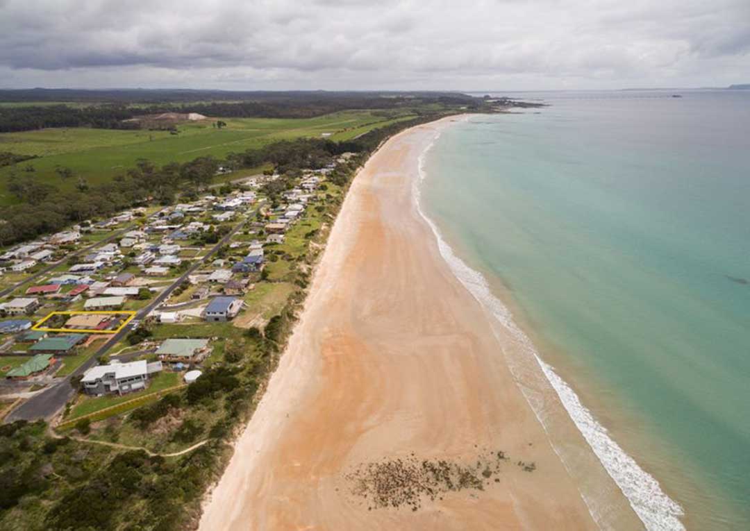
Peggs Beach commences on the southern side of the sandy Black River mouth and curves slightly to the southeast for 3.5 km, terminating at a low rock reef. The highway clips the eastern end of the beach where there is a campground and park in lee of the boundary reef. The road then follows the rear of the ridges, before turning inland to cross the Black River 1 km in from the mouth. The whole beach and barrier system is contained within the 208 ha Peggs Beach Coastal Reserve.
Little Peggs Beach is an eastern continuation of the longer Peggs Beach, with a 100 metre long cluster of low rocks and reefs separating the two, most of which are exposed at low tide.
Geologically, the Peggs Beach rocks area is an unconformity, i.e. a geological contact at which underlying and overlying layered sedimentary rocks of different ages meet at an angle (here about 22 degrees). The older, lower siltstone formation, about 1200 million years old, has evidently been uplifted, slightly tilted, planed off by erosion, and overlain by the younger formation, of conglomerate and quartzite, about 750 million years old. Best visited at low tide.
There are two campgrounds in Peggs Beach Conservation Area: Peggs Beach and Black River campgrounds. The campgrounds are attractive but facilities are basic. There are no powered sites.
Website
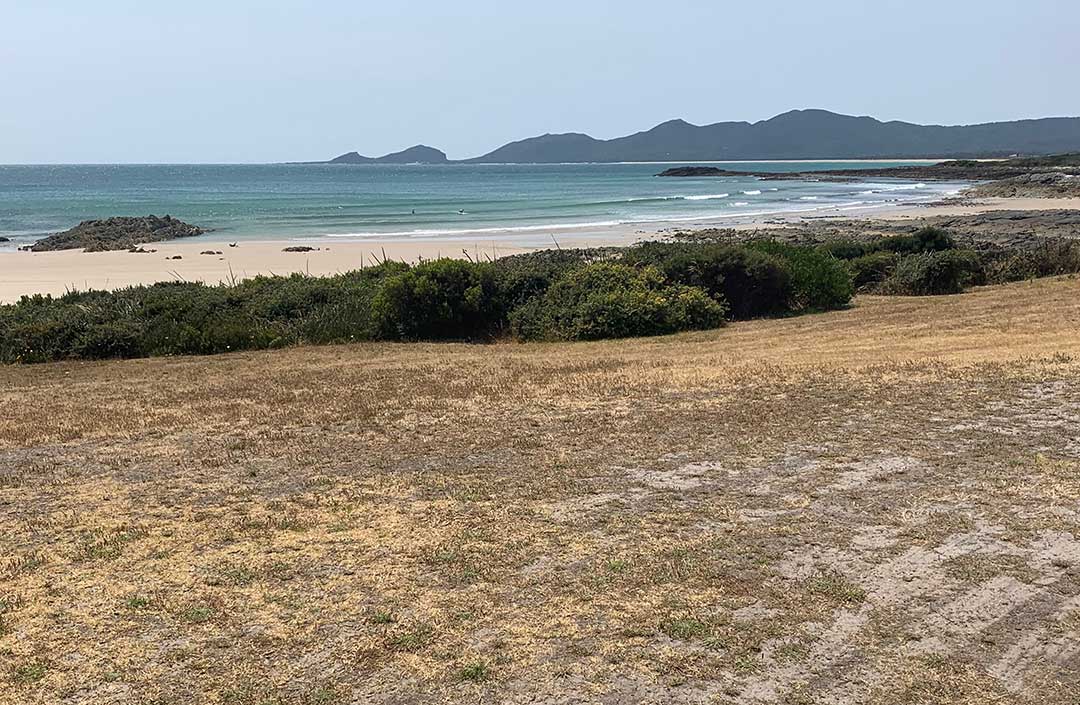
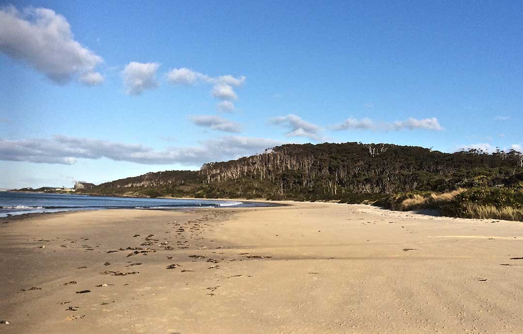
Rocky Cape National Park offers a fascinating variety of walks, ranging from less than 20 minutes to a full day. These take in Aboriginal rock shelters and caves, scenic hills full of wildflowers and birds, and tranquil beaches, bays and rocky headlands. From Sisters Beach there is a one hour walking ciruit to Wet Cave, Lee Archer Cave, returning via Banksia Grove, a stand of giant Banksia serrata. Sisters Beach is the only place in Tasmania where they occur.
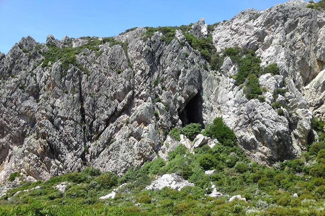
Although small, Rocky Cape National Park offers visitors a varied experience on Tasmania 's coast. Here you can learn about Aboriginal life on the north-west coast. Swimming, fishing, boating and walking are popular activities. There are pleasant day and half-day walks over the hills from either Sisters Beach or from the lighthouse at the western end of the Park. Rocky Cape's unpolluted waters regularly attract dolphins and seals. At low tide on a calm day, the rocky foreshore reveals numerous rock pools inhabited by a variety of colourful fish and plants.
Rocky Cape
Within the park there is a picnic area with tables and a gas barbecue at Mary Ann Cove. Toilet facilities are available at Burgess Cove and Mary Ann Cove in Rocky Cape National Park. Drinking water is not available in the park.


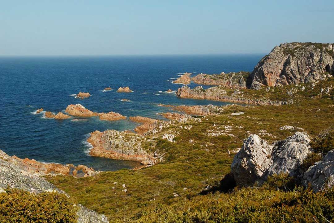
The North West coast extends from Burnie all the way west to Cape Grim, Tasmania's rugged north-west corner. Along the way are the beachside towns and villages of Wynyard, Boat Harbour Beach, Stanley and Smithton, as well as the rugged volcanic headlands od The Nut (Circular Head), Rocky Cape and Table Cape.
Full Itinerary


The first European settlement of Tasmania's Central Coast commenced in the 1840s, the rich basalt soil proved ideal for cropping, and today agriculture is the principal contributor to the area’s economy. Motorists travelling along the north-west of Tasmania are well served by the National Highway. Central Coast, however, is fortunate to have retained a small section of ‘old highway’. This scenic coastal detour hugs the headlands and sandy shores from Ulverstone through to Howth and is well worth the extra time taken to travel this scenic route.
Full Itinerary

Boasting rolling farmland, the hinterland of Tasmania's central coast is home to some of the region's finest agriculture and local produce, its narrow roads making their way through lush farmlands on their way to the alpine terrain of Cradle Mountain. The area is world-renowned for its bush-walking, mountain ranges and canyons, and laid-back small towns set againt mountainous backdrops.
Full Itinerary

The area is dominated by the Tarkine, a wilderness area containing a wildly diverse landscape, a world of natural treasures including Australia's largest patch of temperate rainforest, mountain ranges, wild river and cave systems and buttongrass moorlands. Waterways can be explored by canoe, kayak and riverboat cruises through forests of blackwood, myrtle and celery top pine all the way to the sea.
Full Itinerary

Set against the backdrop of the Great Western Tiers, the Mradner Valley is located at the western end of the Central Coasy Hinterland, located midway between Launceston and Devonport. Dotted among the farms of the area are numerous small towns, each with their own individual character and colonial-era charm. Deloraine, on the banks of the Meander River, has become a centre for artists and craftspeople, drawn by the lifestyle and inspired by the stunning scenery.
Full Itinerary

2 to 3 hours drive from Devonport and Burnie, Tasmania's West Coast region is made up of serene natural harbours, rugged coast, densely forested mountain ranges, fast flowing rivers, steep gorges, rainforest wilderness and ghost towns. The region has some of the most pristine and beautiful wilderness in the world, encapsulated in the World Heritage listed Franklin-Gordon Wild Rivers National Park. Bushwalkers are rewarded by spectacular nature sights. Even the less energetic can enjoy the untouched rainforests while cruising the Gordon and Pieman Rivers.
Full Itinerary
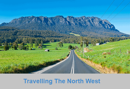
The North West region of Tasmania covers a vast area including the towns of Devonport, Burnie, Cradle Mountain National Park and the Tasmanian west coast as far south as Strahan and Queenstown. The gateway to this region is Devonport, with an airport and the Spirit of Tasmania (ferry between Victoria and Tasmania) terminus. The port handles much of the export produce from the rich agricultural areas around Devonport. The town itself is used as an arrival or departure port for most travellers rather than a destination itself.
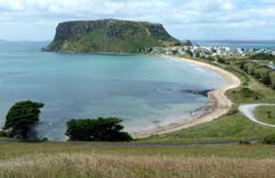
A major farming area stretches from Devonport along the coast to Stanley. Many of Australia's finest vegetable and dairy produce come from this region. Stanley is an historic fishing village with a large volcanic headland - The Nut - accessible by chairlift. Far out to the north-west in the stormy waters of Bass Strait, King Island consists very much of uninhabited bushland teeming with wildlife. The island produces some of the best dairy products, for which it is famous.
Cradle Mountain-Lake St Clair National Park, in Tasmania's World Heritage Wilderness Area, offers a rugged environment with many wilderness retreats and walking tracks. Icy streams, ancient pines, glacial lakes and wildlife surround the jagged contours of Cradle Mountain. The area is one of the most glaciated in Australia and includes Tasmania's highest mountain, Mt Ossa (1617 metres) and Lake St Clair, Australia's deepest natural freshwater lake, the source of the River Derwent.
The West Coast area of Tasmania is made up of rugged coast, mountain ranges, flowing rivers, steep gorges, rainforest wilderness and ghost towns. Strahan is situated on Macquarie Harbour and is the starting point for Gordon River cruises and air tours over the South West Wilderness. Strahan is the only town on this rugged and dangerous coast.