

Hellyer Gorge
Hellyer Gorge is the steeply winding gorge of the Hellyer River. The Murchison Highway passes through the area with many sharp and steep bends, which provides the setting to a stage of Targa Tasmania.
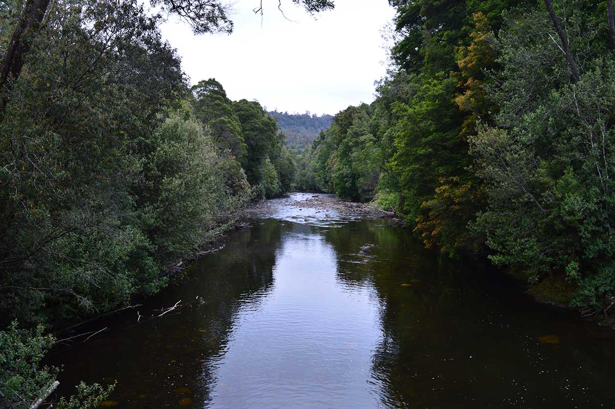
A delightful wayside stop at the Gorge on the Murchison Highway south gives the opportunity for travellers to stop and explore a section of rainforest of tall myrtle beech, encrusted with mosses, fungi and epiphyte orchids. A number of walking tracks along the banks of the Hellyer River (near the rest area) provide a pleasant walk to refresh before journeying on. It is situated in the heart of a mountainous and heavily forested area, near one of the visually most impressive sections of highway in Tasmania.
Where is it?: Off the Murchison Highway on the way south to Waratah, 52 km south of Burnie; 128 km north of Queenstown.


Hellyer Gorge and the river which flows through it are named after Henry Hellyer (1790-1832), an English surveyor who was one of the first explorers to visit the rugged interior of the north west of Tasmania, and made the most comprehensive maps of the area up to that time. When the Van Diemen’s Land Company (VDL Co) was formed in 1825 he was one of the first officers to sign on, as a surveyor (later Chief Surveyor) and Chief Architect. His achievements in Tasmania are well documented.
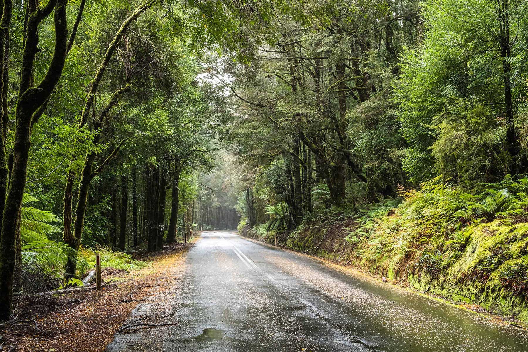
The road from Watatah to Hellyers Gorge is one of the prettiest rainforest drives in Tasmania
The gorge is protected byf the Hellyer nGorge State Reserve. The Murchison Highway passes through the area with many sharp and steep bends. Being subject to ‘black ice’, this portion of road has now been bypassed by the newer Ridgely Highway. Nevertheless, the area is quite picturesque and some bush-walking tracks have been blazed for tourists. Hellyer Gorge is off the Murchison Highway to the south to Waratah, 52 km south of Burnie; 128 km north of Queenstown.
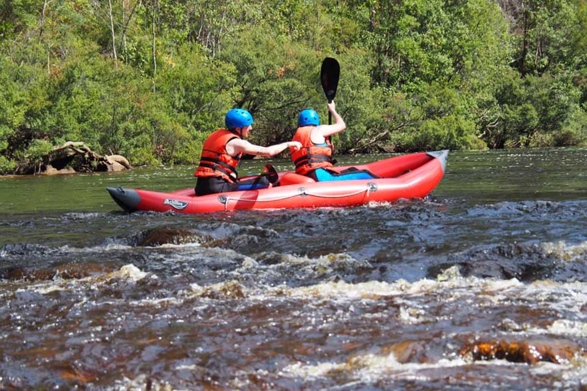
Kayaking/Rafting
There are a number of sections of the Hellyer River that are suitable for kayaking.
Hellyer River from the gorge: Enter at the Murchison Highway Bridge on the Hellyer Gorge and travel downstream 13 km to Blackwell Road Bridge. Exit at the Blackwell Road Bridge over the Hellyer River. The river consists of small drops and easy grade 2 rapids. It flows through some beautiful rainforest.
Hellyer River above Link Road: A 5m run, commencing at Chilton Bridge and exiting at the bridge over the Hellyer River on the Hampshire to Murchison Highway Link Rd. On this 5km section, the river drops very steeply with a series of vertical falls. There are a number of very tricky sections and at high water, these could be very difficult.
Hampshire Link Road to Hellyer Gorge: begin from the bridge over the Hellyer River on the Hampshire to Murchison Highway Link Rd and exit at the Murchison Highway Bridge in the Hellyer Gorge. This 16 km section of river runs through very steep country and it drops continuously with many good grade 3 rapids. The rapids are very close together and log jams are always a danger. There are a number of small waterfalls in the first 5 km several of which usually need portaging as they contain logs. Inspection is necessary as a walk out is horrendous. The river can be very cold and an early start is recommended. The last 5 km are grade 2.
Hellyer Lower – Blackwell Road Bridge to Farquhars Bridge: a 15 km run from Blackwell Road Bridge over the Hellyer River to Farquhars Bridge.
A PocketOz Travel and Information Guide
Design and concept © Stephen Yarrow | Email | W3Layouts | Test