Romaine Reserve
3.4 km from Burnie city centre.Walk: 15 mins each way to Singline Avenue, Downlands.

The Romaine Reserve is 12.69ha of park lands that runs down the eastern side of the suburb, along Romaine Creek. The Reserve forms part of a walkway and boardwalk that circumnavigates Burnie and can also be used for cycling or relaxing. It features a fitness track that winds around a dam on Romaine Creek containing domestic and wild fowl. Beyond the dam is a walking trail which passes through a wooded wildlife corridor. The Reserve and corridor contains both remnant and exotic vegetation, with large mountain ashes, white gums, sub-storey blackwoods and man ferns. The walking tracks link up with Brooklyn Reserve. Romaine Creek is home to the Engaeus yabbimunna, a freshwater crayfish.

Romaine Reserve has full picnic facilities including toilets, shade areas, barbecues, picnic tables, a drinking water fountain, rubbish bins and a play area. Dogs are not permitted in the area of the Reserve between the dam wall and the southern end of the pond, but are allowed to be walked through the Reserve along the formed walking track if they are on a lead. Location: 11 Amanda Court, Romaine.

William Romaine
The name of the reserve recalls William Romaine, one of the original settlers of the Van Diemens Land Company, brought out to Tasmania (then Van Diemens Land) in 1839. At that time the Company began leasing bush blocks to tenant farmers, but there were few takers. It started selling its land in and around the settlement, renamed Burnie after a Company director in November 1842. Sales were slow and Burnie stagnated. In 1880 its population was only 300.
William Romaine appears on a list of men, women and children who were shipped from London as tenant farmers to Circular Head on the "Thomas Laurie". Others on the list were H. D’Arch, John L. Archer, John Chambers, Samuel Dyer, Henry Emmett (Adelaide), Rev. Thomas N. Grigg, Henty & Co. (Launceston), John Jacobs, N. Kentish, Hugh Mackay, William Mill, J.H. Munce, Robert Power, Thomas H. Power (Melbourne), George Rouse and J.D. Willshire.
James Inglis, James Bischoff, Brice Pearse and Edward Curr were the senior executives of the Van Diemens Land Company at that time. They company was established in London, England, on 11 May 1825.


North West Coast
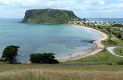
The North West coast extends from Burnie all the way west to Cape Grim, Tasmania's rugged north-west corner. Along the way are the beachside towns and villages of Wynyard, Boat Harbour Beach, Stanley and Smithton, as well as the rugged volcanic headlands od The Nut (Circular Head), Rocky Cape and Table Cape.
Full Itinerary


Central Coast
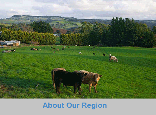
The first European settlement of Tasmania's Central Coast commenced in the 1840s, the rich basalt soil proved ideal for cropping, and today agriculture is the principal contributor to the area’s economy. Motorists travelling along the north-west of Tasmania are well served by the National Highway. Central Coast, however, is fortunate to have retained a small section of ‘old highway’. This scenic coastal detour hugs the headlands and sandy shores from Ulverstone through to Howth and is well worth the extra time taken to travel this scenic route.
Full Itinerary

Central Hinterland
Boasting rolling farmland, the hinterland of Tasmania's central coast is home to some of the region's finest agriculture and local produce, its narrow roads making their way through lush farmlands on their way to the alpine terrain of Cradle Mountain. The area is world-renowned for its bush-walking, mountain ranges and canyons, and laid-back small towns set againt mountainous backdrops.
Full Itinerary

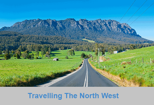
North West Hinterland
The area is dominated by the Tarkine, a wilderness area containing a wildly diverse landscape, a world of natural treasures including Australia's largest patch of temperate rainforest, mountain ranges, wild river and cave systems and buttongrass moorlands. Waterways can be explored by canoe, kayak and riverboat cruises through forests of blackwood, myrtle and celery top pine all the way to the sea.
Full Itinerary

Meander Valley
Set against the backdrop of the Great Western Tiers, the Mradner Valley is located at the western end of the Central Coasy Hinterland, located midway between Launceston and Devonport. Dotted among the farms of the area are numerous small towns, each with their own individual character and colonial-era charm. Deloraine, on the banks of the Meander River, has become a centre for artists and craftspeople, drawn by the lifestyle and inspired by the stunning scenery.
Full Itinerary

West Coast
2 to 3 hours drive from Devonport and Burnie, Tasmania's West Coast region is made up of serene natural harbours, rugged coast, densely forested mountain ranges, fast flowing rivers, steep gorges, rainforest wilderness and ghost towns. The region has some of the most pristine and beautiful wilderness in the world, encapsulated in the World Heritage listed Franklin-Gordon Wild Rivers National Park. Bushwalkers are rewarded by spectacular nature sights. Even the less energetic can enjoy the untouched rainforests while cruising the Gordon and Pieman Rivers.
Full Itinerary
The North West region of Tasmania covers a vast area including the towns of Devonport, Burnie, Cradle Mountain National Park and the Tasmanian west coast as far south as Strahan and Queenstown. The gateway to this region is Devonport, with an airport and the Spirit of Tasmania (ferry between Victoria and Tasmania) terminus. The port handles much of the export produce from the rich agricultural areas around Devonport. The town itself is used as an arrival or departure port for most travellers rather than a destination itself.
A major farming area stretches from Devonport along the coast to Stanley. Many of Australia's finest vegetable and dairy produce come from this region. Stanley is an historic fishing village with a large volcanic headland - The Nut - accessible by chairlift. Far out to the north-west in the stormy waters of Bass Strait, King Island consists very much of uninhabited bushland teeming with wildlife. The island produces some of the best dairy products, for which it is famous.
Cradle Mountain-Lake St Clair National Park, in Tasmania's World Heritage Wilderness Area, offers a rugged environment with many wilderness retreats and walking tracks. Icy streams, ancient pines, glacial lakes and wildlife surround the jagged contours of Cradle Mountain. The area is one of the most glaciated in Australia and includes Tasmania's highest mountain, Mt Ossa (1617 metres) and Lake St Clair, Australia's deepest natural freshwater lake, the source of the River Derwent.
The West Coast area of Tasmania is made up of rugged coast, mountain ranges, flowing rivers, steep gorges, rainforest wilderness and ghost towns. Strahan is situated on Macquarie Harbour and is the starting point for Gordon River cruises and air tours over the South West Wilderness. Strahan is the only town on this rugged and dangerous coast.