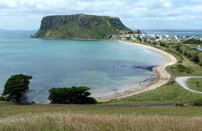
Table Cape
As you approach the town of Wynyard, Table Cape makes for an impressive and dramatic backdrop for the town. Table Cape is a more or less circular volcanic plug with a flat top, its northern and eastern faces rise steeply from Bass Strait to a height of approximately 170 metres above sea level.
Table Cape's top and surrounding areas are composed of fertile basalt soils and are heavily cultivated, the area is renowned for the annual flowering of tulips during spring and accompanying tulip festival. Whilst the top of Table Cape and surrounding district is heavily utilised for agriculture, the steep and rocky ocean-facing embankments remain largely undisturbed from human activity and are covered in dense scrubland. The 1.26 km2 Table Cape Conservation Area extends along the shoreline from Boat Harbour Beach to the Table Cape State Reserve before continuing along to Freestone Cove near Fossil Bluff.

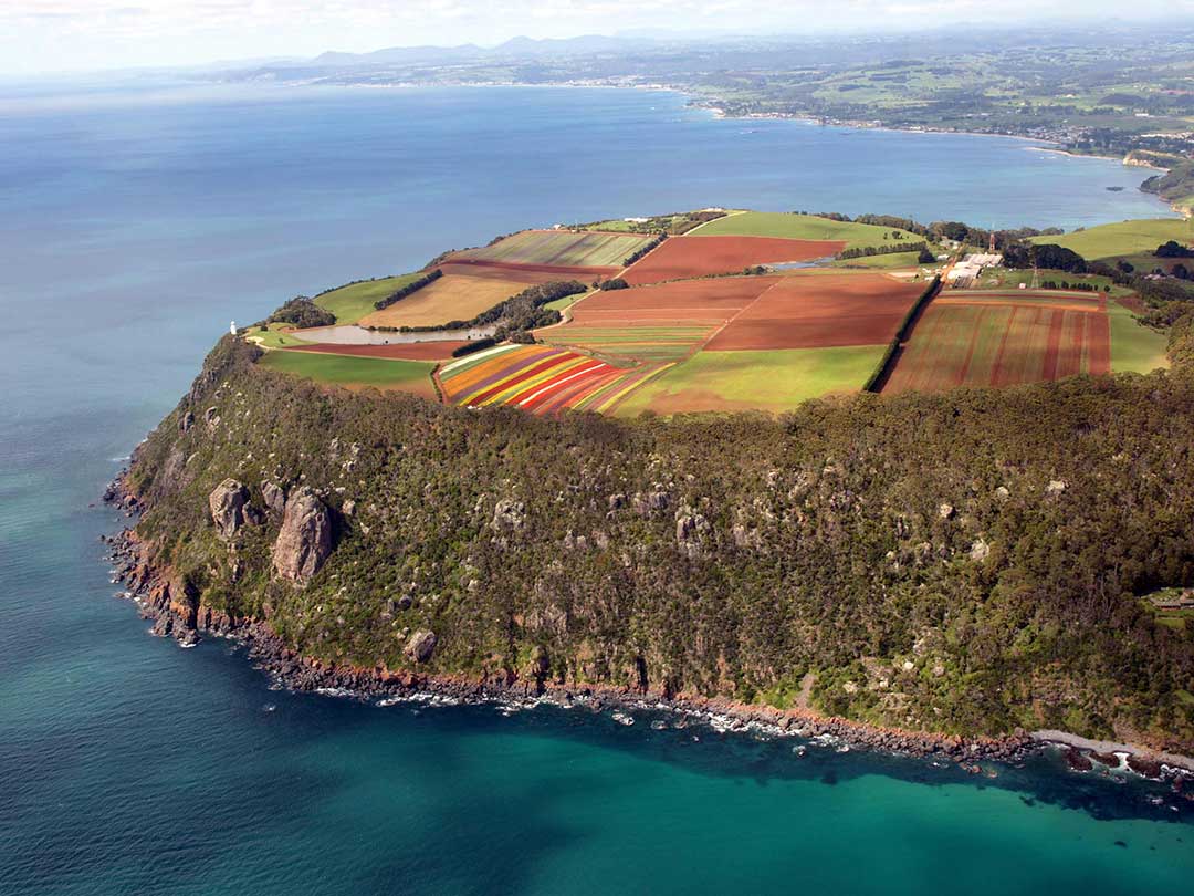
The Cape itself is a magnificent example of a weathered volcanic neck (12 to 13 million years) whivh was once a lava lake (hense its flatness) in a volcanic structure in a volcanic terrain. The rock is a Tertiary teschenite (a course grained basalt). The headland grades upwards to courser and lighter coloured rocks. the tuffs and breccias of the old crater are cut back by the erosional effects od the sea during sea level changes, leaving the solid neck as a promotory. The original height would have been three to fice times its present height.
Table Cape was within the territory of the Tommeginer clan of Aboriginal Tasmanians, and built the stone tidal fish traps that remain evident at nearby Freestone Cove. The Cape was named by British navigator, Matthew Flinders, as he and George Bass circumnavigated Van Diemen's Land (now Tasmania) in 1798 upon the Norfolk. Flinders also progressively named the nearby Circular Head, Three Hummock and Hunter Islands.
There are two roads up to the top of Table Cape - one from the Wynyard town centre via Table Cape Road, and the other from Bass Highway between Boat Harbour and Wynyard.
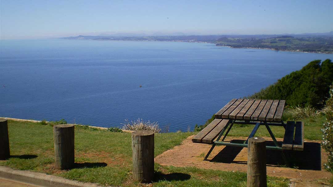
When you reach Murdering Gully Road (one wonders what happened to evoke that name!), continue on Tape Cape Road past the tulip farm. You then have a choice of taking a left turn to the lighthouse or going straight ahead to the lookout. We prefer to do the latter and take a walk along the clifftop to the lighthouse from the lookout. The view from the lookout is quite stunning - the clearer the day the further you will be able to see - and as a bonus, there is a display panel identifying the mountains and coastal features you are looking at.
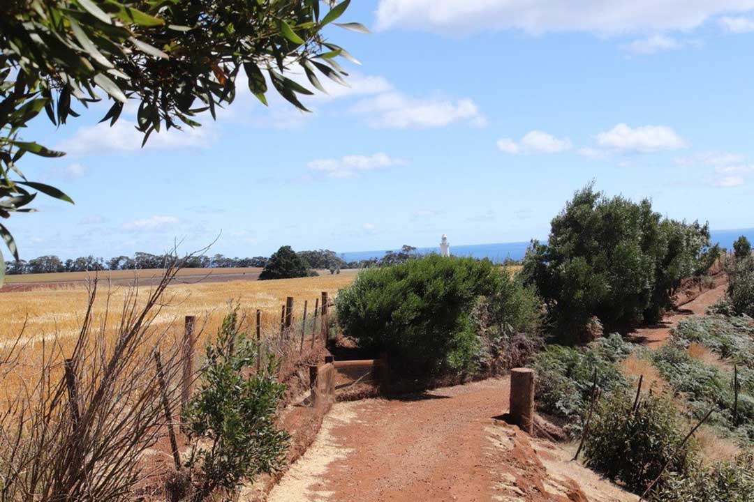
The walk to the lighthouse takes about 20 minutes in each direction. There's not a huge lot to see along the way but it's a good opportunity to stretch one's legs and get some exercise.
The Table Cape Lighthouse sits on a sheer cliff edge surrounded by scenic farmlands that first farmed by the Van Dieman’s Land Company in the 1820’s. After several shipping incidents in the area, Table Cape was selected as the most logical place for a light. Construction began and the tower and cottages were completed and in service in 1888. Materials were brought to the site, from Wynyard 7 kilometres to the south, by bullock wagon. The tower was constructed of brick, then painted white. It has a circular steel stairway and a steel fly-over gangway to the door which is set above the below ground level base. The keeper’s cottages were built of stone.
Its beginning was marked with the tragic death of the headkeeper’s 14 month old son, Bertie, at the age of 14 months. The cause is not known, but it is the cause of a sad entry in the lighthouse log book. The undertaker struggled up from Wynyard on horse back with the small casket and after consultation with the clergy recommended that Bertie be buried near the lighthouse were his family could tend to his grave. He was placed in a grave marked by a fuchsia bush. The bush has long since disappeared, but locals who knew the place have recently constructed a memorial.

View from the top of the lighthouse
The lamp had to be lit every day, as soon as the sun dipped into the sea, and it had to be kept alight all the time until the sun rose again. They used a special oil called mineral colza, which used to be carted up in big drums by bullock wagon. By day, the keepers used to pull heavy curtains round the light house windows, to protect the reflecting lenses from damage by the sun.
After the light was converted to automatic acetylene operation in 1920, the lightkeepers were withdrawn. The cottages were demolished in 1926 due to rapid deterioration.
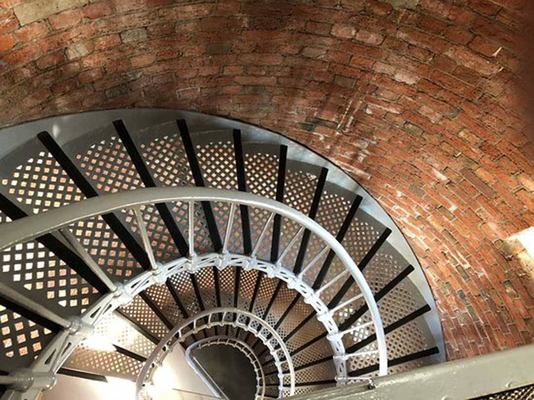
Table Cape Lighthouse is the only operating Lighthouse open for tours on mainland Tasmania. Between October and May you can take a tour of the lighthouse. Its open Daily 11am – 3pm, with tours every 20 minutes (Closed Christmas Day), weather permitting. Its and easy climb up the beautiful spiral staircase, and the guide takes you up the four levels detailing the history of the lighthouse and ending with the exhilarating balcony experience and magnificent views and photo opportunities. In accordance with the Australian Maritime Safety Authority children under 5 years of age are not permitted into the Lighthouse. All children to be accompanied and strictly supervised by an adult. Entry fees apply.

Many visitors to Table Cape find themselves having to look twice at one crop grown in the rich, fertile volcanic soil of Table Cape. Are those poppies growing here? Indeed they are - opium poppies have been grown on Tasmanian farmland for half a century and the tiny island can now claim the title of being the largest legal supplier of opiates in the world. The state has quietly been fuelling the world’s growing appetite for painkillers and built up a global dominance worth about $290 million a year. Tassie currently supplies almost half of the world’s demand for opium poppies, from which morphine and codeine can be extracted.
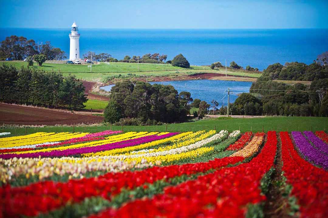
The flowers everyone comes to see here are the tulips grown on the farm of Van Diemen Quality Bulbs. It is in fact the largest tulip fields in the Southern Hemisphere that you can actually wander in, but though the farm operates all year round, it is only during late September through to mid October that it explodes with colour. Visitors are welcome to see this spectacle and delight at walking amongst the tulips. It is also a lure for photographers who have the opportunity to take fantastic shots utilising backdrops of Bass Strait, the lighthouse and the surrounding rich farmlands to showcase the vista of colourful blooming fields.
Best viewing is normally from end of the first week to the end of the second week in October. Just remember thopugh, this is a real farm, so be sure to wear appropriate footwear and don't be surprised if you can't get in outside of tulip blooming season. By the way, the farm does not sell tulips, but tulip bulbs, which are available to purchase online from their website.
The annual Tulip Festival Wynyard is Waratah-Wynyard's annual celebration of everything that is colourful, beautiful and charming about not only the tulips that adorn Table Cape, but also the municipality. The major event within the three-week calendar of events is the Tulip Festival Wynyard - a one day event to be held this year on Saturday 10 October 2020.
The Tulip Festival Foreshore Market is an integral part of the festival and is held on the first and third Sunday of each month from 8.30am until 2pm. For more information on any of these events contact the Waratah-Wynyard Council on 6443 8320.
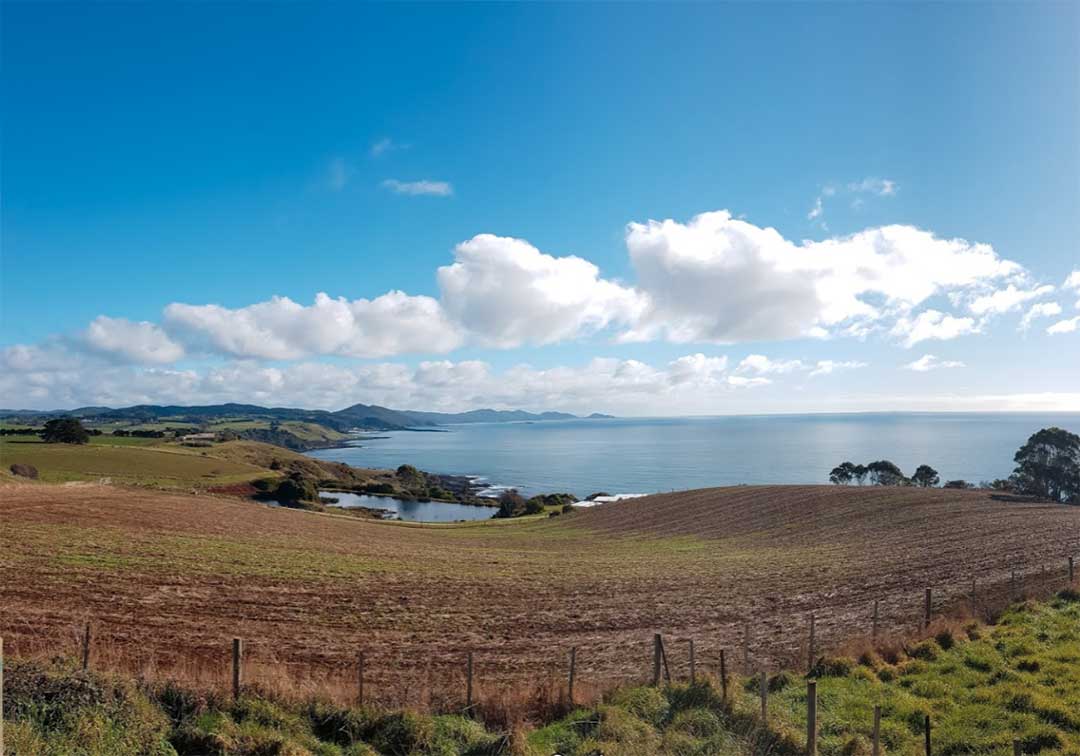
When you leave Table Cape, if you approached Table Cape from Wynyard, it's worth going back a different way. Initially return the way you came, but when you get to Murdering Gully Road, keep going straight ahead on Tollymoor Road. After passing through some pretty farmland, you'll come to a great stopping place where you can take in the view up the coast towards Stanley. From there, keep on in the direction you were travelling in and you'll reach Bass Highway.
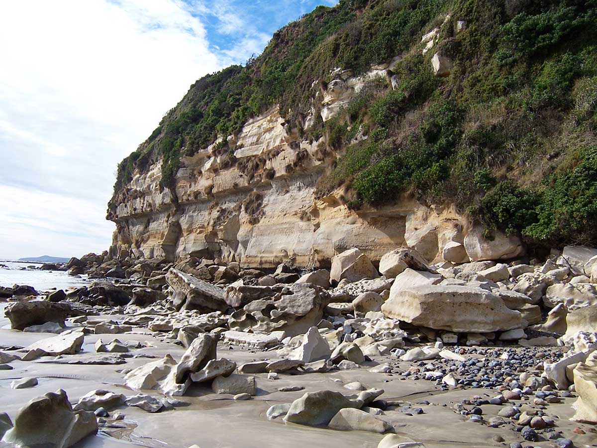
Fossil Bluff
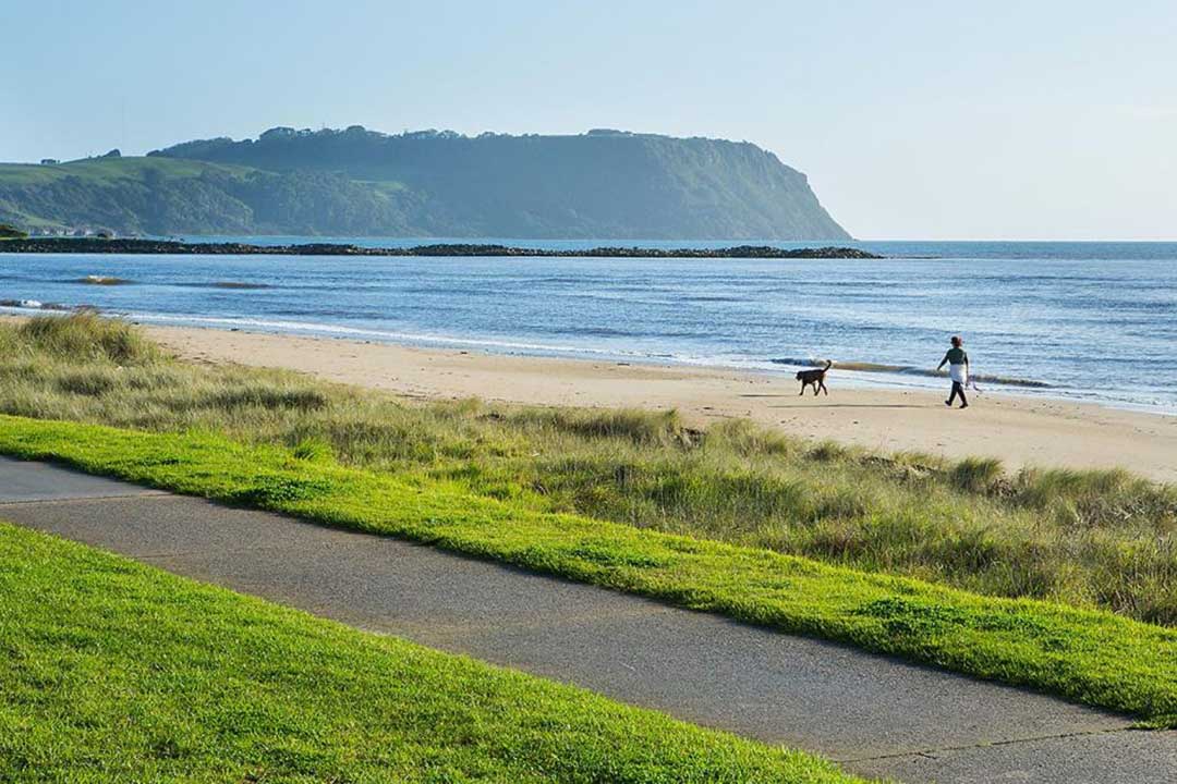
6.5 km north of Wynyard via Saunders Street and Golf Links Rd.Located between Table Cape and Wynyard, Fossil Bluff is an unusual geological structure comprising glacial Permian Tillite, sandstone and basalt. There is a small beach and the rocks at either end of the beach are characterised by shells which have been caught and fossilised. Embedded into the shore rocks and visible at low tide are Australia's oldest marsupial fossils. The beds of tillite are believed to have been created 275 million years ago, according to the Geology Department of the University of Tasmania. The were formed as boulder clay from a large glacier as the ice melted, and was later consolidated by a load of ice and other rocks on it.
Near high water mark close to the cliff face of Fossil Bluff there are many blocks of very fossiliferous sandstone or siltstone, which have fallen from the cliffs above. The cliffs contain a succession of light coloured rocks, scarcely consolidated sands and limey silts which were deposited on a beach and in a shallow bay some 22 million years ago. Please note that collecting is not permitted in the Conservation Area.
To the right of the beach is a track which leads to high ground, with panoramic views across Wynyard and the surrounding countryside.


The North West coast extends from Burnie all the way west to Cape Grim, Tasmania's rugged north-west corner. Along the way are the beachside towns and villages of Wynyard, Boat Harbour Beach, Stanley and Smithton, as well as the rugged volcanic headlands od The Nut (Circular Head), Rocky Cape and Table Cape.
Full Itinerary


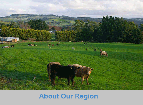
The first European settlement of Tasmania's Central Coast commenced in the 1840s, the rich basalt soil proved ideal for cropping, and today agriculture is the principal contributor to the area’s economy. Motorists travelling along the north-west of Tasmania are well served by the National Highway. Central Coast, however, is fortunate to have retained a small section of ‘old highway’. This scenic coastal detour hugs the headlands and sandy shores from Ulverstone through to Howth and is well worth the extra time taken to travel this scenic route.
Full Itinerary

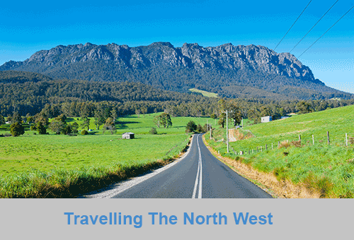
Boasting rolling farmland, the hinterland of Tasmania's central coast is home to some of the region's finest agriculture and local produce, its narrow roads making their way through lush farmlands on their way to the alpine terrain of Cradle Mountain. The area is world-renowned for its bush-walking, mountain ranges and canyons, and laid-back small towns set againt mountainous backdrops.
Full Itinerary

The area is dominated by the Tarkine, a wilderness area containing a wildly diverse landscape, a world of natural treasures including Australia's largest patch of temperate rainforest, mountain ranges, wild river and cave systems and buttongrass moorlands. Waterways can be explored by canoe, kayak and riverboat cruises through forests of blackwood, myrtle and celery top pine all the way to the sea.
Full Itinerary

Set against the backdrop of the Great Western Tiers, the Mradner Valley is located at the western end of the Central Coasy Hinterland, located midway between Launceston and Devonport. Dotted among the farms of the area are numerous small towns, each with their own individual character and colonial-era charm. Deloraine, on the banks of the Meander River, has become a centre for artists and craftspeople, drawn by the lifestyle and inspired by the stunning scenery.
Full Itinerary

2 to 3 hours drive from Devonport and Burnie, Tasmania's West Coast region is made up of serene natural harbours, rugged coast, densely forested mountain ranges, fast flowing rivers, steep gorges, rainforest wilderness and ghost towns. The region has some of the most pristine and beautiful wilderness in the world, encapsulated in the World Heritage listed Franklin-Gordon Wild Rivers National Park. Bushwalkers are rewarded by spectacular nature sights. Even the less energetic can enjoy the untouched rainforests while cruising the Gordon and Pieman Rivers.
Full Itinerary
The North West region of Tasmania covers a vast area including the towns of Devonport, Burnie, Cradle Mountain National Park and the Tasmanian west coast as far south as Strahan and Queenstown. The gateway to this region is Devonport, with an airport and the Spirit of Tasmania (ferry between Victoria and Tasmania) terminus. The port handles much of the export produce from the rich agricultural areas around Devonport. The town itself is used as an arrival or departure port for most travellers rather than a destination itself.
A major farming area stretches from Devonport along the coast to Stanley. Many of Australia's finest vegetable and dairy produce come from this region. Stanley is an historic fishing village with a large volcanic headland - The Nut - accessible by chairlift. Far out to the north-west in the stormy waters of Bass Strait, King Island consists very much of uninhabited bushland teeming with wildlife. The island produces some of the best dairy products, for which it is famous.
Cradle Mountain-Lake St Clair National Park, in Tasmania's World Heritage Wilderness Area, offers a rugged environment with many wilderness retreats and walking tracks. Icy streams, ancient pines, glacial lakes and wildlife surround the jagged contours of Cradle Mountain. The area is one of the most glaciated in Australia and includes Tasmania's highest mountain, Mt Ossa (1617 metres) and Lake St Clair, Australia's deepest natural freshwater lake, the source of the River Derwent.
The West Coast area of Tasmania is made up of rugged coast, mountain ranges, flowing rivers, steep gorges, rainforest wilderness and ghost towns. Strahan is situated on Macquarie Harbour and is the starting point for Gordon River cruises and air tours over the South West Wilderness. Strahan is the only town on this rugged and dangerous coast.