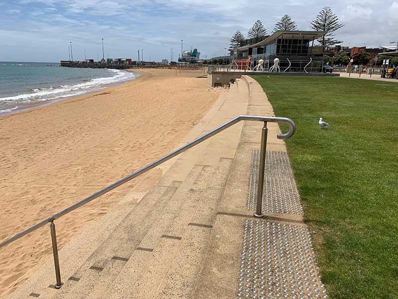
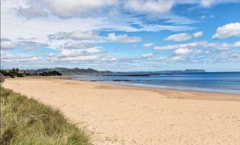
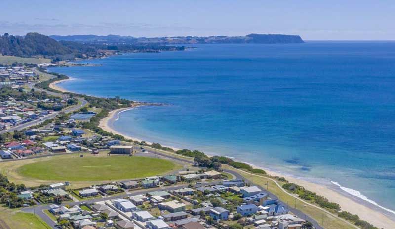
West Beach
West Beach is located adjacent to the main business area and is backed
by both a road and railway line. Wedged in between the railway and the
sand is a reserve containing the Burnie Surf Life Saving Club, which was
established in 1921, car parking (metered Mon-Sat), childrens playground and picnic
facilities (shelters, tables and seats, electric barbeques), toilets. More parking available in Marine Terrace Car Park (free for first hour Mon - Sat, all day Sun).

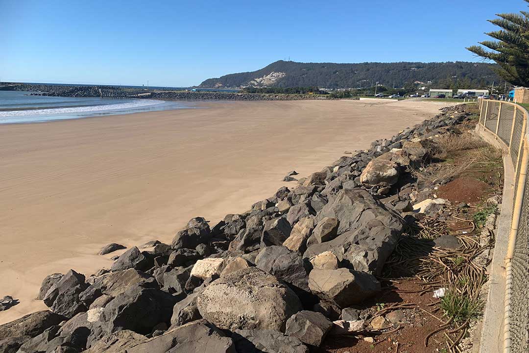
The beach is composed of medium sand, which combines with
the usually low waves to produce a moderately steep narrow high tide
beach, which widens up to 100 m at low tide. West Beach is relatively
safe under normal low wave conditions, with best swimming at mid to high
tide. However care must be taken to avoid the rocks at both ends and in
the centre, and during higher waves when there is a heavy shorebreak.
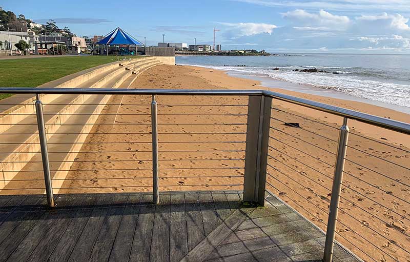
West Beach towards Parsonage Point
A fairy penguin colony is located on Parsonage Point at the end of West
Beach and the boardwalk, behind the Makers' Workshop and University of
Tasmania facility. Burnie's Little Penguin Observation Centre overlooks
the nesting area. From the Centre and surrounding boardwalk, it is
possible to view little penguins each night around dusk, particularly
between the months of October to March.
During those months, volunteer guides are on hand and point out the
penguins with their special torches, as well as provide any information
not found on the informative display panels at the Little Penguin
Observation Centre. The winds blowing off Bass Strait can be quite cold
at nights, so be sure to wear clothing that will protect you from the
wind. The boardwalk is wheelchair and children friendly.
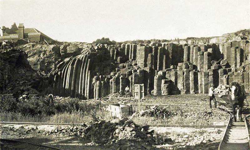
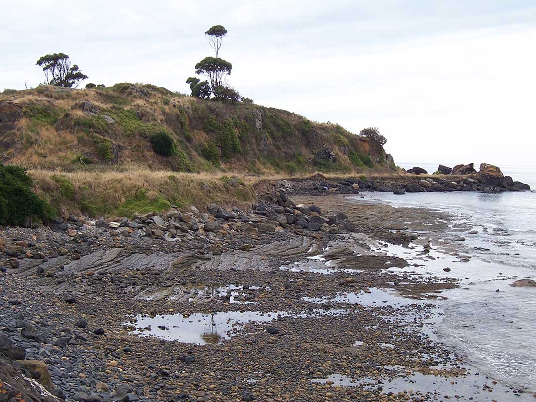
Blackmans Point marks the eastern end of West Beach. Though the Emu Bay side of the headland has been greatly modified over years to accommodate the Port of Burnie, behind the railways, cranes and wharves are series of distinctive basalt columns that have traditionally been a source of inspiration for artists and photographers. The remaining basalt columns are remnant features of the once far more extensive geological formation.
The area has been progressively quarried and built upon. Major modifications to the Blackmans Point headland and basalt columns began in 1885 with the construction of the first breakwater for the Port which resulted in large-scale quarrying of the site for construction materials.
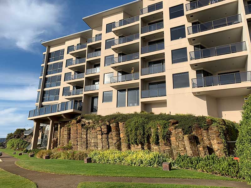
A great deal of controversy was created when plans were submitted for the nearby apartments as the original design both destroyed and covered much of this unique geology. The compromise was the considerable redesign of the foundations of the apartment block so that the basalt columns remained visible and largely untouched. A remaining section of the quarry face has been incorporated as a landscape feature in the car park, and is an example of columnar jointing in basalt, with vertical columns at both extremities of the face. There is relatively little remaining of the columns in public view.
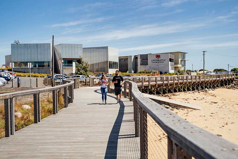
Parsonage Point marks the western end of West Beach. Occupying the point is West Park, the home of Burnie's Little Penguin Observation Centre and the University of Tasmania's Cradle Coast Campus. The University's main building on Bass Highway, known as the Field Building, supports students who are undertaking study on campus, at a University of Tasmania site elsewhere, or by distance. Formerly the Maker's Workshop, it is now a University-run Tech Solutions Hub which conducts training for local people and industry projects in technology, design and specialised manufacturing. Monthly tours of the building are available to everyone. Unity café, operated by Burnie Community House, is open to the public Tues – Thurs, 8.30am - 3pm. The cafe is located on the Campus opposite the Little Penguin Observation Centre.
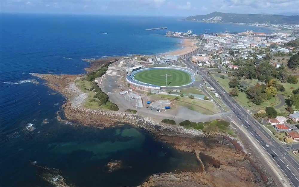
On the western side of Parsonage Point is West Park Oval, home to both Australian Rules football and cricket facilities, as well as cycling and athletics and a skate park. It has been a centre of sport since it was opened in 1900 and has hosted some legendary moments, including champion cyclist Danny Clark's Burnie Wheel win in 1977 and the infamous goal post removal during the 1967 Tasmanian State Premiership Final. Beyond Parsonage Point is the suburb of Parklands
which spreads out along the narrow strip of coastline.
Burnie's Other Beaches
You may not realise at first as you make your way through the North-West Coast’s rolling fields or along its picturesque coastline that beneath the rich soil and weathered rocks lies some of Australia’s most unique and fascinating geological experiences. For one corner of a small state, the region boasts a rich and diverse range of geological features that are exceptionally well exposed for the casual observer. Here, the handiwork of the Earth’s massive forces and geomorphological processes are evident in almost every view. Rocks from all major geological periods are found and Tasmania is custodian to Australia’s key glaciated landscapes, of which Cradle Mountain is iconic.

Blythe Heads
Blythe Heads is where the Blythe River enters Bass Strait. The highway runs around the base of Titan Point (eastern side of Blythe River) and clips the western end of Blythe Mouth beach with a seawall backing the first 200 metres of the beach.
To the east of the Blythe River is a 200 metre long section of rocky shore and rock flats, followed by a beach which curves to the east, terminating at a low protruding rocky point. This is a narrow sandy high tide beach, backed by some cobbles and fronted by ridged rock flats. The community of Heybridge is located on the southern side of the highway. Blythe Point is the home of the Max Stonehouse Woodchop arena, Blythe Heads Axemens Club and the annual Blythe Heads wood-chopping carnival.
Chasm Creek
The shore of Round Hill Point consists of a strip of high tide cobbles, fronted by ridges of meta-sedimentary rocks and inter tidal rock flats. The railway line clips the rear of the beach, with some scrub and a house between the line and highway. The beach in the lee of Titan Point almost disappeared when widening the highway required the construction of a seawall. The once 400 metre long beach now consists of an 70 metre long wedge of sand between the western boundary rocks and the seawall, with the small Chasm Creek draining out against the rocks.
Round Hill Point
Wivenhoe Beach
Wivenhoe Beach extends east of the shallow river mouth for 1.3 km to the
rocky base of 225 m high Round Hill. The beach is relatively straight
and narrow with a 100 m wide low tide terrace and a few rock flats
towards the eastern end. A seawall has been constructed in front of the
Naval Reserve building towards the centre of the beach, while the
remainder is backed by a narrow reserve, the highway and then South
Burnie. There are currently no services provided by Surf Life Saving
Australia for this beach.
South Burnie Beach
South Burnie Beach commences on the eastern side of the rock jetty and
trends to the east-southeast for 750 m to the sandy mouth of the Emu
River. The low gradient beach is narrow at high tide widening to a 100 m
wide low tide terrace at low tide, with the river draining across the
western end. It is backed by a vegetated reserve, with parking at the
western end adjacent to the jetty.
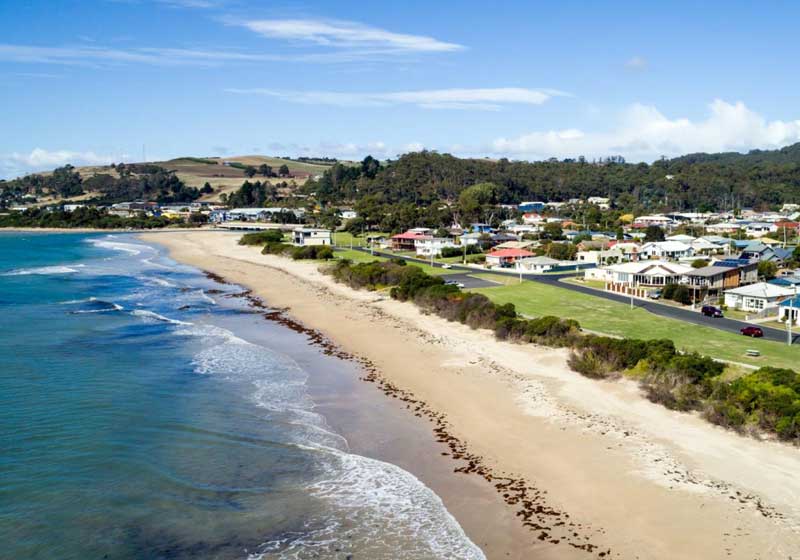
Burnie town centre is located on low ground in lee of Parsonage and
Blackman Points, with the port in lee of Blackman Point. Wharfs and
breakwaters extend nearly 1 km east of Blackman Point providing more
shelter and anchorage for shipping. Today the port and its facilities
form the eastern boundary of Burnie, while West Beach forms the
northern.
Parklands waterfront
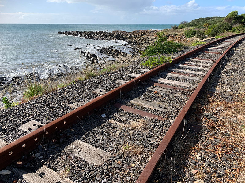
On the western side of Parsonage Point is a skate park. Beyond Parsonage Point is the suburb of Parklands which spreads out along the narrow strip of coastline. The foreshore is very rocky with few places to swim, but it has a walking path following the shore which is very popular. For something different you can also walk along the single line of abandoned railway track beside the walkway. The line was closed over a decade ago so there is no chance of being skittled by a train.
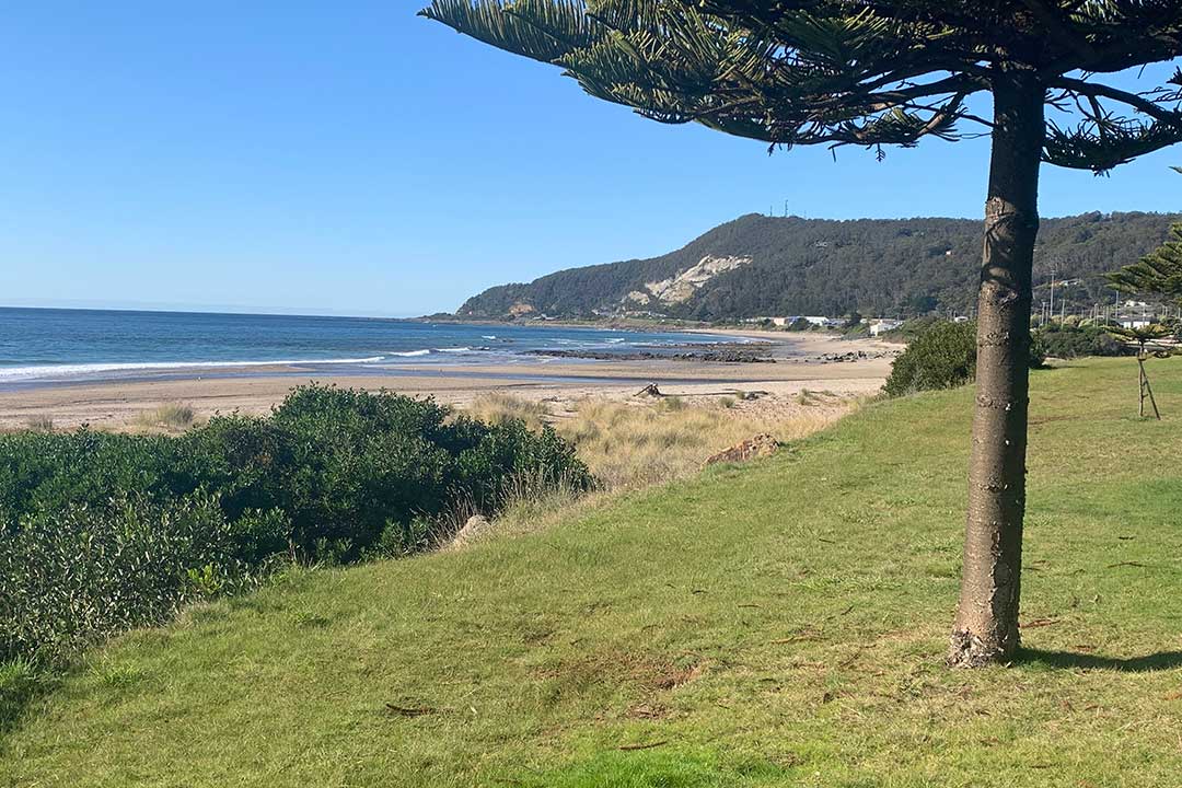
Cooee Beach
Cooee Beach commences at the reef-tied foreland and curves to the east
for 600 m to the base of the low Cooee Point, which protrudes 300 m
seaward. It is a sandy high tide beach, paralleled by a 50 m wide band
of mid tide sand, then 50-100 m wide low tide rock flats, with sandy sea
floor beyond. A grassy reserve backs the beach, with car parking at the
eastern end, and the highway and Cooee township behind. There are
currently no services provided by Surf Life Saving Australia for this
beach.
Camdale Beach
Camdale beach commences at the reef-tied point that forms the eastern
boundary of the 50 m wide Cam River entrance. The beach initially
protrudes in lee of the reef and then curves to the east for 1.4 km to
the next reef-tied foreland. Inter tidal rock reefs dominate the western
half of the beach, with a 100 m wide low tide bar along the eastern
half then the boundary reef. A narrow grassy reserve paralleling the
highway backs the beach. There are currently no services provided by
Surf Life Saving Australia for this beach.
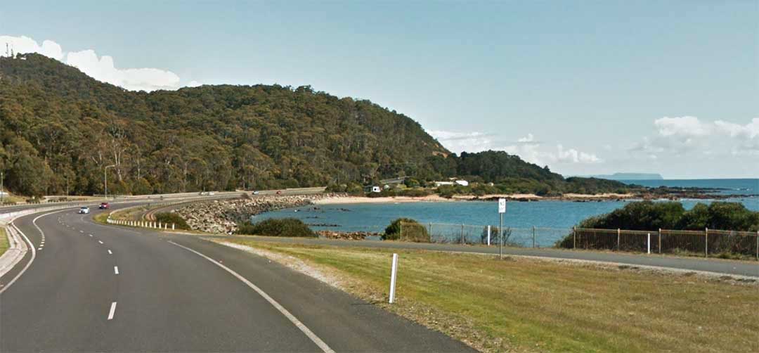
Somerset Beach
Somerset Beach is narrow at high tide with a sandy low gradient mid
tide, grading at low tide into two sandy channels bordered by inter
tidal rock flats. Waves depend on wind conditions, with low wave to calm
conditions during westerlies, but higher waves during onshore and
easterly conditions. The entire beach is backed by a coastal reserve,
with sporting facilities located at the wider western end, then Somerset
road and township. The Somerset Surf Life Saving Club is located
towards the east end of the beach where sand delivered by the river
spreads out over the rock flats and forms a low tide ridge. The Anzac
Park picnic area is located across the road from the surf club.

Doctors Rocks
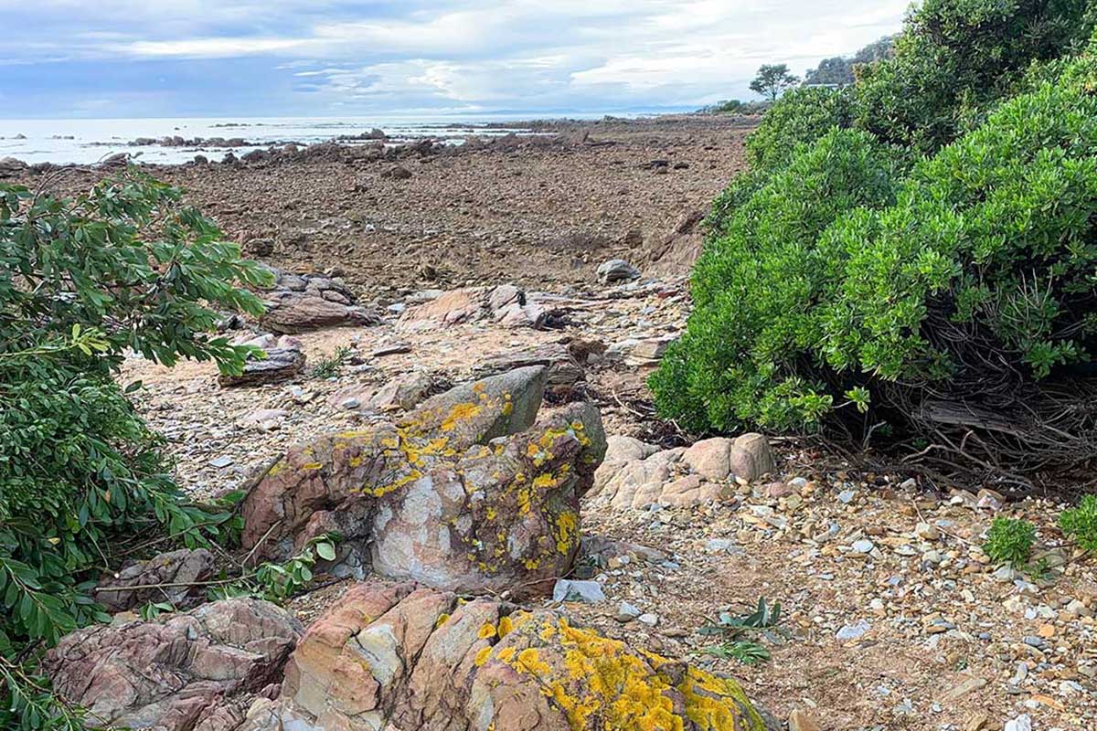
Doctors Rocks is a small rocky headland of basalt on the beachfront
near where Seabrook Creek enters Bass Strait, behind which an escarpment
rises to the north west coast plateau. The terrain forced early road
builders to construct a narrow roadway behind the rocks that was the
scene of many serious accidents before modern vehicular traffic forced
major earth-moving and re-siting of the main road further away from the
rocks.
Doctors Rocks
Doctors Rocks protrude 100 metres north from the shore rising to 20
metres in height. A beach extends for 300 metres west of the rocks to
the junction of the old and new Bass highways, with the old railway
paralleling the rear of the beach and a narrow vegetated reserve between
it and the shore. Doctors Rocks was named after Dr Thomas Wilson who
lived at the rocks. For many years he served the community between
Circular Head and Burnie.
In addition to basalt, several trace minerals occur on the site
including gold, the presence of which has attracted gold panners for
decades. Gold and rare Osmiridium can still be panned on the foreshore
in various places toward Wynyard at low tide, and appears to derive from
the tillite.
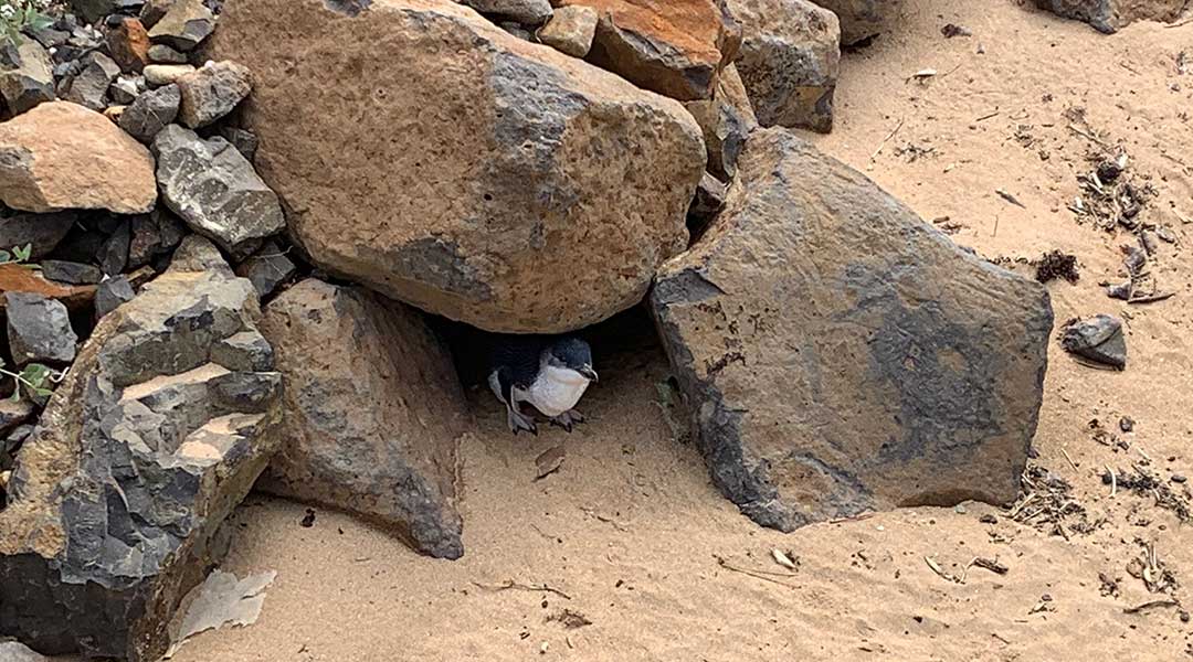
The Doctors Rocks Conservation area is home to a significant number of
little penguins with large groups on the immediate west and eastern
sides of Doctors Rocks itself and smaller pockets of penguins along the
whole conservation reserve. The Little Penguins have no difficulty in
traversing over the rocky terrain to get to their nesting areas, but
significant numbers utilize the sandy beaches as access points from the
water to the foreshore nesting area. The locality is Wynyard’s premier
spot to capture a Tasmanian sunset.


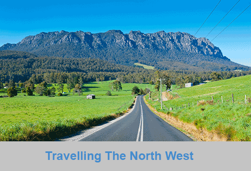
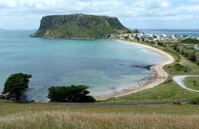
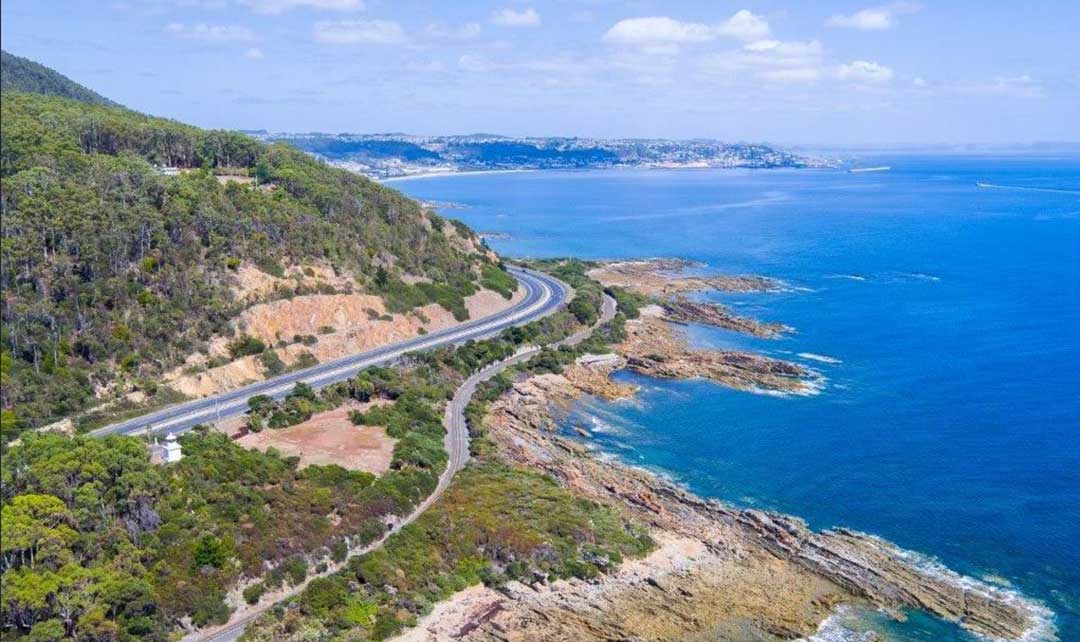
The North West coast extends from Burnie all the way west to Cape Grim, Tasmania's rugged north-west corner. Along the way are the beachside towns and villages of Wynyard, Boat Harbour Beach, Stanley and Smithton, as well as the rugged volcanic headlands od The Nut (Circular Head), Rocky Cape and Table Cape.
Full Itinerary


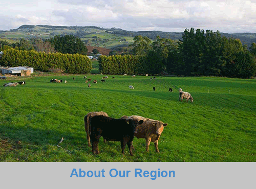
The first European settlement of Tasmania's Central Coast commenced in the 1840s, the rich basalt soil proved ideal for cropping, and today agriculture is the principal contributor to the area’s economy. Motorists travelling along the north-west of Tasmania are well served by the National Highway. Central Coast, however, is fortunate to have retained a small section of ‘old highway’. This scenic coastal detour hugs the headlands and sandy shores from Ulverstone through to Howth and is well worth the extra time taken to travel this scenic route.
Full Itinerary

Boasting rolling farmland, the hinterland of Tasmania's central coast is home to some of the region's finest agriculture and local produce, its narrow roads making their way through lush farmlands on their way to the alpine terrain of Cradle Mountain. The area is world-renowned for its bush-walking, mountain ranges and canyons, and laid-back small towns set againt mountainous backdrops.
Full Itinerary

The area is dominated by the Tarkine, a wilderness area containing a wildly diverse landscape, a world of natural treasures including Australia's largest patch of temperate rainforest, mountain ranges, wild river and cave systems and buttongrass moorlands. Waterways can be explored by canoe, kayak and riverboat cruises through forests of blackwood, myrtle and celery top pine all the way to the sea.
Full Itinerary

Set against the backdrop of the Great Western Tiers, the Mradner Valley is located at the western end of the Central Coasy Hinterland, located midway between Launceston and Devonport. Dotted among the farms of the area are numerous small towns, each with their own individual character and colonial-era charm. Deloraine, on the banks of the Meander River, has become a centre for artists and craftspeople, drawn by the lifestyle and inspired by the stunning scenery.
Full Itinerary

2 to 3 hours drive from Devonport and Burnie, Tasmania's West Coast region is made up of serene natural harbours, rugged coast, densely forested mountain ranges, fast flowing rivers, steep gorges, rainforest wilderness and ghost towns. The region has some of the most pristine and beautiful wilderness in the world, encapsulated in the World Heritage listed Franklin-Gordon Wild Rivers National Park. Bushwalkers are rewarded by spectacular nature sights. Even the less energetic can enjoy the untouched rainforests while cruising the Gordon and Pieman Rivers.
Full Itinerary
The North West region of Tasmania covers a vast area including the towns of Devonport, Burnie, Cradle Mountain National Park and the Tasmanian west coast as far south as Strahan and Queenstown. The gateway to this region is Devonport, with an airport and the Spirit of Tasmania (ferry between Victoria and Tasmania) terminus. The port handles much of the export produce from the rich agricultural areas around Devonport. The town itself is used as an arrival or departure port for most travellers rather than a destination itself.
A major farming area stretches from Devonport along the coast to Stanley. Many of Australia's finest vegetable and dairy produce come from this region. Stanley is an historic fishing village with a large volcanic headland - The Nut - accessible by chairlift. Far out to the north-west in the stormy waters of Bass Strait, King Island consists very much of uninhabited bushland teeming with wildlife. The island produces some of the best dairy products, for which it is famous.
Cradle Mountain-Lake St Clair National Park, in Tasmania's World Heritage Wilderness Area, offers a rugged environment with many wilderness retreats and walking tracks. Icy streams, ancient pines, glacial lakes and wildlife surround the jagged contours of Cradle Mountain. The area is one of the most glaciated in Australia and includes Tasmania's highest mountain, Mt Ossa (1617 metres) and Lake St Clair, Australia's deepest natural freshwater lake, the source of the River Derwent.
The West Coast area of Tasmania is made up of rugged coast, mountain ranges, flowing rivers, steep gorges, rainforest wilderness and ghost towns. Strahan is situated on Macquarie Harbour and is the starting point for Gordon River cruises and air tours over the South West Wilderness. Strahan is the only town on this rugged and dangerous coast.