
Wivenhoe, Tasmania

Wivenhoe is a locality and suburb of Burnie, located about 3 kilometres to the south-east on Bass Highway. The northern boundary is formed by Bass Strait, and the western by the Emu River. It is essentially an industrial suburb, however it has a few residential streets where its population of around 220 live.

Main Road, which runs parallel to Bass Highway, has a row of shops that attract both local and passing trade. These include a number of popular eateries ranging from takeaways, a bakery, cafes and restaurants, which attract custom from residents of Burnie itself.

Wivenhoe was named after the Town (and parish of Wivenhoe) south-east of Colchester in Essex County, England, by Captain Henry Butler Stoney (of Essex) in the 1850's. Wivenhoe, which is thought to mean Wifa's Ridge, is of Saxon origin. It is recorded in the Domesday Book of 1086 as Wiivnhou. The name was given when Capt. Stoney planned a war service land scheme east of the Emu River for members of the British 99th Regiment.

Wivenhoe General Cemetery
Wivenhoe has a traditional memorial cemetery, which is closed to new burials. Opened in 1900, Wivenhoe General Cemetery is located at 27-45 Pearl Street, Wivenhoe. Prior to it being a cemetery, the site was used by Mr. H. B. Storey for his brickyard in the early days of Burnie. Those buried there include Duncan Bridley, who was thrown from a horse at 15, and Captain William Jones, a pioneer sawmiller, hotelier and shipping company owner whose funeral procession in 1907 included 125 horse-drawn carriages, 40 horsemen and the Burnie Federal Band.Jessie Spinks Rooke (1845-1906), a key warrior for women's rights in Tasmania, is buried there. Rooke was known as a powerhouse for fighting for women to have the right to vote in the state of Tasmania. As as state president of the Woman's Christian Temperance Union, Rooke led the campaign for suffrage in Tasmania until 1903. Women were granted the right to stand for election in 1921.
Agnes Turley, transported on the Cadet, 10 November 1848, is one of numerous ex-convicts buried in unmarked graves in the Wivenhoe Cemetery. Trial papers from the High Court, Glasgow, dated 11 May 1848 relating to Agnes Turley, show she, along with Susan Kean, alias McKean, received a 7 years Transportation sentence for theft by housebreaking, habit and repute, and had a previous conviction. 18 years old when she came to Australia. Agnes was married to a Bounty immigrant named John Townsend in Launceston 21 April 1851. They had 11 children. Agnes died 11th August, 1907.

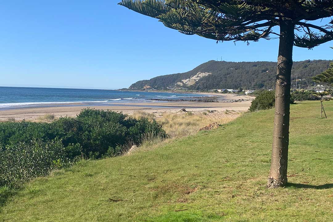
Round Hill Lookout
Round Hill is the highest point overlooking the city of Burnie and the sea. It offers panoramic views in all directions - the view inland is towards farms, hills and escarpments, the coastal scenery includes views to Penguin in one direction and Table Cape in the other, as well as the majestic sweep of Emu bay. Round Hill is accessed via Stowport Road at Wivenhoe.
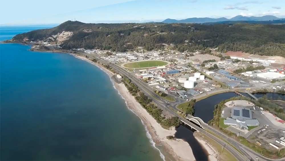
Wivenhoe Beach
Wivenhoe Beach extends east of the shallow mouth of the Emu River river for 1.3 km to the
rocky base of 225 m high Round Hill. The beach is relatively straight
and narrow with a 100 m wide low tide terrace and a few rock flats
towards the eastern end. A seawall has been constructed in front of the
Naval Reserve building towards the centre of the beach, while the
remainder is backed by a narrow reserve, the highway and then South
Burnie. There are currently no services provided by Surf Life Saving
Australia for this beach.

Australian Navy Cadets Training Ship Emu
Australian Navy Cadets Training Ship Emu is a military facility situated on Wivenhow Beach cose to Wivenhoe Show Grounds, Burnie Harness Racing Club, and the LifeHouse church. The Australian Navy Cadets is a leading national youth development organisation, with the character and values of the Australian Navy, founded on a strong community partnership, fostering and supporting an ongoing interest in the Australian Navy. Wivenhoe Barracks is home to the 64 Regional Cadet Unit, Army Cadet Unit. Wivenhoe Depot is a military facility nearby.
More

Chasm Creek
The nearby coastal locality of Chasm Creek takes its name from a small watercourse that empties into Bass Strait there. The 2016 census recorded a population of 68 for the state suburb. The name is probably descriptive, as Chasm Creek does plunge down a small chasm on its way to Bass Strait. Chasm Creek rises in Upper Natone ans flows north through Stowport. The locality is about 6 kilometres east of Burnie.
A PocketOz Travel and Information Guide
Design and concept © Stephen Yarrow | Email | W3Layouts | Test