
Battery Point, Tasmania
Location: south of Hobart city centre.
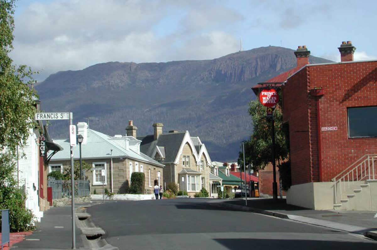
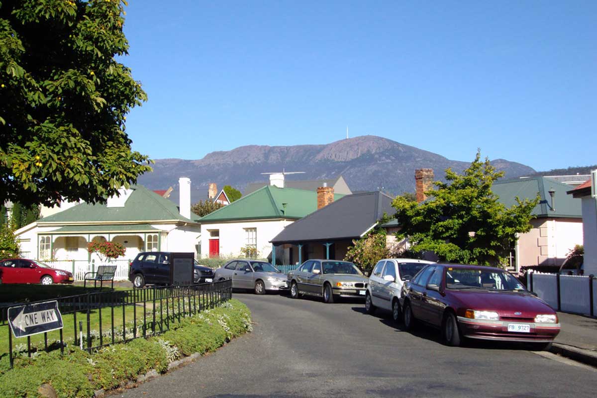
Retaining the character of a Cornish fishing village of the last century, the inner Hobart suburb of Battery Point began life as a home for mariners who worked out of Hobart Town. It is still mainly a residential area, with many historic homes and shops, some which are open for inspection as folk museums and art galleries.
Battery Point is named after the three defence batteries that were built at various times on the point of land that is today’s park. They were statements of British territorial claim, a warning to foreign shipping and in the early days, a deterrent for convicts who hoped to steal an escape vessel. The batteries were also used for ceremonial purposes.
How to get there: from Salamanca Place via Kelly's Steps, a set old colonial era stairs, or walk along Davey Street from the city, left into Harrington St, left into Hampden Rd. Kelly's Steps were built in 1839 by the adventurer James Kelly to connect Salamanca Place with Battery Point. Kelly was a dominant figure in seafaring and port activities during the formative years of Hobart.
Battery Point was the site of the first residence outside the 'camp' which comprised the early settlement: Cottage Green, built by the Rev Robert Knopwood in 1805 on a grant of 30 acres. This grant and another 90 acres to William Sorell covered almost the entire area of Battery Point, with the Signal Station and Guard House (1818), and Barracks Hill, chosen in 1811 as the site for Anglesea Barracks.
In 1824 Sorell's land passed to merchant and settler, William Kermode, but a proposal to divide Knopwood's land caused an inquiry, which resulted in John Lee Archer's proposals becoming the Sullivans Cove/Salamanca development as we know it today. Lt-Gov. Arthur's insistence on a foreshore road and wharf apron saw Salamanca Place extended to include the 'new wharf' area – a boon to the future of the working port, albeit a reclamation project that took thirty years of convict labour to complete. The release of the Sorell/Knopwood land saw the erection of a series of villas along the escarpment that became Hampden Road, many of which still stand today.
Arthur's Circus
At the heart of Battery Point is Arthurs Circus, a ring of old cottages circling a old village green. It was one of the earliest sub-divisions in Australia, the land having been established by then Governor George Arthur in dubious circumstances in 1829. 18 years later the land was subdivided and the blocks were sold. Auction advertisements described "delectable building sites in a neighbourhood that will inevitably become The Resort of the Beau Monde" for officers of the town and harbour garrison. Most of the quaint privately owned Georgian cottages of Arthur's Circus were built in the 1840s and 1850s, and all have been carefully restored. A visit to Arthur's Circus is truly to step back in time.
History of Battery Point
The area of Battery Point has a long history. Although the current site was settled in 1804, it was not until 1811 that land grants were given to free settlers. Those grants were used by the first settlers for farming. By 1814 several farms were located in the area. In 1818 a battery of guns, called the Mulgrave Battery, were placed on the southern side of the point as part of the coastal defenses on the deep water port established at Hobart Town.
Although the outpost was originally established as a penal colony and defensive outpost, by the 1820's the area had began to have free settlers arrive or establish themselves on farms around Hobart Town. One of the major infusions of wealth into the colony was that the Royal Navy made Hobart Town an important Pacific base. The Navy shipped timber, flax, and rum from the port.
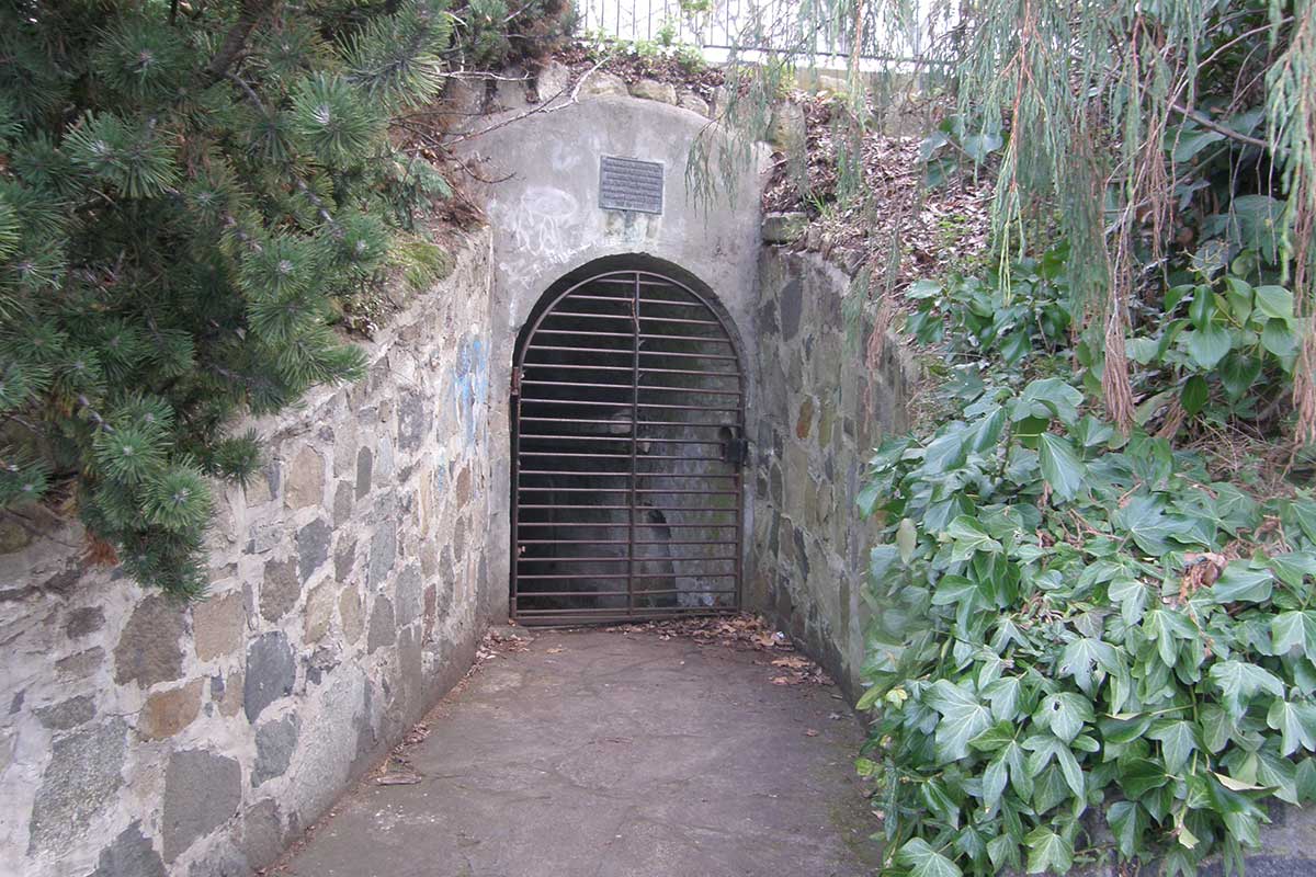
Remnants of Mulgrave Battery
Mulgrave Battery
Mulgrave Battery, now within Princes Park, was built in 1818 on the shoreline with an accompanying signal station. It was on the point of land known as ‘Blow My Skull Point’ after the explosive beverage once popular with the military officers who picnicked on this hill. Poorly positioned and all but useless, the fortification was described in 1829 by colonist Henry Widowson as: " pitiful mud fort with half a dozen honeycombed guns perfectly harmless to the artillery men who fire them and serving only to make a noise on the King’s birthday and on one or two other public occasions." – Old Hobart Town Today, Frank Bolt, page 141
Once part of the Mulgrave Battery complex, this cottage at the bottom of Princes Park is now the oldest remaining building on Battery Point. An efficient signaling system operated between Port Arthur, various relay stations, the battery and the Mount Nelson signal station. It took less than 20 minutes to transmit a message to and from Port Arthur. The signaling system also reported vessels entering the Derwent estuary, including its country of origin and likely time of arrival. The semaphore mast is still in place at Mount Nelson.
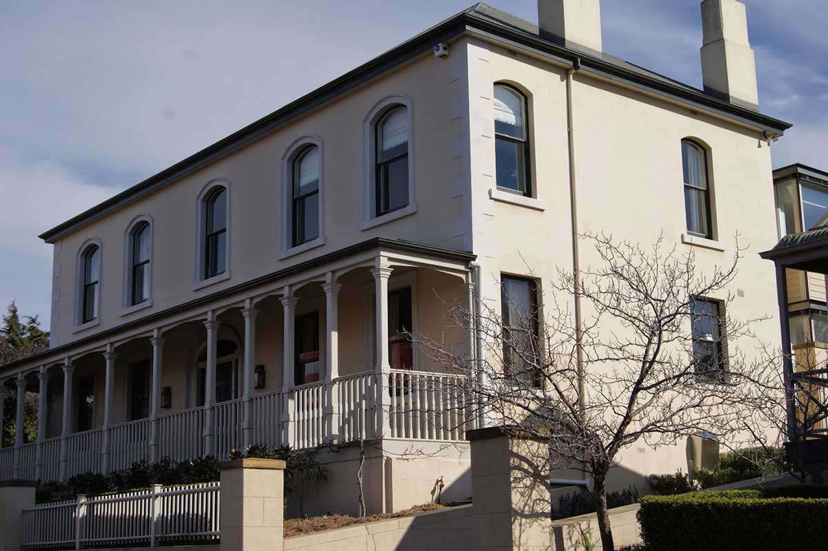
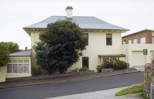
A large residence on the high side of Hampden Road which offers views across the Derwent River, it was once the home of Andrew Inglis Clarke, one of the authors of the Australian Constitution. It is a two storey townhouse with hipped roof, shallow boxed eaves and symmetrical facade. There are arched windows on the upper level and moulded architraves around the front windows and doorway. There is a fanlight above the front door. 11 Hampden Road, Battery Point.
One of the finest examples of a double storey Colonial Georgian mansion in Australia, it was designed by Edward Winch for Capt. Andrew Haig, a master mariner who owned a warehouse on Salamanca Place. It is a brick building with a stone facade and features a shallow fanlight window above the entrance door. The building is meticulously proportioned and scaled. Narrynais today an historic gallery. 103 Hampden Road, Battery Point
Imposing double storey Italianate style mansion, built by shipowner and merchant Alexander Mcgregor in the 1870s. Erected in several stages, it is a good example of elaborately detailed high Victorian residential architecture. Its design features richly modelled facade with bay windows, two storey colonnaded verandah, balustraded parapet, elaborate bracketing to the cornice. The slate roof has round head dormers with elaborate bracketing and bracketed cornice to chimneys. 20 Runnymede Street, Battery Point
An architectural landmark in Hobart, Kelly's Steps connect the suburb of Battery Point to Salamanca Place. The staps recall James Kelly, who constructed the steps in 1839. At the time, Battery Point was on a cliff that overlooked wharfs of Sullivans Cove. The steps were cut into the stone of the cliffs. The warehouses that lined the wharfs on what is now Salamanca Place were built with stone quarried from the cliffs. The steps lead up to Kelly Street, Battery Point. Kelly, a mariner, explorer and port official, was born in 1791 at Parramatta, New South Wales. He was probably the son of James Kelly, a cook in the convict transport Queen, and Catherine Devereaux, a convict transported for life from Dublin in the same ship. Kelly was first apprenticed as a seaman in 1804 and sailed in vessels engaged in the sealing and sandalwood trades as well as making a voyage to India. In 1812 he was chief officer of the full-rigged ship Campbell Macquarie on a sealing voyage when the ship was wrecked on Macquarie Island. He became the first Australian-born master mariner with voyages in the sealing industry and general trade between Hobart and Sydney. In December 1815 Kelly left Hobart in command of an expedition to circumnavigate Tasmania using the whaleboat Elizabeth . The party made the official discovery of Port Davey on the south west coast, and on 28 December of Macquarie Harbour on the central west coast. The site of Anglesea Barracks, selected by Governor Lachlan Macquarie on 2 December 1811, is the oldest continuously occupied barracks site in Australia. It has strong association with the evolution of Tasmania's and Australia's military forces. The early fabric, including the Barracks Square, the former Officers Quarters, 1814 and the former Hospital 1814-1818, documents the influence of Governor Macquarie (1811-1822) and Thomas Davey, Lieutenant-Governor of Van Diemen's Land.
This two-storeyed mansion is an excellent example of wealthy housing in Victorian period Hobart. Built in the Gothic style, with fine detailing and with a large garden its imposing presence adds to the streetscape. Beaumaris was built for Henry Llewellyn Roberts and his wife, Mary, in 1878/79. It was situated on a two acre block of land on the eastern side of Sandy Bay Road (then known as Montpelier Road) and extended back to Newcastle Street. Henry was the founder of today’s Roberts Limited. The company started in 1865 as an agricultural auctioneering firm. It still operates in the farming industry but is now better known for being Tasmania’s largest real estate agency.
This fine example of a Georgian two-storey house was built in 1849 for the Rev. HP Fry, rector of St George's Church, Battery Point. It is a two storey stucco Georgian house of four bays by four bays. Iron hip roof. Front door with sidelights and semi-circular fanlight. Twelve pane windows. Wide eave with flat timber brackets. Single storey verandah, partially infilled with twinned columns at entry and corners. Location: 112 Hampden Road, corner Ellerslie Road, Battery Point.
John Aldridge, Pilot for the Port of Hobart Town, purchased a block of land on the northern side of Cromwell Street for ₤60 when the area was first subdivided in 1833. The block was located near the top of the hill and commanded ‘a beautiful view of the Town and River.’ Aldridge built a house and advertised its lease in the Colonial Times in February 1836. He described it as ‘A Comfortable Dwelling-house, containing a dining and drawing-room with folding doors, five bed-rooms, kitchen, store-room, and large wash-house newly finished and completely painted, suitable for a respectable family.’ (It is noted that the foundation stone for St George’s Church, on the opposite side of Cromwell Street, wasn’t laid until October 1836.)
John Watson was a master shipbuilder who arrived in Van Diemen’s Land in 1833 and spent several years supervising and training convicts at the government shipyards at Port Arthur. In 1839, Watson leased a site on the eastern side of Napoleon Street and began building ships there. Watson is acknowledged as the father of Hobart’s shipbuilding industry and his apprentices included Alexander McGregor, John Gibson McGregor, John Lucas and James Mackey who went on to run successful shipyards on their own account. Watson never owned the cottages that now bear his name.
Shipbuilding was the first important manufacturing industry established in Van Diemen’s Land – the colony’s blue gum timber was well-suited for boat-building and there was strong demand for trading and whaling vessels. A number of slipyards were established at Battery Point, with some near Secheron at the bottom of today’s Finlay Street, and the remainder along the foreshore on the eastern side of Napoleon Street.
The parcel of land where Portsea Terrace is built was one of several that were sold at auction on 3 December 1849. Notices in the newspaper described them as ‘valuable building sites’ that were ‘remarkably convenient for parties connected with the New Wharf, Ship Building Yards, Docks, etc. Thomas Fisher purchased the block on the north-east corner of the Montpelier Retreat / Hampden Road intersection for £152. There was strong demand for good quality accommodation in such close proximity to the harbour and Fisher built a terrace of four two-storey brick townhouses (today’s 54-60 Montpelier Retreat) which he rented out to various tenants. Each of the townhouses had 6 rooms and newspaper adverts described them as ‘well-finished’ and enjoying ‘a healthy and respectable situation’.
Stowell is a large town residence and garden of the 1830s which displays the gracious life style of the wealthy Colonial families of eastern Australia. The later history of the site as a private hospital and as the regional research laboratories of the CSIRO demonstrate the changing landuse demands on large properties in Battery Point. The open setting of Stowell, with its remnant early trees, represents the largest surviving garden area attached to any of the early grand houses of Battery Point. Stowell has been associated with prominant people in Tasmania's history. The original residence was erected for Captain John Montagu, a leading official in the administrations of both of Governor Arthur and his successor, Governor Franklin. Later owners were Gamaliel Butler, the founder of a Tasmanian legal dynasty, and William Gibson, a successful Tasmanian merchant and politician.
A malt-house is a building where cereal grain is converted into malt by soaking it in water, allowing it to sprout and then drying it to stop further growth. John Tooth, a merchant and brewer, emigrated from Kent, England to Sydney in 1828 and established the Kent Brewery there in 1835. John’s nephews, Robert and Edwin Tooth, leased the brewery from their uncle in 1843. Edwin subsequently moved to Van Diemen’s Land, residing at Bagdad. Edwin Tooth purchased a block of land on the northern side of Hampden Road and invited tenders for the erection of a malt-house in September 1847. Tooth’s malting establishment included a granary, steep and kiln and was reported to have been ‘built without regard to cost of sold masonry, and completed in the most perfect manner.’
The Grand Old Duke was built in 1856 and was Battery Point’s third hotel. The suburb’s population was steadily increasing and there were plenty of thirsty workers from the numerous shipyards along the Battery Point foreshore (Salamanca).
On a Knoll known as Kermode’s Hill stands St George’s Church, with a Georgian façade and unusual three-tiered belltower. This church and windmill that once stood opposite were landmarks for ships at sea in earlier days. The impressive tower and porch were designed by the convict architect James Blackburn, the tower being built within ten years of the nave. The porch was not added until 1888. The three tiered belltower is said to be a copy of the ‘Temple of the Winds’ in Athens.
This walk takes us up laneways, past old seafarers cottages and through an historic precinct in which the outside of the buildings and the streetscape is largely unchanged since it was built in the 1800s and early 1900s.
To remedy this situation, a second Prince of Wales Battery was built in 1840, and a third, the Albert Battery, was constructed at the height of the Crimean War in 1854. By 1880, as a result of technological and building developments, alternative batteries were constructed in Sandy Bay and Bellerive. In 1882, the site was handed over to the City of Hobart as a recreation ground. The magazine and parapets were retained for military purposes in case of war.
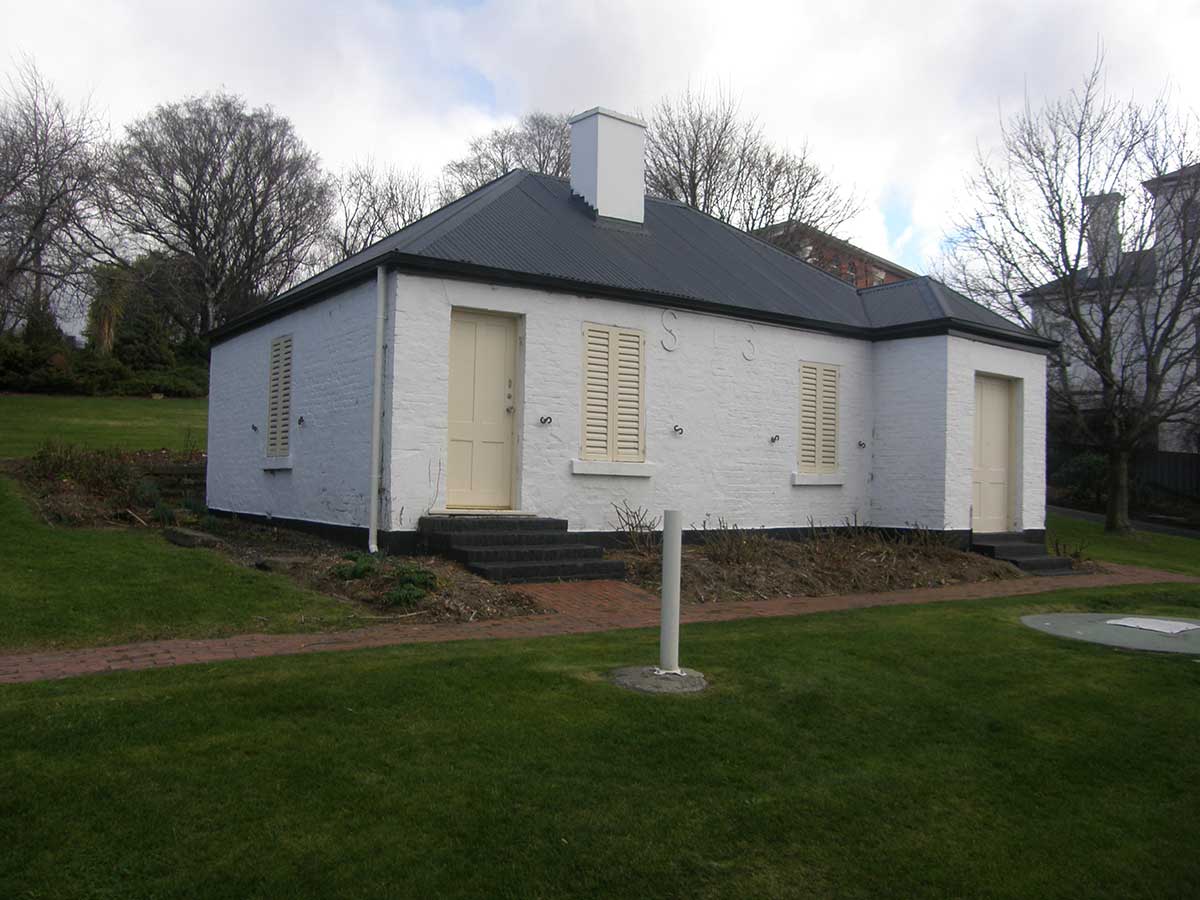
Signalman's Cottage
Rosebank
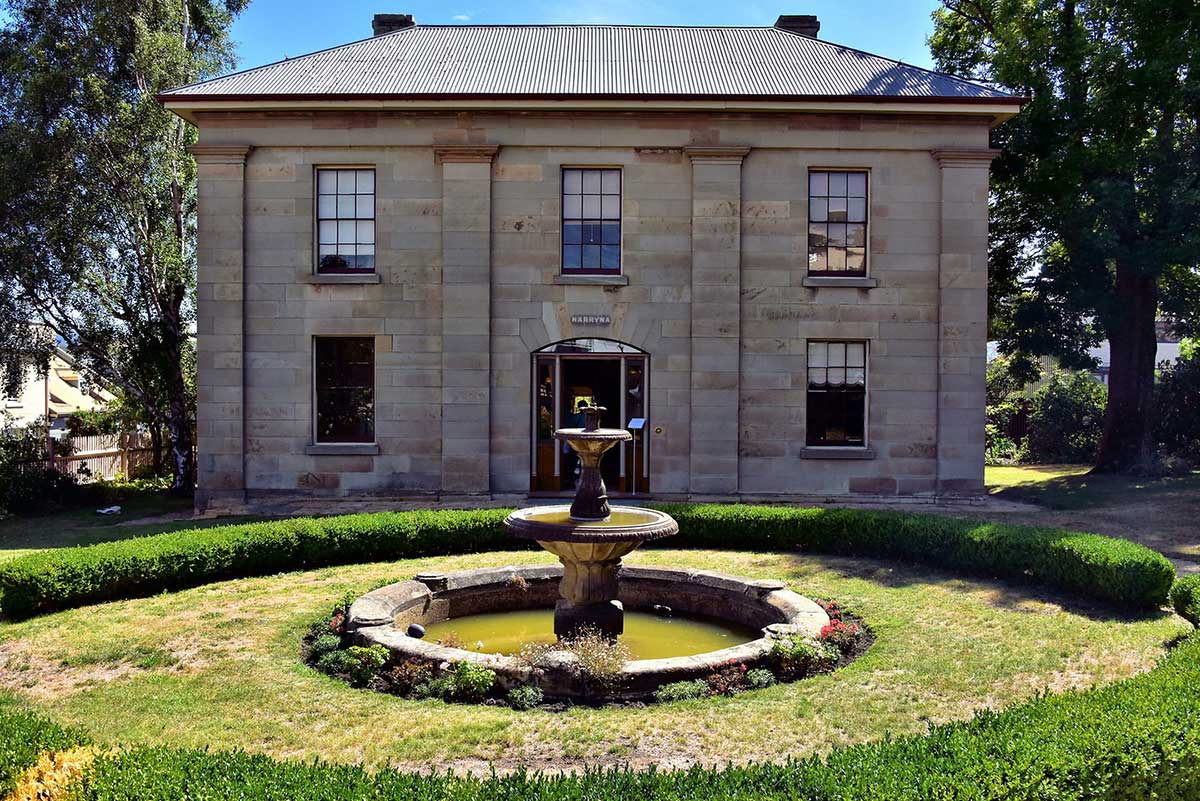
Narryna
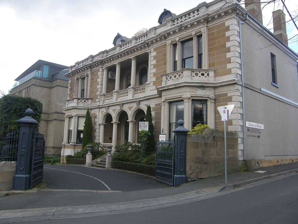
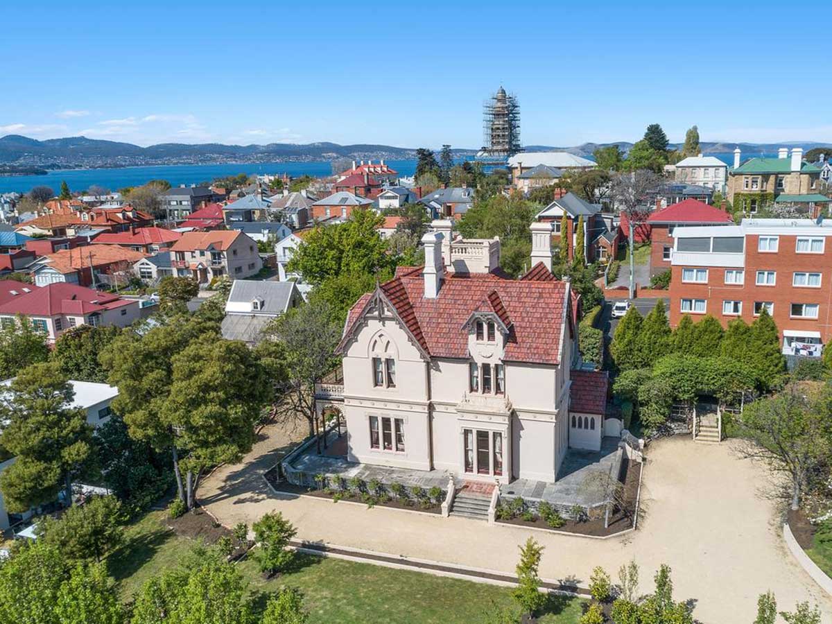
Lenna
Kelly's Steps
In May 1819 Governor Macquarie confirmed Kelly's appointment as pilot and harbourmaster at the Derwent River. In December 1821 as master of the Sophia he assisted in transporting convicts to the newly established penal station at Macquarie Harbour, and in 1825 he helped to set up the secondary penal station on Maria Island. Business interests, mostly in whaling, banking and insurance, saw him resign from Government service in the late 1820s. He was financially ruined by the economic depression of the early 1840s and spent most of the remainder of his life back in the employ of the port authorities. He died suddenly in Hobart on 20 April 1859. Kelly's name is perpetuated by a number of geographical features including Kelly's Steps in Battery Point, Hobart, Kelly Basin at Macquarie Harbour, Kelly Island off Forestier Peninsula and Kelly Point on Bruny Island (later renamed Dennes Point).
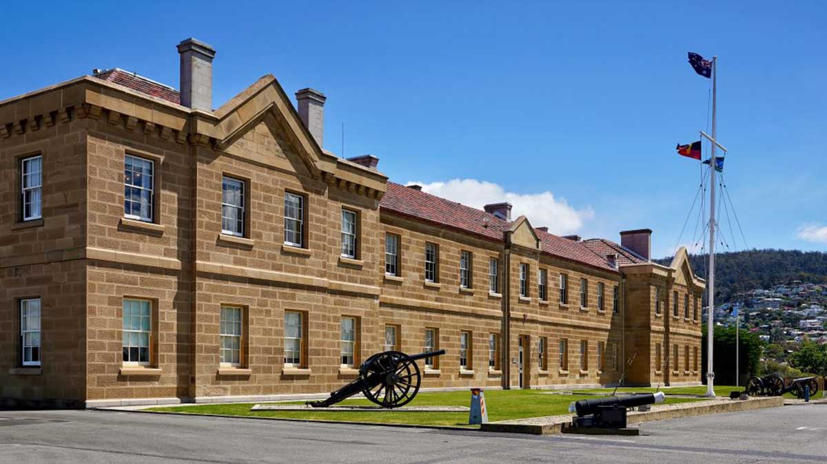
Anglesea Barracks
The separation of Van Diemens Land from New South Wales in 1824, and the arrival of Governor Arthur, stimulated military development, led to doubling the capacity of the barracks in the three-year period to 1830. Colonial Architect David Lambe designed the second Soldiers Barracks in 1826 with noted architect John Lee Archer responsible for the design of many buildings including the Subalterns Quarters in 1828, the Canteen (210/39) completed in 1835 and the brick Guard House completed by 1840.
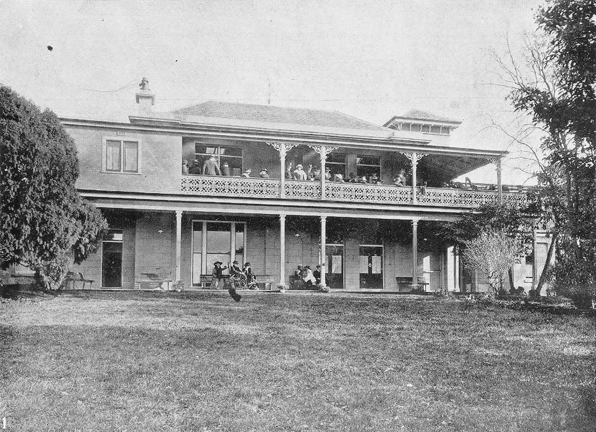
Beaumaris & Grounds
Henry’s wife, Mary, was interested in the welfare of animals and developed a private collection of exotic birds and native animals in the grounds of their Battery Point home. It became known as Beaumaris Zoo but was not open to the public except during special fundraising events for local charities. Mary is recognised as the first zookeeper to draw attention to indigenous Tasmanian fauna. Her collection included thylacines (Tasmanian tigers) and she was the first person to breed Tasmanian devils in captivity.
When Mary died in November 1921, her daughter gave the collection of birds and animals to the Hobart City Council. They relocated the zoo to a site on the Domain, near Government House, but it continued to be known as Beaumaris Zoo. The last known thylacine died there in 1936 but the event attracted little attention at the time. High running costs and falling attendances led to the zoo’s closure the following year. Henry and Mary’s son, William Arthur Roberts lived at Beaumaris until his untimely death in April 1932. Location: 82 Sandy Bay Rd, Battery Point. The Defence Department owned the property until the 1990s. The grounds of Beaumaris have since been developed with modern apartments and townhouses.
Ellerslie

Hanover Cottage
John Aldridge died in June 1855 but his widow continued to rent out the property to various tenants, including Captain John Austin who had spent many years transporting military and prisoners to the colony and was credited with having brought more people to Tasmania than any other man. Location: 29 Cromwell St, Battery Point
Mr Watsons Cottages
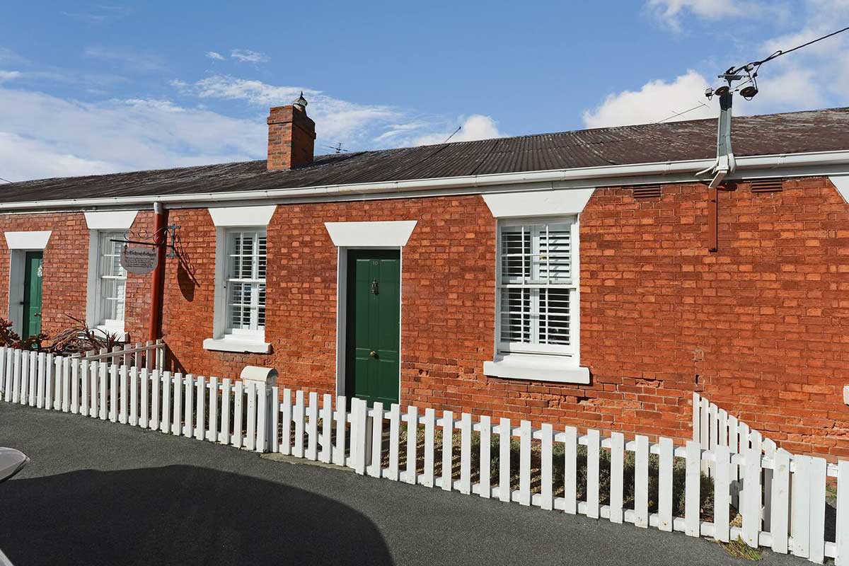
James Poynter, a successful Hobart merchant, had purchased a strip of land sloping down to the River Derwent from the eastern side of Napoleon Street. He had plans and specifications drawn up for a row of four brick cottages along the Napoleon Street frontage. Each of the cottages contained four rooms and there was a cart entry down one side and along the rear. Poynter invited builders to tender for erecting the ‘Four adjoining Cottages’ in the Colonial Times in December 1846.. The brick-built cottages were auctioned in May 1853. Location: 6-12 Napoleon St, Battery Point.
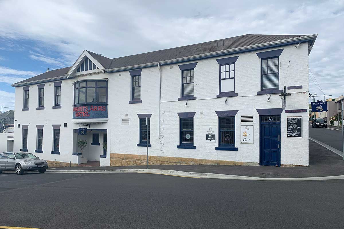
Shipwrights Arms Hotel
The amount of shipbuilding activity in the vicinity of Napoleon Street steadily increased during the 1840s with more slipyards established, more vessels launched and larger numbers of workers employed. Shipbuilding is thirsty work and the Shipwrights Arms Hotel which still operates at the top end of today’s Trumpeter Street was first licensed in May 1846. The shipyard workers needed places to stay, as well as places to drink, and there was high demand for rental accommodation in the neighbourhood.
"Shippies", as it is known to locals these days, is a traditional style English corner pub, filled with history, tradition and local pride. It is lined with a very unique collection of photographs, ornaments and fittings depicting Tasmania's maritime and historical past. The pub has become best known with its link with the Sydney To Hobart Yacht race and has become a favorite with crew members and spectators alike. Location: 29 Trumpeter Street, Battery Point.
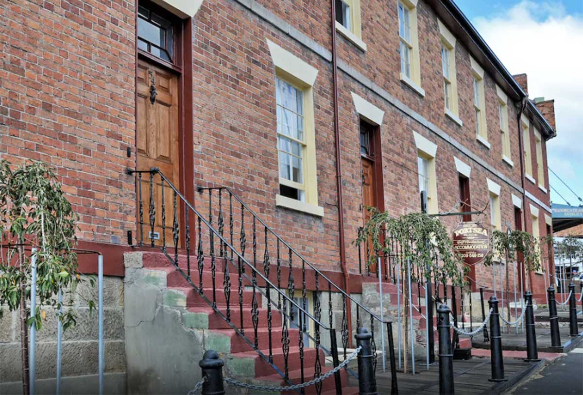
Portsea Terrace
One of the tenants was Phineas Moss who had emigrated to Van Diemen’s Land from Portsea, Hampshire, England and that may be the origin of the property’s name. The townhouses were originally called Portsea Place but became known as Portsea Terrace in the 1890s. The four townhouses were purchased for £1,550 by James Robertson in 1890 and he continued to rent them out to various tenants. Robertson built today’s 62 Montpelier Retreat in 1894, endeavouring to match its appearance with the adjoining four townhouses. Location: 54-60, 62 Montpelier Retreat, Battery Point.
Stowell
Captain John Montagu and his wife, Jessy, erected Stowell in 1833 on land granted to them by Lieutenant Governor George Arthur. Their house was a two storey hipped roof building, in fashionable Regency style. The early residence was set in extensive gardens, with graperies heated by hot air, greenhouses and other garden features. Battery Point rapidly became a fashionable residential suburb for the very wealthy. Montagu lived in the house until his fall from favour with Governor Sir John Franklin and Lady Franklin in the late 1830s. In 1840, Stowell was purchased by Gamaliel Butler, founder of the early legal firm, Butler, Mcintyre and Butler. Butler owned many Tasmanian properties including the rural estate of Shene near Bagdad, also entered in the Register of the National Estate.
The Stowell house and its extensive outbuildings accommodated Gamaliel and Sarah Butler, their six children and servants. The outbuildings were set around extensive cobbled stone yards, and included coach houses, servant quarters and stables. The main stone-paved courtyard was enclosed by the early house, kitchen and offices, workshops originally for the convict tradesmen, and conservatories. The fine gardens established by Montagu were carefully maintained and added to by Gamaliel Butler and his architect son, Francis, who imported fruit trees for the garden from England. Location: 6 Stowell Avenue, Battery Point.
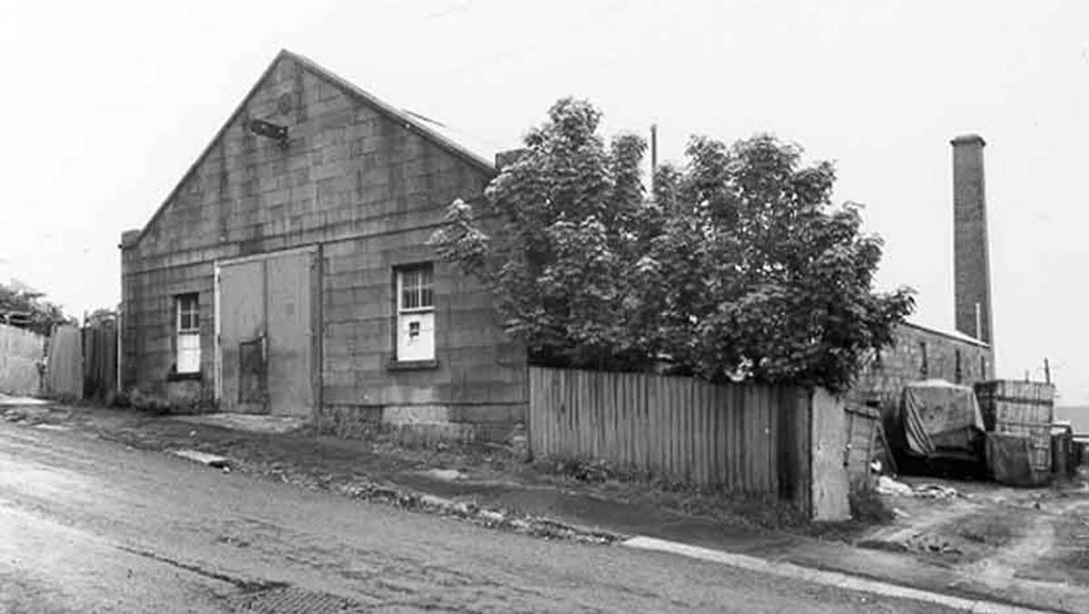
Tooth's Malthouse
Edwin Tooth offered the malt-house for sale in March 1854 but it didn’t attract a buyer. He re-advertised the following year, pointing out that the property was well-adapted ‘for a Steam Flour Mill, Brewery, or any manufactory requiring space.’ The malt-house wasn’t sold until August 1863 when Robert Walker purchased the property for ₤1,400. Walker was the owner of Walker’s Brewery on the corner of Collins and Barrack Streets. Edwin Tooth returned to Sydney in 1852 and left the colony in December 1855. In London he lived at 29 Cleveland Square, Hyde Park, and was on the London board of the Bank of New South Wales.
In 1874 Walker leased the malt-house to Joseph Bidencope and he converted it into a hat factory. Bidencope had been exporting hats to the Australian mainland for some time and had decided to expand his operations. He installed steam-powered machinery which allowed the production of thirty dozen hats per day. The hat factory operation only lasted about five years before the building reverted back to a malt-house. James Boag, the Launceston based brewer, owned the malt-house for a period in the early 1900s. The double-storey stone building has now been converted into offices but its brick chimney recalls its industrial past.
The land on the north-east corner of the malt-house was acquired by the Hobart City Council to allow construction of the Harrington Street Deviation (today’s Sandy Bay Road) in 1886/87. The road and retaining wall have a slight kink in their alignment that was necessary in order to avoid the tall brick chimney stack at the rear of the malt-house. Location: 119 Hampden Road, Battery Point.
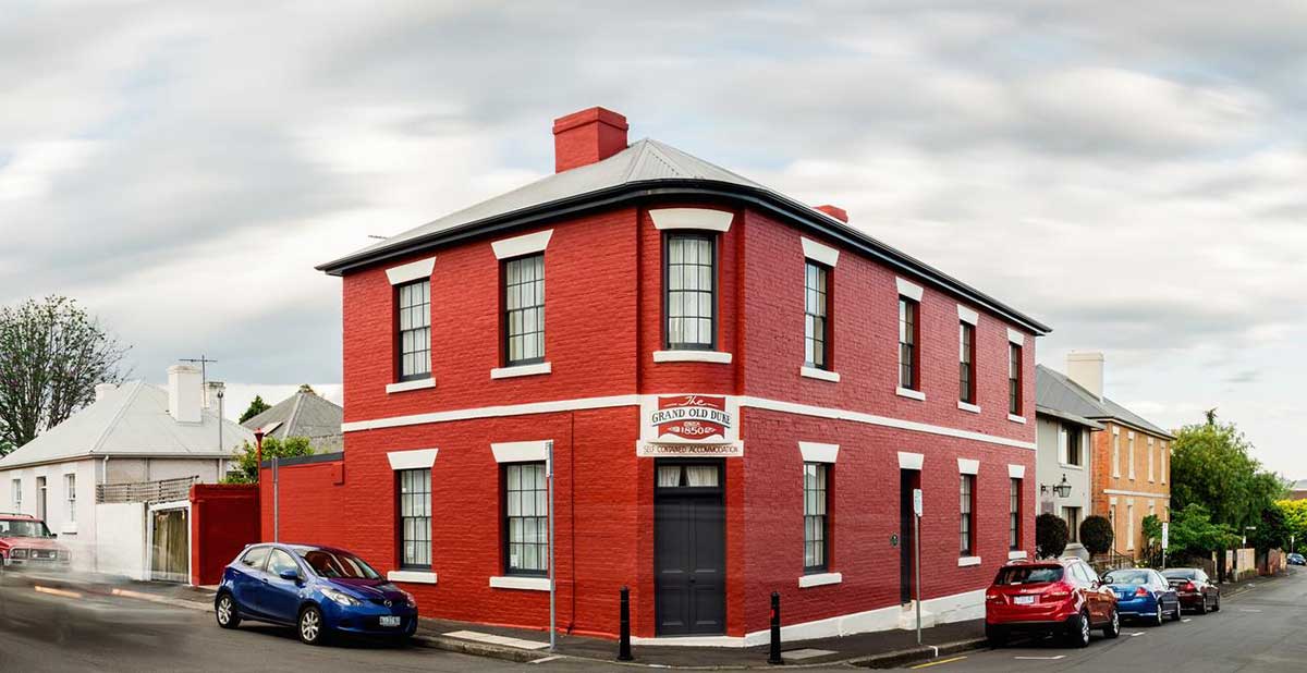
Grand Old Duke Hotel
Edward Prentis originally applied to license his pub as the Patent Slip Hotel but discovered the name was already taken. He settled on the Duke of York instead. Prentis died shortly after in 1859 and his wife, Ann, took over the operation of the hotel. Working as a publican was one of the few occupations available to women at the time and Ann remained the licensee until her death in 1877. After Ann’s death, the pub had a series of different landlords and its name was changed to the Exhibition Hotel in 1892. Just three years later it was forced to close down – the pub’s license had lapsed after the publican failed to apply for its annual renewal. When he later re-applied, the Licensing Court deemed there were too many pubs in the area and the Exhibition Hotel was no longer required.
The building subsequently served for many years as a boarding house. In more recent times it has been refurbished to provide four star luxury accommodation in the centre of Battery Point. The Grand Old Duke survives in excellent condition and remains a fine example of Georgian style corner hotels. Location: 31 Hampden Rd, Battery Point .
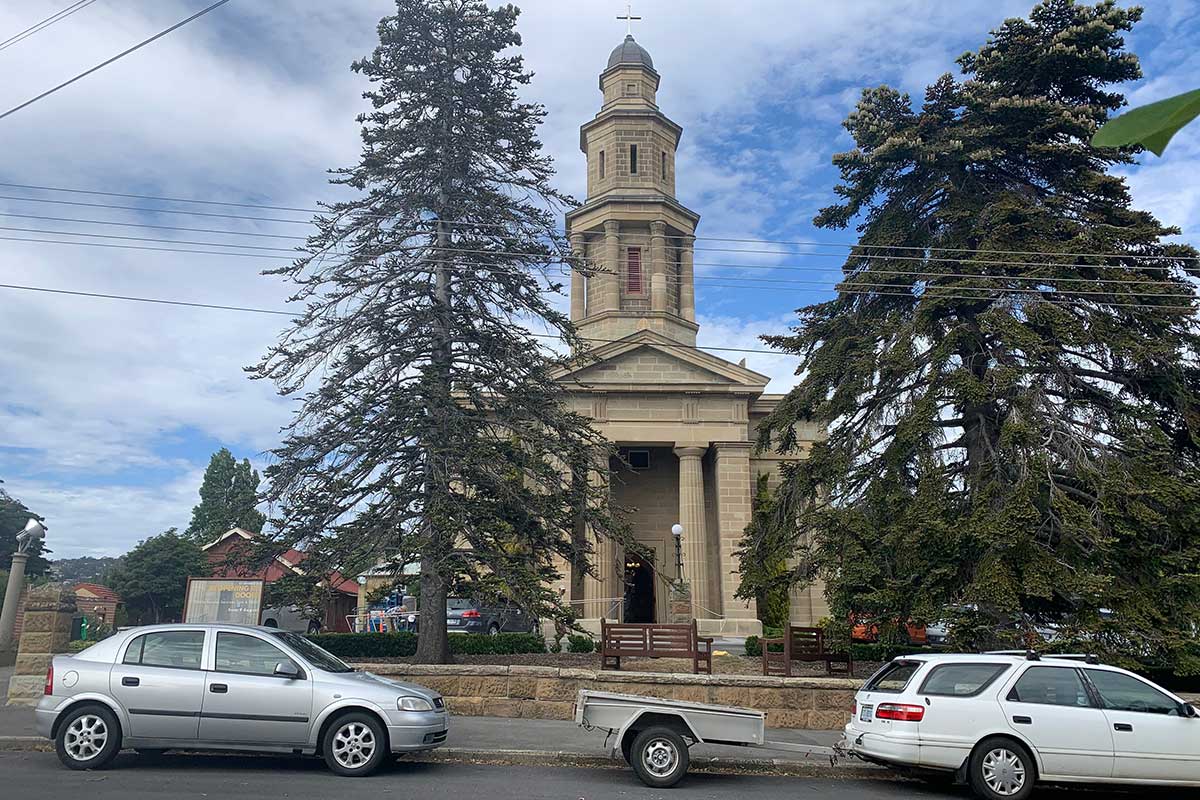
St George’s Church
St George’s itself was designed by two of Hobart’s earliest and best known architects, John Lee Archer and James Blackburn. The nave designed by Archer and built by John Wright, cost £1,239, and this sum was raised by subscription and Government grant after residents petitioned for assistance. The foundation stone was laid by laid on 19 October 1836 by Governor Arthur but has been hidden by additions to the building. The first Bishop of Australia, the Right Reverend D.W.G Broughton, consecrated the church in 1838.
Battery Point Historic Walk