
South Hobart
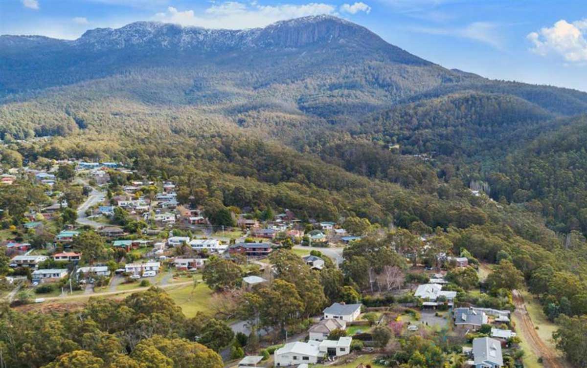
South Hobart is one of Hobart's southern suburbs. It is bound by Fern Tree, West Hobart and the central business district. South Hobart is home to many of the most beautiful homes in Hobart, including the classical Georgian residence of Milton and the Henry Hunter-designed Ashleigh."The World Heritage-listed Cascades Female Factory Historic Site in South Hobart is Australia’s most significant site associated with female convicts and sits in the shadow of Mount Wellington, a short distance from the Hobart CBD.
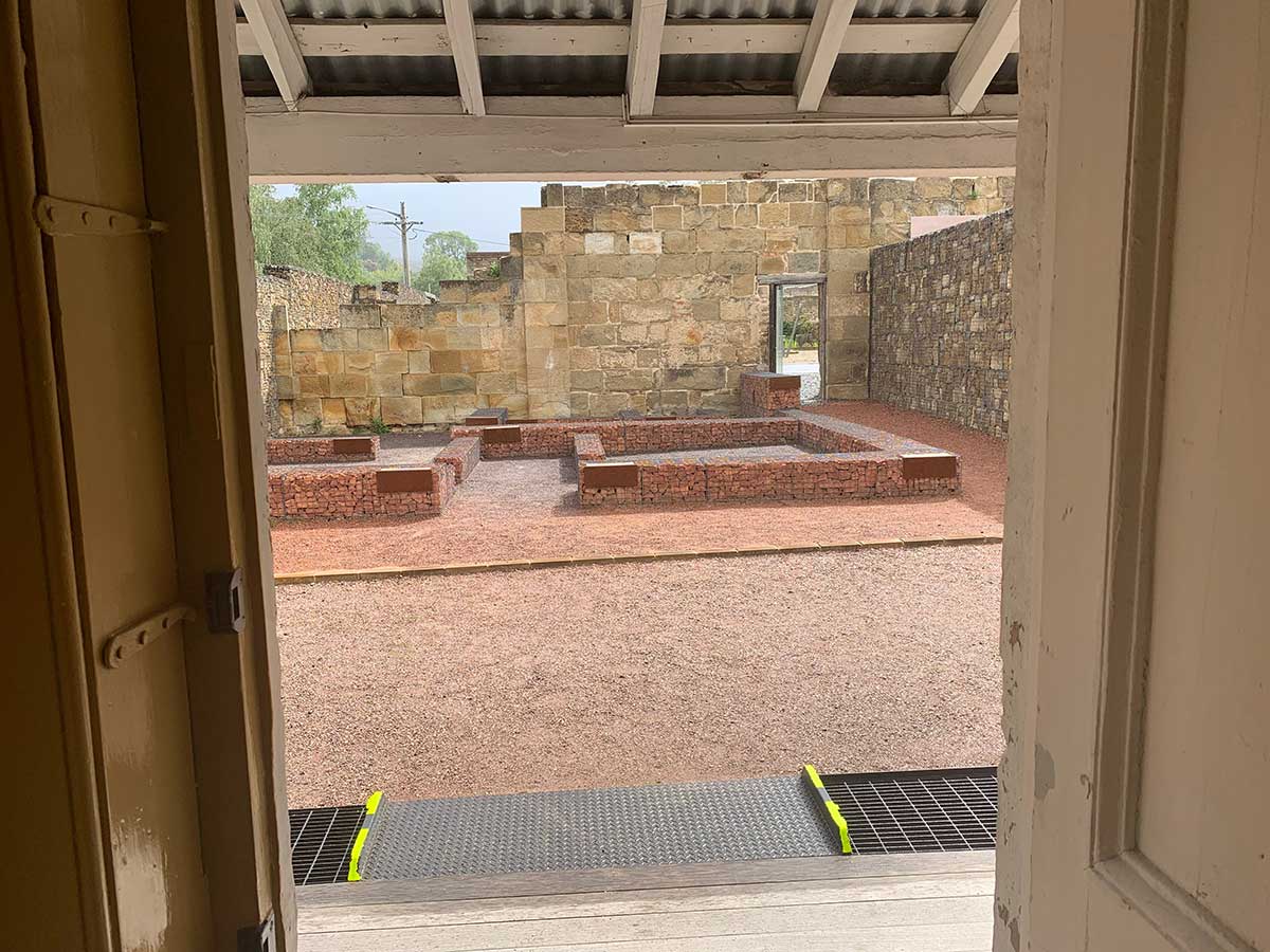
Cascades Female Factory
From 1828 to 1856, the Cascades Female Factory operated as a purpose-built institution intended to reform female convicts. More than 5,000 women convicts are known to have spent time here; the Cascades Female Factory was established on the site of a failed rum distillery, adapted and expanded to comprise five conjoined, rectangular walled yards. After 1856, the site was used for a variety of institutional purposes before being sold in 1904 and subdivided."The Cascade Brewery, the oldest brewery in Australia, is located here.
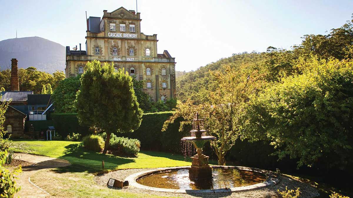
Cascade Brewery
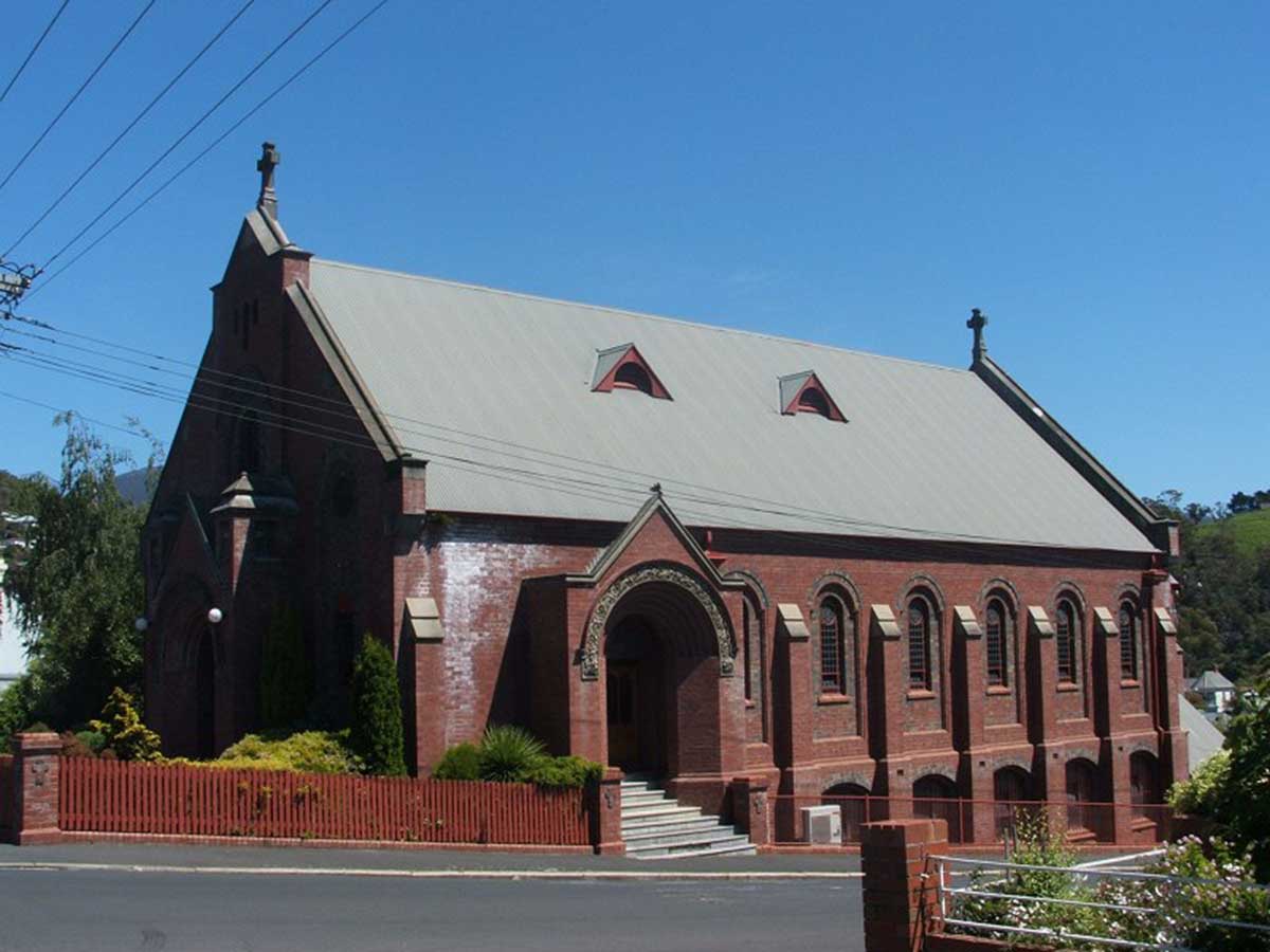
Another landmark is All Saints' Anglican Church. Established in 1858, it is heritage listed; the building was designed by the prominent architect Henry Hunter. The Church is renowned for containing a memorial plaque for school teacher and founder of women's cricket in Australia, Lily Poulett-Harris.
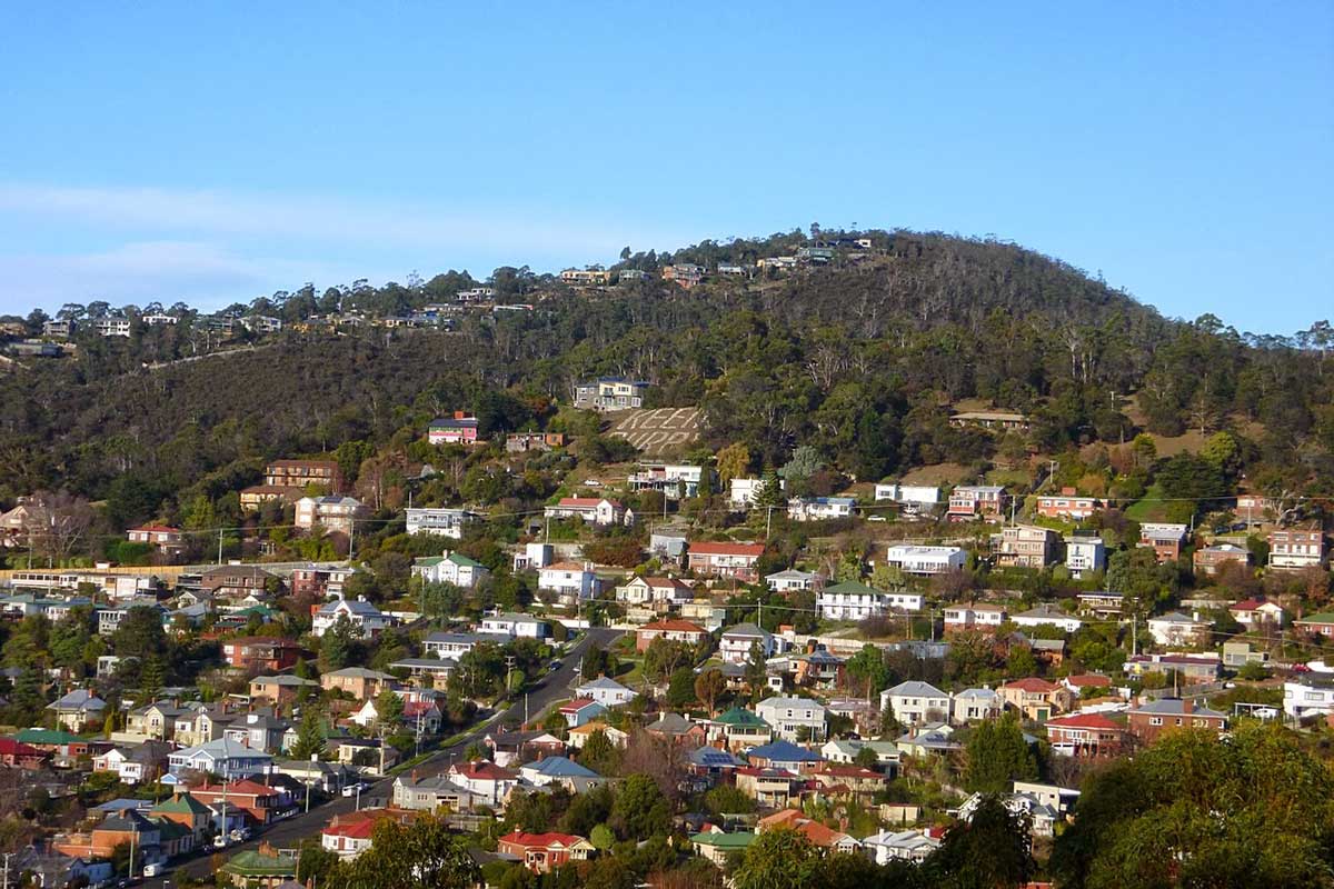
South Hobart is famous for its Keen's Curry sign; the sign read "VR 60" to mark the Jubilee of Queen Victoria. This was created when the son-in-law of the company's founder "purchased land in the foothills of Mount Wellington, overlooking Hobart, in 1905 transformed it into a large advertising sign. Heavy stones were collected from the site, painted white and used to form the words'Keen's Curry' in letters some fifty feet high. Public uproar resulted. In June 1926 the familiar landmark changed to read 'Hell's Curse' as a university prank, students altered it again in 1962 to promote a theatre production. In 1994 the landmark read 'No Cable Car' as a protest against a proposed development. After every change the sign was restored and as of 2012 was still in place."

Keen's Curry Powder, today a nationally recognised condiment, was first developed by Joseph Keen (1819–92) in the early 1860s. He and his wife Annie, and many of their sixteen children, ran a small grocery and manufacturing outlet from their Kingston store for fifty years. By 1866 the curry powder was already an award-winning product with a medal from the Inter-Colonial Exhibition, Melbourne. Louisa, their sixth daughter, and her husband Horace Watson took over the business. Horace bought purchased land in the foothills of Mount Wellington overlooking Hobart in 1905 and created the sign. The best place to view the sign (from a distance) is Liverpool Crescent, West Hobart.
South Hobart is known for its high green vote, reflected by the existence of a community sustainability network. This is coordinated through a community. There is a strong sense in part created by the suburb's location, it has an active community association - The South Hobart Progress Association Inc. founded in 1922 making it one of the oldest such organisations in Tasmania. All Saints' Anglican Church is today known for being Hobart's centre of Anglo-Catholic worship; the suburb is home to the successful South Hobart SC. Known as'SoHo village' by locals; the Cascade Hotel is host to the weekly Gypsy Jazz Jam session, every Wednesday, for locals and visiting artists.
Upper Macquarie Street Post Office opened on 1 April 1874, it was renamed Cascade Road in 1884 and Hobart South in 1895. Huon Road is an extension of Davey Street. Huon Road used to be named "The Huon Highway" and was the major road to the Huon Valley until the opening of the Southern Outlet during the latter half of the 20th century. Autumn time during the 1950s would see apple trucks continually travelling along this road carting apples to Europe, thus helping Tasmania to earn its title of "The Apple Isle".
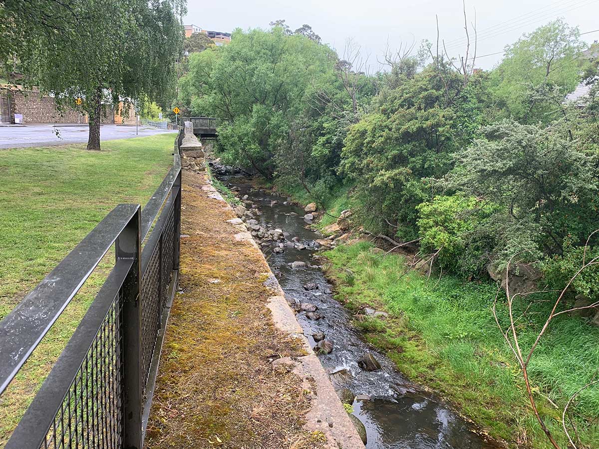
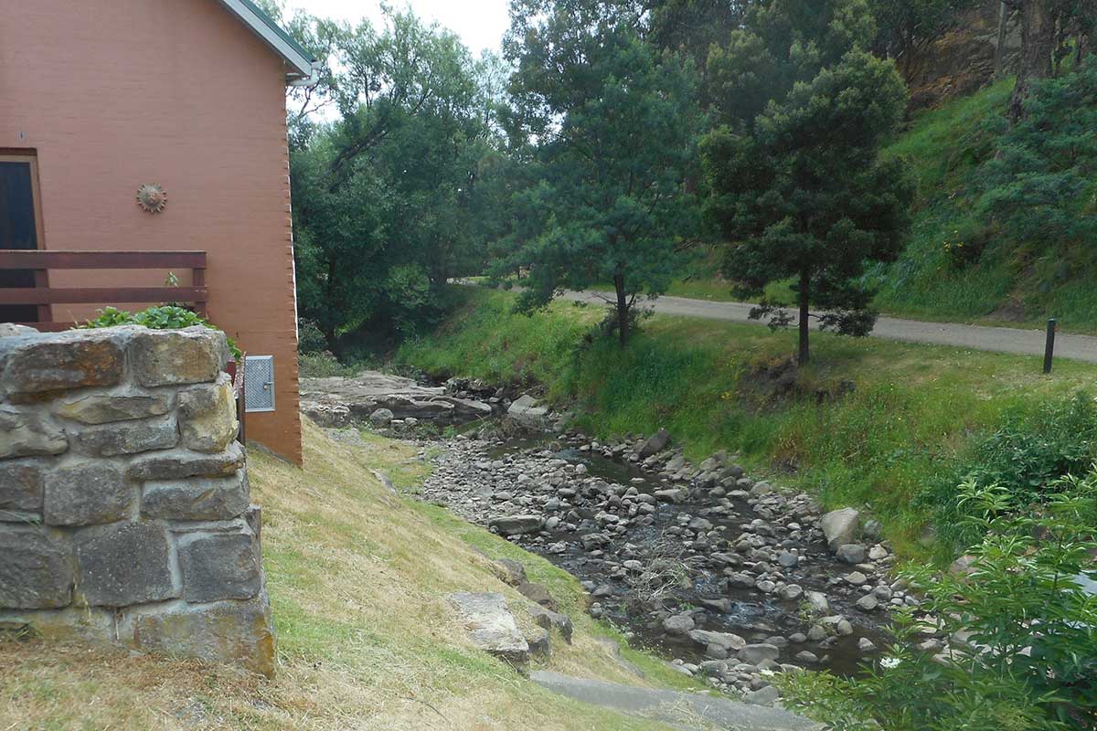
Hobart Rivulet alongside the Cascades Female Factory
The Hobart Rivulet is one of the few rivulets to have been the given care and attention it deserves, no doubt because of its significat role in the establishment and development of Hobart. The rivulet was an important source of drinking water for the Mouheneener Aborigines, and later for the first European settlers. The site for Hobart was originally chosen in part due to the availability of fresh water from the rivulet - unlike the rancid creek at Risdon Cove on the eastern shore, where they had originally tried to settle. Hobart Rivulet rises on the slopes of Mount Wellington and flows generally northeast over O'Grady's Falls, Strickland Falls, through South Hobart and past what was known as the World Heritage-listed Cascades Female Factory towards the Hobart central business district.
Hobart's Rivulets
Heritage Precincts of South Hobart
The following information is drawn from the City of Hobart Local Heritage Precincts surveys conducted by the City of Hobart - City of Hobart Local Heritage Precincts Description, Statement of Local Historic Heritage Significance and Design Criteria / Conservation Policy, January 2019. The review itself includes more detailed information and is the perfect companion for anyone wishing to do a more detailed study of West Hobart's history and heritage, particularly if researching the history of a particular property, street or area. Click on the link below to access the full survey.
City of Hobart Local Heritage Precincts
South Hobart is one of the oldest suburbs in Hobart, it has a rich history and retains many of its historic buildings and significant streetscapes.

Ispahan Avenue
Ispahan Avenue is a small precinct that is located off the northern side of Macquarie Street, and slopes gently down to the banks of the Hobart Rivulet. The precinct was developed as a residential area in 1938-39 and most of the existing housing dates to this period. The dwellings are consequently very similar in design and scale with contiguous original fencing. One residence number 18 is a slightly later addition to the street dating from 1948.
Ispahan Avenue is located on merchant Thomas Hewitt’s original 1830 land grant, Vaucluse Estate. Thomas Hewitt's vast gardens at Vaucluse in the 1830s were the cause of much excitement in Hobart, with the garden including conservatories, an ornamental lake, and white swans.
In 1901 an outbreak of scarlet fever raised awareness of the need for an infectious diseases hospital in Hobart. Thomas Hewitt's 1830 property, Vaucluse, was subsequently bought by the government to create such a hospital in 1907. It was opened in 1908 and Vaucluse remained a hospital until the 1990s. Many of the houses within the precinct and remaining structures of Vaucluse were redeveloped as part of the Vaucluse Gardens retirement complex in 1996.

283 Macquarie Street
Component streets: Weld Street, Macfarlane Street, Excell Lane
Until 1826 South Hobart was located beyond the town boundary and the first settlers to these fringe areas lived in harsh conditions, usually in very plain and humbly assembled log huts. By 1826 a rough track followed the alignment of Macquarie Street through the William Birch’s farm to Peter Degraves’ industrial brewing complex at the Cascades. The track was upgraded in 1827 following the colonial government’s decision to purchase Lowes’s distillery and convert it to the Cascade Female Factory. The upgraded road subsequently encouraged suburban development and, along with Davey Street, became the major access into the future suburb of South Hobart. Davey Street quickly became Hobart’s most prestigious residential street, where as Macquarie Street became the home of working class families. Birch’s farm was subdivided in 1838, with 24 allotments offered for sale along Macquarie Street between Elboden and Darcy Streets.
As South Hobart developed, Macquarie Street became the main commercial and retail strip of the suburb. With its striking backdrop of Mount Wellington it acquired a distinctive quality. Retailing developed on Macquarie Street during the nineteenth century. Shops concentrated around areas of high residential density, the majority of shops were clustered on Macquarie Street near Elboden Street, whilst a smaller number of shops were dotted up Macquarie St and Cascade Rd as far as the gardens where shops operated near the tram terminus and along Darcy Street at the turn of the century.
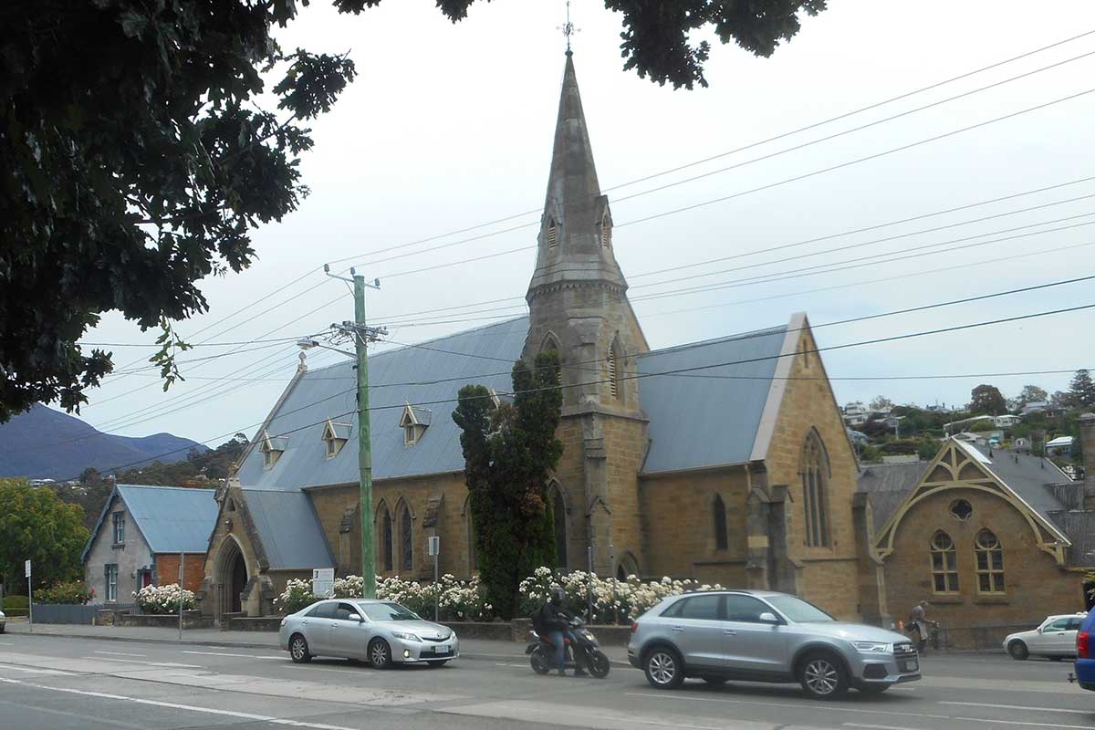
All Saints Anglican Parish Church
The precinct has a mix of residential development, commercial development, and institutional buildings. At 339 Macquarie Street is All Saints Church, designed by Henry Hunter in the Gothic Revival Style in 1861. 354 Macquarie Street features a Victorian Georgian small single storey rendered cottage with a low corrugated iron hipped roof. 359 Macquarie Street is a weatherboard building featuring two parallel gabled wings, with attic windows, and bargeboards. 356-360 Macquarie Street features five Interwar Georgian Revival conjoined two storey brick shops with a corrugated iron gabled roof, double hung sash windows to upstairs flats and original shopfronts with display windows, and the shop awnings featuring pressed metal ceilings.
404-406 Macquarie Street with the former Macquarie Street State School behind
At 377 Macquarie Street is a Post-War Functionalist two storey house with a parapet roof the façade is dominated by a large semi-circular wing with porthole windows, it is set off the street in a large front garden. At 404-406 Macquarie Street are a pair of Victorian Georgian conjoined weatherboard cottages with a corrugated iron hipped roof and a single dormer in each cottage. 407 and 433 Macquarie Street are shops with adjoining residences in Federation Free Style, 433 Macquarie Street features a parapet with rich rendered detailing conceals the roof of the flat above. At 408 is the former Macquarie Street State School, a single storey Federation stone building with prominent gables at either end. 413 Macquarie Street is a Victorian Georgian brick cottage with a corrugated iron hipped roof. At 333A is an Old English style dark brick house with a double gable frontage, arched entrance porch, and large chimney.
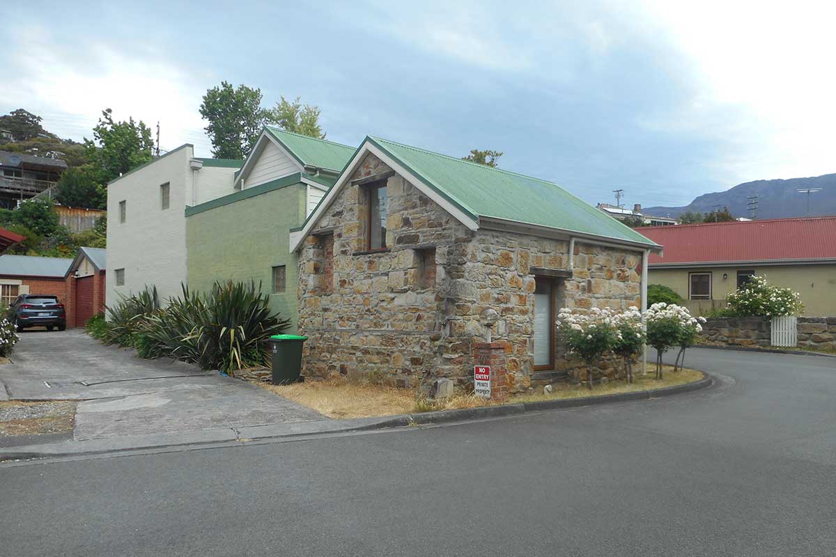
40 Macfarlane Street
A small stone cottage still exists on William McRobie's mill site at 40 Macfarlane Street (above) but it would be very difficult to say whether it belonged to the original mill or was a later addition in the site's history. Several large sandstone blocks and the remains of equipent lie nearby.
Mill site on Hobart Rivulet
Component streets: Nevada Street, Wellesley Street, Washington Street, Wentworth Street
The precinct is marked by steep streets rising up the hillside with extensive views over the suburb and back to the northern end of the rivulet. The main road of Macquarie Street intersects with Washington Street which continues to rise steadily south westerly through the precinct until it terminates at Congress Street. Views and vista from the precinct extend beyond the boundary of South Hobart to the wooded slopes and grassed knolls of the hills to the north and north-west which are an integral part of the landscape and significance of the area.

Wellesley Street
Before the establishment of the Cascade Female Factory in 1827 residential development in Hobart reached only as far as Molle Street, with the exception of a small scattering of cottages and farms. The Female Factory’s construction assisted the subsequent subdivision of Robert Lathrop Murray's South Hobart estate in 1835. Three years later William Birch's farm which was largely undeveloped was also sold and subdivided. These two subdivisions imprinted on the South Hobart landscape and created the basic street pattern that is still present today.
Major streets such as Adelaide, Weld, Angelsea, Darcy, Washington, Wellesley, Wentworth and Congress were surveyed at this time, although not all roads were created through streets until the early twentieth century. As residential development increased dairies were located further up the slope in Washington and Wellesley Streets. A survey in 1916 shows the precinct was well established with Washington Street containing 16 residences including Mrs Crowle’s Dairy, and Wellesley Street containing a further 18 houses.
A major community facility within the precinct is the South Hobart Recreation Ground in Washington Street although marked on 1890s maps of Hobart it appears that the ground was not formed until after 1904. The most prominent sports have been cricket and soccer, both of which continue to be played at the ground. The allotment had initially been sold to the Minister of Lands in 1890 by E. Fisher, but was vested to the Hobart City Council by an Act of Parliament in 1913.
The precinct represents a range of significant architectural styles dating from the mid-19th century through to the mid-20th century. Styles present within the precinct include: Victorian Georgian, Victorian Italianate, Federation Queen Ann, Federation Domestic, and Inter-War Brick Cottages and Bungalows. Buildings are primarily single storey detached residences, although there are examples of double storey detached residences, double storey co-joined townhouses, and single storey co- joined cottages.

South Hobart Oval and Grandstand
South Hobart Oval Grandstand on Wentworth Street was built in the Inter-War period, it constructed of vertical boarding with a corrugated iron hipped roof. 5 Washington Street is a Victorian Georgian residence constructed in c1850-60 when a number of residences were erected in the Wentworth and Washington Street precinct, it is a two storey rendered house with a hipped corrugated iron roof. 9 Washington Street is the residence ‘Sunnyside’ built in c1860 it is a fine single storey rendered house with a corrugated iron hipped roof and a later Victorian bull nosed verandah with timber posts and cast iron filigree.
Ivy Cottage
Ivy Cottage at 13 Washington Street c1860 is a fine single storey weatherboard cottage with a corrugated iron hipped roof, and verandahs on two sides. 34 Washington Street is a c.1890 Victorian Italianate weatherboard house with a hipped corrugated iron roof, built on a stone base it features polychromatic brick chimneys, a prominent bay window in the gable, finial, ornate timber barge boards. 58 Wellesley Street is a fine 1.5 storey weatherboard house with a corrugated iron gabled roof with two dormers, the house has a rear skillion with tall brick chimney.

Component streets: Belton Street, Ferndene Avenue, Wentworth Street, Hean Street, Wellesley Street
Whilst Wentworth Street had been laid out as early as the 1830’s, development was limited to a row of small workers cottages (above), with the area primarily composed of struggling working class families living in largely rental accommodation known colloquially as ‘Wellington Hamlets’. In 1863 the Mercury newspaper observed that no part of Hobart had 'progressed so favourably of late years', noting that the area now comprised a large population 'composed principally of the middle and working classes'. Even so, residential development appears to have been sporadic and despite later sub-divisions formed by the laying down of Hean and Belton Streets, by the early 1900’s the area was principally home to orchards, dairy farms, and the Hobart Brick, Tile and Pottery Company, a large complex including a boiler, engine, machinery houses, stables, sheds, blacksmith's shops, brick kilns, chimneys, tramways and roads sited at what is now the South Hobart Oval just to the north of the precinct. Despite the capital investment it seems to have lasted only a few years.
Belton Street
1915 however saw what would be the first of a wave of new development of ‘social’ housing. The first state funded public housing in Hobart were built at Wentworth St between Hean and Belton Street. Rents were 14 shillings a week for 5 room cottages, 12 shillings a week for 4 room cottages (criticised as being too high, the front and rear verandas and ornate timber detailing in particular identified as unnecessarily features). 1919 saw the construction of seven 5 room Government War Service Homes for returned World War 1 service men in Wentworth, Belton, and Hean Streets. By 1939 the number of residents in the precinct had nearly doubled, with Belton Street growing from 2 to 13 houses, Wentworth from 46 to 75, and Wellesley increased from 19 to 35. As such, by the end of WW2 the precinct was largely as we see it today.
The upper section of Wentworth Street contains several substantial houses that relate to the Davey Street precinct. However the majority of the precinct consists of single storey, small to medium sized houses. Architectural styles within the precinct include Victorian Georgian, Federation Queen Anne, Federation Bungalow, Federation Italianate, and Inter-War housing.

One of the earliest buildings in the precinct is the Victorian Georgian farm house dating from the 1850s located at 14 Wentworth Street (above). Also significant to the precinct is the grouping of seven cottages 30-38 Wentworth Street and 2 - 4 Belton Street that were built in 1915 as Hobart’s first public housing. The cottages feature paired offset gables projecting to the street and another gable to the side. There are small front verandas to the main entrances with timber posts and railings, oriel double hung sash windows in the main street facing gable, pressed metal gable infill and timber brackets. They are on brick bases and feature roughcast rendered chimneys with terracotta pots.

Component streets: Belton Street, Ferndene Avenue, Wentworth Street, Hean Street, Wellesley Street
This precinct lies on land initially part of both the Birch and Murray estates. It was mainly used for farming and market gardening until it was extensively developed as a residential area during the first two decades of the twentieth century. The first major subdivision that encompassed D’Arcy Street dates back to 1835 when 100 acres of Robert Lathrop Murray's holdings was sold. This was followed by William Birch’s estate that was released in 1838 that offered 24 house and garden allotments for sale along Macquarie Street including where D’Arcy Street is today. Chinese market gardeners worked allotments in D’Arcy Street from the 1890s to the 1920s.
During the mid-19th century South Hobart evolved into a residential area with views of an enclosed and densely settled valley, with development thinning up toward the forested backdrop of kunanyi / Mount Wellington. Davey Street quickly became one of Hobart’s most prestigious residential streets made up of large houses and estates, whereas Macquarie Street became the home of working class families with many working at industries located along the Hobart Rivulet and living in small domestic cottages. D’Arcy Street, links the two streets and is a transition in scale and housing history with medium scale houses on long narrow allotments forming a consistent streetscape with an overall high level of integrity.
Architectural styles within the precinct include Victorian Domestic, Victorian Georgian, and Victorian Italianate. 20th Century styles include Federation Queen Anne, Federation Bungalow, Federation Italianate, Federation Arts and Crafts, Inter-War Anglo Dutch, and Inter-War Californian Bungalows. There are a small number of post war houses such as 5 D’Arcy Street that contribute to the precinct and compliment the earlier architectural styles in both scale and form.
Buildings of note within the precinct include 2A D’Arcy Street, a Federation Queen Anne House, 4 D’Arcy Street is a Federation Bungalow with an unusual castellated widow’s walk in front of the attic dormer window, 6 D’Arcy Street is a Federation Italianate house with decorative timber veranda posts and freezes, 7 D’Arcy Street - ‘Edenhope’ - is a fine example of a Arts and Crafts Federation style house. 11 D’Arcy Street is a double storey Inter-War Dutch Anglo residence with a large Dutch style gable parapet facing the street, 28 D’Arcy Street is a circa 1850s Georgian Victorian Cottage and represents a building from the early subdivision of the area. 40 D’Arcy Street - ‘Fairlie’ - is a double storey Victorian Italianate building that forms an important element of the streetscape, the property was used as a flock factory by A.K.Guilline after 1886, 53 and 55 D’Arcy Street consists of a co-joined sandstone Victorian Domestic building, on the ground floor of the building a there is an arched carriageway through the middle of the two houses leading to the rear of the site.
Component streets: Adelaide Street, Anglesea Street, Cameron Street, Denison Street
The European history of the precinct starts with the area being granted to William Birch, who sought to establish a 100 acre farming estate. Whilst the area proved largely unsuitable for farming, its flowing water and abundance of timber made it a good site for local industries, and by the 1820’s land was being leased for industrial purposes. The Anglesea Street Tannery operated from 1827-1907, joined later by the Weld St Tannery (1877 till 1920). These tanneries produced leather for shoes, book binding, and hat making from kangaroo, cattle and sheep skins. They proved to be a lucrative business, exporting to the mainland colonies.
The largely unsuccessful Birch’s farm was sub-divided in 1838. Seventy-five lots were created, bounded by Davey Street to the south-east, Macquarie Street to the north-west, D’Arcy Street to the west, and Elboden Street to the east. The original intention of the subdivision was to create half-acre house and garden allotments, however, due to economic depression, lots were sold off and further subdivided, leaving a townscape of varying plot sizes; from large mansions, with spacious gardens, to small conjoined workers’ cottages.
St Francis Xavier Church
The precinct also become the focus of community establishments, such as the Anglesea Street Free Kindergarten. St Luke's Ragged School on the corner of Hennebry and Anglesea Streets was opened in 1868, by the Catholic Sisters of Charity. The charity school averaged 50 students a year and remained open until the early 1900s. St Francis Xavier Church was built in 1933 on land formerly part of the grounds of 61 Adelaide Street. The church was designed by A.T. Johnston of Walker and Johnston Architects and built by Charles Dunne at a cost of 600 pounds and provides a key visual element in the Adelaide Street streetscape.
The south western corner of the precinct features small and narrow Victorian era streets lined with modest workers cottages. Original sections of stone kerbing can still be found in Downie and Adelaide Street, demonstrating some of the principal characteristics of Victorian era urban street construction.
The precinct represents a range of significant architectural styles dating from the mid-19th through to mid-20th century. Styles present within the precinct include: Victorian Domestic, Victorian Georgian, Victorian Italianate, Federation Domestic, Federation Queen Ann, Inter-War Romanesque, and Inter-War Brick Cottages and Bungalows.
20 Adelaide Street is a double storey Federation Queen Anne brick house with a fine Cyprus tree hedge and was the former home of three consecutive Tasmanian Directors of Education in the early 20th Century. 37 Adelaide Street features a Victorian Georgian cottage built in 1845. 61 Adelaide Street was built in 1891 and later became the Catholic Presbytery, providing accommodation for priests serving at the neighbouring St Francis Xavier’s Church from the 1930s.
30-34 Anglesea Street is the aforementioned St Francis Xavier Church, an Inter-War Romanesque church built in 1933. 1 and 5 Drummond Street are small Victorian Georgian cottages which together with the narrowness of the street form an integral element of the working class Victorian streetscape of the precinct. 2 and 4 Paget Street are a pair of similar early Victorian Georgian cottages with timber posted verandas and filigree ironwork.
Davey Street, nr Elboden Street
Component streets: Upper Fitzroy Crescent, Davey Place, Elboden Street, Davey Street, Lynton Avenue
With upper Davey Street provideding Hobart’s most sought after residential addresses since the 1830s when the first major houses were constructed along what was originally known as Holbrook Place. Many of these large residences captured views over Sandy Bay to the River Derwent, and back towards kunanyi / Mount Wellington. In the late Victorian period the street was the favoured address of numerous influential citizens and prominent public servants of the colony, many of whom commissioned Hobart’s best known Victorian architect, Henry Hunter, to design their homes. Consequently Upper Davey Street has one of the city’s best collections of Henry Hunter residences.
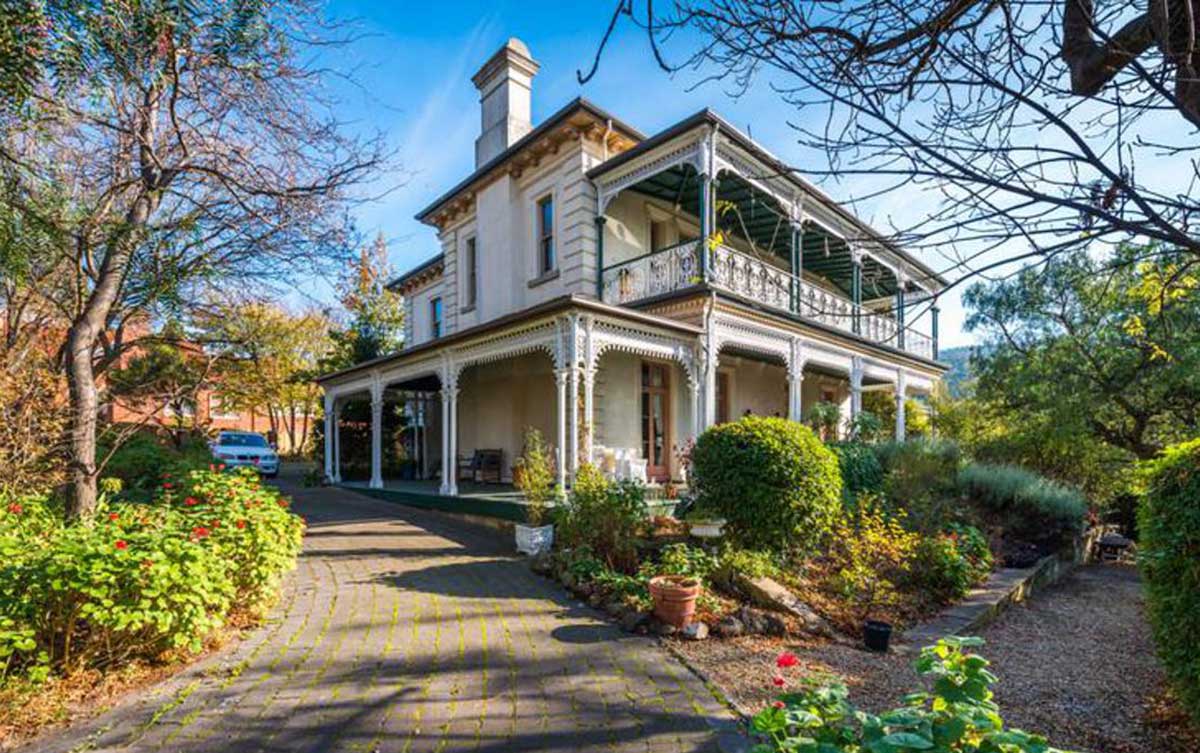
Ashleigh, 289 Davey Street (1887), designed by Henry Hunter for one of Hobart's early Lord Mayors
Major residences continued to be constructed along Davey Street up until World War II. Unfortunately since this period several nineteenth century residences have been lost to fire, major road constructions, and other redevelopments, while a number of the original large allotments have been subdivided into smaller blocks. Nonetheless the street retains a large number of significant gardens and trees that reflect the early Davey Street resident’s preference for European plantings in an attempt to beautify the colony’s native landscape and vegetation. Many of the substantial homes in the precinct dating from the mid-nineteenth century include servant’s quarters and demonstrate Victorian domestic arrangements. Upper Davey Street represented clear social stratification in early Tasmania, with its preserve of wealthy residents and grand mansions, whilst neighbouring South Hobart streets were a stark contrast containing humble workers cottages located nearby to the industries on the Hobart Rivulet.
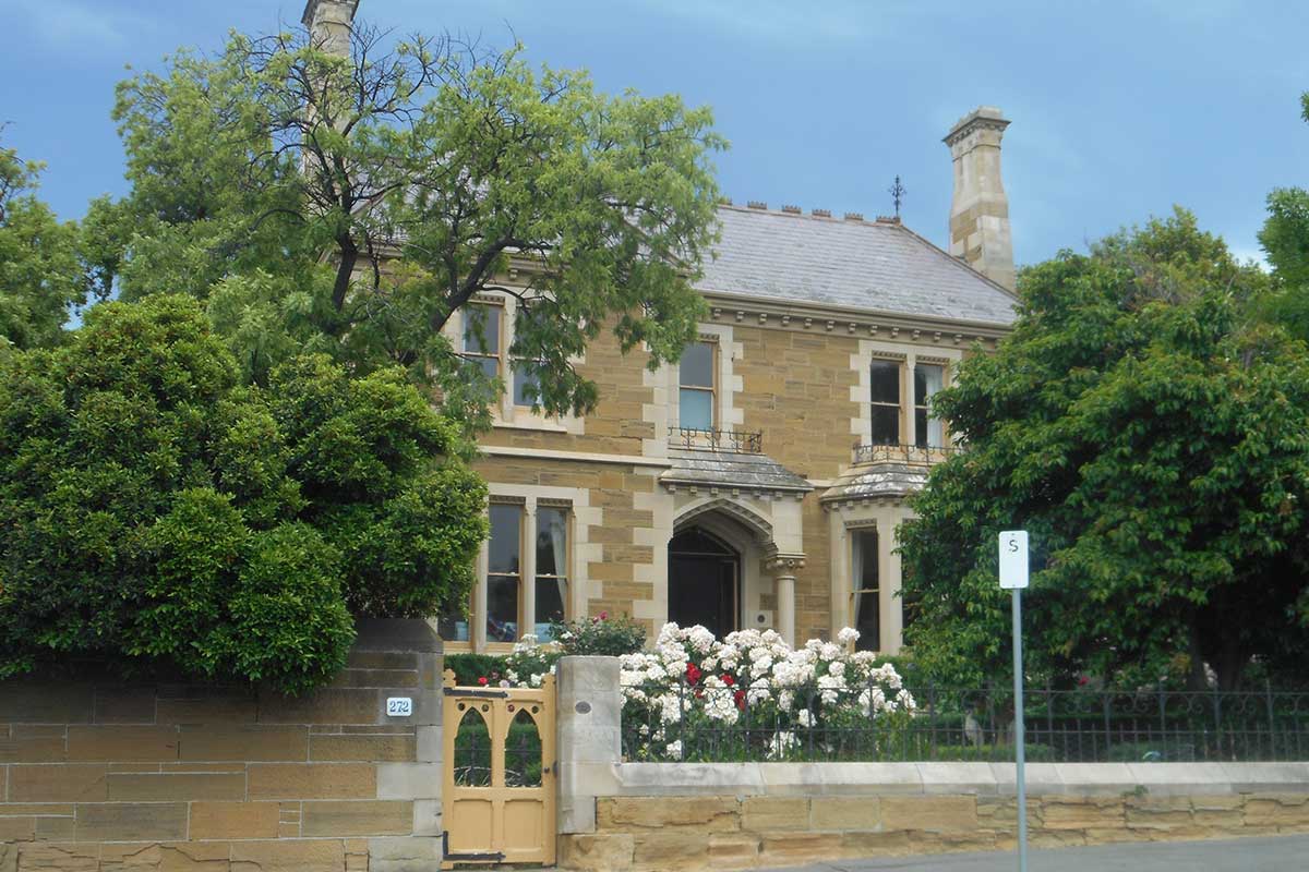
272 Davey Street
The precinct has mostly maintained large lot sizes and many of its early substantial houses. As a result the Upper Davey Street Heritage Precinct presents an almost complete Victorian through to early Twentieth Century streetscape. Davey Street extends from the main spine road of Hobart, and is a main thoroughfare to the heart of South Hobart. Although parts of the precinct now overlook the intrusive Southern Outlet the precinct has retained a separate and unique character from the rest of the South Hobart area. Davey Street is characterised by the substantial size of allotments and housing that has been developed along the ridge reflecting the status of the precinct as the most salubrious and prestigious address in Hobart from early last century.
The precinct demonstrates a range of housing styles and reflects some of the best examples of architectural styles from the 1830s to the 1950s. Styles within the precinct include Victorian Regency, Victorian Georgian, Victorian Italianate, Federation Queen Anne, Federation Arts and Crafts, Inter-War Old English, and Inter-War Art Deco.
There are many buildings of note within the precinct these include buildings designed by prominent colonial architect Henry Hunter include Lebrena (294 Davey Street), Leswalt (Jane Franklin Hall) at 308 Davey Street, Ashleigh (289 Davey Street). Other prominent buildings include Varuna (314 Davey Street), Roseleigh (352 Davey Street), The Priory and Barn (328 Davey Street), The Islington (321 Davey Street), Holebrook (336 Davey Street), and Moretta (344 Davey Street).
South Hobart Heritage Report, prepared for the Hobart City Council

296 Davey Street
296 Davey Street (fornerly Holbrook Place) was built in 1911 by Jam entrepreneur Henry Jones for his daughter, Amelia Jones. It was one of three houses commissioned for her and her sisters in Davey Street, South Hobart, at that time. Amelia rented out the property, and it was for some time the childhood home of Errol Flynn (1909-1959), the Tasmanian born actor who gained fame in Hollywood in the 1930s as the screen's premier swashbuckler. Other places he lived before leaving Hobart were 10 D'Arcy Street, South Hobart and 60 Duke Street, Sandy Bay (1915), appropiately named 'Flynn Cottage'. There is a reserve named after him at Sandy Bay, where he learned to swim. Other places of note include the Theatre Royal, where Flynn appeared in a pantomime, aged five or six, and the State Cinema, where he watched silent films as a teenager.
During Errol’s early childhood it seems likely that his mother was restless, probably lonely and miserable in Hobart, which is why she left Errol with his father (a University Professor of Biology, and fisheries researcher) when the boy was 9. Errol and his father, Theo, returned to Hobart in May 1924 after living in Sydney, and the pair moved into 12 Aberdeen St, Glebe Errol spent a year at Hobart High School before being expelled.
Errol was only 15 when expelled from Hobart High so his education had to continue elsewhere. A boarding school would be best, and Theo turned to a friend in Sydney. The headmaster of North Shore Church of England Grammar, LC Robson agreed to give the ‘Tasmanian Devil’ another chance. Errol became a boarder in the same house as John Gorton, later Prime Minister of Australia. His father’s discovery of the fossil whale received some coverage in Sydney and for a short time Errol basked in the reflected glory.