Cataract Gorge, Launceston
Launceston's own piece of wilderness is just 15 minutes walk from the city centre. Here you'll find walking and hiking trails, the world's longest single span chairlift, swimming pool, restaurant, kiosk, cafe peacocks and wildlife, beautiful gardens, suspension bridge, inclinator for easy access, Interpretation Centre and panoramic lookouts with spectacular views.
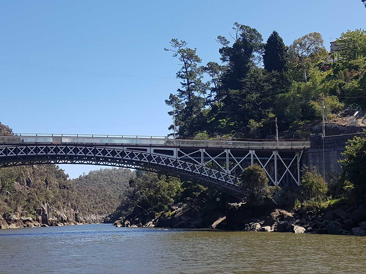
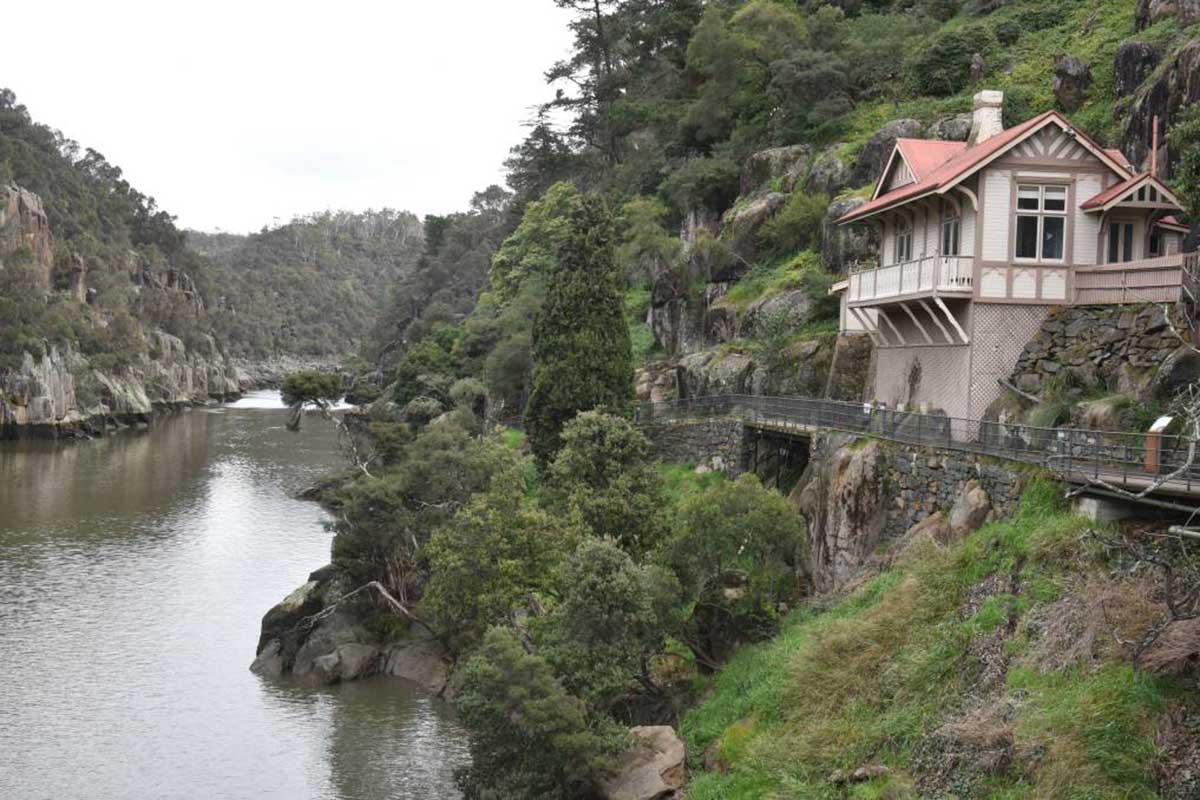
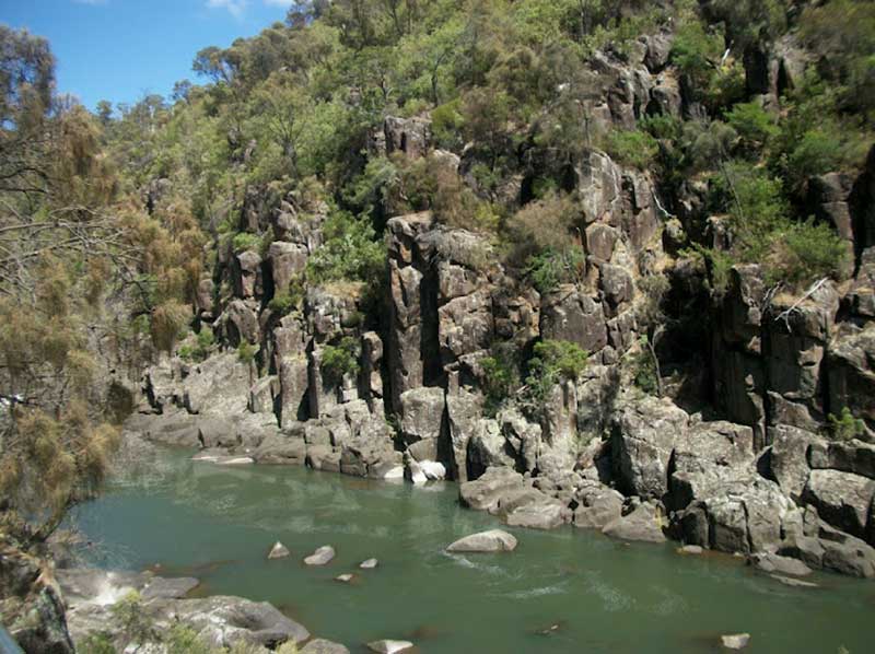
Cataract Gorge Reserve, or "The Gorge" as the locals call it, is a unique natural formation within a two-minute drive of central Launceston - a rare natural phenomenon in any city. In 15 minutes you can walk from the city centre along the banks of the Tamar River into "The Gorge". From here you follow a pathway along the cliff face, originally built in the 1890s, looking down onto the South Esk River. The Kings Bridge over "The Gorge" was floated into place in 1867.
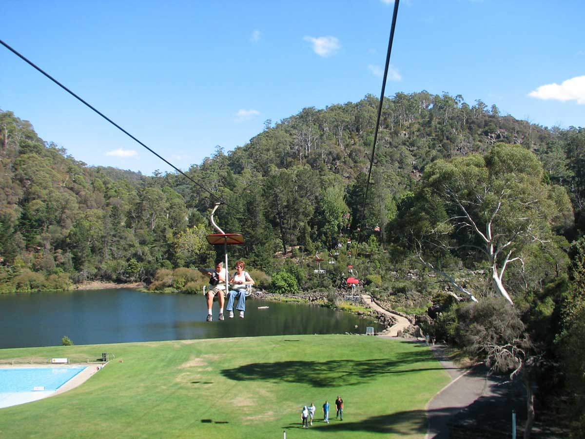
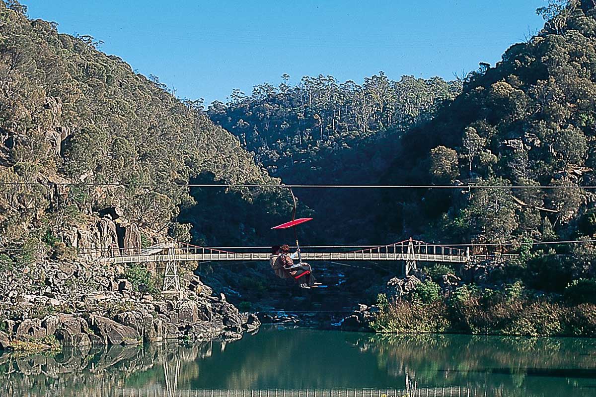
Ride the First Basin Chairlift
For a fabulous view of the First Basin, you can't beat a ride on the chairlift. A ride on the chairlift upon arrival at Cataract Gorge is highly recommended as it provides a bird's eye view of the whole gorge and what it has to offer the visitor. It covers some 457 metres, with terminal buildings at the First Basin (West Launceston) end and idling station at the Cliff Grounds side (Trevallyn).
Built in 1972, the central span of 308 metres is believed to be the longest single chairlift span in the world. Seating is designed for complete safety and includes a safety bar which can be operated by either the passenger or attendant. Don't forget to being your camera along.

The First Basin
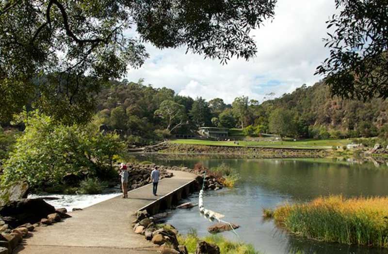
The First Basin, on the southern side, features a swimming pool and an open area surrounded by bushland. In contrast, the shady northern side, named the Cliff Grounds, is a Victorian garden where wilderness is created with ferns and exotic plants - nature is enhanced by art. There's a Restaurant and kiosk, rolling lawns and a rotunda, a pub with a view, a footbridge and chairlift across the river, peacocks in the trees, wallabies at dusk. This may be the nation's most alluring urban reserve.
The basin itself has created many of myths about its depth: some locals say it is a bottomless pit; a volcanic plug; or that a submarine sent in to find its bottom during the 1960s ran out cable before accomplishing this feat. In fact, the basin was formed by erosion at the intersection of two faults - the Basin Road Fault and an un-named fault approximately at right angles which the South Esk is following. Where the two faults meet, the Dolerite rock is badly shattered and hence more easily eroded, giving rise to the formation of the basin. Measurements in 2016 found the maximum depth is 20.5 metres.
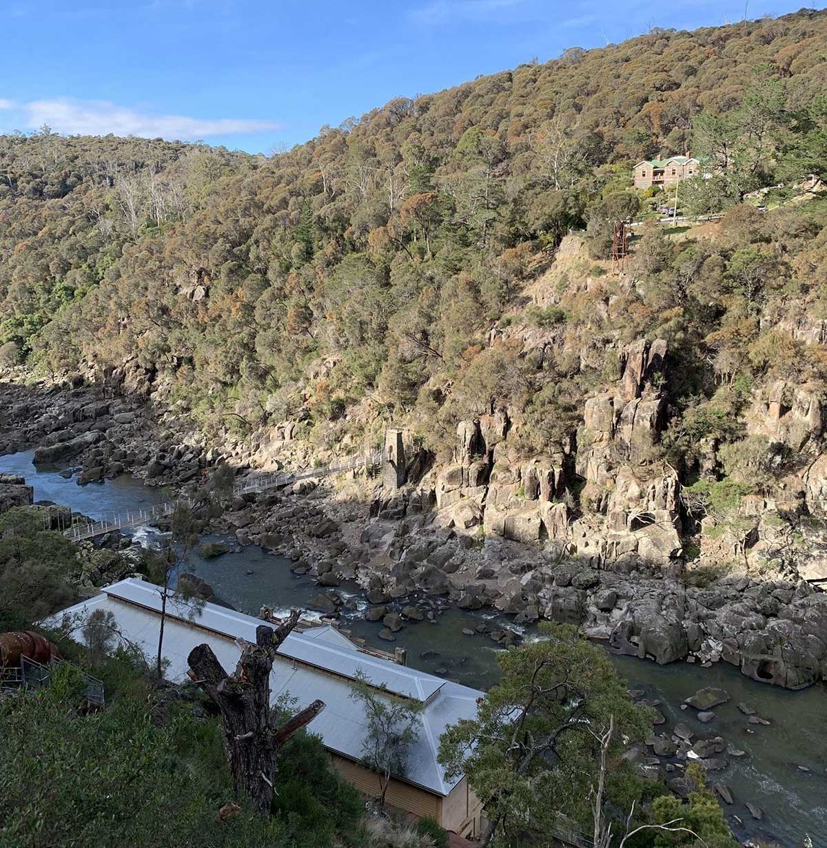
Prior to the development of the Trevallyn Dam there were three lesser basins upstream of the "First Basin", with the second and third still visible on a map, while the fourth is flooded by Lake Trevallyn. Before the Dam was built upstream in the 1950s, flood waters could rise up as high as 12 metres. In the past, there was a power station at Duck Reach, about 2.5 kilometres from a suspension bridge which was built in 1940. It was washed away in the floods of 1929, rebuilt and then decommissioned when the Trevallyn Dam was finished in 1955. The building is now an interpretive museum.
Further upstream from The Basin is the historic Duck Reach Power Station, now an Interpretation Centre. The Launceston City Council originally commissioned the Power Station in 1893, making it the largest hydro-electric scheme of its day. By 1895 it was lighting the city.
At the lower end of the gorge, the South Esk spills into the Tamar River going under King's Bridge and another more modern bridge on the way. The King's Bridge was the only bridge leading north out of the city for nearly 100 years.
Creating Launceston's Cataract Gorge
Though looking calm and serene most of the time, every now and again Cataract Gorge reminds us that it is in fact a a wilderness area that is subject to the fury of Mother Nature at her wildest. As the Gorge is a flood prone area, a weekend of heavy rainfall across northern river catchments can turn the rising waters of the South Esk River into a raging torrent as they squeeze through the narrow Gorge. Before the Trevallyn Dam was built upstream in the 1950s, flood waters could rise up as high as 12 metres. The Duck Reach Power Station was washed away in the floods of 1929, rebuilt and then decommissioned when the Trevallyn Dam was finished in 1955.
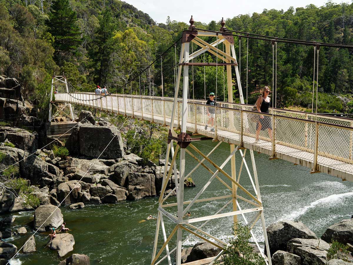
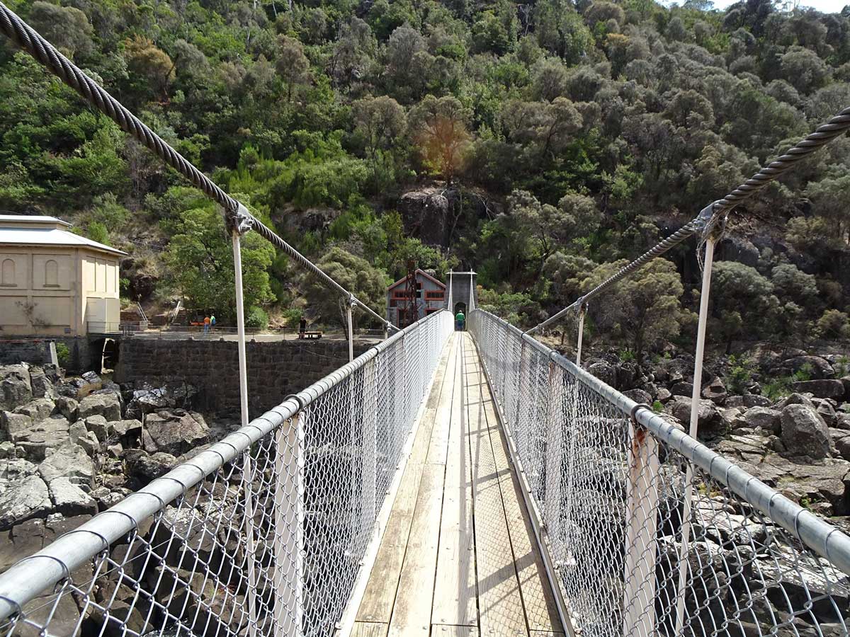
Alexandra Suspension Bridge is located at the First Basin of Cataract Gorge near Launceston. The footbridge above the at-times savage ravine of the South Esk River is the work of Launceston chief engineer Charles St John David. When originally built in 1904 the structure was said to be the best of its kind in the Commonwealth. While being light, it is exceptionally strong, and is so splendidly braced that it vibrates only very slightly. It is of graceful proportions that are appropriate to the surroundings.
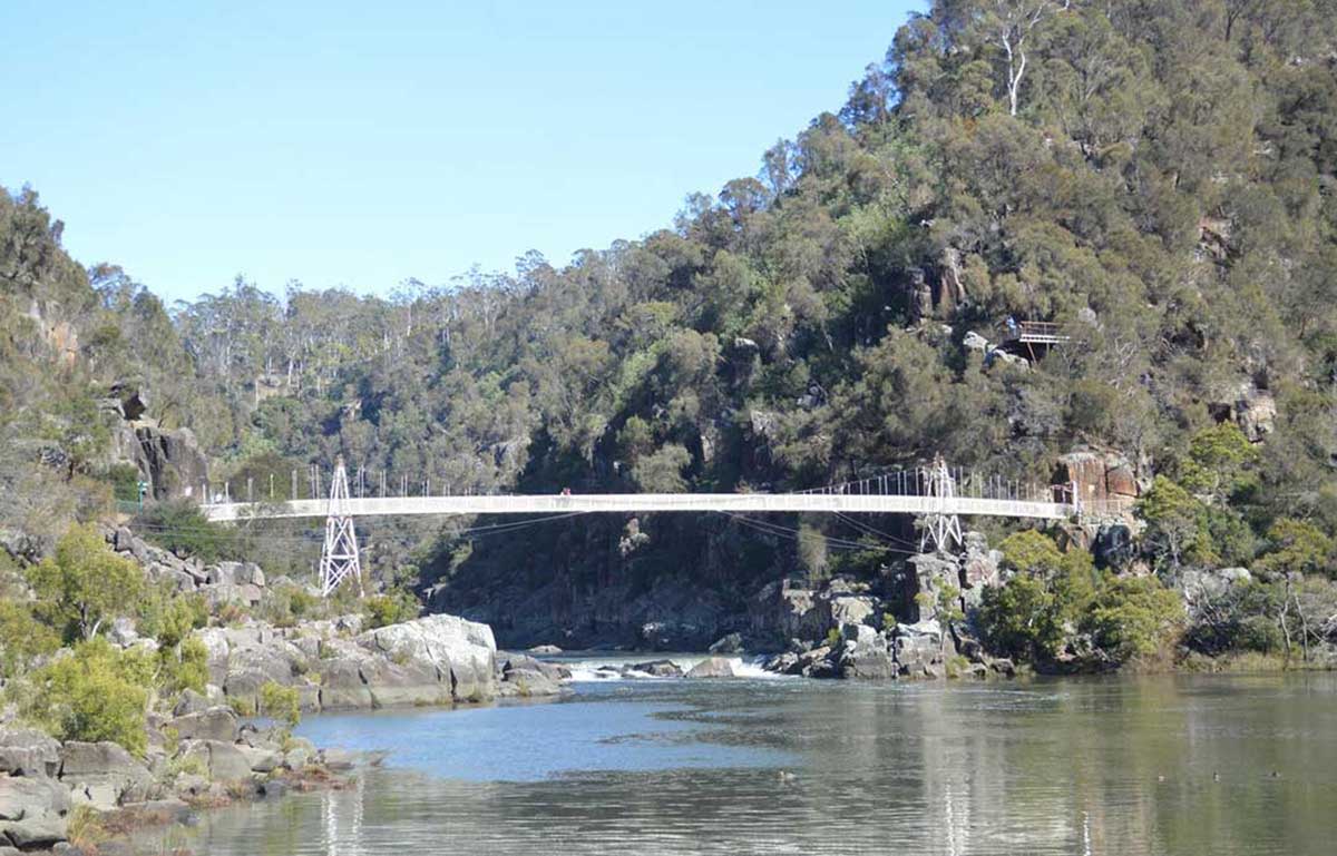
The design is by David St John, the city surveyor, who supervised the work of construction and erection by the contractors, the Salisbury Foundry Company. The cost of the original structure was about £450.
More about the Alexandra Suspension Bridge
Located in the Cliff Grounds Reserve - enjoy Superb Dining in World Class Surrounds. Taste quality Food Showcasing Tasmania's Finest Produce, matched with an award winning wine list and warm friendly service. A Crackling Log Fire sets the atmosphere in the cooler months, with outdoor alfresco dinning in the warmer months. The Gorge Restauranht is very popular, so we recommend you book ahead to avoid disappointment. Phone: (03) 6331 3330
Casual Cafe Dining in World Class Surrounds, Located on the West Launceston side of the Cataract Gorge Reserve Grounds, near the Main Station Chairlift, the cafe is open for Breakfast, Lunch, Morning and Afternoon Tea from 8am onwards seven days a week. Also open nights on request for private Functions and Weddings. The Basin Cafe also has a fully stocked Souvenir Shop. Phone: (03) 6331 5222
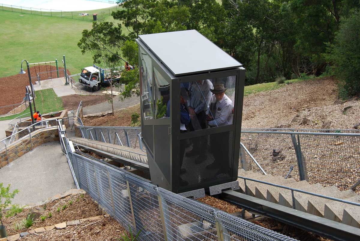
The Inclinator
Launceston's Cataract Gorge has recently added a new perestrian Inclinator and main entrance. The inclinator is a mechanised people mover consisting of a glass-lined compartment, similar to a cable car, resting on twin rails set into the ground.
Cataract Gorge Website
Gorge Walks
Cataract Walk
Distance: 1km one way. Grade Easy – Flat or gentle incline.
Surface type: Sealed/boardwalk/wheelchair accessible with assistance
Linking Kings Bridge to the beautiful Victorian gardens of the historically significant Cataract Gorge Cliff Grounds, this walk runs along the cliff face providing superb views of the dolerite columns and South Esk River.

Distance: 1km one way. Grade Hard – Steep and challenging.
Surface type: Dirt
An historic trail that links the Kings Bridge to the First Basin, with a series of zig–zags that climb high above the Cataract Gorge Reserve. Popular with runners, this trail has been described as ‘testing the lungs of travellers’, but the views from the track are well worth the effort.
Distance: 900m loop. Grade Easy – Flat or gentle incline.
Surface type: Sealed/boardwalk/gravel
This trail will enable you to discover the First Basin with the chairlift overhead, taking in views of the river, basin lawns, gardens and swimming pool.
Distance: 2km one way. Grade Hard – Steep and challenging.
Surface type: Gravel/dirt
For a greater challenge on your return journey from the Duck Reach Trail, test your hiking skills by heading up the hill on the stairs at the Duck Reach Power Station. The stairs lead to the Reedy Gully and Snake Gully Tracks which link to the Trevallyn Nature Reserve tracks
Distance: 2km one way. Grade Moderate – Sloping incline.
Surface type: Gravel/dirt
Take the Duck Reach Trail from the First Basin to the historic Duck Reach Power Station. This trail passes the Sentinel Lookout, a place to enjoy the tranquillity of the South Esk River and serenity of the Reserve.
Duck Reach Power Station
Duck Reach Power Scheme (1895-1955) was part of a hydro-electric scheme on the South Esk River built by Launceston City Council to light the city streets. It was the first publicly owned hydro-electric plant in the Southern Hemisphere, The penstock ran diagonally down the hill into the centre of the rear of the power station where it channeled in to successively smaller pipes and finally to eight Siemens turbines. The tunnel was drilled to a length of 850 metres at a 1 to 110 grade. The tunnel was cut through the hill side instead of being piped around and it took 16 months to complete using pneumatic drills.
Duck Reach Power Station was replaced by Trevallyn Power Station in 1955. Trevallyn Power Station is on the Tamar River north of Launceston. It has four Francis turbines, with a combined generating capacity of 90 MW of electricity. It uses water diverted from the South Esk River by the Trevallyn Dam. Trevallyn and Poatina are the only hydroelectric power stations currently located in the drainage basin of the South Esk River. Trevallyn Power Station was commissioned in 1955, replacing the Duck Reach Power Station.
Duck Reach Power Station: More information