Derwent Bridge, Tasmania

Though it is a very small dot on the map, and a tiny community in Tasmania's Central Highlands where Lyell Highway crosses the River Derwent, Derwent Bridge is the gateway both to Wild Rivers National Park and Lake St Clair (5 km).
You'll find Derwent Bridge on the Lyell Highway at the southern edge of the Cradle Mountain-Lake St Clair National Park, midway between Hobart and Queenstown. It is just south of Lake St Clair and the Lake St Clair visitor centre; and it is north of Lake King William and the Butlers Gorge Power Station. The Derwent Bridge Wilderness Hotel is at the hub of community activities in the small settlement.
Derwent Bridge Wilderness Hotel Website
Walking Trails
There are several short walking trails that can be taken at the southern end of Lake St Clair, ranging from 30-40 minutes lakeside to a 7 hour round trip to Mt. Rufus.

Lake St Clair Short Walks (Cradle Mountain-Lake St Clair National Park)
A combination of three shorter trails, the Lake St Clair Short Walks combine the last stretch of the Overland to Riversmeet, the Platypus Bay Loop and the Larmairremener tabelti in a figure 8 loop. Featuring pleasant forest walking, highlights include the view at Riversmeet, the platypus hide along Lake St Clair and the beautiful section along the Hugel River. Recommended as an easy option for walking in the Lake St Clair area.
Walking Track Notes
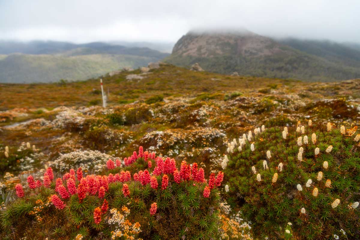
Mt. Rufus Circuit (19 km)
The walking track climbs up from Lake St Clair to Mt Rufus, which provides sweeping views over Lake St Clair, Mt Olympus, Frenchmans Cap and the headwaters of the Franklin River. You can return the same way, or do a circuit which takes you back past Shadow Lake (a large alpine tarn). Incredible displays of flowering heath (scoparia) in summer. A well marked track with boardwalks in sections.
Walking Track Notes

The Wall In The Wilderness
The Wall In The Wilderness, situated just outside Derwent Bridge, is Australia's most ambitious art project undertaken in recent years. Creator/designer, Greg Duncan has carved the history of the highlands in 100 metres of timber, most of which will be in our rare Huon Pine. The beautifully carved works set out in relief sculpture depict the history, hardship and perseverance of the people in the Central Highlands and pay homage to the individuals who settled and protected the area.
Duncan is already known for the uncanny realism he brings to his work and his pieces are sought after by collectors around the world. Each metre of the panels, including horses, thylacines and foresters represents a month's work. There is nothing like this anywhere else in Australia. The Wall is a world-class experience.
Opening Times: Daily. September to April: 0900 - 1700. May to August: 0900 - 1600. Closed Christmas Day, Good Friday and from 6 - 19 August.
Beyond Derwent Bridge
Derwent Bridge is the last inhabited location before Linda Valley in the West Coast Range. After Derwent Bridge, Lyell Highway winds for 56 kilometres through the heart of the Wild Rivers National Park, which lies in the heart of the Franklin - Gordon Rivers Tasmanian Wilderness World Heritage Area. It is a region of dramatic mountain peaks, beautiful rainforest, deep river valleys and spectacular gorges.
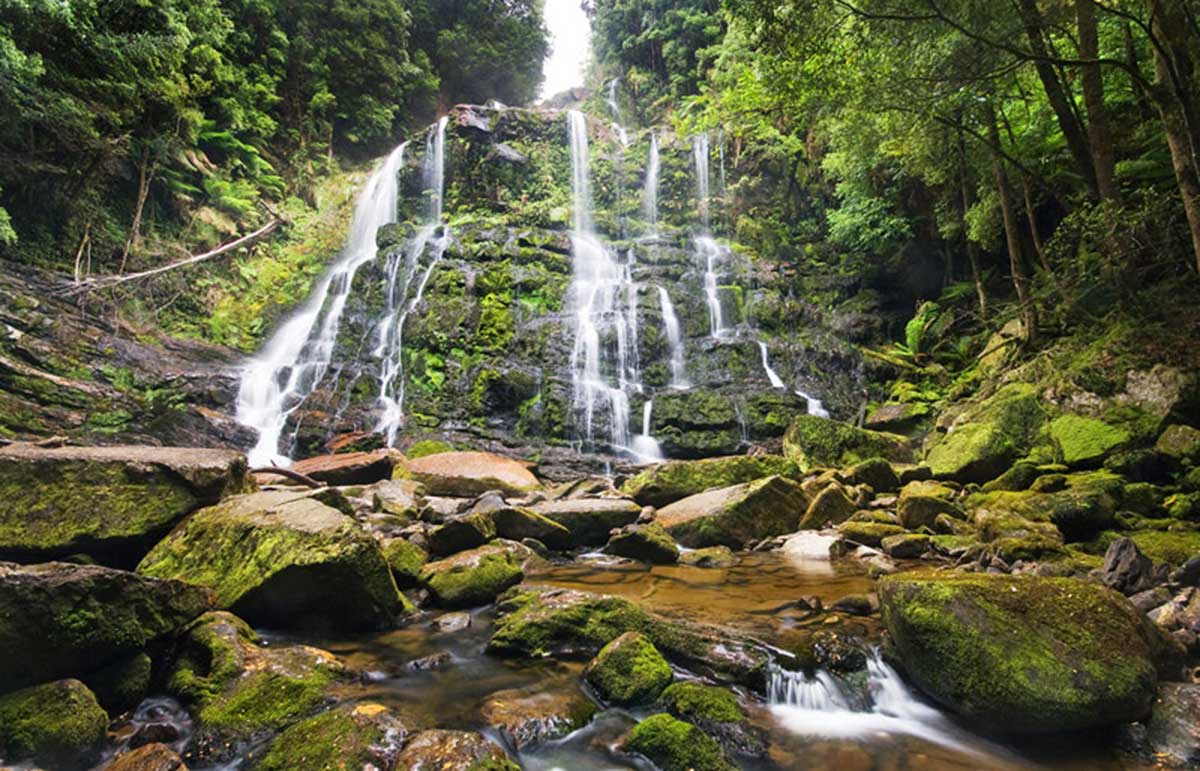
Nelson Falls
There are several short walks and picnic stops along the way that will allow you to discover the grandeur and beauty of the Wild Rivers region. One of these is a short walk to Nelson Falls provides a welcome break from what can be a tedious drive through the mountains, depending on the weather conditions and traffic.

Donaghys Hill lookout
You’ll want to take your camera on the wonderful walk toDonaghys Hill lookout in the Franklin-Gordon Wild Rivers National Park. Located on the Lyell Highway (A10) between the Franklin and Collingwood rivers, apart from being a great leg stretch for those driving the Lyell Highway between Derwent Bridge and Queenstown, this walk offers superb wilderness views. The 1.1km one-way track climbs gradually through forest and scrub to a high lookout perched on rocky Donaghys Hill. From there, in clear weather, you can look down into the Franklin River valley and out to the impressive Frenchmans Cap and its neighbouring peaks. Return via the same track.
Walking Track Notes