Magnet, Tasmania
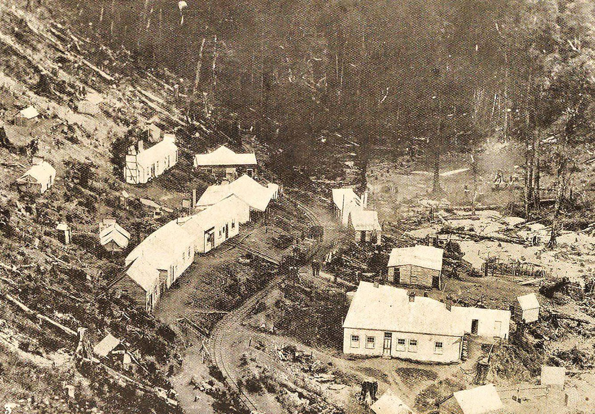
Magnet township
The Magnet Mine
Mount Magnet silver mine, also known as the Magnet Silver Mining Company operated between 1902 and 1941. The former locality and mine site that supported the mine in the years of its operation lies about 20 km out of Waratah.
In the 1890s the operation was mined by the Mount Magnet Silver-Lead Mine name, and this continued after the 1902 company started. The discovery of the deposit was in 1881, but the ground was not worked until 1890. The 10 mile long Magnet Tramway commenced in 1902. It was walking distance from Waratah. The mine was ranked third after Bischoff and Mount Lyell in the 1920s in its success and production. The mine company went into liquidation in 1932, but operated until 1941.

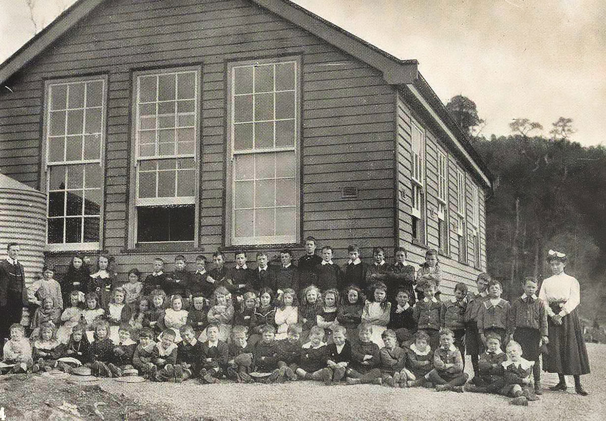
Magnet School, c1912
The old Magnet mine is located six kilometres directly west of the town of Waratah, although access is by a somewhat circuitous route. The mine has been intermittently worked for silver, lead and zinc for many years, and more recently for specimen minerals. The site is reached by traversing an unsealed road (the Magnet Road) leading off the sealed Waratah Road opposite Whyte Hill (on which a Telstra tower has been erected). This junction is approximately 12 km west of Waratah. The track is steep and badly eroded and is best restricted to 4WD vehicles.
The Trail begins 1.75km west of Waratah and traverses lush rainforest on its way to the Magnet mine site. The mine site has relics to explore and good places to camp. You can create a circular route using local roads, particularly if cycling. A great walk if you have the time and energy.
Distance: 16km.
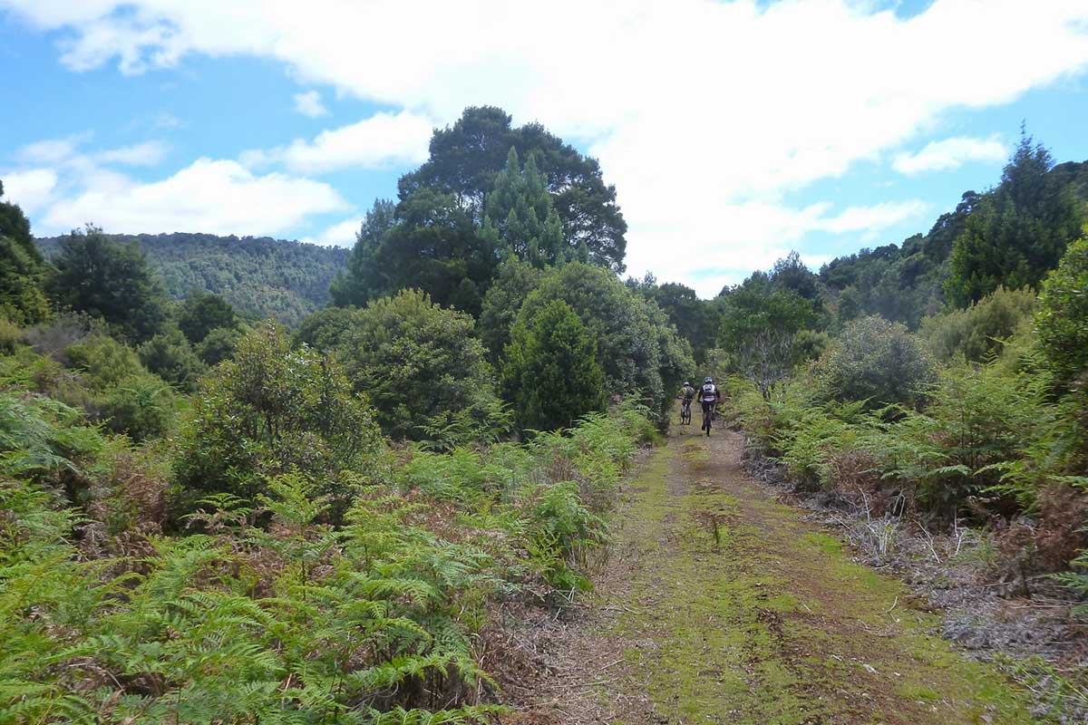
Magnet Mine Trail
The area around the old Magnet mine is today a recognised fossicking area. The main collecting area is the ferromanganese gossan, which is located above the ruins of the old mill beside the access road (at AMG reference 370 100 mE, 5 410 650 mN). The collecting point is reached after travelling approximately 3 km along the unsealed road and passing through a gravel pit. The main collecting area is the ferromanganese gossan, which is located above the ruins of the old mill beside the access road. The collecting point is reached after travelling approximately 3 km along the unsealed road and passing through a gravel pit. The Magnet Road continues back to Waratah, but is almost impassable due to washouts.
Magnet's only life line was its unique winding 10 mile rail track. The construction project was overseen by Mr. B.F. Waller who was employed as the engineer-in-charge (and General Manager) who took up the task in January 1901. Prior to this a route had been roughly surveyed by former mine manager Mr TH Jones. 2 routes had been considered, but the shorter one through gently sloping (sideling) country, requiring several shallow cuttings was chosen and the reasoning behind this was explained to the Board by Waller in January 1901. The line was established to connect into EBR’s newly constructed siding 1.5 miles north of Waratah thereby allowing ore to be carted to the Port of Burnie for shipment or Zeehan Smelters for processing. Apart from the two mining operations running out of Mt. Lyell, no other company had undertaken the arduous task of connecting its mine into an existing rail system.
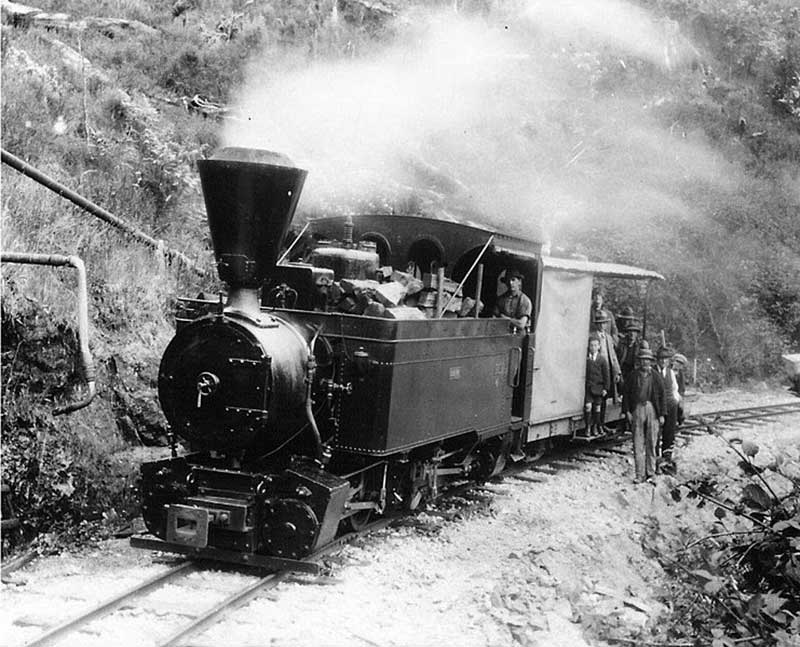
Magnet Tramway, early 1900s
The tiny 2ft. gauge track was carved through some of the wildest territory that had ever seen rails. The lightweight 30lb.per yard rails sat on a total of 22,000 sleepers, many of which were Huon Pine. Although it’s final destination was just a mere 4 miles as the crow flies from the junction at Waratah, its final length was 10 miles, and had a combined total of 194 curves and snaked back on itself in several sections so as to reduce the incline, as its termination was almost 600ft. below its starting point. The initial 8 miles of the track have a fall of 100ft per mile and the final 2 miles are a slight climb.
A feature of the line, and one of Magnets current untapped features is the magnificent scenery, which according to one commentator of the day was equal to, if not better than The Cataract Gorge in Launceston. Most of the line is hugging the side of a Gorge, where Myrtle, Leatherwood, Celery Top Pines, Sassafras and man ferns are in abundance. 250 ft below the Arthur River can be seen in places its it glistens its way over rocks on its path through the valley.
More