
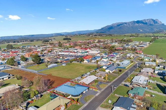
Deloraine, Tasmania
Deloraine's resident population of around 2,000 swells by 30,000 when Australia's biggest working craft fair comes to town every November. Held over four days, more than 200 exhibitors show everything from kites to candle wicks, kaleidoscopes to fine silkscreen paintings, woodcarvings, lead lights and hand-blown glassware.

If you can't make it to Deloraine in November, don't let that deter you from coming any time of the year as Deloraine is a major centre for arts and crafts in Northern Tasmania. Wander around and you'll come across many galleries, craft shops and antique stores displaying mainly the works by local artists. Among our favourites are Art as Mania, Bush Rabbit and The Alpaca Shoppe.
Where Is it?: Deloraine is 53 km south east of Devonport and 51 km west of Launceston on Bass Highway in the valley of the Meander River.
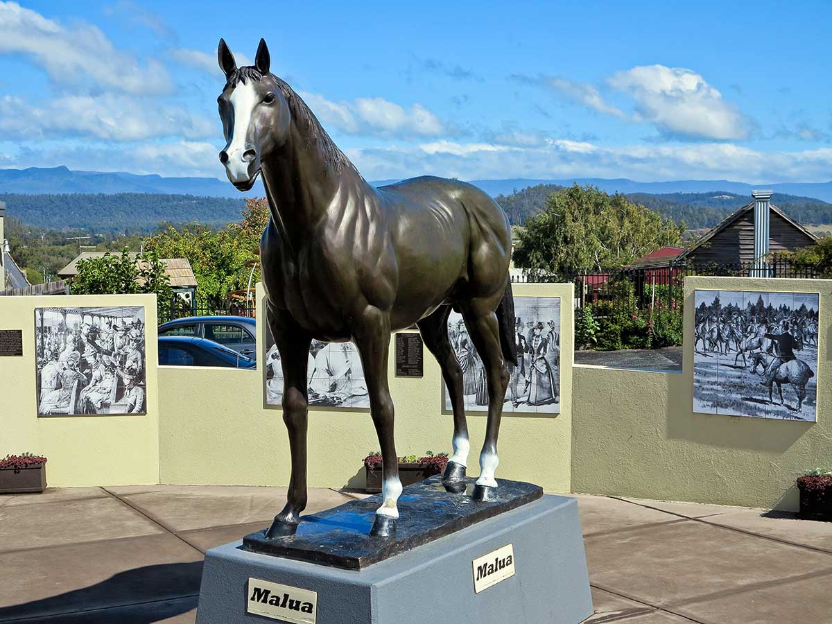
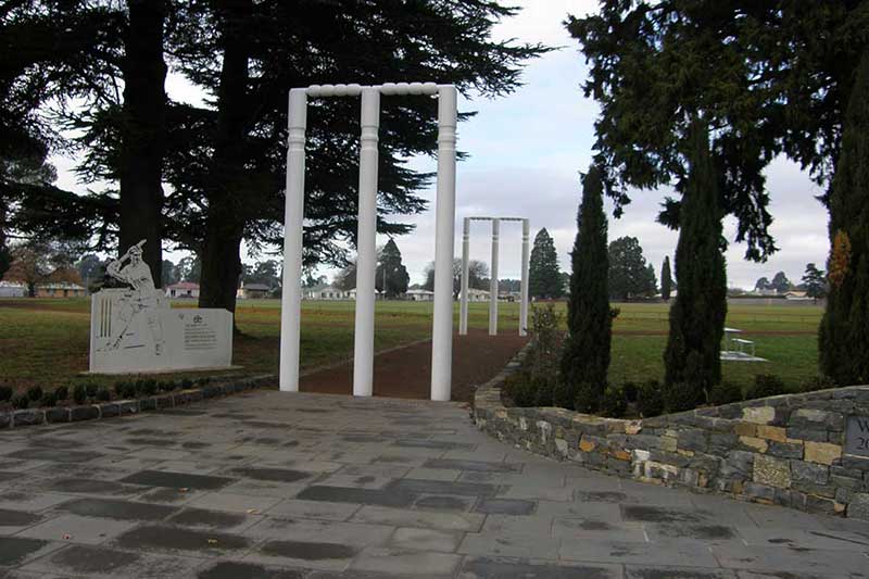
The Malua Memorial, commemorates the winner of the Melbourne Cup in 1884. Malua was bred at the famous Calstock stud property at Deloraine in Tasmania in 1879. The memorial features a life size bronze statue of Malua as well as a series of photos behind the statue commemorating the racehorse. In 1884 Malua not won the Melbourne Cup but also the nation's top sprint races, the Newmarket Handicap and the Oakleigh Plate against the best sprinters in the land. A few months later he won Australia's richest stayer's race of the time , the Adelaide Cup, and then capped it off by winning that year's prestigious Melbourne Cup against the nation's best stayers.
He was retired to a very successful stud career, but in 1886 he was brought back to the track to win the Australian Cup. In 1888 he came out of retirement again, and, ridden by his owner he won the stayer's Australian Grand National Hurdle against the best jumpers of the time. No other horse has ever come near to Malua's amazing record and he is always always known as “Australia's Most Versatile Champion.”
Great Western Tiers Sculpture Trail
These works from 15 different artists are located beside the river in Deloraine (7 works of art) and in the surrounding countryside. Most are located on the road from Deloraine through Mole Creek and on to Mayberry and Lake Mackenzie. The brochure provides detailed information about the artists and descriptions of what they were trying to express with the sculptures.
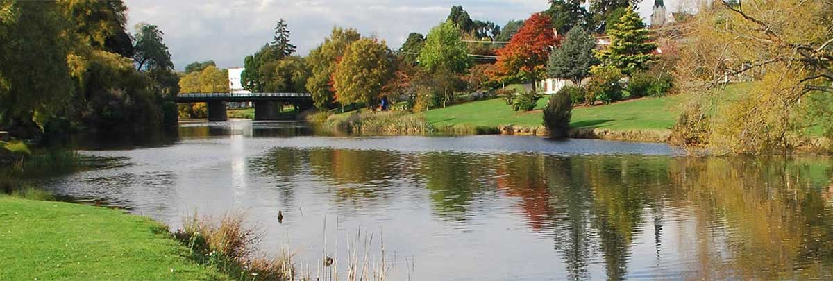
Meander Riverside Walk
The 45 minute walk starts beside the Meander River downstream from the bridge where the weir was built to drive the wheel inside the historic Electric Power Station. The circuit takes you over two suspension bridges. The walk also features a series of significant sculptures along both banks and the Kooparoona Niara Cultural Trail follows the same path, so you will learn about the rich local indigenous culture as you follow the trail.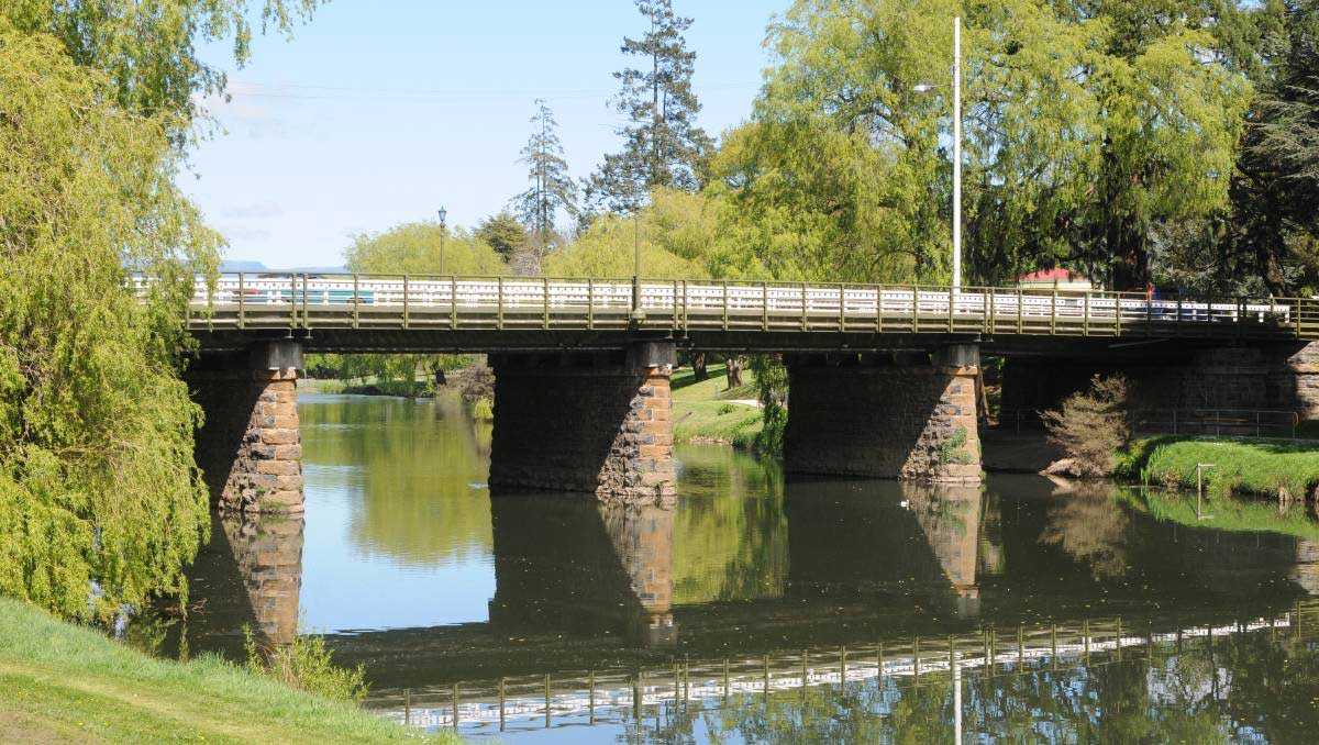
The first bridge across the river was built by convicts in 1831. It was destroyed by a flood in 1844 but quickly replaced by another bridge built by convicts. The second bridge was replaced in 1877 and part of that bridge - the stone piers which can be seen from the parks on either side - still stand today. Although this bridge does not form part of this link, it was constructed as part of the second stage of the line - to Devonport, 1885 - and is at the western extremity of the original line.
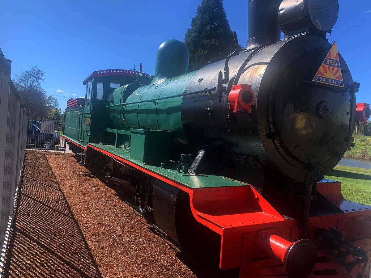
Beside the river park is the E Class No. 1 locomotive which commemorates the opening of the Launceston to Deloraine railway on 10 February, 1871. It was the first railway in Tasmania - unless you class the human driven tramway at Port Arthur as a railway. If your in town early morning or late afternoon, you may see a goods train passing through Deloraine on its way to Devonport or Burnie. The bridge carries a single track railway.
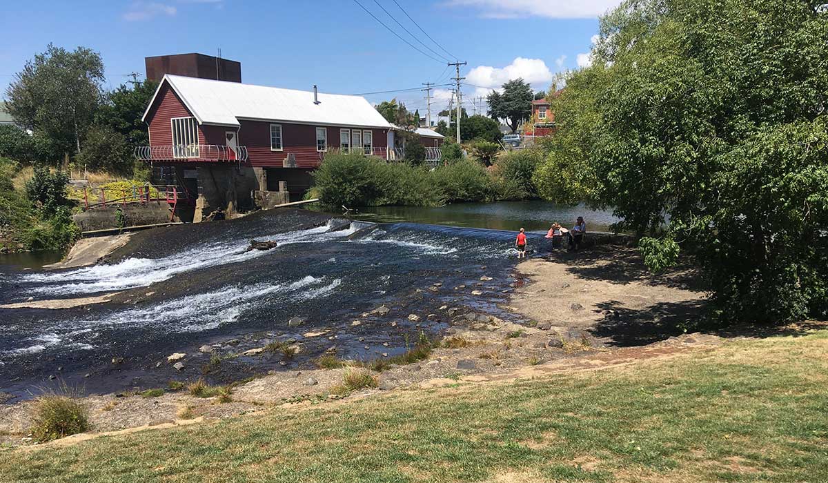
The Power Station, on the opposite bank to the park, is claimed to be the oldest existing hydro-generating plant built and operated by a local authority in Tasmania, and a rare survivor of its type in Australia made additionally significant by the survival of one of the turbines. Built in 1907, it housed two turbines, a 19 H.P. Gunter and a 45" Samson. The concrete weir across the river, and a diverting channel under a portion of the building, were all part of the complex.

41 ̊ SOUTH SALMON & GINSENG
Free tastings, café meals available all day, outdoor dining and self-guided walks. Open 7 days.
23 Montana Rd, Deloraine/Red Hills 7304
Ph: (03) 6362 4130
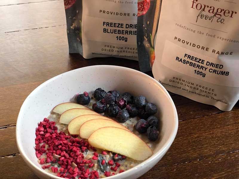
FORAGER FOODS CO
World class innovator of freeze dried 100% Tasmanian Crunchy Dried Apple Wedges, berries and other fruits. Free tasting, Mon-Fri.
95 Montana Rd, Red Hills TAS 7304
Ph: (03) 6362 3989

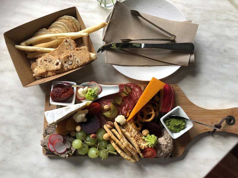
THREE WILLOWS VINEYARD
Boutique cool climate family owned & operated single estate vineyard, cellar door & luxe self-contained B&B. Open weekends 12:30pm till 4:30pm for tastings of wine & gin, cellar door sales, quality local cheese plates, artisan tea & coffee.
46 Montana Rd, Red Hills TAS 7304
Ph: 0431 645 153
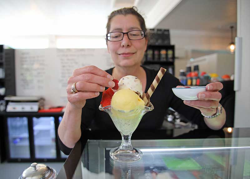
DIXIE BLUE GELATO CAFE
Artisan Gelato made on premises daily using local produce from the Meander Valley. Various varieties avaliable including Vegan options. Open 10am - 6pm. Full lunch menu available.
8 East Parade, Deloraine
Ph: (03) (03) 6362 1137
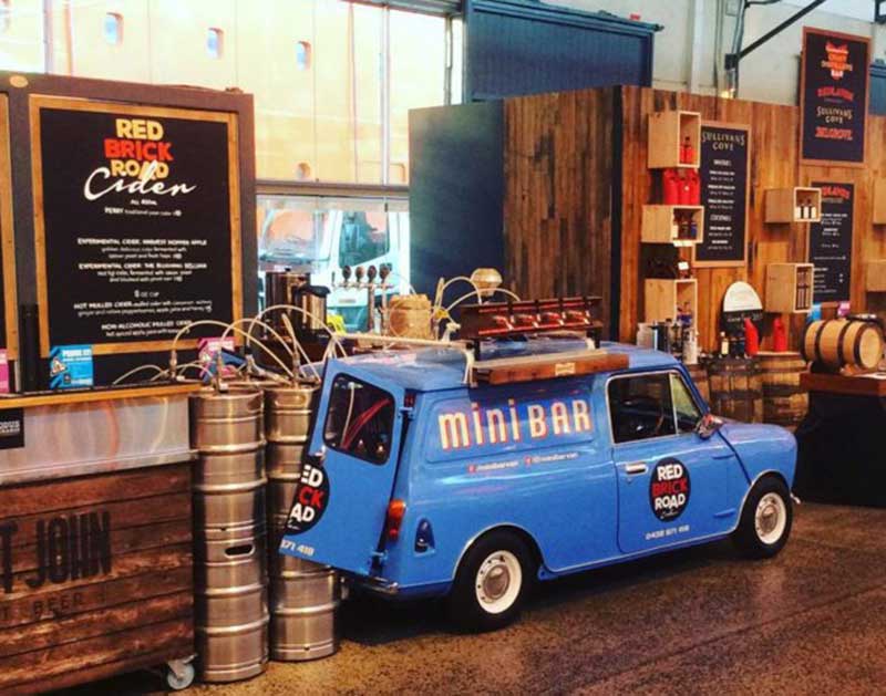
RED BRICK ROAD CIDER
The Ciderworks is a new cidermaking facility and cellar door in Red Brick Road Cider's hometown of Deloraine. Guests are invited to hang out and have a drink, listen to the vinyl, play a board game or meet friends.
30 East Parade, Deloraine, 7304 Ph: 0438 671 418
Hagley
HAZELBRAE AT HAGLEY
Australia’s largest Hazelnut producer, with hazelnut inspired lunch and dessert options available from Hazelbrae House. Restaurant specialities include hazelnut shortbread, hazelnut cappuccino and a chef prepared menu, filled with delicious produce from Northern Tasmania.
127 Hagley Station Lane, Hagley 7292
Ph: 0438 506 988

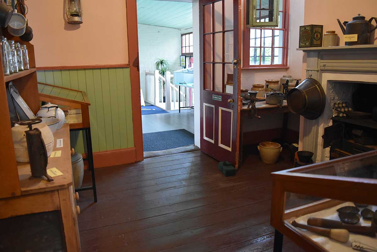
Deloraine and District Folk Museum
The Deloraine and District Folk Museum is housed in a building dating from 1856. It was opened as the Family and Commercial Inn in 1864. Today it reflects the life of the country publican and his family. Housed in the extensive garden is a Pioneer Walk where you can view reproduction and reclaimed heritage buildings showcasing the lives, tools and farming equipment of early settlers. A new exhibition about chair maker, Jimmy Possum, is now open. Who was Jimmy Possum? Come along and learn about this Deloraine mystery. 98-100 Emu Bay Road, Deloraine.
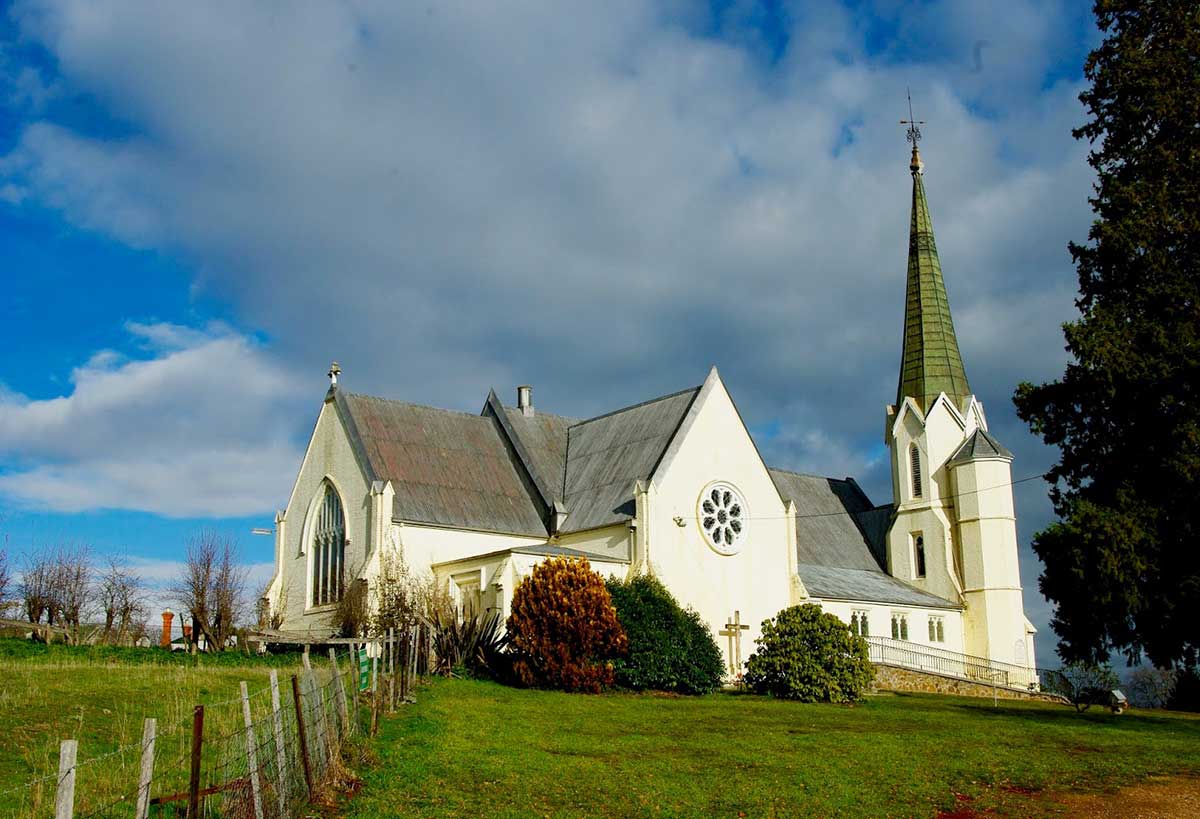
St Mark's Anglican Church
St Mark's Anglican Church is a fine Gothic Revival brick church designed by W.A. Clayton. The church with its tall spire and hilltop location, dominates the settlement of Deloraine in the best English tradition. The main portion of the church was dedicated in March 1859 and consecrated in March 1860 while the chancel and sanctuary were added in 1878. Its three level octagonal tower with gable top to each face is surmounted by a spire. The church features a rose window to the transept, fine north and south windows with tracery and label moulds and blanked arches to the west facade. Location: St Mark's Anglican Church, 7 East Westbury Place, Deloraine.
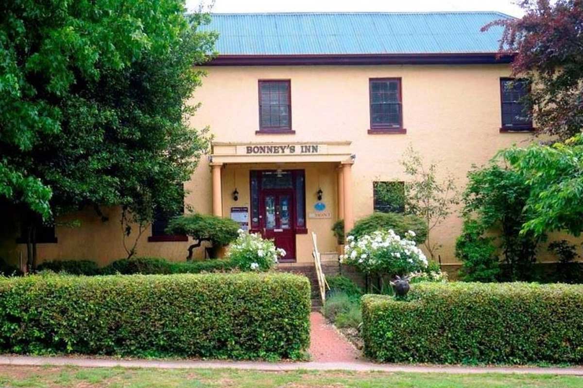
Bonney's Inn
Bonney's Inn was established in 1831 and is the town's oldest building. It is one of Tasmania's most famous early wayside inns and was built as a coaching inn by John Bonney, the son of a convict. The bricks, but not the actual building, were constructed by convicts. Bonney designed the building along the lines of the coaching inns in England. It has walls which are nearly 50 cm thick, cedar mantelpieces and panelled walls. It has changed hands a number of times being, at various points in its history, a Temperance Hotel, a coffee palace, flats, and historic accommodation. It currently offers upmarket bed and breakfast accommodation. 19 West Parade, Deloraine.
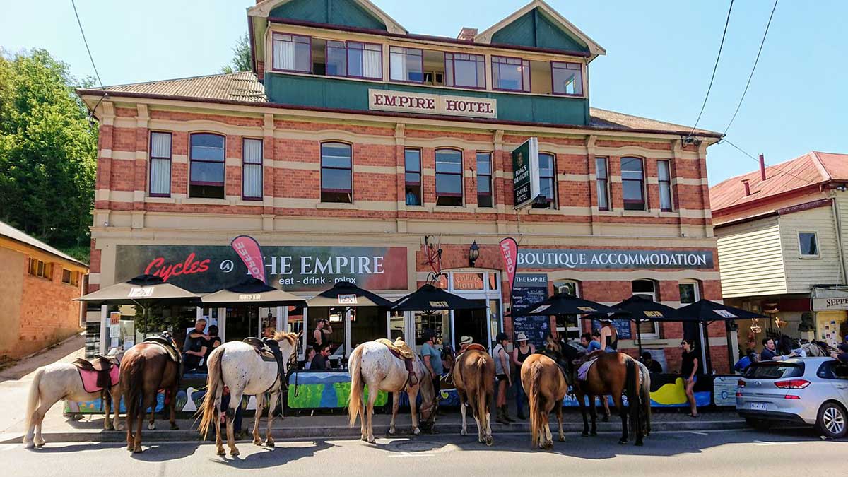
The Empire Hotel
The Empire was built circa 1900 by Septimus Woodbury. At the time it was the tallest building in Deloraine – and it still is! It was originally built as a tourist hotel, providing stables and agistment for people making the trek from Launceston to the Mole Creek Caves by horse. In 1917 the front corner of the Hotel was occupied by Fowler’s Cycleworks – local lads who built quality push bikes. There are still Fowlers living in town today.
Over the years The Empire was often regarded as the place in town that welcomed outsiders. During the late seventies and into the early days of the forest wars The Empire was the watering hole and gathering place for the hippies. Many stayed on to make Deloraine the vibrant artistic community that it is today.
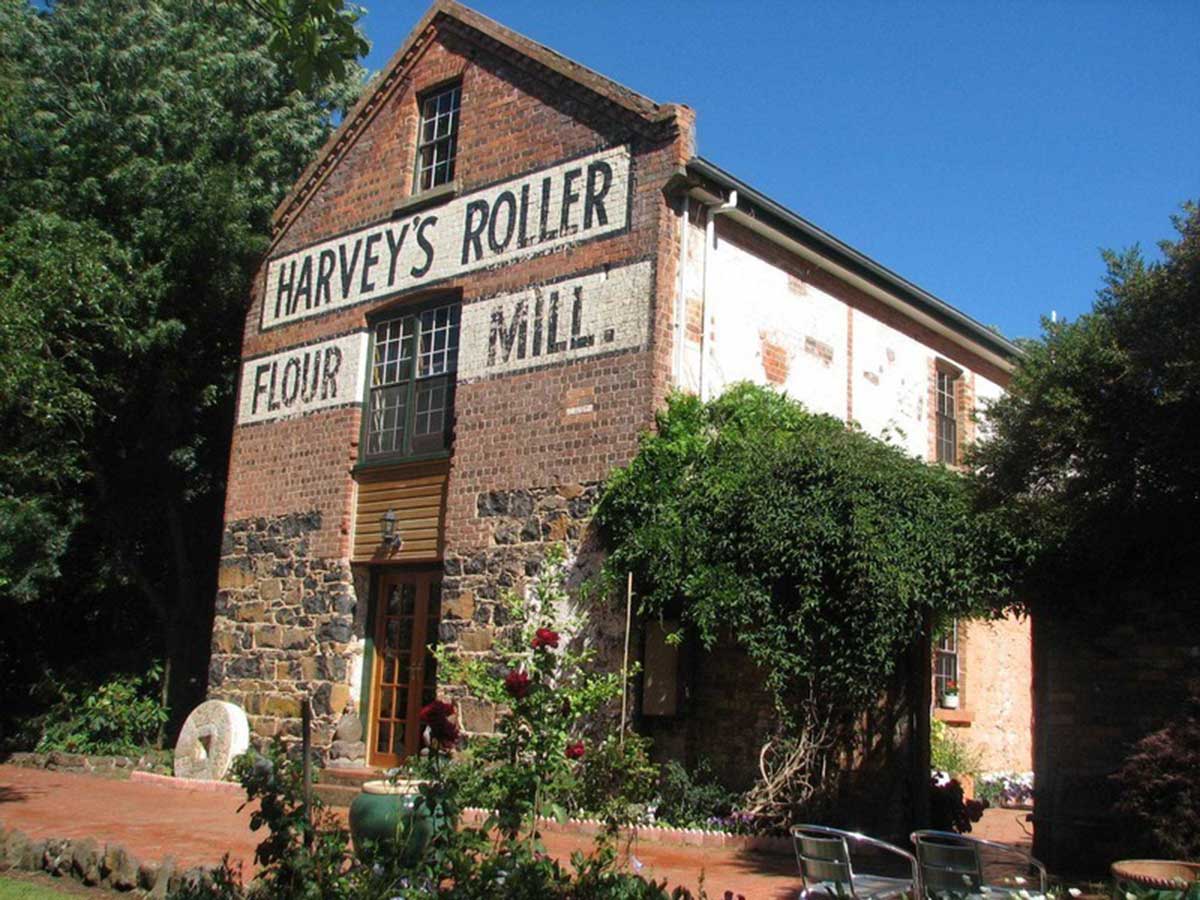
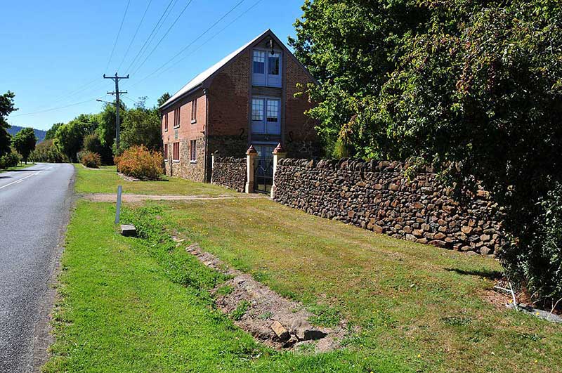
Harveys Roller Mill
1860 - Harvey's Mill which was built in the 1850s by Samuel Shorey. The mill once produced flour, oatmeal and rolled oats. It is now a private dwelling. Occupying a fine site adjacent to the Meander River, the mill complex consists of a two storey steam-driven mill and a two storey transitional Georgian house.The consistent use of stone and brick to different levels in both buildings is unusual. Leavel one of the mill features irregular bluestone blocks laid to courses. The wood supports were pit sawn and one foot (30 cm) square. 7 Westbury Place, Deloraine.
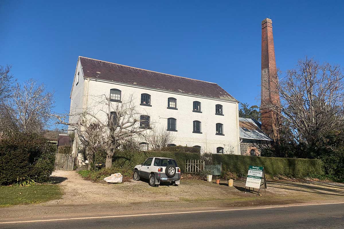
Bowerbank Mill and Gallery
A three storey Georgian stone mill with single storey annex and brick chimney. The building is intact and in good condition. The tall brick chimney, and its location close to the road, give the building landmark qualities. The Mill was designed in 1853 by William Archer, Van Diemen's Land's first native-born architect. It was originally powered by a water wheel but in 1870 it was converted to steam when a boiler room and chimney stack were added. Today it is an art gallery which offers accommodation. Location: 4455 Bass Highway, 2km east of Deloraine.
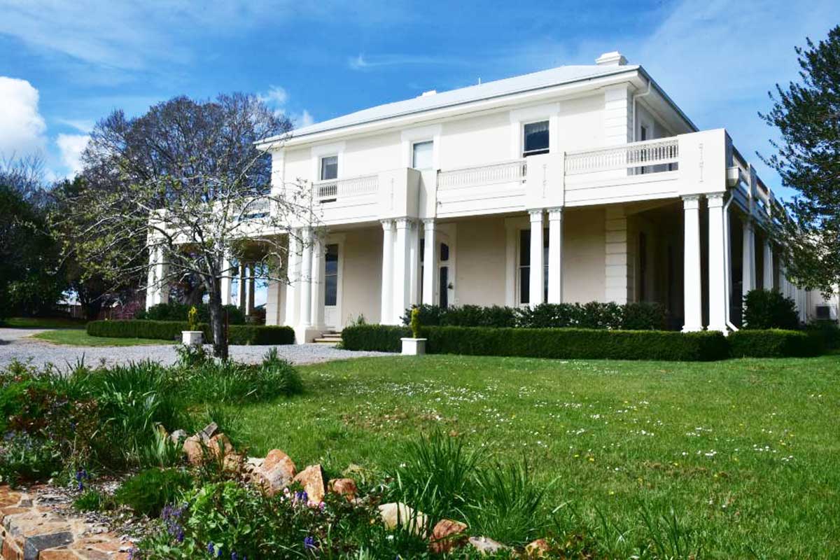
Calstock
A heritage-listed 10-bedroom Georgian mansion,construction commenced about 1830 by Lt Pearson Foote, RN, who had first been a settler in the failed West Australian Venture. It is possible that the porthole in the stables and the rounded detail to the front door are due to Foote's naval background. The property passed to John Field (of Westfield etc) who built the main part of the house in the 1850's. The house has an extensive mature garden and a fine setting in the landscape on a low saddle below Quamby Bluff. Still boasting original shutters, locks and gas lights that have been converted to electricity, Calstock has all the modern features you would expect from a prestige property, with the hallmarks of its heritage significance.
The Fields added to Calstock’s prominence, both in stature and reputation, through their horse breeding program and agricultural pursuits. The property became a racehorse breeding stud, with two 19th century Melbourne Cup-winning horses – Malua in 1879 and Sheet Anchor in 1880 – bred on its grounds. 14746 Lake Highway, 2km south-west of Deloraine.
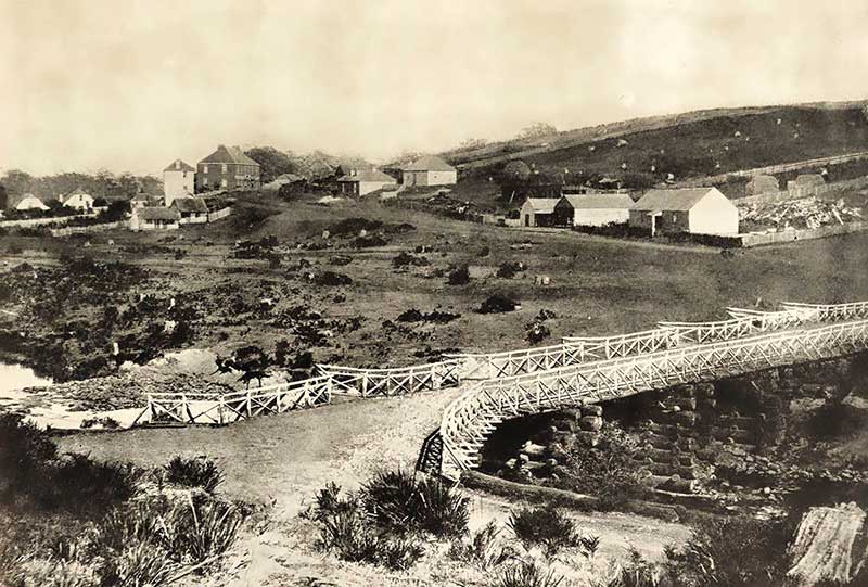
Deloraine, 1858
In 1823 Governor Sorell sent Captain John Rolland to explore the far west of Norfolk Plains (now Longford) and land to the west to find suitable land for agriculture. The area was subsequently opened up and named Mount Roland (it was incorrectly spent on the first offical documents and has remained mis-spelt ever since).
The settlement on the Meander River that became Deloraine grew from the village of Alveston and its convict probation station. Located on the east side of the river, it was named by John McArthur who had purchased land in the area, which he named after Alveston, his home town in Devonshire, England. McArthur built cottages to house labourers who came to work on the neighbouring estates; his small village with its two shops, a blacksmith, post office and tri-weekly mail and coach service fro Launceston was the obvious place to built the convict station when the decision was made to open one in the area. In 1832, the original bridge across the river was built by convicts, who began work on construction of a macadamised road to Wetsbury after the bridge's completion. Housing up to 500 men, the station was closed when the probation system ended in the late 1840s.
The district was surveyed by Thomas Scott in 1824; as early as 1832 he had refered to the locality as Deloraine, after Sir William Deloraine in the poem 'Lay of the Last Minstrel', written by a family member, Sir Walter Scott. James's brother, James Scott, also a surveyor, appoved the name when the town was surveyed. The district's free settlers were required to pay to take up leases in 1825 when Lieutenant Governor Arthur appointed Land Commissioners to assess the use of the land for future Crown Land leases. Bonney's Inn was built around 1831, and the town began to take shape around West Parade, up the hill from the more developed convict village of Alveston, but on the opposite side of the river. Town lots were surveyed in 1839, among the buyers were Capt. William Moriarty, and John Bonney, who in 1840, built a brick inn, which still stands.
The first Anglican church in the town was a wooden building completed in 1847, replaced in 1859. Early settlers in the district raised cattle and grew wheat, but the climate was unsuitable and they did not prosper. Alveston gradually joined with Deloraine as the towns developed. In the 1850s laws were changed to encourage development, allowing land to be purchased for as little as one pound per acre. Settlement then grew rapidly, in spite of problems with bushrangers and transport.
By then, Deloraine had developed as a major commercial centre with a daily stage coach service to Launceston, flour mills, breweries, churches, and shops lining the Emu Bay Highway on both sides of the river. Regional properties of up to 200 acres became focused on beef production, while smaller farms raised pigs, dairy cattle and grew crops. 30,000 acres were under cultivation by 1870, and quadrupled by the end of the century. The State's first rail link between Launceston and Deloraine opened in 1872.
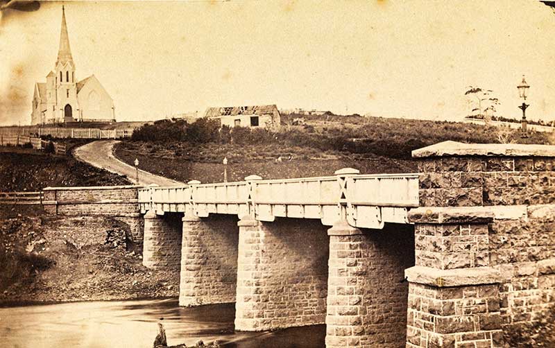
The newly built road bridge and St Mark's Anglican Church prior to its chancel and sanctuary being added in 1878
The town of Deloraine became a municipality in 1863. A Baptist Tabernacle was built in 1880. In about 1890 a Victorian Italianate post office was constructed in the main street, now called Emu Bay Road. It was later used as the Deloraine library. Two years later local family doctor Frank Cole built the large mansion, 'Arcoona'.
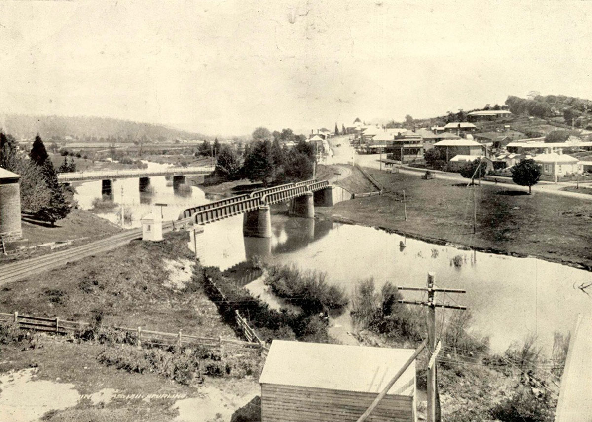
Deloraine, c1909
In the twentieth century tourism became important to the local economy, with buildings from the 1830s and 1840s still standing in the town proving to be a populat attraction.
The Meander Valley Council was created on 2 April 1993 from the merger of the former Municipalities of Deloraine and Westbury. The Central Highlands Municipal Area was formed the same year by the amalgamation of the whole of the Hamilton and Bothwell municipalities and a relatively small part of the Municipality of Deloraine.
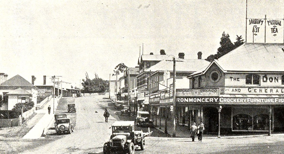
Deloraine, c1933
Drives From Deloraine
Gt Western Tiers Drive
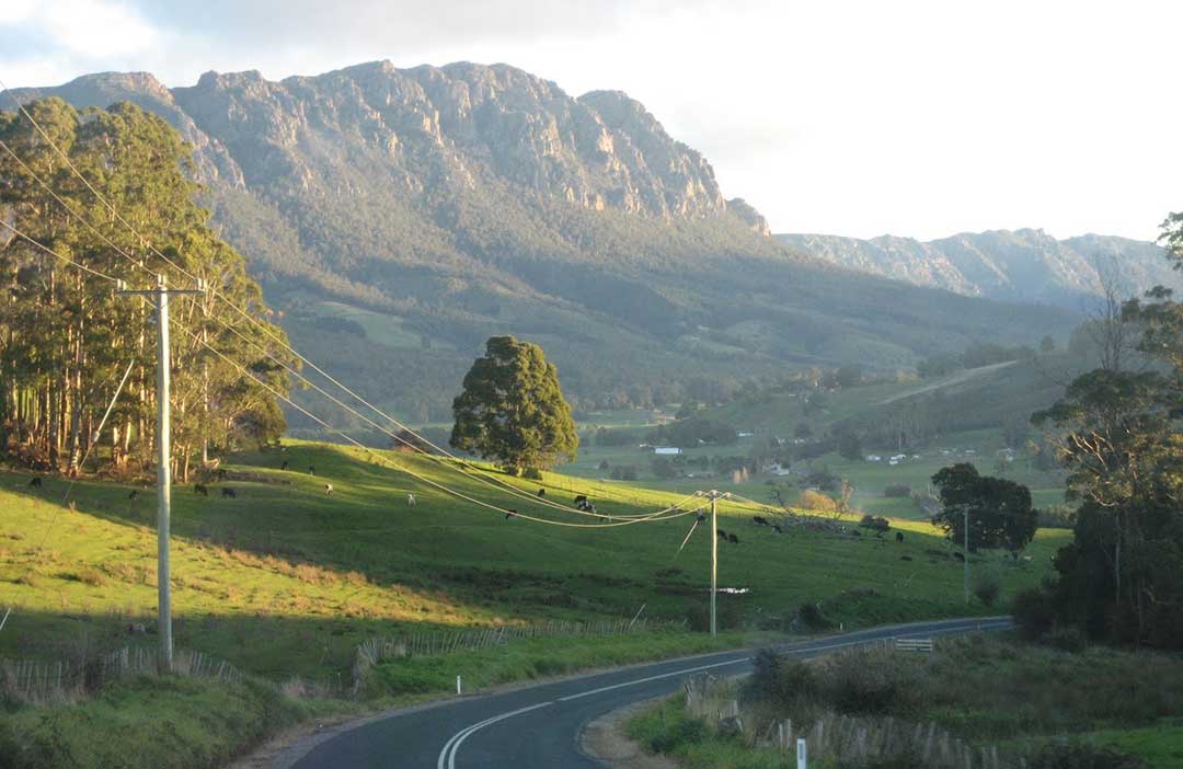
The Great Western Tiers are the northern face of the Tasmanian Central Plateau, which rises up to 1420m above sea level and is dominated by Cradle Mountain. In the foothills of the Great Western Tiers can be found a wide range of attractions both man made and natural which can be explored on this drive.Allow a full day for the drive; add additional time if you are contemplating taking any of the bushwalks in the area or spending more time than a quick visit. The Great Western Tiers are the gateway to Tasmania's best known National Parks - Cradle Mountain, Lake St. Clair and Walls Of Jerusalem - as well as an alternative route to the west coast of Tasmania.

Meander Valley Highway
There are essentially two ways to travel by road between Devonport and Launcestion; there's Bass Highway, which is takes just over an hours and bypasses just about every town on the way, and then there's the Meander Valley Highway, which follows Bass Highway closely, but takes in just about every town, village and settlement on the way. It will take a lot longer, and how much longer depends on how captivating you find the places you pass through.
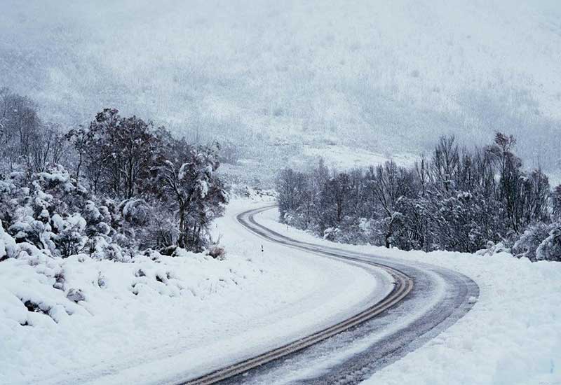
Highland Lakes Road
Highland Lakes Road gets nowhere near the same amount of useage as Tasmania's other North to South main roads, so chances are you won't see much other traffic. This makes it easy to stop and taking in the scenery - and there is plenty to stop and take in - without having to worry about that driver who is hard on your tail and wants to go faster than you do. It's a sealed road all the way, but be aware that snow is common in winter. Highland Lakes Road begins in the north near Deloraine and finished in the south at Bothwell. From there, it is an easy drive through the Derwent Valley to Hobart.Beyond Deloraine

Liffey Falls
25 km south of Deloraine via Quamby Brook Road and Bogan RoadLiffey Falls is a series of four distinct tiered–cascade waterfalls on the Liffey River. The Falls are situated upstream of the town of Liffey, in Meander Valley. The falls commence from the Great Western Tiers at an elevation of 514 metres above sea level and descend in the range of 120–160 metres. Each of the tiered cascades is named in order from upstream to downstream; Alexandra Falls, Hopetoun Falls, The Leap or Spout Falls (also called the Albert Falls), and Victoria Falls.
Access is down a steep narrow road to a large, secluded picnic area with information booth, picnic shelters, gas barbecues and disabled access toilets. The 40 minute return walk through wet eucalypt forest and tall ferns has viewing points for the upper falls and cascades. A steep descent allows access to the base of the Western Tiers' most well known and majestic falls.

Quamby Bluff
20.4 km south of Deloraine via Highland Lakes Road and Golden ValleyQuamby Bluff is the northernmost peak in the Tasmanian Wilderness World Heritage Area. It provides panoramic views of Northern Tasmania including the Central Plateau and Great Western Tiers. The original inhabitants of the area were the Pallittorre Clan of the northern nation of Aboriginal Tasmanians and lartitickitheker is the Aboriginal name for Quamby Bluff.
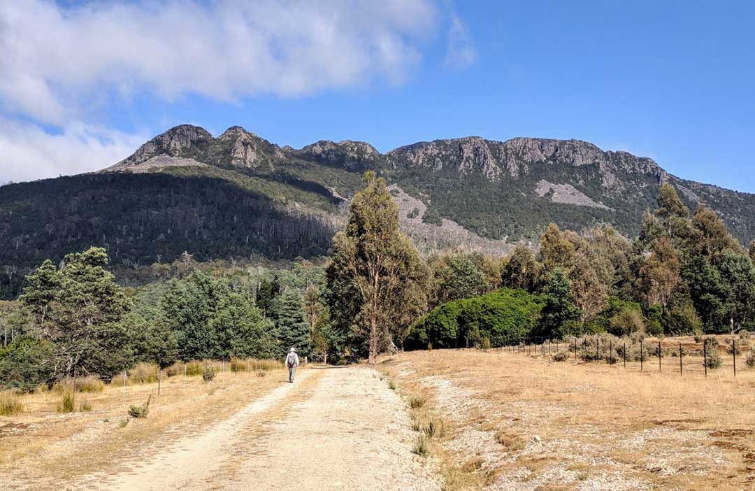
Taking 4-5 hours to complete, the steep 6km return climb to Quamby Bluff 20km is fantastic day hike passing through rainforest, vast rock sprees, lush Myrtle Forests and splendid alpine scenery before reaching the 1250m summit. With breathtaking uninterrupted 360 degree views from the top stretching as far as Bass Straight on clear days, the challenging 500m climb to the summit of Quamby Bluff is definitely well rewarded.
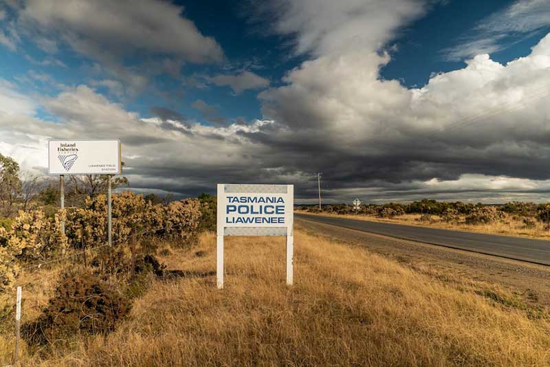
Liawenee
57.1 km south of Deloraine via Highland Lakes RoadLiawenee, built near Great Lake and the River Ouse, was established on 11 June 1920 as a Hydro village. With a permanent population that can be counted on one hand, Liawenee is now a residence for Inland Fisheries Services (IFS) and a Tasmania Police station. It is known for its exceptional fishing at nearby Great Lake and hosts several trout fishing events. Liawenee is the coldest permanently-inhabited place in Australia.
Liawenee is located along the Highland Lakes Road among the central Tasmanian mountains. The mountains surrounding Liawenee include Split Rock, Willow Run Hill, Headlam Hill and McDowall Hill, with the latter being the tallest. It is known as the twelfth-highest locality in Tasmania and the nearest ocean beach is 100 kilometres (62 miles) west-south-west from Liawenee's centre. The rough terrain suits bush-walking and mountain biking, except during winter, and the nearest populated area is Miena, about 13 km south.
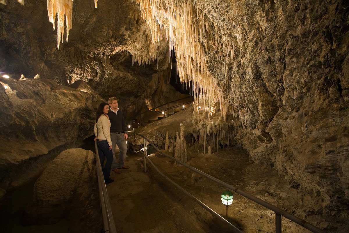
Mole Creek
23.4 km west of Deloraine via Mole Creek RoadMole Creek is a pretty town surrounded by some of Tasmania's most beautiful wilderness and is the perfect base for exploring nearby national parks, and its extensive, amazing caves.
Chudleigh
16.5 km west of Deloraine via Mole Creek RoadThe village of Chudleigh, not far from Mole Creek, is one of those places that seemed destined for greatness but never quite got there. It's well worth the stopover on your way to Mole Creek.
Westbury
16.1 km east of Deloraine via Meander Valley RoadOften described by visitors as a hidden treasure, somewhere that they have stumbled across, Westbury is a pretty English-style Georgian village on the Great Western Tiers tourist Route between Devonport and Launceston. A village green, lots of tree-lined streets, old courtyards and stables, elegant old inns and a feast of charming old buildings means a visitor could easily spend a day just wandering around the streets.

Chocolate mud cake, Christmas Hills Raspberry Farm Cafe
Elizabeth Town
11.5 km north-west of Deloraine via Bass HighwayElizabeth Town is not really a town at all, just a collection of houses and business alongside Bass Highway midway between Devonport and Launceston. Though it has a population of around 500, it's one of those places that if you blink you might miss it. But if you do miss it, you will miss out on some of the best gourmet produce of Tasmania's north-west.
Elizabeth Town is at the heart of a thriving agricultural region known for its dairy products and small fruits, which makes it a great place to stop for morning or afternoon tea, or lunch. The choice of places to eat and what to eat is remarkably wide, and the quality is of the highest standard. You can eat in or take away, and by take away we aren't just talking about meals. You can buy chocolates, dairy produce, fruit and fruit products straight from the farm or factory in what has become a mecca for foodies.
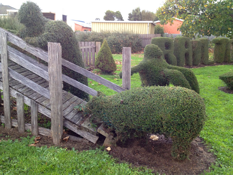
Railton
31.4 km north-west of Deloraine via Railton RoadThe main attraction in this rural inland town is topiary, which is the art of shaping bushes and trees by careful pruning to resemble familiar objects such as animals. The town is 12 km from Sheffield.
Sheffield
38.6 km north-west of Deloraine via Railton RoadA rural inland town set against the backdrop of Mt Roland, Sheffield is known as the Town of Murals because of the many murals that decorate the walls of buildings around the town. Names like Promised Land, Paradise and No Where Else were used to encapsulate the beauty of the region. Visitors today believe this still rings true! View rich agricultural fields, rolling green hills and natural vistas when journeying to Sheffield, Cradle Mountain, Wilmot and Railton.
A PocketOz Travel and Information Guide
Design and concept © Stephen Yarrow | Email | W3Layouts | Test