
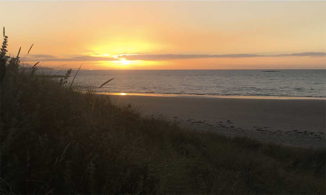
Port Sorell, Tasmania


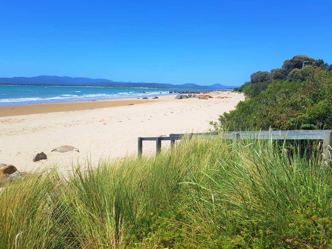
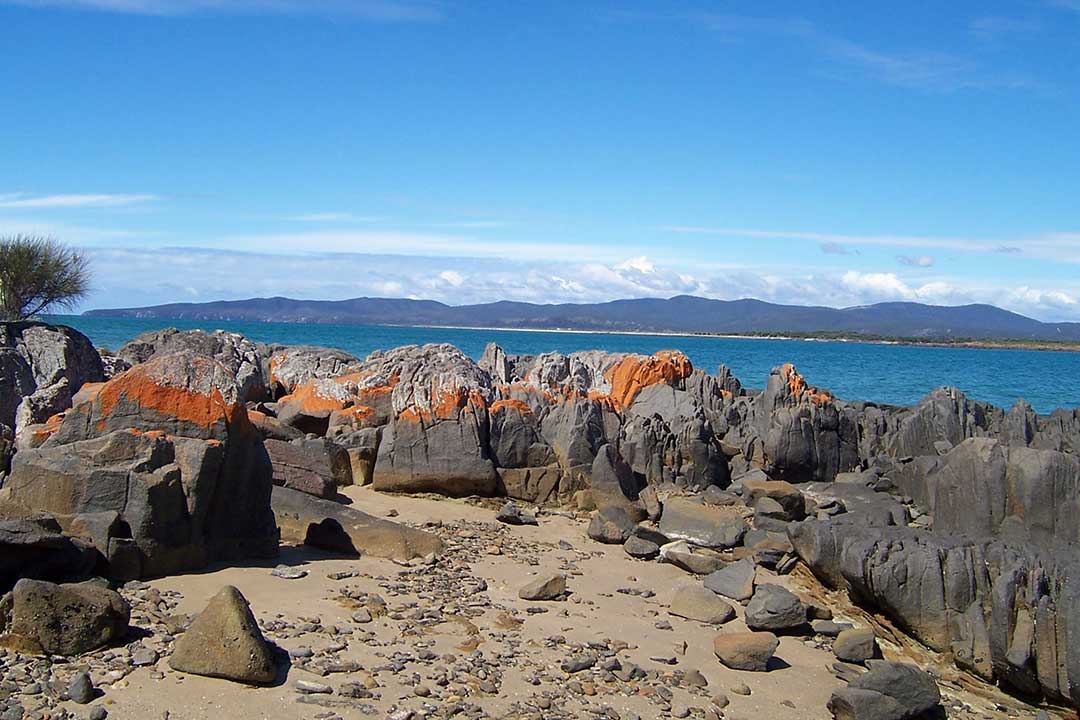
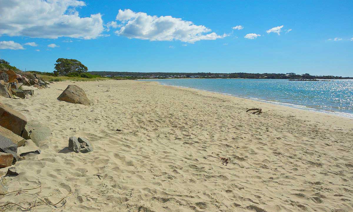
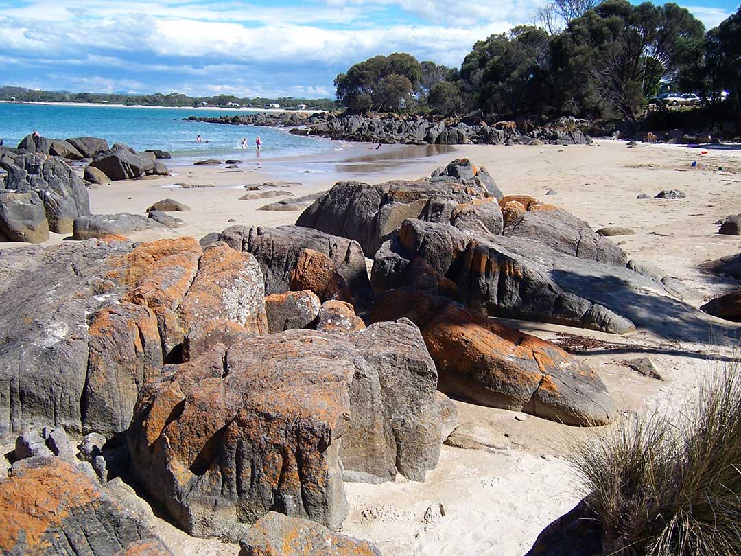
Much of the activities around Port Sorell revolve around water, partularly the Rubicon Estuary. Diving, boating, fishing from the beach or floating pontoon, water skiing and sea kayaking are all popular activities here. The town's boat ramp is the busiest on the north-west coast. The beach, with its orange lichen-covered granite rocks, is both beautiful to look at and ideal for swimming.

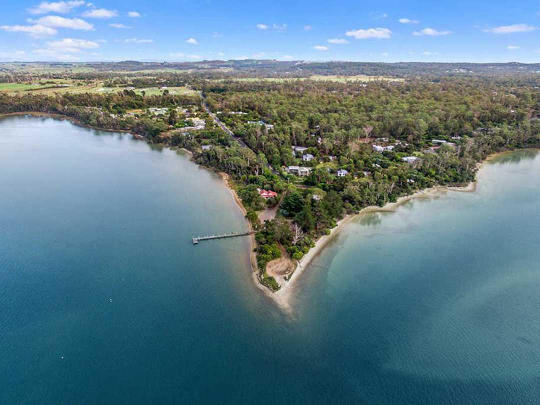
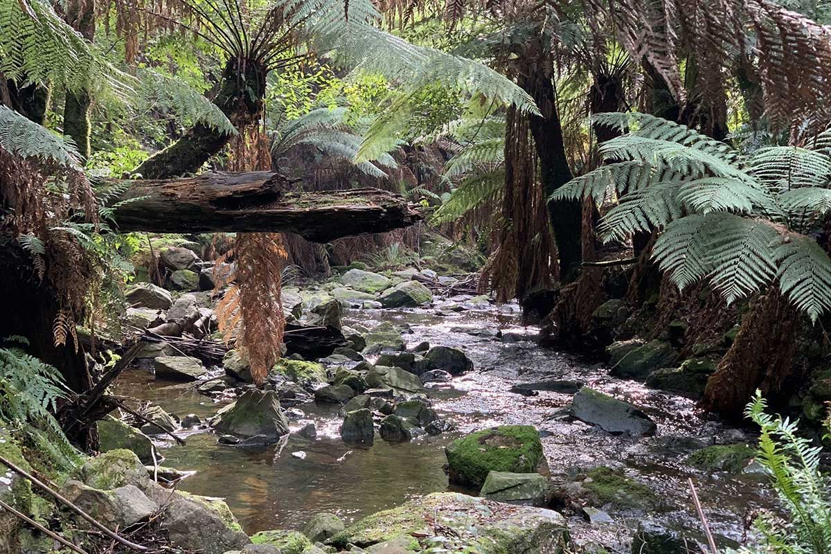
Rubicon Estuary
The town draws nature lovers with plenty of foreshore and beach walks, and large sand dunes. A brochure detailing these self guided walks is available from the Latrobe and Port Sorell Visitor Information Centre.
Rubicon Beach Walk: This walk follows on from the Panatana southern shore walk and ends at Squeaking Point through the Port Sorell Conservation Area, a shoreline Reserve. Return 2 kms.
Estuary Eastern Shoreline Walk: Follow the signs on the Frankford Highway to Narawntapu National Park to access the Franklin River starting point. From 1? kilometres south of The Tongue at the western entrance to south east arm, Franklin River and Sugar Creek to The Tongue and around to Lades Road near The Point there is over four kilometres of shoreline reserve to explore. You will need vehicle access as your starting point is 16-18 kilometres from Port Sorell.
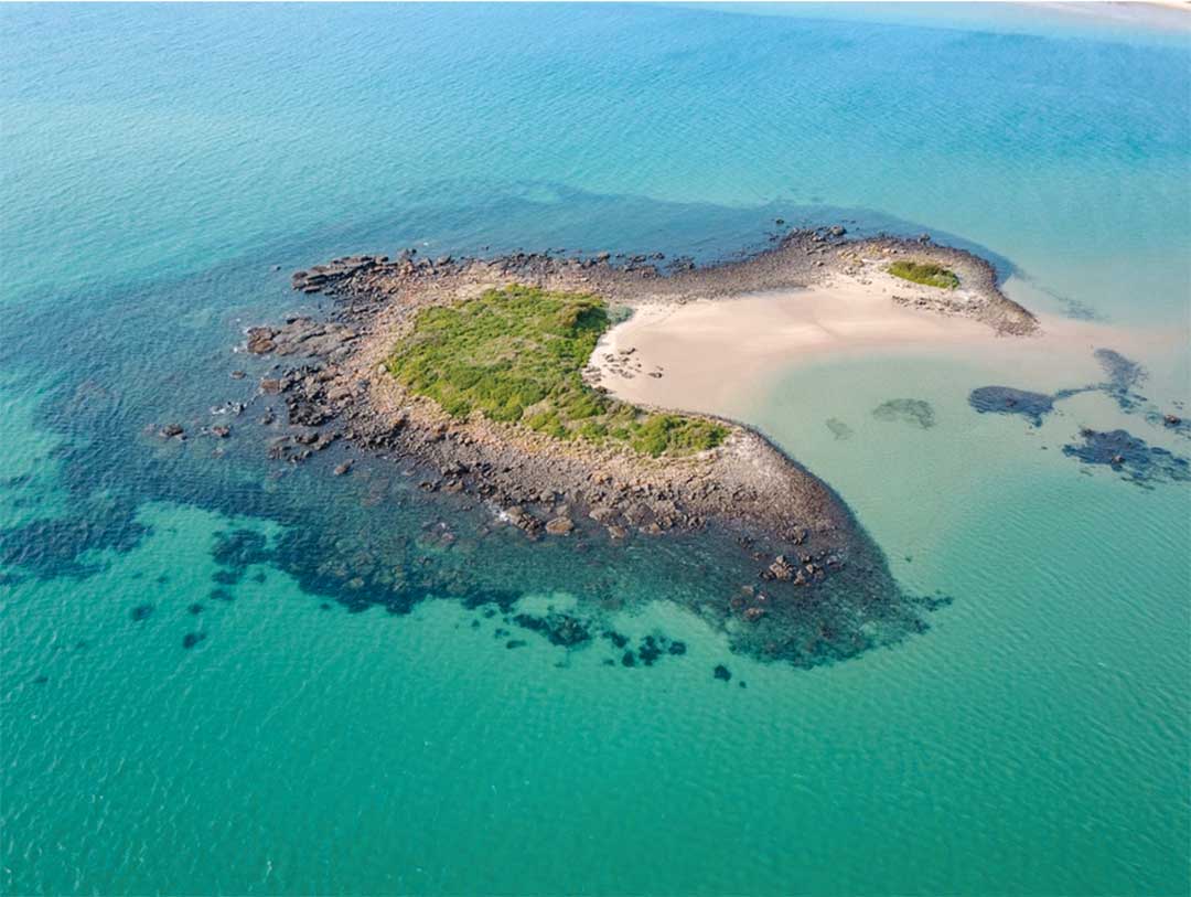
Penguin and Rabbit Islands
At low tide it is possible to walk to Penguin Island and Rabbit Island the latter a hideout for bushrangers in the mid-1800s. Penguin Island is part of the Narawntapu National Park. An estimated 100 pairs of little penguins breed on Penguin Island.The islands are part of the North Coast Group.
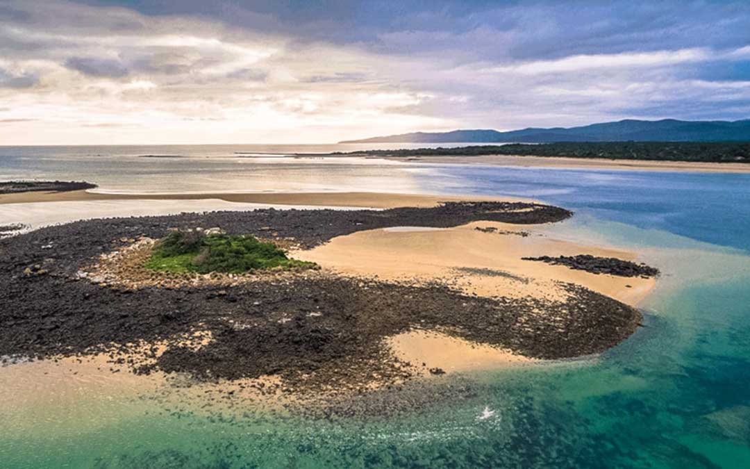
Penguin Island
The Port Sorell to Penguin Island swim is an Ocean Swim run by Port Sorell SLSC at Freers Beach in Port Sorell every March. The event is a part of the Tasmanian Ocean Swim Series and has swim distances of 2km.
Beaches
The Port Sorell beaches have a relatively low hazard rating, with usually low to calm waves and shallow bars and sand flats. The best swimming is at mid to high tide. However care must be taken of the rocks on Hawley and Taroona, and in particular if walking or wading out over the sand flats and reefs at low tide. People have been caught on the reefs and high shoals by the rising tide, in addition there are strong tidal currents across the flats at high tide and in the channel at all tides.
Freers Beach, Shearwater
Freers Beach curves from the southern rocks of Taroona Point for 1.7 km to the south, then southeast to the 500 metres entrance of the more constricted inner entrance to the port. A road parallels the back of the beach, with several seawalls and groynes crossing the beach, including one at the southern end. It is usually calm, with a narrow, in places eroding, high tide beach. The Port Sorell Surf Life Saving Club, was founded in 1986 and is located at the northern end of Freers Beach.
Hawley Beach
Hawley Beach is near Port Sorell and the locality of Shearwater. Hawley Beach is known for its clean sand, lichen covered rocks, minute red sand crabs, hooded plovers and reasonable fishing. It borders the Rubicon Estuary, which has been identified by BirdLife International as an Important Bird Area because of its importance for waders, especially pied oyster catchers.
Hawley Esplanade runs along the length of the beach, which extends for just under 2 kilometres. Along the way are numerous parking bays, some with toilets, alongside access points to little pockets of beach, some with rocks, some without.
Squeaking Point
The waters of the Rubicon Estuary form the eastern boundary of the small rural community of Squeaking Point. Located immediately south of Port Sorell, its name dates from the early days of settlement. It was given to the area because of the noise made by some pigs that escaped from a ship. The official name was changed from “Moriarty” to Squeaking Point in 1948.
Like many coastal communities on the north coast, Squeaking Point is a quiet, peaceful place with not too many houses, all of which are dotted around through bushland. The point itself has a boat ramp, quite essential in a place like this where the lifestyle revolves around boating and fishing on the calm waters of Rubicon Estuary. The point has parking for vehicles and trailers, toilets and a few picnic tables.
Northdown Beach
Northdown Beach
Northdown Beach is a relatively straight north-northwest-facing 6.3 km long sandy beach, fully exposed to the westerly waves and one of the higher energy beaches on the mid-north coast. Wave height increases to the east where under high wave conditions more dissipative surf with two to three shore-parallel bars prevails.

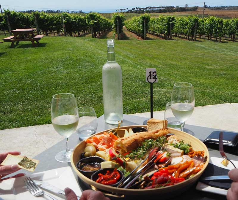
GHOST ROCK TASMANIA
Sample award winning wines, enjoy lunch with ocean and mountain views on the terrace. Art gallery and gift shop. Open daily.
1055 Port Sorell Road, Northdown 7307
Ph: (03) 6428 4005
Exeter
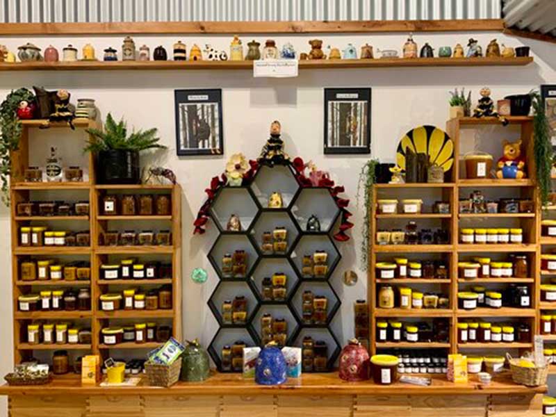
HONEY TASMANIA: THE BEEHIVE
Operated by a small family of Tasmanian beekeepers and producers of pure, raw native floral honey, including leatherwood and manuka, both of which are classified as “super honey”. Open 10am - 4.30pm every Thursday for sales, or purchase online.
124 Main Rd, Exeter
Ph: (03) 6426 2958
Beyond Port Sorell
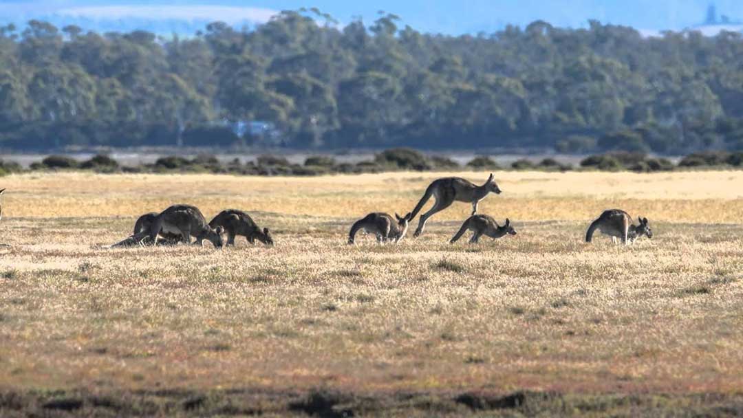
Just across the Rubicon River, Narawntapu is a must-see for any visitor to Tasmania wanting to see wildlife in its natural habitat. It’s the most likely place in Tasmania you will see wombats, possums, bettongs, pademelons, kangaroos, wallabies, quolls, Tasmanian Devils and birds in their natural environment. Dawn and dusk are the best times to observe marsupials such as the wombat around the visitor centre area, which is known as Springlawn.
The park’s diverse flora ranges from coastal heathlands and grasslands to wetlands and dry sclerophyll woodlands. This in turn attracts many bird species – as many as 116 species have been recorded – including honeyeaters, green rosellas, black cockatoos, raptors, robins, wrens and fantails. Along the beaches, tidal flats and around the lagoon, a wide variety of waterbirds, waders and coastal birds can be observed. A bird hide in the melaleuca at the lagoon offers an ideal spot for birdwatching and photography: binoculars are recommended.
The Park includes a historic farm, a complex of inlets, small islands, headlands, wetlands with a wonderful array of birdlife, dunes and lagoons.
More
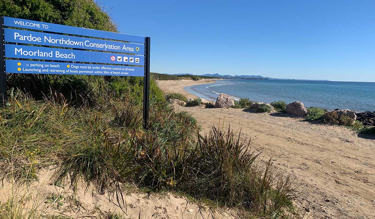
Moorland Beach
Moorland Beach, Wesley Vale
Moorland Beach extends east-northeast for 2.1 km between Pardoe and the low Moorland Point. There is a slight protrusion in the beach caused by wave refraction and attenuation to the lee of Wright and Egg islands, located 1-1.5 km offshore. The beach has a near continuous 150 m wide low tide bar, with low tide rips forming during higher waves, while closer to Moorland Point intertidal rocks and reefs are located in the intertidal zone.
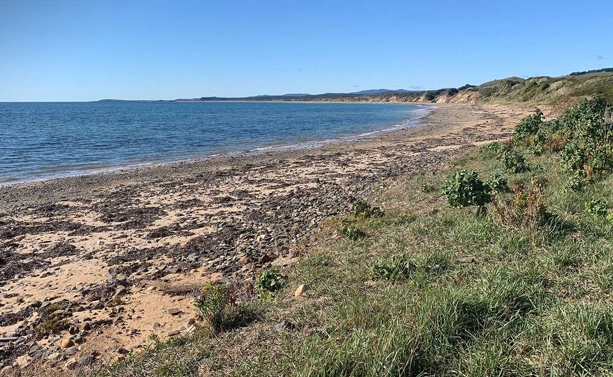
Pardoe Beach
Pardoe Beach, Wesley Vale
Pardoe Beach commences against the end of the cobble beaches that surround Pardoe Downs, with a car park marking the boundary. It trends to the east-northeast for 3 km to the cobble, reef-tipped Pardoe Point. It receives the full force of the westerly wind waves, which average over 1 metre and maintain rips in the low tide surf during periods of higher waves. The beach is backed by a 150 m wide series of hummocky foredune ridges, with a waste treatment plant in the east and the western end of Devonport Airport to the west, and farmland extending inland.
Tamar River estuary
The western side of the Tamar River estuary is on the eastern side of Narawntapu National Park and can be accessed by the road from Port Sorell. The 55.4 km road brings you out at Exteter, from where you can drive north to Launceston (24 km), or south to Beaconsfield (16.9 km), Beauty Point (23.3 km) and Green Beach (35.3 km) on the shores of Bass Strait. To drive to Exeter, leave Port Sorell via Frankford Road and follow the signs to Exeter.
Exeter, on the West Tamar Highway, is a small but important town agriculturally due to its positioning in the centre of a large rural area known for its orchards, dairy and beef cattle, fruit produce and sheep herds.
More
Brady's Lookout
Brady's Lookout is 5 km south of Exeter on the West Tamar Highway. It was used by the infamous bushranger Matthew Brady to identify potential victims below. The popular picnic spot offers great views of the surrounding country side.
Batman Bridge
15 km north of Exeter, Batman Bridge gives road access to the eastern side of the Tamar Valley between Whirlpool Reach, Hillwood at its eastern end and Sidmouth / Deviot midpoint at its western end. The bridge connects the Batman Highway with the West Tamar Highway (state route A7) and the East Tamar Highway (state route A8). The bridge is named in honour of John Batman, a Launceston businessman and co-founder of Melbourne.
![]()
Beaconsfield
55.9 km east of Port Sorell via Frankford Road and West Tamar HighwayAn historic goldmining town on the West Tamar Highway, Beaconsfield services the many small communities located on the western side of the Tamar Valley. The Beaconsfield Mine and Heritage Centre is the main attraction in the town and should not be missed. Twice the size it was a decade ago, the remnants of the original Tasmania Gold Mine that was the original Grubb Shaft Museum still stand, but have been extensively added to with an impressive state-of-the-art wing.
More
Holwell Gorge
Holwell Gorge reserve (8 km south-east of Beaconsfield via Kellys Lookout Road) is centred around a narrow gorge and fern glade in the Dazzler Range. It features many beautiful tall trees, ferns and a 45-minute scenic walking track past three waterfalls. The walk to the first falls is relatively easy - in fact it's a leisurely 15 minute stroll to the Holwell Gorge Falls.
Notley Fern Gorge
Notley Fern Gorge (11 km south-west of Beaconsfield) is a forest dominated by large, old eucalypts over a understorey of rainforest. Towards the creek, there are a variety of fern species growing in abundance. The gorge is a 3/4 hour walk from the carpark along a well constructed path following a creek, with a 1.5 km return walking track through the forest. Look out for Brady's tree, a giant hollowed-out tree that bush-ranger Matthew Brady and his band of followers sheltered in during the 1820s. Brady’s Tree is only five minutes’ walk from the car park.
The Fern Gorge trail is ideal for for beginners, it's easy to walk, not too long, with lots of interesting fungi to photograph. There are plenty of fallen logs, fairy-tale moss-covered trees and plenty of ferns, not to mention white gums and blackwoods overhead. The Gorge has a picnic area is at the car park along with clean rest rooms. Unfortunatlry, no dogs are allowed so as to not disturb the abundant wildlife.
Beauty Point
59.6 km east of Port Sorell via Frankford Road and West Tamar Highway6 km south of Beaconsfield, Beauty Point is a small fishing town, sited where West Arm meets the Tamar Estuary. The town is the home of Seahorse World, a working seahorse farm and educational centre that is open to the public, and Platypus House, a unique attraction being the only venue in Tasmania where visitors can watch Tasmanian Platypuses and Echidnas in daylight conditions in an indoor setting.
More
York Town
York Town (7.8 km north of Beaconsfield) is the site of the first attempt to establish a British presence in northern Tasmania. For a brief period between 1804 and 1808 Col. William Paterson and his party of settlers, soldiers and convicts created a small, bustling village and established farms and a government garden at York Town. They faced many difficulties stock losses, poor soil, food shortages and episodes of robbery, bushranging and piracy. Only two years after its settlement, it was clear that relocation would be necessary, and by 1811 York Town was virtually deserted. Today, a walking trail and interpretive signs tell the story of York Town, though little of the settlement remains above ground. There was forty acres of settlement at this historical site and almost the whole entire town remains buried underground, however, occasionally remnants make their way to the surface to remind us of a past that has been forgotten.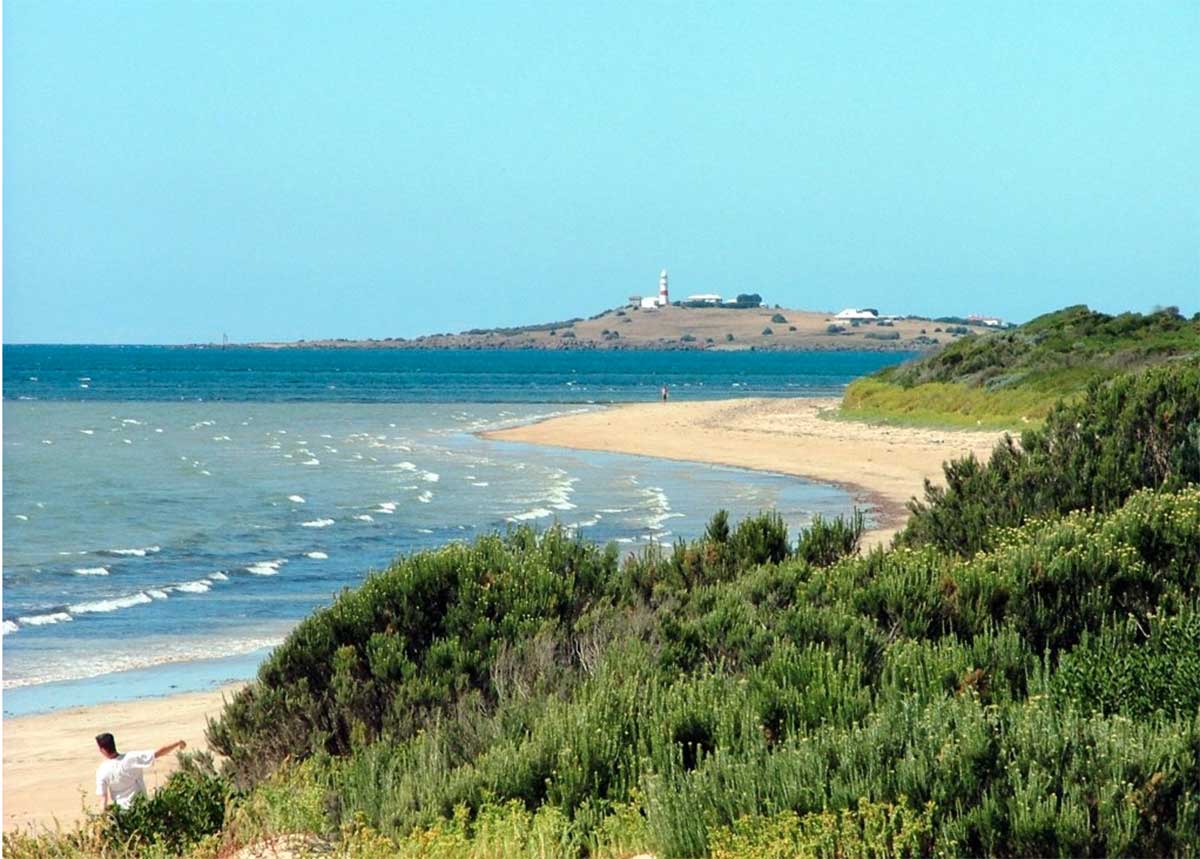
Greens Beach
53.4 km east of Port Sorell via Frankford Road and West Tamar Highway
Greens Beach (18.4 km north of Beaconsfield) is located on Badger Head on the eastern side of the mouth of the Tamar estuary opposite the Low Head lighthouse. The often deserted, long Badger Beach at this small holiday and retirement village is ideal for a stroll. Bass Strait forms the northern boundary. The West Tamar Highway runs north-west through the locality, terminating in the Greens Beach township.
More
A PocketOz Travel and Information Guide
Design and concept © Stephen Yarrow | Email | W3Layouts | Test