


Bothwell and Central Highlands
Tasmania's Central Highlands boast glorious scenery and dramatic built heritage dating back to the early 19th century. It is the birthplace of Tasmania’s Hydro-Electric power system and home to the best trout fishing in the southern hemisphere. The Central Highlands covers 8,010 sq km, or 12 per cent of Tasmania’s land mass, has a permanent population of over 2,000, many of whom own shacks in the communities around the region’s numerous spectacular lakes and mountains.
The Central Plateau Conservation Area is a wild place of sub-alpine moorlands and a myriad of tarns on the northern edge of the Tasmanian Wilderness World Heritage Area. It is in the isolated heart of Tasmania and is un-serviced by the State’s major road network other than the A5 which forms the eastern boundary. Flanked on the east by Great Lake and the west by the Walls of Jerusalem National Park, it is also known as the Land of a Thousand Lakes.
Anglers and bushwalkers are frequent visitors to the Central Plateau Conservation Area and, luckily for them, they have the interior of this vast tract of watery wilderness to themselves. Generally, travellers in Tasmania stay on the main traffic routes - the Great Eastern Drive on the East Coast, the Heritage Highway through the Midlands, or the Western Wilds (A10).

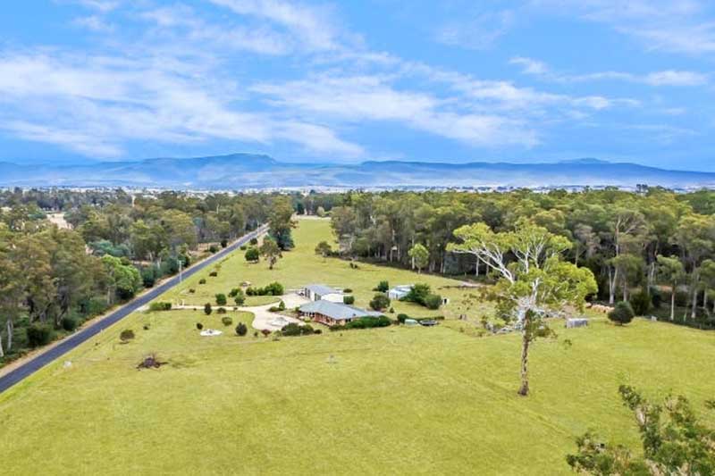
A classified historic town, Bothwell is the southern gateway to the central Highlands. In season Bothwell is also known as the gateway to some of the best trout fishing in Australia. Bothwell is the home of Australia's first Aberdeen Angus stud. The town, laid out in 1824, was populated by mainly settlers of Scottish descent and today still has a distinct Scottish flavour. It was here that the famed Irish political exiles John Mitchell and John Martin lived during their stay in Tasmania in the 1850s. Both had been arrested for treasonable writings

Liawenee, to the north of Miena, is known for its great fishing at nearby Great Lake and hosts several fishing events bringing people from all over Tasmania. Built near Great Lake and the River Ouse, the ex-Hydro village is now a residence for Inland Fisheries Services (IFS) and a Tasmania Police station. It is known for its exceptional fishing at nearby Great Lake and hosts several trout fishing events. Liawenee has a reputation of being the coldest town in Tamania.

The small village of Miena (57 km north of Bothwell), on Highland Lakes Road beside the shores of Great Lake, is the main centre of Tasmania's Lakes District. The town's surrounding landscape consists of mountain peaks and alpine lakes. During winter, snow settles on the shores of the lakes and clear crisp days satisfy those who enjoy feeling close to the environment. The great appeal of Miena is the fishing for which the lakes are famous.

The village of Waddamana is a former Tasmanian 'hydro-town', located at the foot of the southern side of the Central Plateau. It consists of two decommissioned hydro-electric power stations, one of which is a museum, and several cottages, most of which are only used by guests. Schools often take their students to Waddamana for camps. It has gained a reputation for its harsh weather - it often snows and icing was a problem when the hydro plants were still in use.
Whitemore is a small rural community in Tasmania's Central North. Its most prominent features are its 1864 brick church, adjacent to the original church building dating from 1857 - now a community hall - and the large workshop and offices of Shaw contracting, the most significant business in the town's history. Whitemore consists of a small cluster of buildings on either side of the only road, surrounded by farming land.

The Walls of Jerusalem is a mountainous area in the extensive central plateau of Tasmania which forms part of the Tasmanian Wilderness World Heritage Area. As the park is remote and not accessible via road, the Walls retains its wilderness character. The Walls of Jerusalem National Park offers experienced bushwalkers and cross-country skiers the opportunity to pursue their passion within a spectacular mountain region that is little touched by the modern world, and to test their skills against the elements.

Though it is a very small dot on the map, and a tiny community in Tasmania's Central Highlands where Lyell Highway crosses the River Derwent, Derwent Bridge is the gateway both to Wild Rivers National Park and Lake St Clair (5 km). You'll find Derwent Bridge on the Lyell Highway at the southern edge of the Cradle Mountain-Lake St Clair National Park, midway between Hobart and Queenstown. It is just south of Lake St Clair and the Lake St Clair visitor centre; and it is north of Lake King William and the Butlers Gorge Power Station.

A former Hydro town, Poatina is owned by Fusion Australia, a Christian youth and community organization which cares for homeless and unemployed young people in a supportive atmosphere. Set against the beautiful Great Western Tiers, Poatina is known for its charming landscape. The town is the perfect location for fishing, hiking, and other similar outdoor activities because of its geographical location. Activities in and around town include hiking, walking, trekking, cycling, and sightseeing.

Tarraleah Power Station, located on the Upper Derwent River, was opened in 1938. The nearby township of Tarraleah was originally built in the 1930s by the Hydro Electric Commission to house Tasmania's pioneering hydro electricity officers and management. After a multi-million dollar redevelopment, the former Hydro construction village has become a 120 ha estate that comprises Tarraleah Lodge with accommodation, dining options. Fresh water trout fishing, boating, bushwalking, mountain biking and kayaking are all popular activities in and around the township. Tarraleah is also home to one of the highest altitude golf courses in Australia.

If you've ever wondered where the geographic centre of the island of Tasmania is, Bronte Park is about as to it as you are going to get by car. North of Bronte Lagoon, an artificial lake in the Central Highlands, Bronte Park is in fact just 3.2km from the centre. This small locality on the Marlborough Highway at the southern edge of the Cradle Mountain-Lake St Clair National Park, is located just north of the Lyell Highway and approximately halfway in between Hobart and Queenstown.