

See and Do

18 km from Burnie (19 mins. drive)
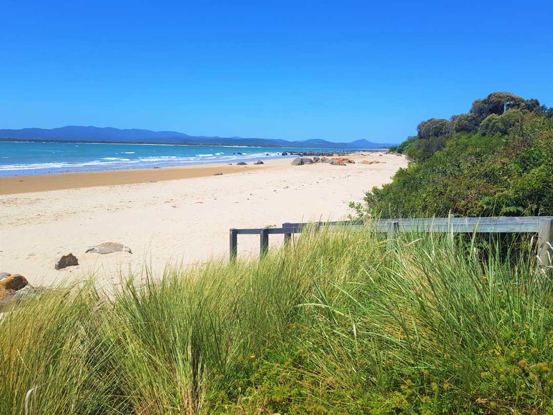
The little town of Penguin sits midway between Burnie and Ulverstone on Tasmania's Bass Strait coast. It's one of those pretty places that you can keep coming back to time and time again and never get tired of. Though it gained its name from the fairy penguin colonies which dot the coast in this part of Tasmania, you will be unlikely see one of the cute little critters as you saunter along the north-facing Penguin Esplanade, but the chance of seeing a sunbeam shimmering off the sea as you sip a coffee is likely. And if you are very lucky - and it has happened to me - you might catch a pod of dolphins at play or even a whale on its way up or down the coast.
More


28 km from Burnie (24 mins. drive)
Ulverstone is a substantial regional centre in a centralised location between the north-west coast's two cities, Burnie and Devonport. Log spiltters worked the area in the area in the 1840s, supplying the newly founded Melbourne with the timber it required for building. A cruise o the Leven River is highly recommended.
More

56 km from Burnie (39 mins. drive)
Devonport, at the mouth of the Mersey River, is one of three major cities in Tasmania's north, the others being Launceston and Burnie. To visitors to Tasmania, it is primarily known as the port for the Spirit of Tasmania car and passenger ferries - Spirit of Tasmania I and II, however there is plenty in the Devonport region for visitors to see and do to justify more than an overnight stop upon arrival or before departure.
More
66 km from Burnie via Devonport (48 mins drive)
Much of the activities in and around Port Sorell revolve around water, partularly the Rubicon Estuary. Diving, boating, fishing from the beach or floating pontoon, water skiing and sea kayaking are all popular activities here. The town's boat ramp is the busiest on the north-west coast. The beach, with its orange lichen-covered granite rocks, is both beautiful to look at and ideal for swimming. Just across the Rubicon River, Narawntapu is a must-see for any visitor to Tasmania wanting to see wildlife in its natural habitat.
More

56 km from Burnie (39 mins. drive)
Latrobe is an historic farming centre on the Mersey River that was once an inland port serviced by ferries from Devonport. The town is just off the highway on the way to Launceston after leaving Devonport. Latrobe has a strong arts community and has become increasingly known for its arts and crafts galleries, antiques and gift shops.
More

86 km from Burnie (57 mins. drive)
Though it has a population of around 500, Elizabeth Town is one of those places that if you blink you might miss it. But if you do miss it, you will miss out on some of the best gourmet produce of Tasmania's north-west, because Elizabeth Town at the heart of a productive agricultural region producing dairy products and small fruits.
More

67 km from Burnie (55 mins. drive)
Sheffield has long been the rural hub for the Mount Roland area, and is is well known for its high quality butterfat production via dairy farming, and its lamb and beef production. Sheffield's revival as the Town of Murals began as a bid by a small group of residents determined to save their town. Sheffield now has more than sixty murals painted on the walls of the town buildings and a further nine murals displayed in Mural Park. These days Sheffield is back on the map, attracting over 200,000 visitors each year.
More

Region: North West Hinterland
59 km from Burnie (52 mins. drive)
Wilmot is one of those kind of places where the journey getting there is as much fun as being there. The big drawcard for me was always the original Coles family store (sadly it's no longer there), from which came "GJ", the son George who decided to move to the mainland and Melbourne, where he figured he had more chance to make a million that if he stayed in the backblocks of North West Tasmania. Follow the road from Wilmot to Devonport through the aptly named 'Valley of the Views' along what is known as the Wilmot Novelty Letterbox Trail.
More

22 km from Burnie (22 mins. drive)
Yolla is a rural community in north-western Tasmania. At the 2016 census, Yolla and the surrounding area had a population of 316. It is on the Murchison Highway about 20 kilometres south of the towns of Wynyard, Somerset and Burnie. The area around Yolla is used for dairying, beef cattle, growing vegetables, opium poppies and other crops, as well as forestry and mining. Local attractions are Hellyer Gorge and the Oldina Forest Reserve.
Yolla was first settled in the 1880s. Camp Creek Post Office was open between 1881 and 1884. It reopened in 1905 and was renamed Yolla in 1906. The name is a Tasmanian Aboriginal word for the short-tailed shearwater or "muttonbird". The area was originally covered by myrtle beech forest, which was gradually cleared for farming.
79 km from Burnie (1 hr. drive)
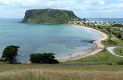
Sheltering on the leeward side of Circular Head, the village of Stanley is a picturesque cray and shark fishing settlement that seems to belong in a previous era, but has somehow managed to defy the march of time and progress and make it into the 21st century relatively intact. A visit to Stanley is like taking a step back in time. It's an opportunity to stop and escape the frantic pace of modern life, if only for a few hours.
More
Region: North West Hinterland
62 km from Burnie (46 mins. drive)
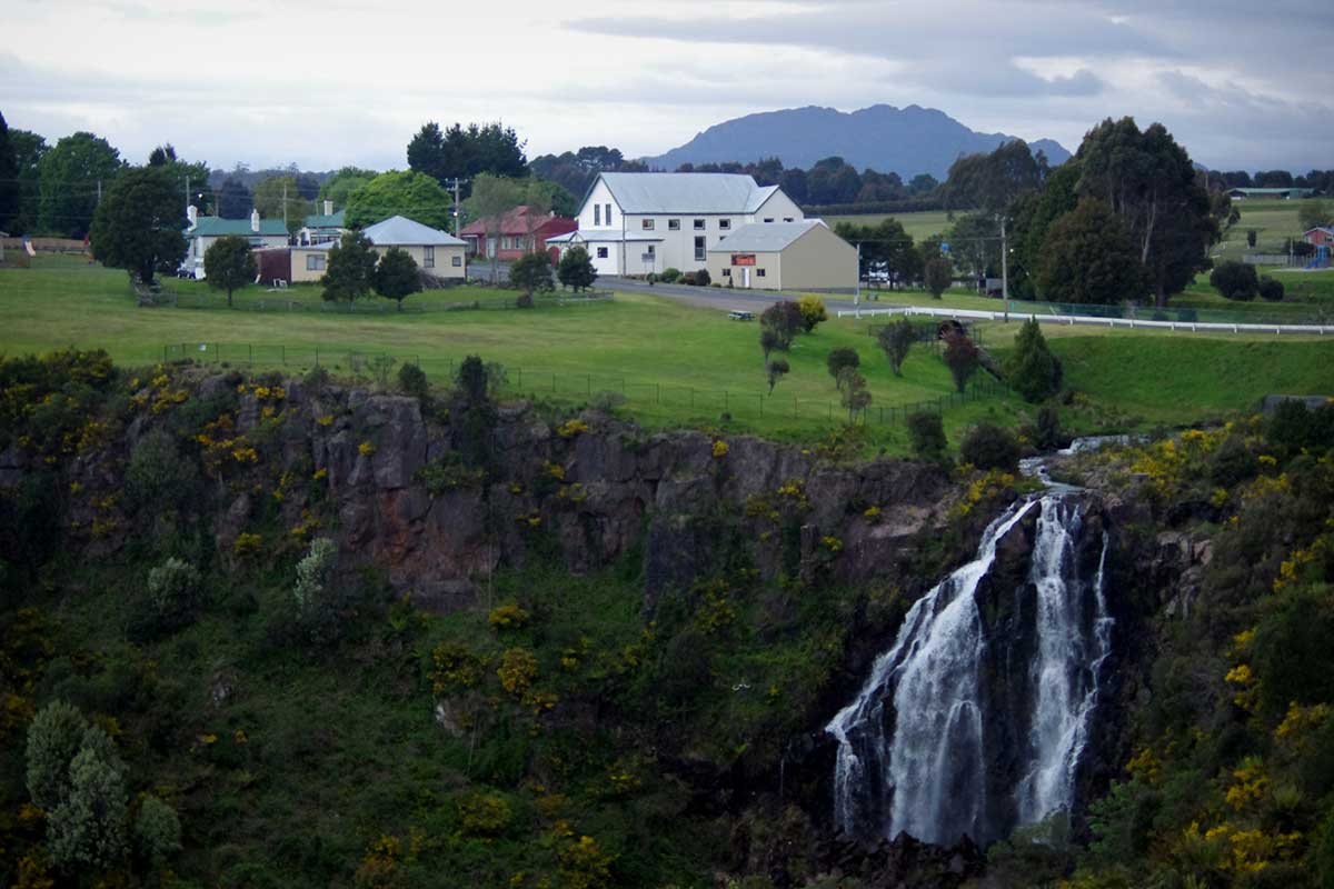
The town of Waratah was constructed to support a tin mine at Mount Bischoff. Built at the top of a waterfall around the shoreline of Lake Waratah, a pleasant central point in the town with picnic and barbecue facilities and a short walk to the falls (just north of Smith Street) and the dam wall near William Street. Make sure to go over the road and inspect the Waratah Falls and the waterwheel. Not far from Waratah, on the road west, is a rainforest walk to the Philosopher Falls.
More
The North West coast extends from Burnie all the way west to Cape Grim, Tasmania's rugged north-west corner. Along the way are the beachside towns and villages of Wynyard, Boat Harbour Beach, Stanley and Smithton, as well as the rugged volcanic headlands od The Nut (Circular Head), Rocky Cape and Table Cape.
Full Itinerary

The first European settlement of Tasmania's Central Coast commenced in the 1840s, the rich basalt soil proved ideal for cropping, and today agriculture is the principal contributor to the area’s economy. Motorists travelling along the north-west of Tasmania are well served by the National Highway. Central Coast, however, is fortunate to have retained a small section of ‘old highway’. This scenic coastal detour hugs the headlands and sandy shores from Ulverstone through to Howth and is well worth the extra time taken to travel this scenic route.
Full Itinerary

Boasting rolling farmland, the hinterland of Tasmania's central coast is home to some of the region's finest agriculture and local produce, its narrow roads making their way through lush farmlands on their way to the alpine terrain of Cradle Mountain. The area is world-renowned for its bush-walking, mountain ranges and canyons, and laid-back small towns set againt mountainous backdrops.
Full Itinerary

The area is dominated by the Tarkine, a wilderness area containing a wildly diverse landscape, a world of natural treasures including Australia's largest patch of temperate rainforest, mountain ranges, wild river and cave systems and buttongrass moorlands. Waterways can be explored by canoe, kayak and riverboat cruises through forests of blackwood, myrtle and celery top pine all the way to the sea.
Full Itinerary

Set against the backdrop of the Great Western Tiers, the Mradner Valley is located at the western end of the Central Coasy Hinterland, located midway between Launceston and Devonport. Dotted among the farms of the area are numerous small towns, each with their own individual character and colonial-era charm. Deloraine, on the banks of the Meander River, has become a centre for artists and craftspeople, drawn by the lifestyle and inspired by the stunning scenery.
Full Itinerary

2 to 3 hours drive from Devonport and Burnie, Tasmania's West Coast region is made up of serene natural harbours, rugged coast, densely forested mountain ranges, fast flowing rivers, steep gorges, rainforest wilderness and ghost towns. The region has some of the most pristine and beautiful wilderness in the world, encapsulated in the World Heritage listed Franklin-Gordon Wild Rivers National Park. Bushwalkers are rewarded by spectacular nature sights. Even the less energetic can enjoy the untouched rainforests while cruising the Gordon and Pieman Rivers.
Full Itinerary

